Item
·
9/1/1973
Part of Mary Fallis fonds
21337 results with digital objects
Show results with digital objects
2023.7.3.64
·
Item
·
Dec. 1976
Part of Grant Hazelwood fonds
Item is a photocopy of a 1976 report by Hazelwood and the Spatsizi Research Committee entitled "Spatsizi Plateau Wilderness Park: A Resource Information and Research Discussion Paper" for the BC Ministry of Recreation and Conservation.
Item
·
7/1/1980
Part of Mary Fallis fonds
Habit of <i>Cypripedium passerinum</i> in flower, Churchill, Manitoba
Item
·
7/1/1977
Part of Mary Fallis fonds
Lateral detail of <i>Cypripedium passerinum</i> in flower
Item
·
7/1/1977
Part of Mary Fallis fonds
Lateral detail of <i>Cypripedium passerinum</i> in flower
Item
·
8/1/1959
Part of Mary Fallis fonds
Wales, Great Britain
2003.13.1.2.056
·
Item
·
[19-?]
Part of Parker Bonney Photograph Collection
2020.4.4.13
·
Item
·
1976
Part of G. Gary Runka fonds
Item is an original copy of "Spallumcheen: The Visual Environment" by W. C. Yeomans, Landscape Architect created for the B.C. Land Commission.
1996.8.1.362
·
Item
·
1977
Part of Chander Suri fonds
A blueprint elevation plan of a building produced by ABC - Cassidy CO.
2007.1.45.27.5
·
Item
·
1935
Part of Aleza Lake Research Forest fonds
Photograph is one of five depicting EP 106.
2002.7.1.142
·
Item
·
ca.1921
Part of H.G.T. (Harry) Perry fonds
Item
·
10/1/1974
Part of Mary Fallis fonds
Habit of <i>Sonchus orvensis</i> [Moore's Meadow] in flower
Item
·
7/1/1983
Part of Mary Fallis fonds
Habitat of <i> Sonchus orvensis</i>
Item
·
10/1/1974
Part of Mary Fallis fonds
Habitat of <i> Sonchus orvensis</i> in flower
Item
·
10/1/1974
Part of Mary Fallis fonds
Habit of <i> Sonchus orvensis</i> in flower
2009.6.13.44.14
·
Item
·
1978
Part of The Honourable Iona Campagnolo fonds
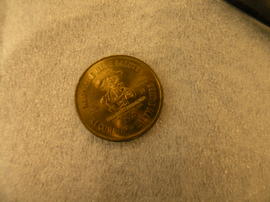
This souvenir token from Edmonton, Alberta was given to Minister Iona Campagnolo when she attended Klondike Days as Yellowhead Highway Association representative. On the front of the coin pioneers McDougall and Secord are depicted, while on the reverse is the Klondike Mike figure with inscription "Klondike Mike Salutes XI Commonwealth Games." This token was equal to $1 in Edmonton during the games and expired August 15, 1978.
2009.6.13.44.18
·
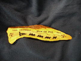
Item
·
1977
Part of The Honourable Iona Campagnolo fonds
This antler was a gift to Minister Iona Campagnolo commemorating her visit to Atlin, British Columbia. Inscribed on the antler are the words "Iona Campagnolo - Atlin Fun Days 1977" and a silhouette of dogsled team.
Item
·
Oct-69
Part of Mary Fallis fonds
Item
·
7/1/1972
Part of Mary Fallis fonds
Takla Lake, Northern British Columbia
2007.1.45.49.03
·
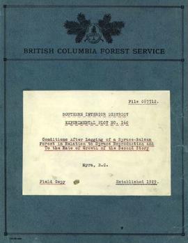
Item
·
1936
Part of Aleza Lake Research Forest fonds
Item is the 1936 strip notes accompanying the BC Forest Service report from Myra, BC titled "Southern Interior District Experimental Plot No. 160: Conditions After Logging of a Spruce-Balsam Forest in Relation to Spruce Reproduction and to the Rate of Growth of the Second Story".
2007.1.45.49.02
·
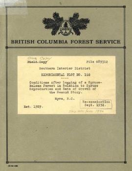
Item
·
1936
Part of Aleza Lake Research Forest fonds
Item is the office copy of a 1929 BC Forest Service report from Myra, BC titled "Southern Interior District Experimental Plot No. 160: Conditions After Logging of a Spruce-Balsam Forest in Relation to Spruce Reproduction and to the Rate of Growth of the Second Story".
2007.1.45.49.01
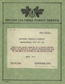
·
Item
·
1929
Part of Aleza Lake Research Forest fonds
Item is the field copy of a 1929 BC Forest Service report from Myra, BC titled "Southern Interior District Experimental Plot No. 160: Conditions After Logging of a Spruce-Balsam Forest in Relation to Spruce Reproduction and to the Rate of Growth of the Second Story".
2020.4.7.015
·
Item
·
1982
Part of G. Gary Runka fonds
Item
·
1/1/1965
Part of Mary Fallis fonds
Jasper National Park

2012.13.1.51.124
·
Item
·
June 1979
Part of J. Kent Sedgwick fonds
Image depicts the interior of the ferry at Southbank, B.C.

2012.13.1.51.123
·
Item
·
June 1979
Part of J. Kent Sedgwick fonds
Image depicts Southbank, B.C.
2000.1.1.3.13.57
·
Item
·
[ca. 1975]
Part of Cassiar Asbestos Corporation Ltd. fonds
Photograph depicts the Cassiar mine, pit partially visible behind West peak in right centre of image. South west mountain range in background.
2000.1.1.3.13.58
·
Item
·
[ca. 1975]
Part of Cassiar Asbestos Corporation Ltd. fonds
Photograph depicts the Cassiar mine, pit partially visible behind West peak in right centre of image. South west mountain range in background.
2013.6.36.1.088.21
·
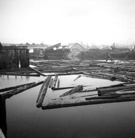
Item
·
Feb. 1966
Part of David Davies Railway Collection
Photograph taken at the east end of False Creek, looking south towarsd Quebec and Ontario Streets.
2000.1.1.3.13.56
·
Item
·
[ca. 1975]
Part of Cassiar Asbestos Corporation Ltd. fonds
Photograph depicts the Cassiar valley: plant and tailings pile in left foreground, west end of town in right foreground. South mountain range stands in background.
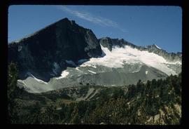
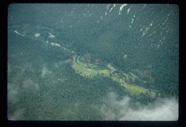
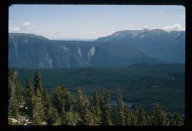
2012.13.1.46.07
·
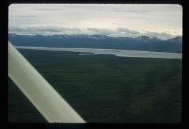
Item
·
1980
Part of J. Kent Sedgwick fonds
Image depicts an aerial view of what is likely Turner Lake in South Tweedsmuir Provincial Park.
2012.13.1.46.12
·
Item
·
1980
Part of J. Kent Sedgwick fonds
Image depicts an aerial view of South Tweedsmuir Provincial Park. The lake is possibly Lonesome Lake.
2012.13.1.46.18
·
Item
·
1980
Part of J. Kent Sedgwick fonds
Image depicts an aerial view of a lake in South Tweedsmuir Provincial Park. It is possibly Lonesome Lake.
2012.13.1.46.23
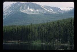
·
Item
·
1980
Part of J. Kent Sedgwick fonds
Image depicts an aerial view of Glacier Mountain in South Tweedsmuir Provincial Park.
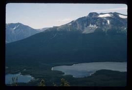
2012.13.1.46.08
·
Item
·
1980
Part of J. Kent Sedgwick fonds
Image depicts an aerial view of what is likely Glacier Mountain in South Tweedsmuir Provincial Park. The two lakes present are possibly Vista and Junker.
2012.13.1.46.10
·
Item
·
1980
Part of J. Kent Sedgwick fonds
Image depicts an aerial view of a "glaciated valley" in South Tweedsmuir Provincial Park. Glacier Mountain is present in the image.
2012.13.1.46.13
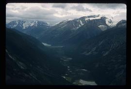
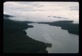
·
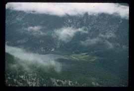
Item
·
1980
Part of J. Kent Sedgwick fonds
Image depicts an aerial view of a chain of lakes in South Tweedsmuir Provincial Park.
2012.13.1.46.05
·
Item
·
1980
Part of J. Kent Sedgwick fonds
Image depicts an aerial view of South Tweedsmuir Provincial Park.
2012.13.1.46.06
·
Item
·
1980
Part of J. Kent Sedgwick fonds
Image depicts an aerial view of South Tweedsmuir Provincial Park.
2012.13.1.46.11
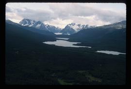
·
Item
·
1980
Part of J. Kent Sedgwick fonds
Image depicts an aerial view of South Tweedsmuir Provincial Park.
2012.13.1.46.28
·
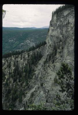
Item
·
1980
Part of J. Kent Sedgwick fonds
Image depicts a view of South Tweedsmuir Provincial Park.
2012.13.1.46.09
·
Item
·
1980
Part of J. Kent Sedgwick fonds
Image depicts an aerial view of South Tweedsmuir Provincial Park.
2012.13.1.46.15
·
Item
·
1980
Part of J. Kent Sedgwick fonds
Image depicts an aerial view of South Tweedsmuir Provincial Park.

2012.13.1.46.21
·
Item
·
1980
Part of J. Kent Sedgwick fonds
Image depicts an aerial view of South Tweedsmuir Provincial Park.
2012.13.1.46.41
·
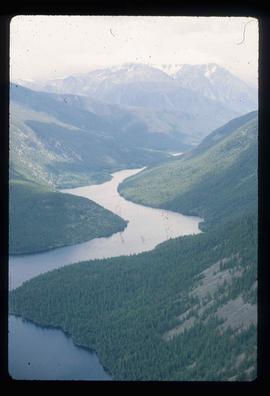
Item
·
1980
Part of J. Kent Sedgwick fonds
Image depicts a lake and mountain somewhere in South Tweedsmuir Provincial Park.
2012.13.1.46.14
·
Item
·
1980
Part of J. Kent Sedgwick fonds
Image depicts an aerial view of a lake in South Tweedsmuir Provincial Park.
2012.13.1.46.22
·
Item
·
1980
Part of J. Kent Sedgwick fonds
Image depicts an aerial view of South Tweedsmuir Provincial Park.
2012.13.1.46.27
·
Item
·
1980
Part of J. Kent Sedgwick fonds
Image depicts a view of South Tweedsmuir Provincial Park. An unidentified man stands on the side of the image.
2013.6.36.1.028.33
·
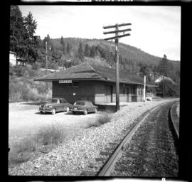
Item
·
14 Sept. 1970
Part of David Davies Railway Collection
Photograph depicts the South Slocan Junction at mile 11.9 on the CPR line on the Nelson Boundary Subdivision. It closed as an agency in June 1969 but the telegrapher still maintained it. Three to four freights pass per day on the main line: 2 to Trail, 1 to Castlegar pulp mill, and 1 every other day to Midway. On the branch there is 1 train per week to Nakusp that leaves Nelson on Monday, arrives in Nakusp on Tuesday, and returns to Nelson on Wednesday. The view is looking east.
2013.6.36.1.048.10
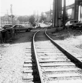
·
Item
·
26 Sept. 1974
Part of David Davies Railway Collection
Photograph depicts the south shore line of the B.C. Electric Railway in False Creek, Vancouver. B.C. Hydro operated it, if not owned it. The location was directly opposite from Granville Island.