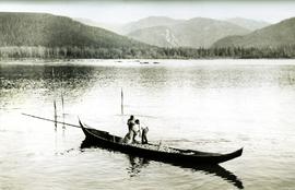
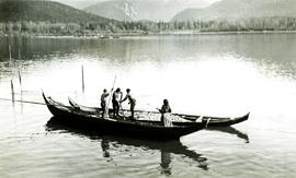
Photograph depicts two men handling fishing net in canoe full of fish. Hills visible on opposite shore in distance.
Handwritten annotation on verso reads: "Oolichan Fishing on Nass River".
Resource industries (eg. mining, forestry, fishing, etc.)
Resource industry cooperatives
Processing, packing and shipping industries
Construction, ship building
Salvage companies and operations
SEE ALSO: Agriculture; Business and Commerce; Transportation and Utilities
MemoryBC Subject Groups
Photograph depicts two men handling fishing net in canoe full of fish. Hills visible on opposite shore in distance.
Handwritten annotation on verso reads: "Oolichan Fishing on Nass River".
Photograph depicts two unidentified men at high elevation on mountain. Trucks and tanks visible in background, hose (possibly of air track drill) in right foreground. Mountain range in background.
Photograph depicts two unidentified men on road or mining bench at high elevation on mountain, valley in background.
Handwritten annotation on recto of photograph: "Bill Giachino & 'Sam' June 1970 / #4 / 74% / by Tom Kiefer".
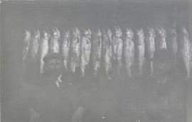
Photograph depicts two men seated in front of a row of hanging fish.
This file contains various aspects of the underground mine.
File contains images depicting the underground mine at Cassiar, showing structural damages, repaired damage ground support, and mining and repair processes.
The file contains a photo inventory entitled “Underground Mine Structural Inspection, Rock Mechanics Dept. Foto Documentation” with a complete file inventory linking the picture number to a location, title, and dated film. This photographic documentation was assembled for the purposes of liaising with a underground mining consultant located in South Africa.
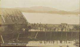
Photograph of a half-demolished building attached to a large dock. A large group is milling around the damage. Debris litters the water. Annotation on recto reads: "Undesired result of big blast at Prince Rupert. August 13 1908. Allen Photo."
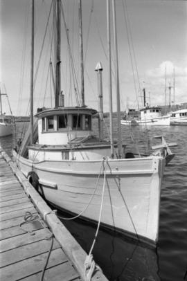
Photograph depicts the an unidentified fishing boat at the Prince Rupert marina.
Photograph depicts an empty canoe floating beside a canoe full of fish. Hills visible on opposite shore in distance.
Handwritten annotation on verso reads: "Loaded with fish - Nass River".
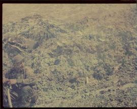
Image of man seated with shovel in mountainous area, loose asbestos fibre in background. This photograph is believed to be either a double exposure of two images, or a print made from two negatives at once. Photo depicts an unidentified man sitting on the south ridge of the Cassiar ore body, where the crusher and rock reject plant would eventually sit. Valley in background appears to depict the "Footwall Road," which was cut into the mountain from the pit to the crusher plant and became the mine's main haul road.
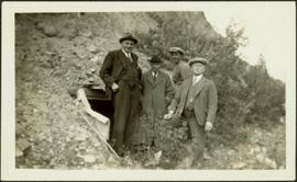
Photograph depicts four men wearing suits and ties, standing in front of mine adit in rocky area, bushes in background. Handwritten annotation on recto of photograph: "1939 H.F. (Bert) Glassey with black hit in middle" (information regarding Glassey believed to be incorrect).
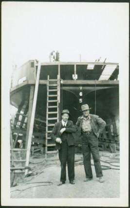
Photograph depicts two men standing in foreground, hull of unfinished ship in background. Construction supplies and materials throughout.
Photograph depicts a man and woman standing on what is believed to be an early mining bench. Two men with air track drill can be seen in background, one man father down on left, mountain range in background. Image slightly distorted due to poor quality of negative.
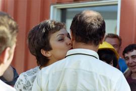
Photograph depicts an unknown woman kissing Trudeau on the cheek in a crowd of people.
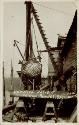
Photograph of a net of halibut being unloaded in a harbour in Prince Rupert, BC. Printed annotation on recto reads: "Unloading Halibut Prince Rupert, B.C. Photo W.W.W."
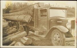
An “Indiana” flatbed logging truck releases logs from its load onto a makeshift log slide at the edge of a road.
Handwritten annotation in pencil on verso: "unloading logs".
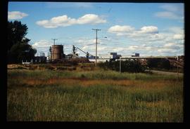
Image depicts Upper Fraser mill yard with log deck and beehive burner in silhouette across railroad tracks. Located in Upper Fraser, B.C. Map coordinates 54°07'01.5"N 121°56'29.6"W
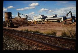
Image depicts numerous log decks at the Upper Fraser sawmill. Map coordinates 54°07'10.8"N 121°56'51.7"W
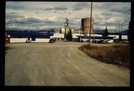
Image depicts the entrance to the Upper Fraser mill yard in Upper Fraser, B.C. Map coordinates 54°07'10.8"N 121°56'51.7"W
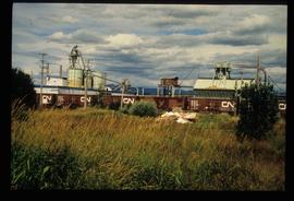
Image depicts the Upper Fraser mill yard with a CN train in Upper Fraser, B.C. Map coordinates 54°07'10.8"N 121°56'51.7"W
Image depicts the entrance to the Upper Fraser mill yard in Upper Fraser, B.C. Map coordinates 54°07'10.8"N 121°56'51.7"W
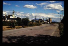
Image depicts the Upper Fraser Road running through Upper Fraser, B.C. A newer style round burner is seen in the background. Map coordinates 54°07'05.7"N 121°56'38.9"W
The item is a CD-R containing Kent Sedgewick's files regarding the Upper Fraser Valley history. Files include literature summaries, oral history transcripts and various other documents referring to the Upper Fraser Valley. Annotations on CD-R state, "Jun 7 '04 Kent - UF files to start."
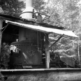
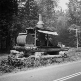
Photograph depicts a Vancouver Iron Works built steam donkey in use until the early 1950s. It was purchased for $800 by an enthusiast in 1963 , set up beside home and roadside at Sayward near Kelsey Bay on North Vancouver Island.
Handwritten annotation on recto of photograph: "ASBESTOS FIBRE VEINS AS THEY OCCURR IN A ROCK FACE". Photo caption under printed copy of image in 1952 Annual Report: "North Wall of adit approximately 225 feet from portal showing asbestos veinlets."
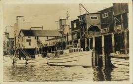
Water level photograph of several vessels docking in Prince Rupert. The "Co Op Fish Liver Oil" building is visible in the background. Printed annotation on recto reads: "Docks Prince Rupert."
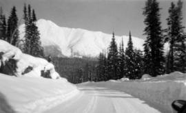
Photograph depicts snow-plowed road in foreground, Cassiar mountians in background. Road is lined with trees and power poles, and vehicle is visible in distance. Handwritten annotation on recto of photograph: "Looking west from townsite".
Handwritten caption beside this photo reads: "View of Bin and Pan Feeder". Interior view of crusher building. A square, snow-covered object is being lowered by crane into building.
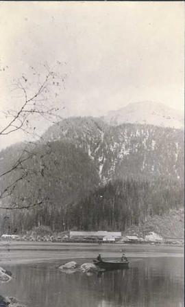
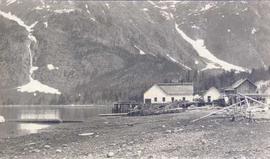
Photograph depicts a view of cannery buildings from the shoreline with mountains in the background.
Men can be seen working on site, building tools and supplies scattered throughout. Handwritten caption beside this photo reads: "View showing various levels of foundations". A chute of some kind extends from high level to men near bottom. Dirt road at site, and tree-covered valley can be seen in background. Construction of a long structure near the edge of the excavation area can be seen in midground; this is believed to be conveyor "B".
View facing into mountainside and showing various levels of foundations. Men can be seen working on site. Unidentified machinery and pile of long metal rods in foreground.
View showing various levels of foundations. Men can be seen working on site. Vertically protruding planks from framework in foreground. A long building believed to be housing conveyor "B" can be seen in background, as well as the tree-covered valley.
Men can be seen working on site. Crusher building in midground, chutes can be seen crossing the different levels of foundation. Lumber is leaning against excavated dirt wall in foreground, as well as a ladder which reaches up to the base level. Large tank can be seen in top level above building construction. Mountaintop and sky in background.
One man can be seen on crusher building framework, unidentified equipment and long metal rods in foreground. Power lines, a large tank, and other small buildings are semi-visible on a level in the mountainside just above the crusher building. Sky can be seen in background.
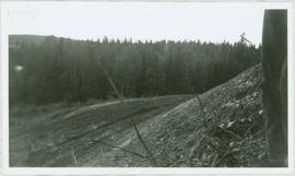
Photograph depicts the steep slope of man-made embankment, forest in background at bottom of slope. Small twigs and pant leg of unidentified individual in foreground.
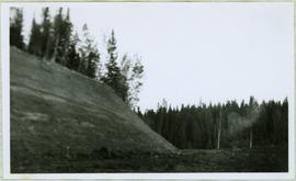
Photograph depicts the steep slope of man-made embankment. Forest in background, level excavated ground in foreground.
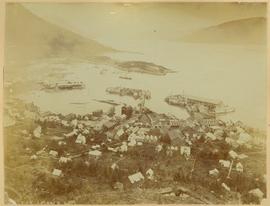
View of town on shore, from above. Boats docked along piers and buildings. Hills visible on either side of water in background.
Handwritten photo captions with arrows pointing to sections of image read: "General Merchandise", "Fort Wrangell Hotel".
Handwritten caption beside this photo reads: "View of Pinion & three sections of Crusher". Red rectangular equipment stands enclosed in wood frame, which is also enclosed in the much larger steel frame of the crusher building. Traveler crane on right.
Photograph depicts a view of a steam donkey probably at Sayward near Kelsey Bay on North Vancouver Island.
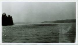
Handwritten caption beside this photo reads: "Sumit Lake." Trees can be seen on shore jutting into the lake on left, as well as on opposite shore in distant background. Unidentified objects can be seen in distance, possibly buildings on far shore.
Book was published by The Allen Photo Co., of Prince Rupert, B.C. and features printed photographs and captions documenting various aspects of Prince Rupert development from 1908 to 1910.
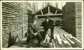
Violet sits wearing a fur coat next to younger brother Dixon who wears a suit and hat. They are seated in unidentified area on a wood structure between tall piles of planed lumber. A tall shelter can be seen behind them, and forest trees in background. Dixon Taylor worked at the sawmill in Penny, BC.
Photographs from Cassiar trip report to R.C. quarry plant in Sweden. This plant utilized rubber type dust enclosures to maintain low dust levels. Labelled Appendix F, this collection includes: landscape photograph of quarry, seal to conveyor gallery, rubber lined truck, rubber seal on equipment, rubber cover screen, and rubber bucket elevator.
Photographs from Cassiar trip report to Demona plant of Friction Materials Corporation in Israel. This plant makes only brake linings and they use a blend of blend of fibre and rayon in production. Labelled Appendix J, this collection includes landscape photos of the plant.
Photographs from Cassiar trip report to Ditton Works, a pipe division of TAC Construction Materials Ltd. Asbestos pipe was made at this particular factory. The company used some Cassiar fibres in their production. Labelled appendix I, this collection includes: photographs of equipment, bagging, packaging, fibre, pipes, and screens from inside the factory.
Photograph depicts Wabco in left foreground in front of shop building, tractor, and miscellaneous supplies. Mine valley and mountains in background. Handwritten annotation on recto of photograph: "Cassiar B.C. 1970 June 23 by Tom Kiefer".
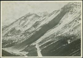
Photograph depicts large swath of dark waste down mountainside to right of valley. The waste dump is believed to be visible at top of swath on right of image. Bench mining visible on the North and South peak in background. Handwritten annotation on recto of photograph: "Oct. 25 / 65 4:25 PM."
Photograph depicts benches of Cassiar's open mine. Men can be seen standing near machinery speculated to be blasthole drills in bottom left of image. Handwritten annotation on recto of photograph: "Waste Stripping Operations on McDame Mt. Ore Mining in lower right Corner.", on verso: "1961".
File contains 3 strips of negatives depicting water control structures inluding pipes, culverts, and holding ponds. The strips were found in a photo lab pouch annotated "Sedimentation Pond Sept 1991" and addressed to "Cassiar Mining Corp. Attn; R. Tyne."