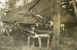
2014.10.1.069
·
Item
·
1909
Part of Arthur Holland Land Surveying Collection
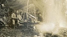
Photograph depicts five men sitting on a rough, log table. Table is under a tarp, upturned pails and cooking utensils are on the table.