Geographic Features

Elements area

Taxonomy

Code

Scope note(s)

  • Includes both natural and artificial features
  • Physical landscape, built landscape
  • Urban and industrial landscapes
  • Topography
  • Site plans
  • Boundaries, districts, reserves, parks, sanctuaries, towns, etc.
  • NOTE: Mainly but not exclusively pertaining to photographic and cartographic records
  • SEE ALSO: Land, Settlement and Immigration

Source note(s)

  • MemoryBC Subject Groups
Display note(s)

    Hierarchical terms

    Geographic Features

      Equivalent terms

      Geographic Features

        Associated terms

        Geographic Features

          4134 Archival description results for Geographic Features

          4134 results directly related Exclude narrower terms
          Clinton Creek Operations
          2000.1.1.3.20 · File · 1961 - [ca.1975]
          Part of Cassiar Asbestos Corporation Ltd. fonds

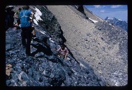
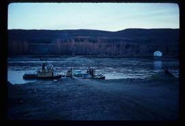
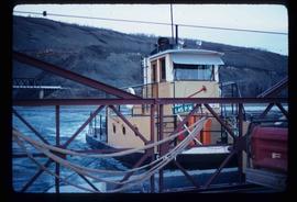
          Cassiar Asbestos Corporation Ltd opened a second mine in 1967 at what became the one-industry town of Clinton Creek, Y.T. File contains photographs depicting different areas of operations at Clinton Creek. Locations include the mine, plant, town, tailings pile, main office, the 40 Mile River, and surrounding area. Town photos depict the grocery store, cafeteria, medical clinic, school, auditorium residential area, Connell Street and power house. File also includes aerial photographs and images depicting forest fighting, photographers capturing the tailings pile, asbestos samples, mining machinery, staff offices, and operations in the mill, lab, and garage.

          Additional photographs integrated into file depict Clinton Creek's surrounding area, and three slides of a tailing pile explosion believed to be Clinton Creek.

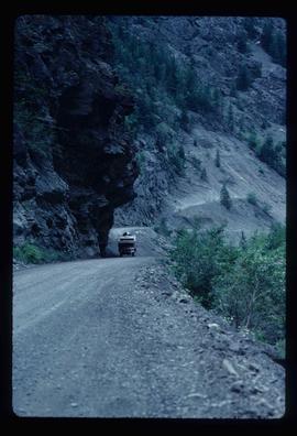
          Cliff Road - Overhang
          2012.13.1.59.14 · Item · July 1980
          Part of J. Kent Sedgwick fonds

          Image depicts a camper passing under an overhang as it drives along a narrow road near a cliff; located somewhere near Bralorne, B.C.

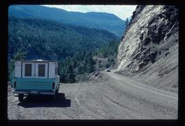
          Cliff Road
          2012.13.1.59.12 · Item · July 1980
          Part of J. Kent Sedgwick fonds

          Image depicts a camper parked on the side of a narrow road along a cliff as another car approaches; located somewhere near Bralorne, B.C.

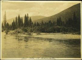
          Clearwater River, BC
          2009.5.3.4 · Item · [ca. 1913]
          Part of Taylor-Baxter Family Photograph Collection

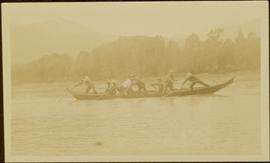
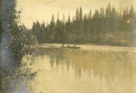
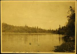
          Photograph depicts opposite shore in background behind river, and close shore in foreground on right. Men can be seen standing and paddling on canoe in distance. Handwritten photo caption on verso and recto of this photograph reads: "On the Clearwater".

          Clear Cut Logging
          2012.13.1.122.03 · Item · Oct. 1975
          Part of J. Kent Sedgwick fonds

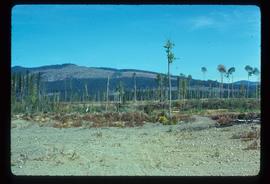
          Image depicts a highway, and a section of mountain in the background which is bare due to clear-cut logging. It is possibly somewhere near Prince George, B.C.

          Clear Cut Logging
          2012.13.1.122.04 · Item · Oct. 1975
          Part of J. Kent Sedgwick fonds

          Image depicts a logging area, and a section of mountain in the background which is bare due to clear-cut logging. The slide is also labelled "logging show." It is possibly somewhere near Prince George, B.C.

          City planning of the Georges
          2012.13.2.02.49 · File · [between 1980 and 1995]
          Part of J. Kent Sedgwick fonds

          File consists of notes and reproductions relating to the planning of the Georges: South Fort George, Central Fort George, and Prince George.

          2023.5.1.26 · Item · [after 1975]
          Part of UNBC School of Planning and Sustainability fonds

          Item is Map 4 of a group of five maps relating to a City of Prince George Study of Construction Aggregates by the firm Willis, Cunliffe, Tair & Company Limited. Map 4 shows development areas, aggregate sources, and requirements for 1984 and 1994. As the map is undated, it is unclear whether the 1984 and 1994 dates are future estimates.

          2023.5.1.23 · Item · [after 1975]
          Part of UNBC School of Planning and Sustainability fonds

          Item is Map 1 of a group of five maps relating to a City of Prince George Study of Construction Aggregates by the firm Willis, Cunliffe, Tair & Company Limited. Map 1 shows development areas and population for 1984 and 1994. As the map is undated, it is unclear whether the 1984 and 1994 dates are future estimates.

          2023.5.1.24 · Item · [after 1975]
          Part of UNBC School of Planning and Sustainability fonds

          Item is Map 2 of a group of five maps relating to a City of Prince George Study of Construction Aggregates by the firm Willis, Cunliffe, Tair & Company Limited. Map 2 shows development areas and aggregate requirements for 1984 and 1994. As the map is undated, it is unclear whether the 1984 and 1994 dates are future estimates.

          2012.13.2.01.03 · File · [between 1970 and 1980]
          Part of J. Kent Sedgwick fonds

          File consists of photocopies and notes relating to the boundary expansions of the city of Prince George since its incorporation. Includes a graph drawn by Kent Sedgwick regarding the addition of land and water each year of the boundary expansion and a "Proclamation" photocopy from the B.C. Gazette (23 Apr. 1953). Also includes 5 maps: "City of Prince George Boundary Expansions since Incorporation in 1915" (1979 or 1980); "City of Prince George" (Feb. 1979); "Map of Prince George" (between 1970 and 1985); "Study Area Boundaries" (Mar. 1977); and "City of Prince George" (Feb. 1972).

          2023.5.1.29 · Item · 1 Nov. 1993
          Part of UNBC School of Planning and Sustainability fonds

          This map is part of Schedule B of the 1993 Official Community Plan, Bylaw No. 5909 for the City of Prince George. This particular map depicts the northeast area of the City of Prince George, including the industrial areas on Prince George Pulpmill Road and Northwood Pulpmill Road along the Fraser River.