Exploration, Discovery and Travel

Elements area

Taxonomy

Code

Scope note(s)

  • Travel or exploration for personal, geographical, scientific or mapping reasons
  • Expeditions, exploration, adventure, prospecting, guiding
  • Individuals and groups involved in exploration or travel (eg. explorers, adventurers, prospectors, guides, outfitters)
  • Expedition planning, reports and accounts
  • Personal travels for discovery and education (eg. travel diaries)
  • Early contact with First Nations
  • SEE ALSO: Land, Settlement and Immigration

Source note(s)

  • MemoryBC Subject Groups
Display note(s)

    Hierarchical terms

    Exploration, Discovery and Travel

      Equivalent terms

      Exploration, Discovery and Travel

        Associated terms

        Exploration, Discovery and Travel

          1199 Archival description results for Exploration, Discovery and Travel

          1199 results directly related Exclude narrower terms
          History of the fur trade
          2012.13.2.13.02 · File · 1974, 2004
          Part of J. Kent Sedgwick fonds

          File consists of notes, clippings, and reproductions relating to the fur trade in British Columbia by the Hudson's Bay Company. Includes material on the fur trade route in the Peace Canyon, Athabasca Pass, and the Yellowhead Pass, as well as "Fur Trade Routes through the Canadian Cordillera" typed notes by Kent Sedgwick. File primarily consists of Kent Sedgwick's handwritten notes on the fur trade routes.

          Historic trails
          2012.13.2.13.03 · File · 1982-1986
          Part of J. Kent Sedgwick fonds

          File consists of notes, clippings, and reproductions relating to historic trails in British Columbia. Includes material on The Okanagan Brigade Trail; the exploration trails of Jean Caux (better known as Cataline); and Hudson's Bay Company brigade trails. Includes: "The Okanagan Brigade Trail" pamphlet from the Okanagan Historical Society (1986); "The Okanagan Brigade Trail in the South Okanagan" pamphlet by Bob Harris, Harley Hatfield, and Peter Tassie (1989); and "Historic Routes '82" symposium program (1982).

          New Caledonia fur trade
          2012.13.2.13.04 · File · [between 1980 and 2000]
          Part of J. Kent Sedgwick fonds

          File consists of notes, clippings, and reproductions relating to the New Caledonia fur trade by the North West Company. The New Caledonia fur trade began with Simon Fraser who set up posts at Fort St. James, Fort Fraser, and Fort George. The fur trade was administered out of the post at Fort St. James. File primarily consists of handwritten notes by Kent Sedgwick for a lecture on the New Caledonia fur trade.

          2012.13.2.13.05 · File · 1979, 2002-2010
          Part of J. Kent Sedgwick fonds

          File consists of notes, clippings, and reproductions relating to the Hudson's Bay Company fur trade in British Columbia, particularly in Fort St. James and Fort George. File primarily consists of Kent Sedgwick's handwritten notes on the Hudson's Bay Company fur trade in British Columbia. Includes: "Parks Canada Lower Fort Garry National Historic Park" brochure published by Parks Canada [199-?]; and "Fort Langley National Historic Park" brochure published by Parks Canada (1979).

          2012.13.2.10.07 · File · 2006
          Part of J. Kent Sedgwick fonds

          File consists of notes and reproductions relating to the Royal Engineers and Henry Spencer Palmer, a British Army military engineer and surveyor. Henry Spencer Palmer was sent to British Columbia and completed a report in 1863 on Wiliams Lake, the Caribou Districts, and the Fraser River from Fort Alexandria to Fort George. File primarily consists of Kent Sedgwick's handwritten notes on Henry Palmer and his work in British Columbia.

          Father Adrien Morice
          2012.13.2.10.06 · File · 2001
          Part of J. Kent Sedgwick fonds

          File consists of notes, clippings, and reproductions relating to Father Adrien Morice. Father Adrien Morice was a missionary and was ordained as a priest who came to British Columbia in 1880 to complete his ecclesiastical studies. After completing his schooling he was signed to the Williams Lake Mission where he worked closely with the Chilcotin peoples, learning their language and ministering. He continued to learn Chinook before moving to work at Stuart Lake with the Na'Kaztl'Tenneh Band in 1885, working with four divisions of the Carrier Tribes, the Alexandria, Quesnel, Blackwater, and Lhuskuz. Morice continued to use the Cree language and eventually published a monthly newspaper between 1881 and 1884 called "Tsettes Nahivelnik" (meaning "storyteller") using the Cree language. File primarily consists of handwritten notes by Kent Sedgwick regarding Father Adrien Morice and his work.

          Fort George Canyon
          2012.13.2.03.05 · File · 1982-2007
          Part of J. Kent Sedgwick fonds

          File consists of notes, clippings, and reproductions relating to the Fort George Canyon. Includes: "City of Prince George" typescript letter from Kent Sedgwick to Mr. Ron Drane, Manager of Pine Centre (7 June 1984) and "Fort George Canyon Hiking Trail" pamphlet published by the Fraser-Fort George Regional Museum (July 1984). Also includes photographs depicting the Fort George Canyon and men hiking the trail (1985).

          2012.13.2.02.61 · File · 1989
          Part of J. Kent Sedgwick fonds

          File consists of notes and reproductions relating to land exploration and surveying in British Columbia by Alfred R.C. Selwyn, who was a British geologist and public servant, director of the Geological Survey of Victoria from 1852 to 1869, director of the Geological Survey of Canada from 1869 to 1894, and President of the Royal Society of Canada from 1895 to 1896. Includes: "Photography: Mirror of the Past" American History magazine special edition (Sept. 1989) and a photocopied article "Ninety Years Later" by F.C. Swannell from The Beaver magazine (1956). File also includes reproduced photographs depicting scenes from Selwyn's exploration around British Columbia (1989).

          2012.13.2.02.62 · File · 1983-1986, 2001
          Part of J. Kent Sedgwick fonds

          File consists of notes and reproductions relating to George Dawson and the Geological Survey of Canada. Includes: "Museum Mirror" Fraser-Fort George Regional Museum newsletter vol. 1 no. 2 (June 1986). File also includes photographs depicting various sights around British Columbia from George Dawson's explorations (1983 reproduced).

          George Dawson
          2012.13.2.02.63 · File · 1980-1989, 2001
          Part of J. Kent Sedgwick fonds

          File consists of notes and reproductions relating to George Mercer Dawson (August 1, 1849 - March 2, 1901), a Canadian geologist and surveyor with the Geological Survey of Canada.

          2012.13.2.02.57 · File · 1984-2002
          Part of J. Kent Sedgwick fonds

          File consists of notes and reproductions of Frank Leonard's writings and research for his 1984 BC Studies article "Grand Trunk Pacific and the Establishment of the City of Prince George, 1911-1915". Includes: "Grand Trunk Pacific and the Establishment of Prince George 1911-1915" typescript document by Frank Leonard for his PhD dissertation (Feb. 1984) and "The Grand Trunk Pacific Railway Company and the Development of Northern British Columbia, 1902-1919" outline of dissertation chapters typescript document by Frank Leonard (1984).

          2012.13.2.02.54 · File · 2000-2004
          Part of J. Kent Sedgwick fonds

          File consists of notes and reproductions relating to the North Coast Land Company, Russel Walker, and Rattenbury Lands. The North Coast Land Company owned and sold many plots of land alongside the developing Pacific Great Eastern Railway line in Fort George and Prince George. The company had an office on George Street. Russel Walker was a sales agent and manager of the North Coast Land Company in Fort George and Prince George, Walker had also become the publisher and editor of the Fort George Herald newspaper. Russel Walker worked in Prince George between 1910 and 1916. Rattenbury Lands was a company that held and sold land in the Prince George area during the 1910s and 1920s, as they had taken over most of the land from The North Coast Land Company. File primarily consists of photocopied newspaper clippings, including articles and advertisements for the North Coast Land Company.

          Simon Fraser
          2012.13.2.02.55 · File · 2006-2008
          Part of J. Kent Sedgwick fonds

          File consists of notes, clippings, and reproductions relating to research conducted by Kent Sedgwick on Simon Fraser, Canadian explorer and fur trader. Includes: "Simon Fraser: The Birth of Modern British Columbia" special edition issue of the Vancouver Sun newspaper (3 Jan. 2006).

          1913 Land Act amendment
          2012.13.2.02.51 · File · [ca. 1980]
          Part of J. Kent Sedgwick fonds

          File consists of notes and reproductions relating a 1913 amendment to the Land Act, which is the British Columbia legislation used by the government to transfer land to the public for community, industrial, or business use. The 1913 amendment stated that land would be free to settlers with proof of three years residence or pre-empting unsurveyed or crown land after March 1913. File primarily consists of photocopied newspaper articles discussing the amendment.

          2012.13.2.02.50 · File · 2004-2011
          Part of J. Kent Sedgwick fonds

          File consists of notes, clippings, and reproductions relating to encouraging settlement and immigration to Prince George. Includes material on Dutch settlement in Prince George; the Hornby Plan, a 1933 settlement plan by the Canadian National Railway to develop communities and stimulate business for the railway, particularly in Prince George; promoting Prince George for settlers; reserved land for veterans; and auction of lands to cover delinquent taxes in British Columbia.

          2012.13.2.02.53 · File · 2004-2006
          Part of J. Kent Sedgwick fonds

          File consists of notes and reproductions relating to soldier land settlement in northern British Columbia following the First World War. Includes material regarding the British Columbia Land Settlement Act; the allotment of land for Prince George; and the opening of reserved lands for veterans. Includes a printed article entitled "Soldiers, Settlement and Development in British Columbia, 1915-1930" by Paul Koroscil (2000).

          2012.13.2.02.40 · File · 1998-2006
          Part of J. Kent Sedgwick fonds

          File consists of reproductions and photocopies of articles on the history of city planning in North America. File predominantly consists of printed articles: "Encyclopedia of Urban Planning" by Arnold Whittick; "Radburn and the American Planning Movement: The Persistence of an Idea" by Eugenie Ladner Birch; "The Making of Urban America: A History of City Planning in the United States" by John W. Reps; and "The Story of the Planner's Journal 1915-1980" by Donald A. Krueckberg.

          2012.13.2.02.42 · File · 2009
          Part of J. Kent Sedgwick fonds

          File consists of printed emails and typed documents relating to Brett & Hall and an exhibit for the National Gallery of Canada. Brett & Hall were landscape architects from Boston, MA who designed the original plan for Prince George, including features such as the Crescents neighbourhood.

          2012.13.2.02.46 · File · 2001-2005
          Part of J. Kent Sedgwick fonds

          File consists of notes and reproductions relating to the Hudson's Bay Company subdivision. Includes material on the subdivision, survey, and sale of lands in Fort George owned by the Hudson's Bay Company.

          Prince George urban planning
          2012.13.2.02.35 · File · 2006-2010
          Part of J. Kent Sedgwick fonds

          File consists of notes and reproductions relating to the planning of the Prince George townsite. Includes material on surveyors, Fred Burden, and town planners working with the landscape architects Brett and Hall on the development of the townsite. File predominantly consists of Kent Sedgwick's handwritten notes on townsite planning in Prince George. Includes a clipped article from the Prince George Citizen newspaper "Town planners involved landscape architects" (4 Nov. 2006).

          2012.13.2.02.34 · File · 1996-1998
          Part of J. Kent Sedgwick fonds

          File consists of notes and reproductions relating to Brett & Hall landscape architecture and urban planning in Canada. File predominantly consists of photocopies of articles relating to urban planning, including "The Influence of Thomas Adams and the British New Towns Movement in the Planning of Canadian Resource Communities" by Oiva Saarinen; "Thomas Adams and the Commission of Conservation" by Alan H. Armstrong; "The Laying Out of Towns" by W.H. Dorsey; "The Relation of the City Engineer to Public Parks" by John C. Olmsted; "The Planning of Company Communities in the Lake Superior Mining Region" by Arnold R. Alanen; and "Planning the Canadian Environment" by L.O. Gertler.

          2012.13.2.02.36 · File · 1996-2003
          Part of J. Kent Sedgwick fonds

          File consists of notes and reproductions relating to Brett and Hall city planning work for Prince George. Brett & Hall were landscape architects from Boston, MA who designed the original plan for Prince George, including features such as the Crescents neighbourhood.

          Survey of Prince George
          2012.13.2.02.29 · File · 1990
          Part of J. Kent Sedgwick fonds

          File consists of notes and reproductions relating to the survey of Prince George. Includes material on survey plans, lots in Prince George, original town planning, subdivision plans, and Kent Sedgwick's handwritten notes on surveying and town planning in Prince George. File primarily includes photopied maps depicting town lots and planning in Prince George. Includes: "RE: Title Search for Fairgrounds" typescript letter from Kent Sedgwick to Dr. Dick Rowe (26 Apr. 1990) and "Map showing South Fort George, Fort George (Central) and the additions surveyed in 1910 or later" reproduced map from the Fort George Tribune newspaper.

          2012.13.2.02.32 · File · 2003-2004
          Part of J. Kent Sedgwick fonds

          File consists of notes and reproductions relating to the boundary survey done by A.O. Wheeler, who was employed by British Columbia Government as a surveyor in 1922 to survey the boundary between British Columbia and Alberta.

          Frank Swannell
          2012.13.2.02.31 · File · 2002-2008
          Part of J. Kent Sedgwick fonds

          File consists of notes, clippings, and reproductions relating to Frank Swannell, who was a surveyor in British Columbia that surveyed many areas across the province between 1898 and 1908.

          Land surveyors
          2012.13.2.02.27 · File · 2003-2009
          Part of J. Kent Sedgwick fonds

          File consists of notes and reproductions relating to land surveyors working in British Columbia. Includes material on Rupert Williams Haggen who became a land surveyor in 1911 and surveyed Prince George, Quesnel, Bowron River, and the Fraser River area below Quesnel; Henry Fry who worked in Victoria between 1871 and 1897; Otto Julius Klotz who surveyed the Alaska-British Columbia boundary and also surveyed for the Canadian Pacific Railway between 1871 to 1927; James Herrick McGregor who worked in the Kootenays and assisted for the survey of the British Columbia Alberta border between 1891 and 1903; and Forin Campbell who came to Prince George in 1908.

          2012.13.2.02.28 · File · 1980
          Part of J. Kent Sedgwick fonds

          File consists of notes, clippings, and reproductions relating to James C. Anderson and engineer J. Gill. James Anderson arrived in Fort George in 1912. Anderson did topographical surveys of the Fort George area for the Grand Trunk Pacific Railway between 1912 and 1913. Engineer J. Gill did a topographical survey of the Indian reserve for the Grand Trunk Pacific in 1912. Includes "Grand Trunk Pacific Maps" typescript document by Kent Sedgwick (3 June 1980).

          Fred Burden
          2012.13.2.02.30 · File · 2001-2006
          Part of J. Kent Sedgwick fonds

          File consists of notes and reproductions relating to Fred Burden, a surveyor in British Columbia who surveyed tar sands in the Fort McMurray region and returned to Prince George in 1921 to complete a topographical survey of Prince George.

          2014.10.1.179 · Item · 1911
          Part of Arthur Holland Land Surveying Collection

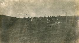
          Photograph depicts a cluster of buildings near Fraser Lake. A fence and grasses in the foreground. Original photo title: "Indian Village at Fraser Lake." First Nations communities with territories overlapping Fraser Lake include Nadleh Whut'en and Stellat'en Nations.

          Arthur Holland Album
          2014.10.1 · Series · 1907-1920
          Part of Arthur Holland Land Surveying Collection

          Series consists of a photograph album from A. H. Holland, a British Columbia Land Surveyor, that was created while working in the Central Interior, the Cariboo, the Chilcotin and southeast British Columbia. This album visually documents steamboat, stagecoach and horse travel in British Columbia and some First Nation village sites. It also captures preparatory survey work and dawn of the age of rail travel.

          Alaska Trip, August 1985
          2020.09.01 · File · Aug. 1985
          Part of Jill Singleton Collection

          This travel scrapbook was created by Jill Singleton to document a trip to Alaska, Yukon, Haida Gwaii, and northern BC. Jill Singleton and Eric Stathers embarked on a 1985 car camping trip using the BC Ferries and Alaska Ferry systems. Includes postcards, ephemera, handwritten notes, pamphlets, issues of local newspapers, and maps. Also includes 37 photographs.

          Includes the following:

          • "Queen Charlotte Islands Observer" newspaper issue for August 8, 1985
          • "A Walking Tour and Business Directory for Queen Charlotte City", June 1985
          • "A Walking Tour and Business Directory for Tlell + Port Clements", June 1985
          • "A Walking Tour and Business Directory for Skidegate Landing, Skidegate and Sandspit", June 1985
          • "A Walking Tour and Business Directory for Masset", June 1985
          • "Explorations Q.C.I." pamphlet advertising guiding, outfitting, and touring
          • "Sandspit Inn, Queen Charlotte Islands" pamphlet
          • "Visit the Queen Charlottes" pamphlet
          • Queen Charlotte Islands map, circa 1985
          • BC Ferries pamphlet "New in 1985... Inside Passage Day Cruise"
          • BC Ferries pamphlet "Tickets and Boarding Information, Inside Passage"
          • "Alaska Marine Highway" pamphlet
          • "Discover Southeast Alaska, Ketchikan" pamphlet
          • "Alaska State Parks" pamphlet/map
          • "Tongass National Forest, Alaska" pamphlet/map
          • "Alaska Marine Highway Summer Schedule - May 1, 1985 through September 30, 1985" pamphlet
          • History leaflet for St. Michael's Cathedral, Sitka, AK
          • Alaska Seafood Marketing Institute leaflets, 1984
          • Anchorage 1984 Visitors Guide, Anchorage Convention & Visitors Bureau
          • "Skagway... some Steps on the Gold Rush Trail... walking Tour of the Historic District - Klondike Gold Rush National Historical Park"
          • "Skaguay Alaskan" newspaper issue, Vol. VIII, No. 1880 (1985)
          • "Klondike Gold Rush" pamphlet for tourists
          • "Broadway, Skagway, Alaska" pamphlet
          • "S.S. Tutshi, Carcross" pamphlet
          • "Moon Watching" pamphlet by BC Ministry of Lands, Parks and Housing (1980)
          • "Some Insects of Provincial Parks" pamphlet by BC Ministry of Lands, Parks and Housing (1980)
          • "Stewart, British Columbia - Hyder, Alaska... Your Gateway to Alaska and the Yukon!" pamphlet
          • "Stewart-Cassiar Highway 37" map
          • "Prince Rupert City Map & Guide" pamphlet
          • "Explore Canada's Yellowhead, Western Canada's New Interprovincial Highway" pamphlet (1983)
          • "101 Things To Do in Yukon" booklet published by Tourism Yukon (1985)
          • "Your Guide to B.C. Ferries' Inside Passage" booklet by British Columbia Ferry Corporation (1985)
          • "Port Alberni, British Columbia, Canada" booklet (1981)

          Trip itinerary:

          • Vancouver, BC
          • Nanaimo, BC
          • Port Hardy, BC
          • Prince Rupert, BC
          • Yakoun River, BC
          • Haida Gwaii, BC (formerly Queen Charlotte Islands)
          • Rennell Sound, BC
          • Graham Island, BC
          • Queen Charlotte City, BC
          • Sandspit, BC
          • Prince Rupert, BC
          • Ketchikan, AK
          • Sitka, AK
          • Tenakee Springs, AK
          • Juneau, AK
          • Skagway, BC
          • Carcross, YK
          • Atlin, BC
          • Telegraph Creek, BC
          • Kitwanga, BC
          • Prince Rupert, BC
          • Prince George, BC
          • Lillooet, BC
          • Vancouver, BC
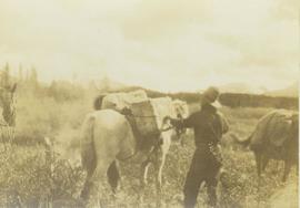
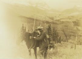
          Loading up a pack horse
          2000.19.2.154 · Item · 29 Aug. 1927-26 Sept. 1927
          Part of Prentiss Gray Collection

          Photograph depicts a man loading up pack horse with two other laden pack horses visible in the periphery of the image.