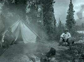
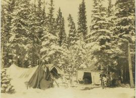
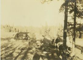
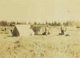
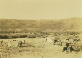
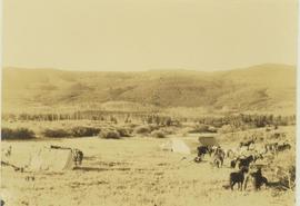
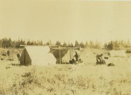
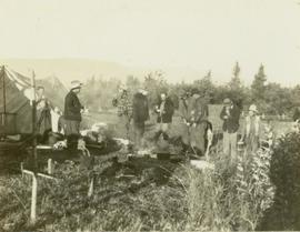
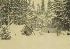
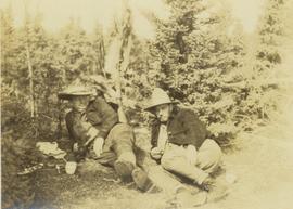
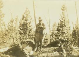
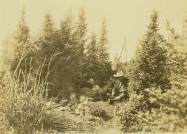
Exploration, Discovery and Travel

Elements area

Taxonomy

Code

Scope note(s)

  • Travel or exploration for personal, geographical, scientific or mapping reasons

  • Expeditions, exploration, adventure, prospecting, guiding

  • Individuals and groups involved in exploration or travel (eg. explorers, adventurers, prospectors, guides, outfitters)

  • Expedition planning, reports and accounts

  • Personal travels for discovery and education (eg. travel diaries)

  • Early contact with First Nations

  • SEE ALSO: Land, Settlement and Immigration

Source note(s)

  • MemoryBC Subject Groups

Display note(s)

    Hierarchical terms

    Exploration, Discovery and Travel

      Equivalent terms

      Exploration, Discovery and Travel

        Associated terms

        Exploration, Discovery and Travel

          1243 Archival description results for Exploration, Discovery and Travel

          1243 results directly related Exclude narrower terms
          Camp on Ton A Qua summit
          2014.10.1.070 · Item · 1909
          Part of Arthur Holland Land Surveying Collection

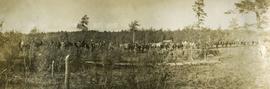
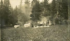
          Photograph depicts a cluster of tents on the edge of a meadow. Four or more people stand or sit amongst the tents. Smoke rises from a wood fire and drifts amongst the stub alpine trees in the background.

          Camp site
          2000.19.2.82 · Item · 29 Aug. 1927-26 Sept. 1927
          Part of Prentiss Gray Collection

          Photograph depicts four men preparing a camp site with tents and a fire for cooking. In the background a dense forest is visible.

          2012.13.2.02.34 · File · 1996-1998
          Part of J. Kent Sedgwick fonds

          File consists of notes and reproductions relating to Brett & Hall landscape architecture and urban planning in Canada. File predominantly consists of photocopies of articles relating to urban planning, including "The Influence of Thomas Adams and the British New Towns Movement in the Planning of Canadian Resource Communities" by Oiva Saarinen; "Thomas Adams and the Commission of Conservation" by Alan H. Armstrong; "The Laying Out of Towns" by W.H. Dorsey; "The Relation of the City Engineer to Public Parks" by John C. Olmsted; "The Planning of Company Communities in the Lake Superior Mining Region" by Arnold R. Alanen; and "Planning the Canadian Environment" by L.O. Gertler.

          2009.7.1.184 · Item · [ca. 1900]
          Part of Archdeacon W. H. Collison fonds

          Photo featuring Captain Vancouver’s tombstone in the churchyard of St. Peter’s Church in Petersham, England.

          Handwritten annotation in pen on verso reads: “Illustration from this to be inserted. No. 4.3. on page 183 of manuscript. Vancouver’s tomb, Petersham, England”.

          Cariboo region
          2012.13.2.19.05 · File · 1978-2006
          Part of J. Kent Sedgwick fonds

          File consists of notes, clippings, and reproductions relating to the Cariboo region of British Columbia. Includes: "Walking Tour of Historic Clinton" pamphlet prepared by Clinton Museum Society and Clinton & District Chamber of Commerce (1980); "Central Cariboo British Columbia, Canada" pamphlet approved by Tourism British Columbia (2010); and "Cariboo field trip" duotang with typescript notes (1978). Also includes photographs depicting Quesnel Forks, British Columbia (2010).

          Cartographic Material
          2004.1.3 · Series · 1934
          Part of Phipps-Mackenzie Collection

          Series consists of a blueline copy of Swannell's 1934 "Preliminary plan showing travelled route of the Bedaux Sub-Arctic Expedition" map. Map legend shows expedition route as travelled by tractor, packhorse and boat, as well as camps, horses used, boundaries and elevations.

          2009.7.3 · Series · 1878-1929
          Part of Archdeacon W. H. Collison fonds

          Maps within this series document the placer streams, islands and harbours of the Queen Charlotte Islands; as well as the mining properties located within the vicinity of Stewart, BC.

          2000.1.2.6 · File · 1972
          Part of Cassiar Asbestos Corporation Ltd. fonds

          A set of 13 maps showing approximate waste extraction areas for different benches during certain months of 1972. Extraction dates are included accompanied by estimated total tonnages for each planned extraction area. All plans are hand drawn using colored pencils, lead and black ink. Approximate calculations of extraction tonnages are included within certain months. Numerical bench markers are included. Total tonnages from the previous year and previous surveys are included within certain plans.

          Cemetery
          2012.13.1.78.21 · Item · 1982
          Part of J. Kent Sedgwick fonds

          Image depicts an individual crouching in an old cemetery located somewhere in the coastal forest on Haida Gwaii, B.C.

          2009.6.1.580 · Item · July 1996
          Part of The Honourable Iona Campagnolo fonds

          Left to right: Deborah Poff, Dennis Macknak, Charles Jago, an unidentified woman, Iona Campagnolo, an unidentified man, Ellen Facey, and an unidentified woman. Unknown man stands on lower deck in foreground. Mountains visible in background. Photograph taken during the Chancellor's 1996 regional tour through Atlin and Whitehorse; see also items 2009.6.1.578 - 2009.6.1.581.

          Handwritten annotation on verso reads: "#3 Chancellor's Tour".

          2009.6.1.581 · Item · July 1996
          Part of The Honourable Iona Campagnolo fonds

          Left to right: Deborah Poff, Dennis Macknak, Charles Jago, an unidentified woman, Iona Campagnolo, Ellen Facey, Nick Petraryszak, an unidentified man, and an unidentified woman. Unknown man stands on lower deck in foreground. Mountains visible in background. Photograph taken during the Chancellor's 1996 regional tour through Atlin and Whitehorse; see also items 2009.6.1.578 - 2009.6.1.580.

          2014.10.1.188 · Item · 1911
          Part of Arthur Holland Land Surveying Collection

          Photograph depicts a long line of 30 or more horses or mules and men. The horses appear to be tethered to a rope, some animals are wearing packs. Several men attend. Note: Fort Fraser, BC was at one time also referred to as "Fraser's Lake" - the name of the Post Office within the Hudson Bay Company store.

          Cheakamus River
          2014.10.1.145 · Item · 1911
          Part of Arthur Holland Land Surveying Collection

          Photograph depicts three men standing in front of a log cabin. Two men hold fishing rods and each of these men hold a freshly caught fish. The third man stand to the side with a loaded back pack. Two men smoke pipes.