Title and statement of responsibility area
Title proper
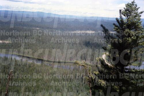
View of Summit Lake EP 1162 area from top of Teapot Mountain
General material designation
Graphic material
Parallel title
Other title information
Title statements of responsibility
Title notes
- Source of title proper: Title based on photograph annotation.
Level of description
Item
Reference code
2006.18.6.06.01
Edition area
Edition statement
Edition statement of responsibility
Class of material specific details area
Statement of scale (cartographic)
Statement of projection (cartographic)
Statement of coordinates (cartographic)
Statement of scale (architectural)
Issuing jurisdiction and denomination (philatelic)
Dates of creation area
Date(s)
-
[July or August 1991] (Creation)
Physical description area
Physical description
- 1 photograph : col. ; 10 x 15 cm
Publisher's series area
Title proper of publisher's series
Parallel titles of publisher's series
Other title information of publisher's series
Statement of responsibility relating to publisher's series
Numbering within publisher's series
Note on publisher's series
Archival description area
Custodial history
Scope and content
Annotation on photograph verso: "July-Aug. 1991, View of Summit Lake EP 1162. Area from top of Teapot Mountain, looking east. Trial area is east of Crooked River, north of Caine Creek [Forest Service] Road, south of gravel pit (on right)".
Notes area
Physical condition
Immediate source of acquisition
Arrangement
Language of material
English
Script of material
Location of originals
Availability of other formats
Restrictions on access
No restrictions.
Terms governing use, reproduction, and publication
Personal or academic use of materials is welcomed under the standard fair use and educational use clauses of Canadian Copyright Law. Commercial use is, however, forbidden without the express permission of the copyright holder. For information on obtaining written permission from the copyright holder, please contact the Northern B.C. Archives and Special Collections.
Finding aids
Associated materials
Part of the Aleza Lake Research Forest Society fonds.