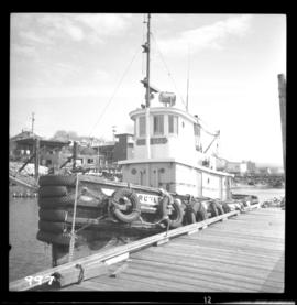
Powell River, BC

Elements area

Taxonomy

Code

Scope note(s)

    Source note(s)

      Display note(s)

        Hierarchical terms

        Powell River, BC

          Equivalent terms

          Powell River, BC

            Associated terms

            Powell River, BC

              10 Archival description results for Powell River, BC

              10 results directly related Exclude narrower terms
              Bridge over Powell Lake
              2013.6.36.1.001.86 · Item · Apr. 1966
              Part of David Davies Railway Collection

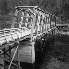
              Photograph depicts a bridge over Powell Lake, directly behind Powell River town. The bridge is in poor condition and being replaced by steel bridge at right (just off the picture).

              2009.6.13.45.03 · Item · [between 1974 and 1979]
              Part of The Honourable Iona Campagnolo fonds

              Map depicts the city of Vancouver, including the electoral districts of Comox-Powell River, Capilano, North Vancouver-Burnaby, Mission-Port Moody, Burnaby, Fraser Valley West, New Westminster-Coquitlam, Surrey-White Rock-North Delta, Richmond-South Delta, Vancouver South, Vancouver Kingsway, Vancouver Quadra, Vancouver Centre, and Vancouver East.

              2013.6.36.1.014.12 · Item · Apr. 1966
              Part of David Davies Railway Collection

              Photograph depicts M.V. "Atrevida" at Westview Harbour, Powell River. It connects Westview with Blubber Bay on Texada Island. It is one of the very few ferries not run by the B.C. Ferry Authority. It carries about 6 to 8 cars.