Maps within this series document the placer streams, islands and harbours of the Queen Charlotte Islands; as well as the mining properties located within the vicinity of Stewart, BC.
Portland Canal, BC
5 Archival description results for Portland Canal, BC
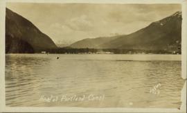
Photograph is a printed postcard, view is from the water of a small settlement with mountains in the background near Stewart B.C.
The photographs depict the geographic areas of Stewart, BC, Boundary Pass, Nelson River, Bitter Creek Glacier, Portland Canal, Red Cliff and Bear Creek; as well as the ships “Camosun” and “S.S. Prince George.” Types of subjects identified in this collection include: community life, surveying, mining and transportation (i.e. dog-sledding, horse and buggy, and the Portland Canal Short Line Railway “P.C.S.L. Rlwy”).
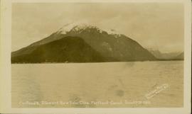
Photograph of a mountain on the waterfront. Annotation on recto reads: "Portland & Stewart. New Twin Cities. Portland Canal. June 17th 1910. Button Photo. Prince Rupert, BC."
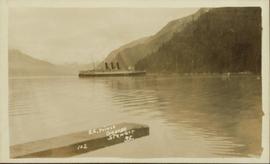
Photograph is a printed postcard depicting the S.S. Prince George at dock in the Portland Canal in Stewart, BC. Annotation written on recto reads: "S.S. Prince George, Stewart, B.C., 102".


