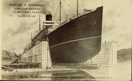
Illustration of a large ocean liner in dry dock. The name "Minnesota" is inscribed on the top right side of vessel. Annotation on recto reads: "William T. Donnelly Consulting Engineer 17 Battery Place Tel. Rector 1491 20000 tons pontoon floating dry dock Prince Rupert, BC"
Prince Rupert, BC
619 Archival description results for Prince Rupert, BC
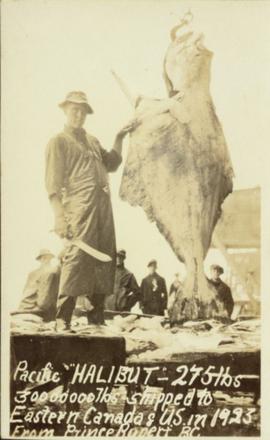
Photograph of a fisherman brandishing a large knife next to a halibut on a hook. Printed annotation on recto reads: "Pacific 'HALIBUT'- 275lbs 30000000lbs shipped to Eastern Canada & US in 1923 from Prince Rupert BC."
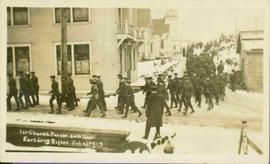
Parade of uniformed men through streets. There is snow on the ground. Printed annotation on recto reads: “1st Church parade 30th Batt Earl Grey Rifles Feb 21st,15, McRae Bros,” handwritten in pencil on verso: “Prince Rupert”. Handwritten message is addressed to “Dear Grandma”.
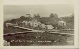
Photograph shows two men and a cart full of lumber at a street intersection. Various residential buildings are visible in the background and atop a large clear cut hill. Annotation on recto reads: "3rd, 4th Aves and Fullton St. Prince Rupert. BC. Allen Photo 8/Aug/09."
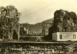
Handwritten annotation on recto of postcard reads: “Were there’s a will there’s a way, 5th Street, Prince Rupert, B.C., F. Button photo Pr. Rupert. No. 514.” Handwritten annotation in pen on verso of postcard reads: “Miss Belding, 33 Marlbro Avenue, Hull Yorkshire, England. S.S. Prince George. Dec. 1918. Dear Bertha, This is a street in the centre of the town Prince Rupert. There is a capacity list of passengers on board. The boat is registered to hold 384. We left at midnight and exped to arrive in Vancouver tomorrow at 3:30 pm. Love from Edie.”
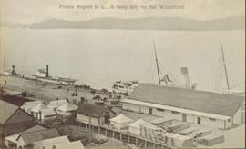
Elevated view of various buildings and vessels along the Prince Rupert waterfront. Several piles of lumber can be seen in the foreground. Printed annotation on recto reads: " Prince Rupert B.C., A busy day on the Waterfront."
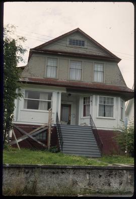
Image depicts a house which is possibly in Prince Rupert, B.C.
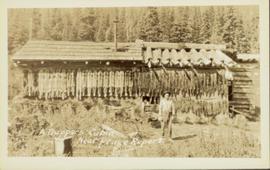
Head on photograph of a trapper standing in front of his cabin in Prince Rupert, BC. The front of the cabin is covered in various pelts. Printed annotation on recto reads: "A Trappers Cabin near Prince Rupert."
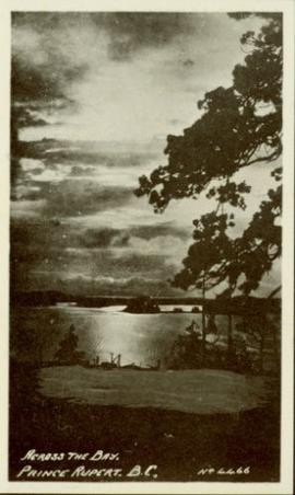
Photograph of the bay at dusk. Trees and distant machinery are silhouetted against a cloudy sky and dark waterfront. Annotation on recto reads: "Across the Bay, Prince Rupert, BC No 4466."
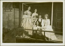
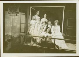
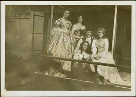
Four unidentified women and one unidentified man pose in costume in front of theatre sets. Play produced and directed by Iona Campagnolo.
Four unidentified women and one unidentified man pose in costume in front of theatre sets. Play produced and directed by Iona Campagnolo.
Four unidentified women and one unidentified man pose in costume in front of theatre sets. Play produced and directed by Iona Campagnolo.
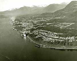
Attached description: The thriving city of Prince Rupert is shown in this aerial picture. Prince Rupert has been enjoying a construction boom which includes the construction of the $80 million Skeena Kraft mill, hundreds of single-family homes, and hundreds of units in apartments, motels, and hotels. The construction of Skeena Kraft provided the stimulus for a population expansion to over 17,000. The Columbia Cellulose and Skeen a Kraft payrolls account for well over a third of the incomes of the city. Prince Rupert is, along with Terrace, the hub of a new economic region encompassing the Nass and Skeena valley regions.
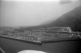
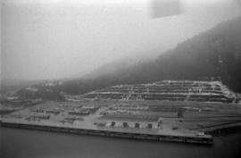
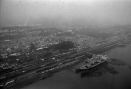
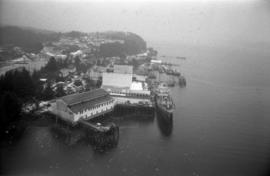
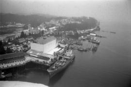
Photograph depicts an aerial view of the Prince Rupert Fairview Cargo Terminal.
Photograph depicts an aerial view of the Prince Rupert Fairview Cargo Terminal with a moored boat.
Photograph depicts an aerial view of the Prince Rupert Fairview Cargo Terminal with a moored boat.
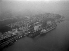
Photograph depicts an aerial view of the Prince Rupert Fairview Cargo Terminal with Prince Rupert in the background.
Photograph depicts an aerial view of the Prince Rupert Fairview Cargo Terminal.
Photograph depicts an aerial view of the Prince Rupert harbour.
Photograph depicts an aerial view of a ship at port in Prince Rupert.
Photograph depicts an aerial view of a ship at port surrounded by logs in Prince Rupert.
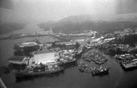
Photograph depicts an aerial view of ships at the Prince Rupert harbour.
Photograph depicts an aerial view of ships at the Prince Rupert harbour.
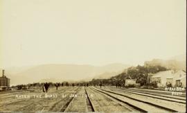
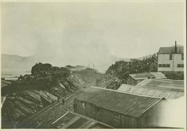
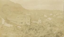
Wide angle photograph of a crowd milling around railroad tracks. A large pile of rubble and various buildings are visible on the right side. Annotation on recto reads: "After the Blast 21 Jan 1914 McRae Bros Photo."
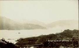
Foreground shows a rocky shore covered in debris. A small crowd is visible along the coastline, and there are foggy outlines of hills beyond the water. Annotation on recto reads: "McRae Bros After the Blast 24th Apr. 13."
People running along railway tracks towards the cloud of smoke and debris left after a large explosion to the left of a railway; wooden buildings visible on the right and water visible in the distance.
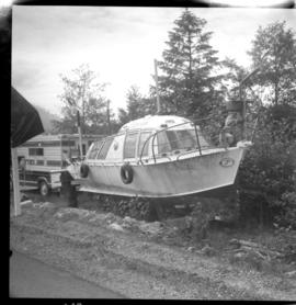
Photograph depicts an air-sea rescue launch that may been used during World War II. It was located just beside Highway 16, about 5 miles from the centre of Prince Rupert.
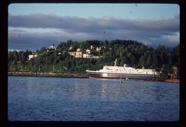
Image depicts the ferry to Alaska in the port of Prince Rupert, B.C.
This travel scrapbook was created by Jill Singleton to document a trip to Alaska, Yukon, Haida Gwaii, and northern BC. Jill Singleton and Eric Stathers embarked on a 1985 car camping trip using the BC Ferries and Alaska Ferry systems. Includes postcards, ephemera, handwritten notes, pamphlets, issues of local newspapers, and maps. Also includes 37 photographs.
Includes the following:
- "Queen Charlotte Islands Observer" newspaper issue for August 8, 1985
- "A Walking Tour and Business Directory for Queen Charlotte City", June 1985
- "A Walking Tour and Business Directory for Tlell + Port Clements", June 1985
- "A Walking Tour and Business Directory for Skidegate Landing, Skidegate and Sandspit", June 1985
- "A Walking Tour and Business Directory for Masset", June 1985
- "Explorations Q.C.I." pamphlet advertising guiding, outfitting, and touring
- "Sandspit Inn, Queen Charlotte Islands" pamphlet
- "Visit the Queen Charlottes" pamphlet
- Queen Charlotte Islands map, circa 1985
- BC Ferries pamphlet "New in 1985... Inside Passage Day Cruise"
- BC Ferries pamphlet "Tickets and Boarding Information, Inside Passage"
- "Alaska Marine Highway" pamphlet
- "Discover Southeast Alaska, Ketchikan" pamphlet
- "Alaska State Parks" pamphlet/map
- "Tongass National Forest, Alaska" pamphlet/map
- "Alaska Marine Highway Summer Schedule - May 1, 1985 through September 30, 1985" pamphlet
- History leaflet for St. Michael's Cathedral, Sitka, AK
- Alaska Seafood Marketing Institute leaflets, 1984
- Anchorage 1984 Visitors Guide, Anchorage Convention & Visitors Bureau
- "Skagway... some Steps on the Gold Rush Trail... walking Tour of the Historic District - Klondike Gold Rush National Historical Park"
- "Skaguay Alaskan" newspaper issue, Vol. VIII, No. 1880 (1985)
- "Klondike Gold Rush" pamphlet for tourists
- "Broadway, Skagway, Alaska" pamphlet
- "S.S. Tutshi, Carcross" pamphlet
- "Moon Watching" pamphlet by BC Ministry of Lands, Parks and Housing (1980)
- "Some Insects of Provincial Parks" pamphlet by BC Ministry of Lands, Parks and Housing (1980)
- "Stewart, British Columbia - Hyder, Alaska... Your Gateway to Alaska and the Yukon!" pamphlet
- "Stewart-Cassiar Highway 37" map
- "Prince Rupert City Map & Guide" pamphlet
- "Explore Canada's Yellowhead, Western Canada's New Interprovincial Highway" pamphlet (1983)
- "101 Things To Do in Yukon" booklet published by Tourism Yukon (1985)
- "Your Guide to B.C. Ferries' Inside Passage" booklet by British Columbia Ferry Corporation (1985)
- "Port Alberni, British Columbia, Canada" booklet (1981)
Trip itinerary:
- Vancouver, BC
- Nanaimo, BC
- Port Hardy, BC
- Prince Rupert, BC
- Yakoun River, BC
- Haida Gwaii, BC (formerly Queen Charlotte Islands)
- Rennell Sound, BC
- Graham Island, BC
- Queen Charlotte City, BC
- Sandspit, BC
- Prince Rupert, BC
- Ketchikan, AK
- Sitka, AK
- Tenakee Springs, AK
- Juneau, AK
- Skagway, BC
- Carcross, YK
- Atlin, BC
- Telegraph Creek, BC
- Kitwanga, BC
- Prince Rupert, BC
- Prince George, BC
- Lillooet, BC
- Vancouver, BC
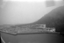
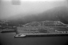
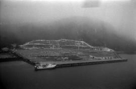
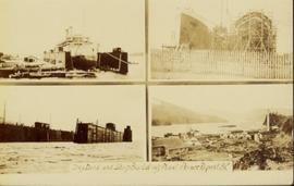
Collection of four photographs of the Prince Rupert dry dock. Printed annotation on recto reads: "Dry Dock and Ship Building Plant, Prince Rupert BC."
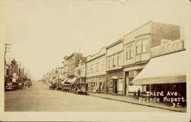
Street view of Third Avenue in Prince Rupert. Many vehicles are parked along the wooden sidewalk. Printed annotation on recto reads: "Third Ave. Prince Rupert. B.C."
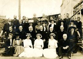
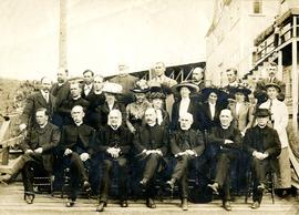
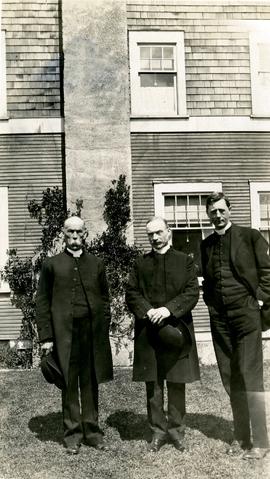
The Archdeacon W.H. Collison fonds consists of textual materials, maps, published materials and photographs all documenting Collison’s life and work with North Coastal First Nations communities in British Columbia. Types of records found within this fonds include manuscripts, sermon notes, correspondence, oral history summaries, monographs, cartographic items, photographs and postcards. The Collison fonds also includes some records created by his children and grandchildren as well as a family tree created in 1986. The Collison fonds has been divided into four series.
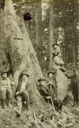
Collison, W.H. (Archdeacon)Photograph of Archdeacon WH Collison reclining against a large tree with a group of friends and family. Handwritten annotation on verso reads: "Arch. Collison with sons Max & Arthur & friends in mountains above Portland [?] Canal Me."
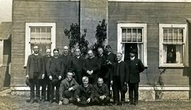
Group stands and sits in front of a large building. W.H. Collison stands fifth from left, W.E. Collison on far right.
Handwritten annotation on verso reads: "Synod at Prince Rupert BC".
Group of men and women pose by large building. W.H. Collison sits second from left in second row, W.E. Collison stands third from right in back.
Handwritten annotation on verso reads: "Early synod of the Anglican Church at Prince Rupert B.C."
Group of men and women pose by large building. W.H. Collison sits second from left in front, W.E. Collison stands third from right in back.
Handwritten annotation on verso reads: "Anglican Church Synod / Prince Rupert".
Group stands in front of a large building, W.H. Collison on left.
Handwritten annotation on verso reads: "Arch. WH Collison / Bishop [Du Vernet?] / Arch. Bish. [Du Pencior?] at Prince Rupert".
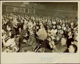
Packed gymnasium applauding after the April 1972 production (see items 2009.6.1.11 - 2009.6.1.17).
Slightly elevated view of the Prince Rupert Inn on Avenue A. Printed annotation on recto reads: "Avenue A Prince Rupert BC Allen Photo." Handwritten annotation on verso reads: "August 9 1908 Hopping[sic] this will find you all well with kind regards. [illegible]. C Mouat." Postcard is addressed to: "Miss Jemima Colvin Rosedale Farm Cowichan Station B.C." Verso affixed with a one cent Canadian stamp. Postmark on verso reads: "Prince Rupert BC Au 9 08."
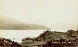
Foreground shows two rocky shores covered in dirt and wood debris, connected by a barely visible bridge. Annotation on recto reads: "Before the Blast Apr. 24th 13"
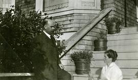
Rev. William Edwin Collison stands to left of wife Bertha who sits on front steps of large shingled home, flower pots in background (oldest son of of Archdeacon W.H. Collison).
Handwritten annotation on verso reads: "Dad & Mother Prince Rupert".
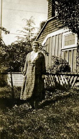
Bertha Collison stands on lawn in front of house (wife of Rev. W.E. Collison).
Handwritten annotation on verso reads: "Mother / Prince Rupert".
Bertha Collison stands on front steps, to left of second woman standing below.
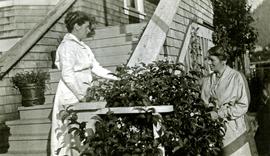
Handwritten annotation on verso reads: "Mother & Aunt Rose Davies at our house in Prince Rupert".
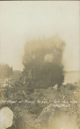
Photograph shows a large explosion surrounded by clearcut brush. Some machinery is visible in the foreground. Annotation on recto reads: "Big Blast at Prince Rupert BC Aug 17/08 Allen Photo."
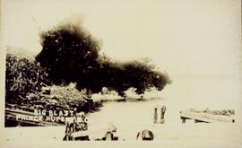
Photograph of a large explosion on what appears to be a shoreline. Printed annotation on recto reads: "'Big Blast' Prince Rupert. B.C."
Item is an audio reel to reel recording of Board of Broadcast Governors (BBG) Hearings, Prince Rupert, 1965 [?] dealing with an application fora broadcasting license for a group in Prince Rupert, BC. The Board of Broadcast Governors later became the Canadian Radio Television Commission
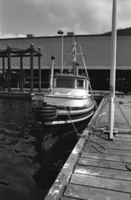
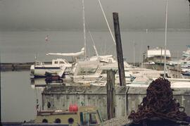
Photograph depicts an unidentified fishing boat at the Prince Rupert marina.
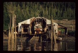
Image depicts a boat docked inside what appears to be a type of boathouse, possibly located in Metlakatla near Prince Rupert, B.C.
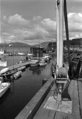
Photograph depicts a hoist and many unidentified boats at the Prince Rupert marina.
