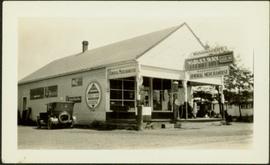
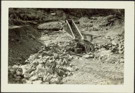
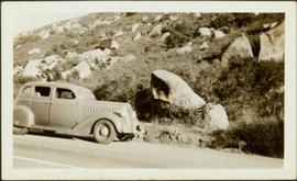
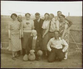
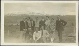
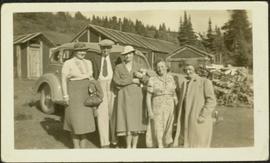
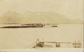
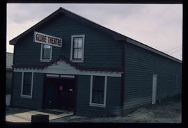
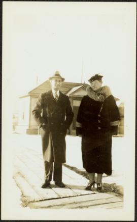
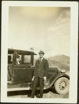
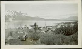
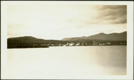
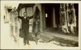
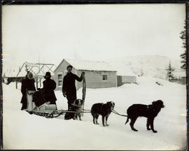
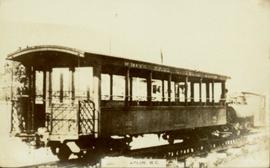
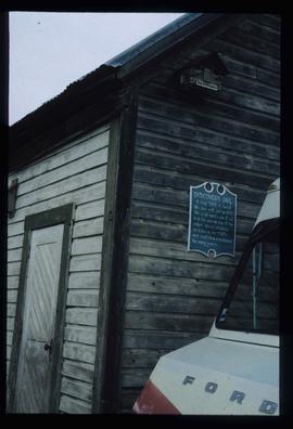
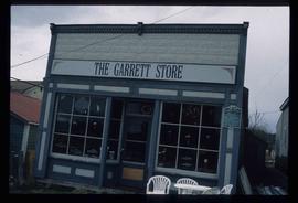
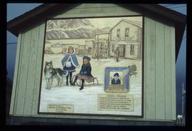
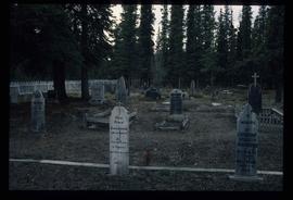
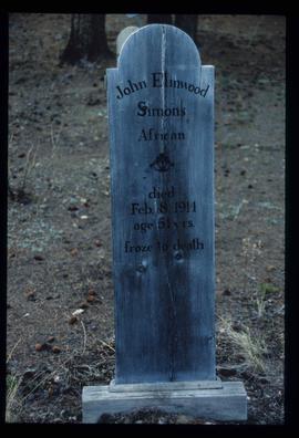
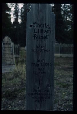
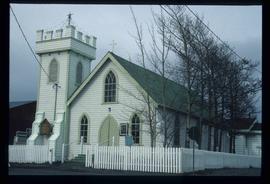
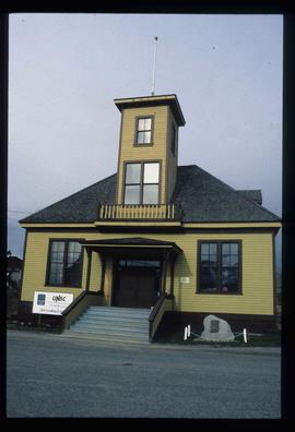
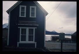
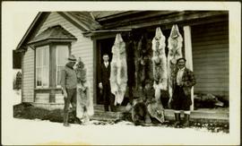
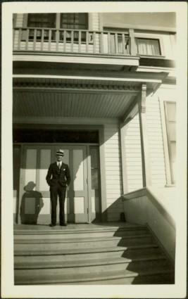
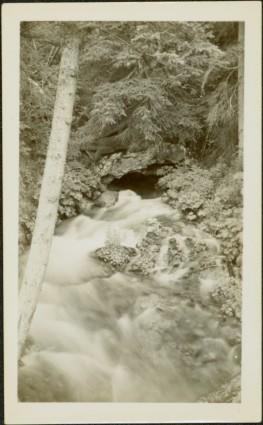
This Collection consists of photographs documenting early development of the Central Interior including such subjects as: homesteading, railway construction, packing & freighting, modes and routes of transportation, schools, mercantile development, leisurely activities, sports, natural resource development and exploitation, political movements, town-site development and policing. This collection also provides a look at history of the Taylor-Baxter Family - a long time pioneering family of this region, including: A.K. & Lillian Bourchier; Hugh & Hermina "Minnie" (nee Wessel) Taylor and family; Herbert & Sarah (nee Wessel) Glassey; and Bob & Violet (nee Taylor) Baxter and family.
Photograph depicts young girl standing on front deck of "WANAMAKER'S GENERAL MERCHANDISE." Car visible on left, gas pump in front. Trees and neighbouring house visible in background. Handwritten annotation on recto of photograph: "ATLIN."
Photograph depicts a large structure in center of mining area in riverbed, equipment and supplies scattered throughout. Buildings and forest in background. Handwritten annotation on verso of photograph: "Spruce Creek, Lower Shovel Workings 6/25/39.", on recto: "Atlin".
Photograph depicts car on road, rocky hillside in background. Typed caption beneath this photograph: "The official car of the Government Agent, Atlin". Handwritten annotation on recto of photograph: "Uncle Bert's car as Government Agent".
Photograph depicts Pine Creek winding through forest and hills. Altin Lake and mountains in background. Handwritten annotation on recto of photograph: "Atlin: Looking down lower Pine Ck, westerly towards Atlin, Atlin Lk, & the Atlin Mts. (part of Coast Range)."
Group of ten men and women stands and kneels in front of fence, field and hills in background. Sarah stands third from left. Similar group also featured in items 2009.5.2.274 - 2009.5.2.294.
Group of eleven men and women stands and kneels in front of fence, field and hills in background. Sarah stands fourth from left, Bert stands on far right. Handwritten annotation on recto of photograph: "Murphy's place ATLIN." Similar group also featured in items 2009.5.2.274 - 2009.5.2.294.
Group of four women and one man stands in front of car in unidentified yard. Sarah stands on far left, buildings, wood pile, and forest in background. Handwritten annotation on recto of photograph: "[Wright Car?] Atlin." Similar group also featured in items 2009.5.2.274 - 2009.5.2.294.
Left to right: Deborah Poff, Dennis Macknak, Charles Jago, an unidentified woman, Iona Campagnolo, an unidentified man, Ellen Facey, and an unidentified woman. Unknown man stands on lower deck in foreground. Mountains visible in background. Photograph taken during the Chancellor's 1996 regional tour through Atlin and Whitehorse; see also items 2009.6.1.578 - 2009.6.1.581.
Handwritten annotation on verso reads: "#3 Chancellor's Tour".
Photograph of a vessel in a large body of water with several mountains visible in the background. Printed annotation on recto reads: "Atlin Mt., Atlin, B.C."
Photographs within this file document resource industries within Northern BC such as mining, fishing, forestry etc. They also represent resource industry cooperatives, processing, packing and shipping industries, construction and ship building, as well as salvage companies and operations.
This antler was a gift to Minister Iona Campagnolo commemorating her visit to Atlin, British Columbia. Inscribed on the antler are the words "Iona Campagnolo - Atlin Fun Days 1977" and a silhouette of dogsled team.
Image depicts old machinery, at the Atlin Museum in Atlin, B.C.
Image depicts Atlin Lake as well as a small section of Atlin, B.C. The mountain is possibly Atlin Mountain.
Image depicts Atlin Lake.
Image depicts the Globe Theatre in Atlin, B.C.
Image depicts a lake somewhere along what is possibly the Atlin Road to Atlin, B.C.
Image depicts a mountain somewhere along what is possibly the Atlin Road.
Image depicts numerous graves in the Atlin Cemetery.
Photocopied map depicts mineral and coal mining properties in north western British Columbia.
This photograph album consists of photographs, membership cards and correspondence of Herbert F. Glassey. Subjects identified in this album include: automobiles, landscape vistas, hunting scenes, snowshoeing, dog sledding, provincial government offices and waterscapes. Identified geographic locations include: Nesutlane Trading Post, Atlin, Teslin Lake, Atlin Lake, McKee Creek, Taku Glacier and Otter Creek. The following of Mr. Glassey’s membership cards are also included within this album: “White Pass & Yukon Route, No. 308: Government Agent, Atlin account, 1939-1940”; “White Pass & Yukon Route, No. 283: Government Agent account, 1941-1942”; “Registration Certificate, 1940”; “The Wartime Prices and Trade Board, no.1305, 1942”; “Dominion Bureau of Statistics, no.252”; “The Society of Notaries Public Membership Card, 1956”; and “Prince Rupert Liberal Association, 1953”.
Sem títuloPhotograph depicts Sarah and H.F. Glassey standing on wood sidewalk in hats and long jackets, unidentified house in background. Handwritten annotation on recto of photograph: "Sarah & Bert Glassey". Photograph speculated to have been taken near the Glassey home at Atlin, BC.
Photograph depicts Sarah seated in passenger seat, and Bert standing to right of car. Mountain in background. Typed caption beside this photograph: "H.F. Glassey (Bert) Government Agent, Gold Commissioner, Coroner, Justice of Peace Atlin, B.C. with his wife Sarah in the car. 1934 --- 1942". Handwritten annotation on recto of photograph: "Auntie & Uncle Bert".
Photograph depicts town site in foreground, lake and mountains in background. Handwritten annotation on recto of photograph: "Atlin: Atlin, Atlin Lk, & Atlin Mts. looking N.west from Glassey's (Govt. Agent) window."
Photograph depicts town in distance, believed to be Atlin, B.C. Lake in foreground, hills in background. See also items 2009.5.2.63 & 2009.5.2.64.
Photograph depicts H.F. Glassey wearing a suit and tie, holding up a wolf pelt in both hands. House stands behind Glassey, pelts hanging from eaves in front of porch. These pelts came from the Teslin Lake area (this region spans Northern British Columbia and the Yukon Territory). Anglican Church partially visible in left background. Typed annotation on recto of photograph: "Come up and do some hunting." Typed caption below this photograph: "Atlin." See also items 2009.5.2.68 & 2009.5.2.69.
Photograph depicts two women and one man standing in snowy street behind loaded sled pulled by three large dogs. Unidentified buildings in background, hill visible in distance. It is speculated that this photograph may have been taken in Atlin, B.C.
Five unidentified miners pose for a photo. Logs and wood scraps in foreground, forest in background.
Printed annotation on recto of photograph: "PLACER MINING, ATLINTOD RIVER, ATLIN, B.C. A.C. HIRSHFELD NO. 753."
Left to right: Chancellor Iona Campagnolo, Nick Petraryszak, Ellen Facey, unidentified woman and men. Mountains visible in background. Photograph taken during the Chancellor's 1996 regional tour through Atlin and Whitehorse; see also items 2009.6.1.578 - 2009.6.1.581.
Photograph of man on the back of a passenger car attached to a steam engine. Printed annotation on recto is obscured by emulsion damage and reads: "[illegible] Atlin, B.C."
Image depicts the post office in Atlin, B.C.
Image depicts an old building which used to be the Discovery Jail. The plaque on it reads: "It cost $800 to build this two cell jail in 1902. The solid walls are 2"x6" laid flat one on top of the other. It was skidded to Atlin in the 1920s and used as a residence for many years."
Image depicts the Garrett Store in Atlin, B.C. A plaque on it reads: "John Garrett, a prominent English cricket player, came to Atlin in 1910 to mine gold. In 1917 he opened this grocery and dry goods store where he also sold his wife's fresh baked bread and sweets."
Image depicts a mural of Atlin with information about the Globe Theatre and Edwin L. Pillman on it. It reads: "Talented businessman arrived in Atlin in 1899, and for nearly fifty years operated a variety of businesses ~ grocery and drug stores, undertaker, market gardens and the theatre. Assissted by his loyal wife Elizabeth." It also states that the Globe Theatre was built in 1917 and was used until the early 40's.
Image depicts a lake somewhere along what is possibly the Atlin Road to Atlin, B.C.
Image depicts what is possibly Atlin Road. Numerous mountains are visible in the distance.
Image depicts a mountain, possibly Atlin Mountain.
Image depicts numerous graves in the Atlin Cemetery.
Image depicts the grave of John Elmwood Simons in the Atlin Cemetery. It reads: "died Feb. 8, 1914, age 61 yrs. froze to death."
Image depicts the grave of Charley William Rudolf in the Atlin Cemetery. It reads: "Born July 2, 1923. Died May 21, 1940. Age 16 years. Died from gunshot wounds, mistaken for a bear."
Image depicts the travel infocentre at the Atlin Museum. The slide labels it as having once been a school.
Image depicts the UNBC partnership campus in Atlin, B.C. The slide also labels it as being a former courthouse.
Image depicts a building which once served as the residence for two nurses in Atlin, B.C. A sign in front of the house reads: "Grateful Atlinites built this house in 1902 for their first missionary nurses, Helen Bone and Elizabeth Mitchell, who came here in 1899 and lived in a crude shack while valiantly and humanely caring for sick and dying pioneers."
Collection consists of a travel scrapbook created by Jill Singleton documenting a trip to Alaska, Yukon, Haida Gwaii, and northern BC. Includes photographs, ephemera, handwritten notes, pamphlets, issues of local newspapers, and maps.
This travel scrapbook was created by Jill Singleton to document a trip to Alaska, Yukon, Haida Gwaii, and northern BC. Jill Singleton and Eric Stathers embarked on a 1985 car camping trip using the BC Ferries and Alaska Ferry systems. Includes postcards, ephemera, handwritten notes, pamphlets, issues of local newspapers, and maps. Also includes 37 photographs.
Includes the following:
- "Queen Charlotte Islands Observer" newspaper issue for August 8, 1985
- "A Walking Tour and Business Directory for Queen Charlotte City", June 1985
- "A Walking Tour and Business Directory for Tlell + Port Clements", June 1985
- "A Walking Tour and Business Directory for Skidegate Landing, Skidegate and Sandspit", June 1985
- "A Walking Tour and Business Directory for Masset", June 1985
- "Explorations Q.C.I." pamphlet advertising guiding, outfitting, and touring
- "Sandspit Inn, Queen Charlotte Islands" pamphlet
- "Visit the Queen Charlottes" pamphlet
- Queen Charlotte Islands map, circa 1985
- BC Ferries pamphlet "New in 1985... Inside Passage Day Cruise"
- BC Ferries pamphlet "Tickets and Boarding Information, Inside Passage"
- "Alaska Marine Highway" pamphlet
- "Discover Southeast Alaska, Ketchikan" pamphlet
- "Alaska State Parks" pamphlet/map
- "Tongass National Forest, Alaska" pamphlet/map
- "Alaska Marine Highway Summer Schedule - May 1, 1985 through September 30, 1985" pamphlet
- History leaflet for St. Michael's Cathedral, Sitka, AK
- Alaska Seafood Marketing Institute leaflets, 1984
- Anchorage 1984 Visitors Guide, Anchorage Convention & Visitors Bureau
- "Skagway... some Steps on the Gold Rush Trail... walking Tour of the Historic District - Klondike Gold Rush National Historical Park"
- "Skaguay Alaskan" newspaper issue, Vol. VIII, No. 1880 (1985)
- "Klondike Gold Rush" pamphlet for tourists
- "Broadway, Skagway, Alaska" pamphlet
- "S.S. Tutshi, Carcross" pamphlet
- "Moon Watching" pamphlet by BC Ministry of Lands, Parks and Housing (1980)
- "Some Insects of Provincial Parks" pamphlet by BC Ministry of Lands, Parks and Housing (1980)
- "Stewart, British Columbia - Hyder, Alaska... Your Gateway to Alaska and the Yukon!" pamphlet
- "Stewart-Cassiar Highway 37" map
- "Prince Rupert City Map & Guide" pamphlet
- "Explore Canada's Yellowhead, Western Canada's New Interprovincial Highway" pamphlet (1983)
- "101 Things To Do in Yukon" booklet published by Tourism Yukon (1985)
- "Your Guide to B.C. Ferries' Inside Passage" booklet by British Columbia Ferry Corporation (1985)
- "Port Alberni, British Columbia, Canada" booklet (1981)
Trip itinerary:
- Vancouver, BC
- Nanaimo, BC
- Port Hardy, BC
- Prince Rupert, BC
- Yakoun River, BC
- Haida Gwaii, BC (formerly Queen Charlotte Islands)
- Rennell Sound, BC
- Graham Island, BC
- Queen Charlotte City, BC
- Sandspit, BC
- Prince Rupert, BC
- Ketchikan, AK
- Sitka, AK
- Tenakee Springs, AK
- Juneau, AK
- Skagway, BC
- Carcross, YK
- Atlin, BC
- Telegraph Creek, BC
- Kitwanga, BC
- Prince Rupert, BC
- Prince George, BC
- Lillooet, BC
- Vancouver, BC
Photograph depicts an unidentified First Nations man standing to right of wolf pelts that hang from eaves of house in Atlin, B.C. Stewart and Glassey stand on left, Glassey wearing a suit and tie. Typed annotation on recto of photograph: "Wolf pelts from Teslin, B.C.", handwritten: "Ron Stewart is policeman." See also items 2009.5.2.67 & 2009.5.2.68.
Photograph depicts Bert Glassey standing on front steps under balcony of building, windows visible in background. Typed annotation on recto of photograph: "Since the snow left 1936. Atlin Government Building."
Photograph depicts the Atlin townsite, forest in foreground, hills in background. Town stands on edge of lake located in left midground. Handwritten annotation on verso of photograph: "Atlin City B.C., Sept. 3rd 1899. Copyrighted by S.A. Smythe Atlin, B.C."
Photograph depicts water flowing from ground in forest. Handwritten annotation on recto of photograph: "Atlin, The Grotto, Outlet of a subterranean stream (in limestone) on way to O'Donnell River."