Print preview Close

Showing 487 results

Archival description
434 results with digital objects Show results with digital objects
Chander Suri fonds
1996.8 · Fonds · 1954-2009

This fonds encompasses the planning career of Chander Suri. The head planner for the Regional District of Fraser-Fort George from 1969 to 1977, Chander Suri embarked on numerous community plan projects in the Prince George area. Suri also worked as an independent planning consultant for local businesses and organizations. Chander Suri's records encompass numerous urban and rural projects facilitating population and industry growth within the RDFFG that spanned beyond Suri's career.

Textual records comprise official and draft planning documents, development reports, planning proposals, contracts, published regulations, socio-economic studies of regions near Prince George, financial and other studies for development sites, illustrated promotional packages/proposals for developments, regional/provincial guides and standards, and correspondence relating to Suri's professional consulting activities. The fonds contains a wide array of maps, architectural plans, and technical drawings ranging from municipal planning layouts, industrial land developments, and private property (commercial and residential) development projects, mainly from in and around Prince George.

These records are relevant to researchers of the subjects of land use, land development and land planning issues in the Prince George and Fraser-Fort George Regional District in the second half of the 20th century.

Series include:

  1. Maps and Plans relating to development projects in British Columbia, predominantly in the Prince George area
  2. Lower Mainland Planning material from Suri's early career period
  3. Regional District of Fraser Fort George Planning records and resource material collected by Suri during his employment at the RDFFG
  4. Planning Consultancy records relating to Suri’s independent planning consultancy work in his later career period
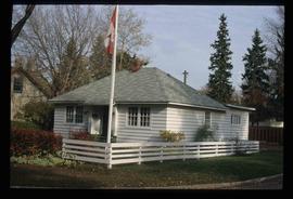
Suri, Chander
2012.13.1.135.01.11 · Item · [between 1980 and 2000]
Part of J. Kent Sedgwick fonds

Photograph depicts a residential building at 1612 12th Avenue, the building was used as "Prince Realty". Annotation on verso: "1612 - 12th Ave., NW corner of Vancouver."

2012.13.1.135.01.05 · Item · [between 1980 and 2000]
Part of J. Kent Sedgwick fonds

Photograph depicts Rosel's restaurant at 1624 7th Avenue. Rosel's restaurant was owned and operated by Wilfred and Rosel Vogt from 1981 to 1997. The building was built in 1916 and was originally owned by Dr. Carl Ewart and later owned by Hubert King of Wilson, King and Company, the oldest law firm in Prince George, after 1946. The building is now a designated heritage building.

2012.13.1.135.01.03 · Item · [between 1980 and 2000]
Part of J. Kent Sedgwick fonds

Photograph depicts a residential building at 1601 6th Avenue, the corner of 6th Avenue and Vancouver Street. Annotation on verso: "CUTE c-7, union, Vancouver/ 6th".

2012.13.1.135.01.26 · Item · [between 1980 and 2000]
Part of J. Kent Sedgwick fonds

Photograph depicts the old post office and federal government building at 1299 3rd Avenue prior to the coat of arms removal. Annotation on verso: "fed. govt bldg, (post office), c. 1990, before, coat of arms, removal".

Businesses along 3rd Avenue
2012.13.1.135.01.24 · Item · [between 1980 and 2000]
Part of J. Kent Sedgwick fonds

Photograph depicts various businesses along 3rd Avenue. The businesses include the Europe Hotel and The Bay in the background. Annotation on verso: "left Europe Hotel, right shearer bldg".

Shearer building
2012.13.1.135.01.23 · Item · [between 1980 and 2000]
Part of J. Kent Sedgwick fonds

Photograph depicts the Shearer building in Prince George. Annotation on verso: "Shearer bldg".

1690 Dogwood Street
2012.13.1.24.32 · Item · 2000
Part of J. Kent Sedgwick fonds

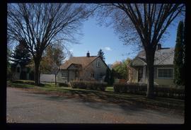
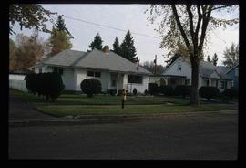
Image depicts 1690 Dogwood Street, on the corner of 17th Ave and Dogwood St. in Prince George, B.C. Also depicts a portion of 1670 Dogwood Street at left.

Houses on Dogwood Street
2012.13.1.24.34 · Item · 2000
Part of J. Kent Sedgwick fonds

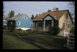
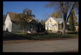
Image depicts houses on Dogwood Street in the Millar Addition neighbourhood of Prince George, B.C. On the left is 1610 Dogwood Street and 1630 Dogwood Street is the middle house; 1650 Dogwood Street is the blue house on the right.

2011.3.2.20 · Item · [ca. 1910-1924]
Part of North Coast & Central BC Postcard Collection

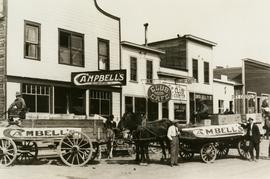
Street view photograph of a commercial section in downtown Prince George with several "Campbell's" delivery carts parked along the road. Visible establishments include "Campbell's All Cash Store" and "Club Cafe." Handwritten annotation in blue ballpoint pen on recto reads: "Howdy from Prince George! Going easy with all these kids- good to see Kathee. Snow here. Have fun at the sports show & don't over do it. Thinking of you guys, love Judy and Vic. P.S. Can't wait to go home to somewhere peaceful and quiet. 2-27-83." Postcard is addressed to: "Mr. & Mrs. Hauffer 8429-221 PL. Sn. Edmonds, WA. U.S. 98020." Verso is affixed with four Canadian 8-cent stamps.

Central Business District
2012.13.1.3.057 · Item · July 1979
Part of J. Kent Sedgwick fonds

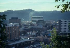
Image depicts the Central Business District of Prince George looking north from Connaught Hill. Map coordinates 53°54'41.4"N 122°44'58.5"W