Image depicts Kent Sedgwick standing in a forest somewhere on Haida Gwaii.
Image depicts a forest somewhere on Haida Gwaii.
Image depicts several individuals examining totem poles which are possibly undergoing a restoration process somewhere on Haida Gwaii.
Image depicts a house on the shore somewhere on Haida Gwaii.
Image depicts a view of the coast of Haida Gwaii.
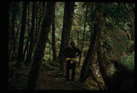
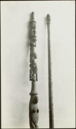
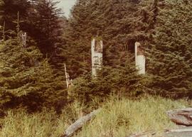
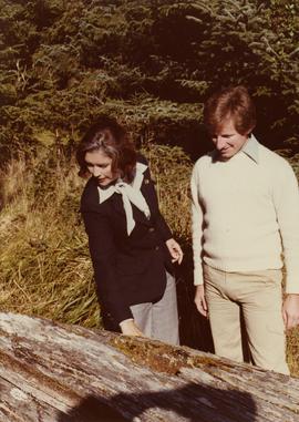
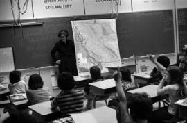
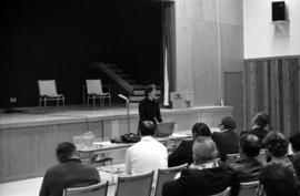
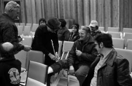
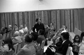
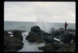
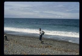
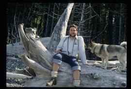
File consists of records created and accumulated by Gary Runka over the course of his consultancy work for Queen Charlotte Islands Forest District for the "Facilitation and Mediation of Local Resource Use Plan for Tlell Watershed" project in Tlell River. This file was numbered as G.G. Runka Land Sense Ltd. client file #539; that client number may be seen referenced elsewhere in the G. Gary Runka fonds. The Land Sense Ltd. client files generally include records such as correspondence, contracts, invoices, project reports, publications, ephemera, memoranda, maps or map excerpts, legal documents, meeting materials, clippings, and handwritten notes.
Maps include:
- BC Ministry of Forests, "Tlell River Local Resource Use Plan - Leading Species", Feb. 1999.
- BC Ministry of Forests, "Tlell River Local Resource Use Plan - Age Class", Feb. 1999.
- BC Ministry of Forests, "Tlell River Local Resource Use Plan - Aspect", Feb. 1999.
- BC Ministry of Forests, "Tlell River Local Resource Use Plan - Ownership/Tenure", Feb. 1999.
- BC Ministry of Forests, "Tlell River Local Resource Use Plan - TEM Ecosystem Types", Feb. 2000.
- BC Ministry of Forests, "Tlell River Local Resource Use Plan - TEM Groupings", Feb. 2000.
- BC Ministry of Forests, "Tlell River Local Resource Use Plan - Soil and Moisture Regimes", Feb. 2000.
- BC Ministry of Forests, "Tlell River Local Resource Use Plan - Berry Potential, Map 1 of 5: Red Huckleberry", Mar. 2000.
- BC Ministry of Forests, "Tlell River Local Resource Use Plan - Berry Potential, Map 2 of 5: Alaskan Blueberry", Mar. 2000.
- BC Ministry of Forests, "Tlell River Local Resource Use Plan - Berry Potential, Map 3 of 5: Salal", Mar. 2000.
- BC Ministry of Forests, "Tlell River Local Resource Use Plan - Berry Potential, Map 4 of 5: Oval-Leafed Blueberry", Mar. 2000.
- BC Ministry of Forests, "Tlell River Local Resource Use Plan - Berry Potential, Map 5 of 5: Wetland Berries", Mar. 2000.
- BC Ministry of Forests, "Tlell River Local Resource Use Plan - Known Scenic Areas", Mar. 2000.
- BC Ministry of Forests, "Tlell River Local Resource Use Plan - Height Class", Mar. 2000.
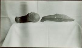
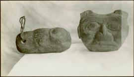
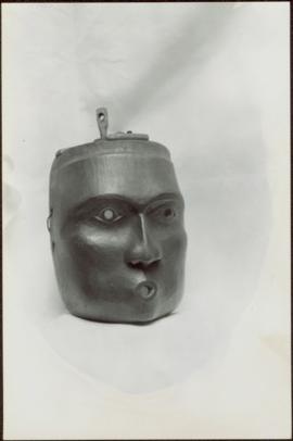
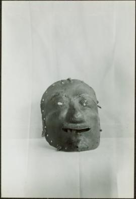
- BC Ministry of Forests, "Tlell River Local Resource Use Plan - Archaeological Overview Assessment", Mar. 2000.
- BC Ministry of Forests, "Tlell River Local Resource Use Plan - Fire Legacy", Mar. 2000.
- Tlell Watershed Society (TWS) and geoMAX carto/graphics, "Northern Goshawk (Accipiter gentilis laingi) Nesting Habitat for the Tllel River Watershed, Queen Charlotte Islands / Haida Gwaii, British Columbia", Draft map, n.d.
- Tlell Watershed Society (TWS) and geoMAX carto/graphics, "Marbled Murrelet (Brachyramphus marmoratus) Nesting Habitat for the Tllel River Watershed, Queen Charlotte Islands / Haida Gwaii, British Columbia", Draft map, n.d.
- Tlell River Local Resource Use Plan, Feather Creek topographic map, n.d.
Two carved wooden figures stand side by side to mark the burial of a Haida medicine man. Each figure has one arm up with a hand under or over the chin, while the other arm is down. Carved chiefly headdresses adorn each of their heads.
Handwritten annotation in pen on verso reads: “Shaman’s grave nr. --Masset QCIs.”
Model totem pole standing upright in front of a blanket backdrop. Handwritten annotation in pen on verso reads: “Dad’s totem pole (W.E. Collison)”
Close-up perspective of the top of the model totem pole which is standing upright on the floor against a blank wall. Handwritten annotation in pen on verso reads: “W.E. Collison.” Stamped annotation on verso reads: “Department of Mines and Resources, Photographic Section. Oct. 6, 1939”. Numeric annotation on verso: “35-4”
Profile perspective of two model totem poles carved from argillite, set against a white backdrop. Handwritten annotation in pen on verso reads: “W.E. Collison.” Stamped annotation on verso reads: “Department of Mines and Resources, Photographic Section. Oct. 6, 1939”. Numeric annotation on verso: “43-2”
Close up perspective of the top of the two carved wooden staffs, both inlaid with abalone shell, leaning against a wall side by side, a white sheet serving as a backdrop. Handwritten annotation in pen on verso reads: “W.E. Collison.” Stamped annotation on verso reads: “Department of Mines and Resources, Photographic Section. Oct. 6, 1939”. Numeric annotation on verso: “52-1”
Intricately carved argillite dish inlaid with abalone shell. Handwritten annotation in pen on verso reads: “W.E. Collison.” Stamped annotation on verso reads: “Department of Mines and Resources, Photographic Section. Oct. 6, 1939”. Numeric annotation on verso: “51-4”
Intricately carved argillite dish featuring inlaid triangular pieces of stone or shell material around its perimeter and a series of seven faces within its centre. Handwritten annotation in pen on verso reads: “W.E. Collison.” Stamped annotation on verso reads: “Department of Mines and Resources, Photographic Section. Oct. 6, 1939”. Numeric annotation on verso: “51-6”
Two carved wooden bentwood boxes; one containing seven carved wooden spoons. Handwritten annotation in pen on verso reads: “W.E. Collison.” Stamped annotation on verso reads: “Department of Mines and Resources, Photographic Section. Oct. 6, 1939”. Numeric annotation on verso: “49-5”
Figure on the left is a club-shaped cylindrical figure with bulbous human face at one end; abalone shell is inlaid in the face for eyes. Figure on the right is a club carved in the shape of a whale with inlaid eyes and engraved markings on its sides. Handwritten annotation in pen on verso reads: “W.E. Collison.” Stamped annotation on verso reads: “Department of Mines and Resources, Photographic Section. Oct. 6, 1939”. Numeric annotation on verso: “51-1”
Carved stone figure on left features a hole at one end through which a rope is strung; while the figure on the right is a soapstone figure carving of a face with two ears to the sides and split ‘u’ ones at the top of the head. Handwritten annotation in pen on verso reads: “W.E. Collison.” Stamped annotation on verso reads: “Department of Mines and Resources, Photographic Section. Oct. 6, 1939”. Numeric annotation on verso: “51-5”
Carved wooden mask of a mythic creature whose mouth is in the shape of an ‘o’. Stamped annotation on verso reads: “Department of Mines and Resources, Photographic Section. Oct. 6, 1939”. Numeric annotation on verso: “33-2”
Mask created from leather or metal, featuring eyeholes and a mouth hole as well as holes pierced around the perimeter of the mask itself. Stamped annotation on verso reads: “Department of Mines and Resources, Photographic Section. Oct. 6, 1939”. Numeric annotation on verso: “45-5”
File contains linguistic notes prepared by W.H. Collison and sermons written by W.H. Collison in various First Nations languages.
Maps within this series document the placer streams, islands and harbours of the Queen Charlotte Islands; as well as the mining properties located within the vicinity of Stewart, BC.
Series contains publications on the following subjects: linguistics, First Nations studies, anthropology, museum studies, the Missionary Society of the Church of England, the Metlakatla Inquiry, material culture and Canadian geography. It is believed that items published prior to 1922 had been collected by the Archdeacon W.H. Collison, while those published post 1922 (the year W.H. Collison passed away) were collected by both his son W.E. Collison and then his grandaughter Joyce Collison.
Photograph depicts village buildings along shore.
Handwritten annotation on verso reads: "67 Section of Massett as it is".
The pair sits on ground beside large totem pole, Bertha on left (wife of W.E. Collison). Log fence can be seen in front of forest in right background.
Handwritten annotation on verso reads: “Mother & Josie Edenshaw at Massett".
The pair stands on beach, Joyce leaning down in foreground (daughter of Bertha and Reverend W.E. Collison, and granddaughter of Marion and Archdeacon W.H. Collison). Water and shoreline in background.
Handwritten annotation on verso reads: “Joyce & Col. [Pragnell?] on North Beach QCIs (Old Massett)."
Totem poles (crest poles?) stand in front of a line of houses. Blanketed canoes sit on beach in right foreground; forest in background.
Handwritten annotations on verso read: “Haida Encampment [crossed through with line]"; "Skidegate Queen Charlottes Islands / To illustrate Introduction / Introduction Trophies from a Song [Trail?] Page 1 Heading."
Totem poles (crest poles?) stand in front of wood building, hills visible in background.
Handwritten annotation on verso reads: "Poles on QC Isl."
Japanese fishing float probably found or received by Minister Iona Campagnolo in Haida Gwaii.
Photograph depicts a totem pole in a British Columbia rainforest, possibly on Haida Gwaii.
Photograph depicts Iona Campagnolo presenting a New Horizons program cheque to Queen Charlotte Islands senior citizens in Masset. The grant was made for the preparation of a written history of the Queen Charlotte Islands.
Photograph depicts three Haida totem poles, partially obscured by grass and young trees.
Photograph depicts Iona Campagnolo looking at a fallen Haida totem pole with Peter Jones in Ninstints, Anthony Island, Haida Gwaii. The totem pole is in the foreground. Peter Jones may have accompanied Campagnolo on her Skeena riding tour as a photographer.
Photograph depicts Iona Campagnolo standing beside a map of British Columbia and talking to a class of elementary school children in Haida Gwaii during Campagnolo's Skeena Riding Tour of Haida Gwaii, BC. The children are in the foreground with their backs to the camera.
Photograph depicts Iona Campagnolo and an unidentified teacher talking to a class of elementary school children in Haida Gwaii during Campagnolo's Skeena Riding Tour of Haida Gwaii, BC. The children are in the foreground and the majority are not facing the camera.
Photograph depicts Iona Campagnolo talking to a class of elementary school children in Haida Gwaii during Campagnolo's Skeena Riding Tour of Haida Gwaii, BC. Several of the children are raising their hands.
Photograph depicts Iona Campagnolo talking to a class of elementary school children about the Canada Fitness Award program in Haida Gwaii during Campagnolo's Skeena Riding Tour of Haida Gwaii, BC. An unidentified adult (possibly a teacher) is in the far right corner.
Photograph depicts Iona Campagnolo standing outside the school and signing an autograph for an unidentified female student during Campagnolo's Skeena Riding Tour of Haida Gwaii, BC.
Photograph depicts Iona Campagnolo talking with unidentified constituents at a community meeting in an auditorium. The constituents, with their backs to the camera, are in the foreground. Taken during Campagnolo's Skeena riding tour in Haida Gwaii, British Columbia.
Photograph depicts Iona Campagnolo signing the cast of an unidentified constituent. Several other unidentified constituents surround them. Taken during Campagnolo's Skeena riding tour in Haida Gwaii, British Columbia.
Photograph depicts Iona Campagnolo standing and talking in a group of unidentified seated constituents. Taken during Campagnolo's Skeena riding tour in Haida Gwaii, British Columbia.
File contains slides depicting places on Haida Gwaii, formerly known as the Queen Charlotte Islands.
Image depicts a woman standing on a rocky shore somewhere on Haida Gwaii, B.C.
Image depicts Kent Sedgwick walking along the coastline of Haida Gwaii, B.C.
Image depicts numerous trees in the coastal forest of Haida Gwaii, B.C.
Image depicts Kent Sedgwick sitting with a dog on a log on the shore of Haida Gwaii, B.C.
Image depicts a downward view of a small section of the shore of Haida Gwaii.
Image depicts an aerial view of the coastline of Haida Gwaii, B.C.
Image depicts the waters of the Hecate Strait.
Image depicts the waters of the Hecate Strait, possibly on approach to Haida Gwaii, B.C.