2020.4.8.2.004
·
Pièce
·
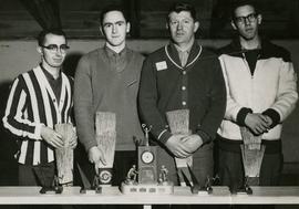
Feb. 1964
Fait partie de G. Gary Runka fonds
Photograph depicts a curling team at a Feb. 1964 Summerland Curling Club event. Trophy at centre reads "L.A. Smith Ltd. Event". From left to right: Unknown, Brian McCormick, Gary Runka, Art (surname unknown).