File consists of records created and accumulated by Gary Runka over the course of his consultancy work for B.C. Women's Institutes for the "Site C - Environmental Impact Statement Technical Review" project in Site C. This file was numbered as G.G. Runka Land Sense Ltd. client file #671; that client number may be seen referenced elsewhere in the G. Gary Runka fonds. The Land Sense Ltd. client files generally include records such as correspondence, contracts, invoices, project reports, publications, ephemera, memoranda, maps or map excerpts, legal documents, meeting materials, clippings, and handwritten notes. Also includes an oversize bound map book by BC Hydro entitled "Preliminary Impact Lines and Preferred Highway 29 Realignments Maps" for the Site C project, published April 2012.
Map depicts Canadian railways in operation at 2011.
The item is a map that depicts subdivision lots along the Fraser River in Prince George. The subdivision is DL 745 and 747 of the Cariboo District. Map is certified by G. F. Templeton, a BC land surveyor.

File consists of records created and accumulated by Gary Runka over the course of his consultancy work for Canoe Creek Indian Band for the "Overview of Issues and Concerns Related to Transmission Line Corridor Component" project in Dog Creek. This file was numbered as G.G. Runka Land Sense Ltd. client file #650; that client number may be seen referenced elsewhere in the G. Gary Runka fonds. The Land Sense Ltd. client files generally include records such as correspondence, contracts, invoices, project reports, publications, ephemera, memoranda, maps or map excerpts, legal documents, meeting materials, clippings, and handwritten notes. File also includes 2 accompanying DVDs.
Maps include:
- Reproduction of NTS map Bambrick Creek 92-O/11 Edition 2 showing photocopied overlay depicting planned transmission line corridor
- Reproduction of NTS map Mount Alex 92-O/10 Edition 3 showing photocopied overlay depicting planned transmission line corridor
- Reproduction of NTS map Gustafsen Lake 92-P/12 Edition 2 showing photocopied overlay depicting planned transmission line corridor
- Reproduction of NTS map Dog Creek 92-O/9 Edition 3 showing photocopied overlay depicting planned transmission line corridor
- Reproduction of NTS map Mount Tatlow 92-O/5 Edition 2 showing photocopied overlay depicting planned transmission line corridor
- Reproduction of NTS map Elkin Creek 92-O/12 Edition 2 showing photocopied overlay depicting planned transmission line corridor
- Jacques Whitford - AXYS Ltd. for Taseko Mines Ltd. Prosperity Project, "Taseko Transmission Corridor Orthophotography Series 1" draft map, August 2008 (revision #2).
- Jacques Whitford - AXYS Ltd. for Taseko Mines Ltd. Prosperity Project, "Taseko Transmission Corridor Orthophotography Series 2" draft map, August 2008 (revision #2).
- Jacques Whitford - AXYS Ltd. for Taseko Mines Ltd. Prosperity Project, "Taseko Transmission Corridor Orthophotography Series 3" draft map, August 2008 (revision #2).
- Stswecem'c Xgat'tem Natural Resources Department, untitled map showing reserves and transmission corridor, scale 1:26,779, May 2009.
- Stswecem'c Xgat'tem Natural Resources Department, untitled map showing reserves and transmission corridor and transmission line, scale 1:35,705, May 2009.
- Stswecem'c Xgat'tem Natural Resources Department, untitled map showing reserves and transmission corridor, scale 1:63,476, May 2009.
![City of Prince George - Schedule C of the Official Community Plan - Long Range Land Use Map [May 2008 Amendment]](/uploads/r/northern-bc-archives-special-collections-1/4/3/a/43a9e75941f1542735d999de340307d163e79dffdadbf4546bb9346b63f7e734/2023.5.1.41_-_2008_May_-_City_of_Prince_George_Long_Range_Land_Use_Map_JPG85_tb_142.jpg)
This map is the May 2008 amendment (Bylaw 8061) of the Schedule C of the 2001 Official Community Plan, Bylaw No. 7281 for the City of Prince George. This Schedule C map shows the long range land use for the City of Prince George.
![City of Prince George - Schedule C of the Official Community Plan - Long Range Land Use Map [October 2006 Amendment]](/uploads/r/northern-bc-archives-special-collections-1/6/d/6/6d643c10801eba2ac493689972e57429dba42ec7592f54cb55151b96362d7048/2023.5.1.40_-_2006_Oct_-_City_of_Prince_George_Long_Range_Land_Use_Map_JGP85_tb_142.jpg)
This map is the October 2006 amendment (Bylaw 7807) of the Schedule C of the 2001 Official Community Plan, Bylaw No. 7281 for the City of Prince George. This Schedule C map shows the long range land use for the City of Prince George.
![City of Prince George - Schedule C of the Official Community Plan - Long Range Land Use Map [May 2006 Amendment]](/uploads/r/northern-bc-archives-special-collections-1/6/5/5/65536bc04aa97580c140131651dc357dfe5c3a1315822394f388d96940bc39cb/2023.5.1.39_-_2006_May_-_City_of_Prince_George_Long_Range_Land_Use_Map_JPG85_tb_142.jpg)
This map is the May 2006 amendment (Bylaw 7807) of the Schedule C of the 2001 Official Community Plan, Bylaw No. 7281 for the City of Prince George. This Schedule C map shows the long range land use for the City of Prince George.

This street map of the VLA area in Prince George includes property outlines and street numbers.
Item is an original 2003 city map depicting Vancouver and the Fraser Valley published by Rand Mc Nally, with annotations in highlighting.
File consists of records created and accumulated by Gary Runka over the course of his consultancy work for BC Ministry of Sustainable Resource Management for the "Facilitation and Mediation of Central Coast Land and Resource Management Plan" project in Central Coast. This file was numbered as G.G. Runka Land Sense Ltd. client file #578; that client number may be seen referenced elsewhere in the G. Gary Runka fonds. The Land Sense Ltd. client files generally include records such as correspondence, contracts, invoices, project reports, publications, ephemera, memoranda, maps or map excerpts, legal documents, meeting materials, clippings, and handwritten notes.
Maps include:
- BC Ministry of Sustainable Resource Management Decision Support Services for Treaty Negotiations Office, "Central Coast LRMP", Nov. 2003.
- Nature Conservancy Canada, "Bella Coola Valley CIT Input and Analysis", Dec. 2005.
Item is a British Columbia Forest Cover Map, serial number 093J010. Includes full format forest cover labels.

This map is Schedule C of the 2001 Official Community Plan, Bylaw No. 7281 for the City of Prince George. This Schedule C map shows the long range land use for the City of Prince George.
File consists of research materials concerning First Nations science primarily in the Yukon but also in northern BC, North West Territories, and Native Americans in Alaska. File includes tourism promotional materials from the Yukon and Alaska.
The Aleza Lake Research Forest Society (ALRFS) records encompass material that was created or collected by the Society over its existence (2001-present). Records created by the ALRFS consist of administrative and operational records, as well as publications from the Society. Collected records include historical records relating to the Aleza Lake Experiment Forest gifted to the Society or its members. These include maps, photographs, reference material, and documents. Members and associates of the ALRFS also documented the history of the forest through the creation of oral history recordings and written histories such as John Revel's "Devil's Club, Black Flies, and Snowshoes".
The fonds includes a significant amount of reproduced archival material about Aleza Lake from other institutions, such as BC Archives, the Canadian Forest Service, and the BC Forest Service. Many of these reproductions were created as part of the 2006 ALRFS Natural Resources History Internship in an effort to compile the history of the research forest.
Also included are cartographic and photographic materials that depict the Aleza Lake Research Forest and surrounding areas.
![City of Prince George - Schedule B of the Official Community Plan, Bylaw No. 5909 [2001 Amendment]](/uploads/r/northern-bc-archives-special-collections-1/c/3/6/c36392b90696286cc6281e8cc2efbf7691c2617726495fa28db2cbdcc20e4e4c/2023.5.1.36_-_Official_Community_Plan_City_of_PG_Schedule_B_2001_JPG85_tb_142.jpg)
This map is part of Schedule B of the 1993 Official Community Plan, Bylaw No. 5909 for the City of Prince George. This particular map reflects the 1998 amendment to the Official Community Plan.
Item is a British Columbia Forest Cover Map, serial number 093I001. Includes full format forest cover labels.
This Slocan Group forestry development plan highlights contributing obstacles to the development like the Pine Beetle infestation.
Map depicts range reference area exclosure locations for livestock and wildlife in the Fort St. John Forest District.
The item is a map depicting the Salmon Portage area along the Salmon River. Various annotations are written in pen and sections of the map are coloured with pencil crayon. The Forest Cover Map identification number is 93J.027.

This map is the Schedule A accompanying map for the City of Prince George's Soil Removal and Deposit Bylaw No. 7022 of 1999. It depicts designated soil removal areas and M.O.T.H. gravel reserves.
The item is a map depicting the Salmon Portage area along the Salmon River. Various annotations are written in pen and sections of the map are coloured with pencil crayon. The Forest Cover Map identification number is 93J.026.

This map depicts the City of Prince George's plan for soil removal and deposit.

File contains information, including diagrams, measurement charts, and a map, for experimental plot 118.

File contains information, including diagrams, measurement charts, and a map, for experimental plot 103.
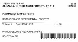
File contains information, including diagrams, measurement charts, and a map, for experimental plot 119.

File contains information, including diagrams, measurement charts, and a map, for experimental plot 115.

File contains information, including diagrams, measurement charts, and a map, for experimental plot 117.
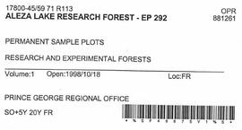
File contains information, including diagrams, measurement charts, and a map, for experimental plot 292.

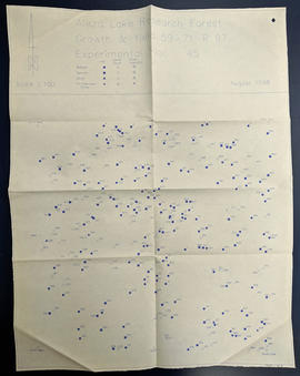
File contains information, including diagrams, measurement charts, and a map, for experimental plot 45.


File contains information, including diagrams, measurement charts, and a map, for experimental plot 112.


File contains information, including diagrams, measurement charts, and a map, for experimental plot 106.

File contains information, including diagrams, measurement charts, and a map, for experimental plot 107.