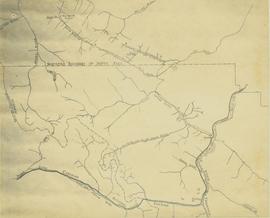
This map depicts the pit layout and estimated waste extraction areas for 6350 bench. Extraction dates accompanied by its total tonnages are located within each planned area. Annotated details include extraction dates, approximate total tonnages per area as well as extraction dates, total planned and broken tonnages and total tonnages from December 31, 1970 from a survey done in September 30. The hand drawn plan consists of solid lines drawn with red, green and orange colored pencils.
This map depicts the ore type and geology that can be found among each of the bench layers. Classifications and grades of ore are included within it. Different bench layers are included in the map. Annotations include a title in the back of the map written out as "1972 BENCH PLANS".
The topographic map shows mine and campsite holdings within the proposed mine site. Asbestos deposits, the tramline and water bodies, such as Troutline Creek, are also included.
Annotations include certain lot titles being crossed out as well as as indication of missing survey information.
A set of 13 maps showing approximate waste extraction areas for different benches during certain months of 1972. Extraction dates are included accompanied by estimated total tonnages for each planned extraction area. All plans are hand drawn using colored pencils, lead and black ink. Approximate calculations of extraction tonnages are included within certain months. Numerical bench markers are included. Total tonnages from the previous year and previous surveys are included within certain plans.
This map depicts the generalized pit layout and estimated waste extraction areas for 6290 bench for the month of November. Annotated details include numerical bench markers and waste extraction dates. The hand drawn plan consists of solid and dotted lines drawn with green, orange, red, blue and lead pencil.
File contains three maps of the Project area.
File contains miscellaneous notes, a hand-drawn map and an itinerary for the Mission.
Subseries contains maps and technical drawings produced by Grand Trunk and Grand Trunk Pacific Railways. Predominantly consists of plans of the rail line in the BC area. Also includes technical drawings of Grand Trunk Railway structures.
Pacific Great Eastern Railway series consists of correspondence between departments, records pertaining to train movements, and ephemera. Series includes publications concerning the topics of unionized labour, railway operation, and public interest. Also consists of maps and technical drawings depicting Pacific Great Eastern Railway lines and structures.
Sans titreThe Miscellaneous Forest History Material series consists of material created or used by various logging and pulp mill companies. Includes forms, union materials, maps, plans and other records related to the forestry sector in British Columbia. The series also comprises publications related to equipment and employee training, and correspondence and memorandum developed by B.C. Chemicals, a division of Canfor.
Subseries consists of maps, plans and posters pertaining to forestry in British Columbia and includes maps and plans depicting pre-emptor lots, communities, and industrial sites.
Map accompanies “Aleza Lake Research Forest Management and Working Plan #2 Draft #3”.
File contains information, including diagrams, measurement charts, and a map, for experimental plot 50.
File contains information, including diagrams, measurement charts, and a map, for experimental plot 113.
File contains information, including diagrams, measurement charts, and a map, for experimental plot 115.
File contains information, including diagrams, measurement charts, and a map, for experimental plot 117.
File contains information, including diagrams, measurement charts, and a map, for experimental plot 149.
File contains information, including diagrams, measurement charts, and a map, for experimental plot 292.
File contains handwritten cross section book, original studies with handwritten measurement charts and black and white photos, loose pages of original correspondence, handwritten diagrams and measurement charts, loose handwritten tally sheets, black and white photographs, hand coloured plot diagrams, photocopies of aerial photographs, and original correspondence for Plot 160.
Map of Timber Sale X72108 shows area to be scarified. Location is outside Prince George in the Upper Fraser area near Kenneth Creek.
Map of Timber Sale X72108 shows area to be scarified. Location is outside Prince George in the Upper Fraser area near Kenneth Creek.
Logging plan of Sinclair Spruce Lumber Company's T.S.X. 73378 at Hubble Creek shows areas to be cut. Annotations show areas logged.
Map depicts the climactic regions of British Columbia which includes the coast, interior, and the northwest.
The map depicts multiple real-estate listings by Multiple Listing Service (MLS) Prince George members.
The map of Canada is part of a greater booklet on Canadian history. This booklet was intended to help those preparing for their Canadian citizenship interview.
The map depicts mineral deposits in Northern British Columbia.
Map depicts the rivers, railways, and select lakes and towns located at Jasper Park between the northern boundary of the park and the townsite of Jasper. Part of the border between Alberta and British Columbia is visible on the west of the map.
File consists of research materials concerning First Nations science primarily in the Yukon but also in northern BC, North West Territories, and Native Americans in Alaska. File includes tourism promotional materials from the Yukon and Alaska.
File contains various correspondence regarding 1964 annual cuts for sawmills in the area, memoranda consisting of various administrative issues such as the 1973 amalgamation of Purden Lake and Aleza Lake, and the sale of lumber previously infested by spruce beetles. File also contains 1972 applications to purchase Crown timber and road use, as well as 1966 logging permits.
File contains drafts of management and working plan for the period of 1992 to 2002, the final draft for the management and working plan, and related correspondence between Mike Jull and those involved with the Aleza Lake Research Forest.
Series contains aerial photographs, stump data sheets, permanent sample plot summaries, correspondence, minutes from meetings, research proposals, budget reports, measurement charts, various historical documents, permits, field notes, overview diagrams, and an inventory of the 1994 Northwood Pulp and Timber donation to the Fraser Fort George Museum.
File contains plot summaries of selected permanent sample plots, correspondence regarding field courses, records of management committee meetings from 1991 and 1990, documents and correspondence pertaining to the re-opening of the Aleza Lake Research Forest, partial cutting summaries, research proposals and studies, cost and revenues documents, a 1961 biography on Percy Barr, charts covering remeasurements of permanent sample plots, hand written correspondence from 1990 discussing the history of marking crews, and a brief history of the Aleza Lake Experiment Station.
File contains various documents pertaining to the history of the Aleza Lake Experiment Station, correspondence regarding various administrative issues and research projects ranging from 1972 to 1996, field notes, 1996 meeting minutes, memoranda containing details on the management and preservation of the Aleza Lake Research Forest, various reports on research projects, 1987 permits, field notes, a 1970 working plan, and 6 colour photographs of the Aleza Lake Garbage Dump.
Map reflects forest type boundary line, bogs and swampy non-forested areas, creeks, lakes, rivers, tree species labels of spruce, balsam, and birch, stand descriptions, historical timber sale boundaries, stand history symbol, gravelled secondary roads, unimproved old roads, management compartment boundary, research forest boundary, ecological reserve boundary, and old growth emphasis areas.
Map commissioned from Ministry of Forests Prince George Region from Madrone Consultants shows Aleza Lake Research Forest Access and Access Management. Map is 3 of 6. Map shows the following road types: all weather 1-lane gravel road, dry weather road, and proposed road access. Also shows areas for parking/turnaround, toilets, and information signs.
Map commissioned from Ministry of Forests Prince George Region from Madrone Consultants shows Aleza Lake Research Forest ecosystems. Map is 5 of 6. Map shows many sub-types of the following ecosystem types: upland, lowland wet forest, wetlands, and the Bowron floodplain benches. Ecosystem classification and mapping by Oikos Ecological Services Ltd.
Map commissioned from Ministry of Forests Prince George Region from Madrone Consultants shows Aleza Lake Research Forest site series classification. Shows ecosystem types that encompass the SBSwk1 Subzone of the Aleza Lake Research Forest.
Colour-coded topographic map depicts forest stands of different heights.
Subseries consists of material relating to the Nechako Fisheries Conservation Program, predominantly publications and reports. Includes some correspondence between NFCP and the Department of Fisheries and Oceans. Also includes air photo maps of the Nechako River from 1990.
Sans titreMap depicts the Gulf of Alaska, Pacific Ocean, Chicagof Island, Baranof Island, Alaskan Boarder, Yukon Territory Boarder, Telegraph Creek, Dease Lake and "Mount Brook" along the Graham Inlet.
Map depicts British Columbia in its entirety as-well as smaller subsequent maps of Vancouver, Victoria and Vicinity, Prince George, Kamloops, Nelson, and Vancouver Island.
Map depicts proven on & offshore oil & gas areas, and probable oil & gas areas in less then 1000' water. The map conveys the North Pole in the centre and spans out to include Canada, Europe and the "Union of Soviet Socialist Republics."
Map depicts Prince Edward Island noting the main highways, hospitals, airports, provincial parks, beaches, golf courses, tuna fishing, and camp grounds.


