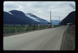
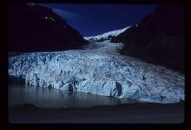
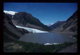
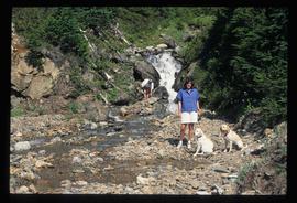
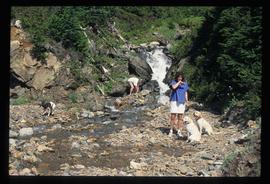
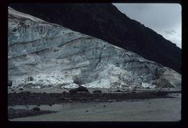
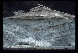
Image depicts Sue and Kent Sedgwick with two dogs, standing with the Bear Glacier in the background.
Image depicts two individuals and two dogs standing by a stream at an uncertain location, possibly somewhere in Bear Glacier Provincial Park. The woman in purple is possibly Sue Sedgwick.
Image depicts two individuals and three dogs standing by a stream at an uncertain location, possibly somewhere in Bear Glacier Provincial Park. The woman in purple is possibly Sue Sedgwick.
Image depicts three individuals and three dogs standing by a stream at an uncertain location, possibly somewhere in Bear Glacier Provincial Park. The woman in purple is possibly Sue Sedgwick.
Image depicts Bear Glacier in the foreground and numerous mountain peaks in the background in Bear Glacier Provincial Park.
Image depicts a glacier at an uncertain location; the slide labels it as "avalanche glac."
Image depicts a glacier at an uncertain location; the slide is labelled "after two days," and shows how much it has melted.
Image depicts the Bear River.
Image depicts a section of road running through the Bear River Gorge.
Image depicts a glacier at an uncertain location; the slide labels it as "avalanche glac."
Image depicts a glacier at an uncertain location; the slide is labelled "before."
Image depicts a glacier on the side of a road at an uncertain location; the slide labels it as "avalanche glac."
Image depicts a close-up of the Bear Glacier in Bear Glacier Provincial Park.
Image depicts the road leading to Hyder, which is on the other side of the Alaska-British Columbia border and is just a little south-west of Stewart, B.C.
Image depicts the Bear Glacier in Bear Glacier Provincial Park.
Image depicts the Bear Glacier in Bear Glacier Provincial Park, as well as what is possibly Strohn Lake.
Image depicts a view of Bear Pass, likely from Glacier Highway and somewhere in or near Bear Glacier Provincial Park, located north-east of Stewart, B.C.
Image depicts several buildings along the main street in Stewart, B.C.
Image depicts Stewart Harbour in Stewart, B.C.
Image depicts Stewart, with a section of Mt. Shorty Stevenson dominating the background.
Image depicts an old, boarded up hotel in Stewart, B.C.
Image depicts a Catholic Church in Stewart, B.C.
Image depicts the Provincial Government Building located in Stewart, B.C.
Image depicts the interior of the St. Marks Community Church in Stewart, B.C.
Image depicts the Robert Stewart house, built in 1910 and inhabited by the Stewart family until 1945. It is located in Stewart, B.C.
Image depicts housing in Granduc, near the Granduc Mine and located north of Stewart, B.C.
Image depicts an example of "typical housing" in Granduc, near the Granduc Mine and located north of Stewart, B.C.
Image depicts a row of boarded up houses in Granduc, near the Granduc Mine and located north of Stewart, B.C.
Image depicts a row of houses in Granduc, near the Granduc Mine and located north of Stewart, B.C.
Image depicts the old telegraph station in Stewart, B.C.
Image depicts a boarded up building in Stewart B.C. There is also a sign that reads: "No U Turns."
Image depicts the main street of Stewart, B.C.
Image depicts a river somewhere in Seton Portage, B.C.
Image depicts a type of gate system for the river water, possibly controlling irrigation, located somewhere in Seton Portage, B.C.
Image depicts a river somewhere in or near Seton Portage, B.C.
Image depicts a small river somewhere in or near Seton Portage, B.C.
Image depicts what is possibly an irrigation channel somewhere in Seton Portage, B.C.
Image depicts water flowing through an irrigation channel in an orchard, somewhere in or near Seton Portage, B.C. There is a sign which reads: "Danger Keep out."
Image depicts water flowing through an irrigation channel in an orchard, somewhere in or near Seton Portage, B.C.
Image depicts the side of a train and the tracks it is on, as well as a small section of what is either Seton or Anderson Lake near Seton Portage, B.C.
Image depicts what is either Seton or Anderson Lake near Seton Portage, B.C.
Image depicts numerous houses and a tractor in Seton Portage, B.C.
Image depicts a church and several houses in Seton Portage, B.C.
Image depicts a road with what appears to be a junkyard to the right of the image, likely located somewhere in Seton Portage, B.C.
Image depicts a collapsing shack somewhere in the Seton Portage area.
Image depicts the side of a train and the tracks it is on, somewhere in the Seton Portage area.
Image depicts a view of D'Arcy, located on the southern end of Anderson Lake.
Image depicts a vehicle on a bridge somewhere near Anderson Lake in the Seton Portage area.
Image depicts power lines running alongside Anderson Lake near Seton Portage, B.C.