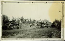
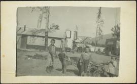
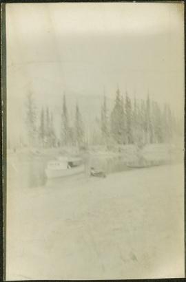
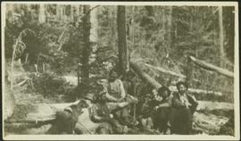
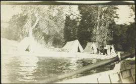
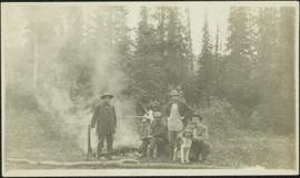
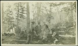
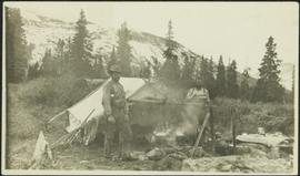
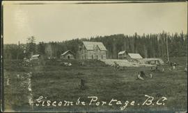
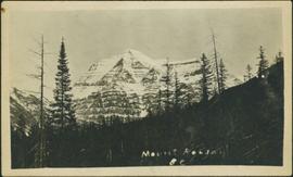
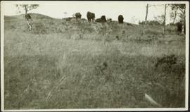
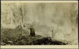
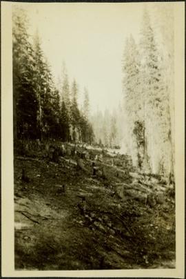
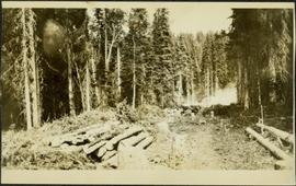
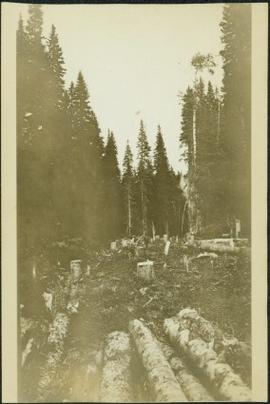
Photograph depicts stumps and log piles in forest clearing of the railway right-of-way.
This Prize List, which was published by the Prince George Agricultural and Industrial Association incorporated with Prince George Horticultural Society, outlines the August 1943 Fall Fair rules and regulations, the prizes to be awarded; as well as a list of prize donors.
Photograph depicts man believed to be Bob Baxter on bulldozer in dirt area. Men on machinery in right foreground, trees and buildings in background.
Photograph depicts man believed to be Bob Baxter on bulldozer by large framework structure in snow. House stands in background as well as a truck with "CITY OF PRINCE GEORGE" visible on its passenger door. Handwritten annotation on recto of photograph: "Civic centre 1948."
Photograph depicts approximately nine dark horses grazing in field to left of large coniferous tree. Wooded hillside in background. Handwritten annotation on recto of photograph: "Cottonwood river".
A woman stands in distance on a road with high snowbanks and trees on either side. A dog can be seen in foreground, facing woman. A fence and other structures stand in midground. Tree-covered slope in background.
Mountains visible in background.
Photograph depicts Violet Baxter's younger brother Art pushing his son Ian in wheelbarrow. Art is wearing a hat and smoking a pipe. A forest stands in background behind the field and fence that cross midground.
Percy Garland (married Ellen Taylor) stands with snowshoes and Husky dog in snowy area in front of two trees.
Cane floats in flooded area of camp, tent buildings and forest trees in background. It is believed that this photograph may depict the Island Cache in flood, at Prince George, BC.
Photograph depicts lane in front of tent buildings flooded with water, and a man standing near doorway to first building. It is believed that this photograph may depict the Island Cache in flood, at Prince George, BC.
Photograph depicts lane in front of tent buildings flooded with water. Tree in midground, forest trees in background. A man can be seen between first and second row of tent buildings. Photograph taken from canoe, portion of canoe visible in right foreground. It is believed that this photograph may depict the Island Cache in flood, at Prince George, BC.
Photograph depicts lane in front of tent buildings flooded with water, forest trees in background. Photograph taken from canoe, portion of canoe visible in foreground. It is believed that this photograph may depict the Island Cache in flood, at Prince George, BC.
Photograph depicts three men standing in dirt area near fire wood. Tent building semi-visible on left, forest trees behind snow pile in background. Handwritten annotation on recto of photograph: "Relief camp at Penny. 100 men - A.K. Bourchier Foreman - Dixon Taylor timekeeper. [Ted Nevan?] purchasing agent - hungry thirties. Construction days. Mile 29 - A.K. Bourchier J.P." Man in middle is believed to be A.K. Bourchier.
Photograph depicts dog standing next to man smoking pipe and leaning against large snow bank (snow stands taller than man). Power lines connect to wood building standing in background. Photograph believed to have been taken in railway construction camp.
Photograph depicts creek barely visible at bottom of steep valley in cliffs. Trees and underbrush in foreground. It is believed that this photograph may have been taken near Mt. Robson. Handwritten annotation on recto of photograph reads: "Sand Creek."
Photograph depicts Mrs. Houghtaling standing with four small children near doorway of tent building (Gertrude, Mary, Henry, and Charlie). This photograph is believed to have been taken at Sand Creek, BC. Forest trees in background. Handwritten annotation on recto of photograph reads: "Tete Jaune 1912".
Photograph depicts three small children (Henry, Charlie and Mary) standing at Sand Creek settlement. A dog stands beside them pulling a small wagon of firewood. Tent and wood buildings in background, including a cafe on far right. Hillside can be seen in distance. Handwritten annotation on recto of photograph reads: "Houghtaling Sand Creek Bourchier 1912".
Photograph depicts small log buildings and loaded wagons in cleared dirt area. Building on far left has the sign "POOL HALL" posted on front . Treetops, lumber piles, and hills in background. Mountains can be seen in distance. Handwritten annotation on verso of photograph reads: "Sand Creek. B.C."
Photograph depicts a small pass through an island or peninsula on the Fraser River. Photo is believed to have been taken near Stone Creek, south of South Fort George. Annotation on verso of photograph reads: "FORT GEORGE CANYON. CANOE PASS. J. HEAY. PHOTO."
Riverboat floats in midground, canoes float by shore. Trees and hillside on opposite shore in background. Poor image quality.
Photograph depicts tree stumps in forest clearing of the railway right-of-way.
Photograph depicts smoke, stumps and log piles in forest clearing of the railway right-of-way.
Photograph depicts men walking among stumps and log piles in forest clearing of the railway right-of-way.
Photograph depicts glacier and snow in mountains. Handwritten annotation on verso of photograph reads: "Glacier, Moose River. B.C."
Photograph depicts settlement across frozen lake. Trees cross midground, mountains stand in background. Handwritten annotation on verso of photograph reads: "Distant view of Tete Jaune B.C.", on recto of photograph: "I marked about where you loaded your boat the telephone pole is down the road toward 53. Tete Jaune Mile 52."
Photograph depicts three men wearing semi-formal attire at doorway to log building, miscellaneous supplies leaning against base of building. Dirt road in foreground, forest trees on hillside in background. Handwritten annotation on verso of photograph reads: "Mile 47 B.C. Police Barracks.", on recto of photograph: "Summit of Yellowhead pass and east boundary of British Columbia Mile 0. 699 miles to Prince Rupert. Tete Jaune Mile 52. Mile 47 east of Tete Jaune in the Park.", "1911".
Photograph depicts three men in semi-formal attire standing on front steps of log building with tin roof. Shovels, saw, ladder, buckets, boxes and logs lean against building. Forest trees, buildings, and hillside can be seen in background. Handwritten annotation on verso of photograph reads: "Police Barracks. Mile 29 B.C.", on recto of photograph: "Mile 29 East of Tete Jaune Mile 52."
Photograph depicts a man in snowshoes leading a line of dogs pulling supplies on a toboggan. The second figure, walking behind dogs, is believed to be a man named Fred Burden. Forest trees in background. Handwritten annotation on recto of photograph reads: "Billy Seymour at toboggan". Billy Seymour was a South Fort George man of First Nations descent, employed by the Hudson's Bay Company, and well-known for his ability and endurance in land travel by foot.
Photograph depicts an empty canoe floating directly in front of small white tents on opposite shore. Forest trees in background.
Photograph depicts one man seated in rear of canoe on still water. Trees on opposite shore in background. This man is believed to be a member of the Bourchier forestry crew.
Photograph depicts three men standing with oars in small boat, forest slash at their feet. More slash lies in foreground behind bushes and plants on swampy shore. Trees in background. These men are believed to be members of the Bourchier forestry crew.
Photograph depicts man smoking pipe in area believed to be a mining location, sandy cliffs in background.
Photograph depicts seven men and one dog sitting in forest, trees standing in background. It is speculated that chef Bob Potts may be seated third from left (see also items 2009.5.3.32 - 2009.5.3.34).
Photograph depicts men standing on shore in front of tents, forest trees in background. Photograph was taken from a boat; portion of boat and oar are visible in foreground. Handwritten annotation on recto of photograph: "View of all four tents."
Photograph depicts four men around fireside in forest clearing. A man believed to be Bob Potts kneels on far right, next to dog. These men are believed to be members of A. K. Bourchier's crew. Handwritten annotation on recto of photograph: "The Last of a Comfortable Camp."
Photograph depicts six men around fireside in forest, trees felled on either side. Bob Potts sits on far right, next to dog in foreground. These men are believed to be members of A. K. Bourchier's crew on the Upper Fraser River. Handwritten annotation on recto of photograph: "Preparing The miday meal. frying Bacon on sticks. Potts. Chief Chef."
Photograph depicts two men standing in front of a short tent. Cooking supplies are scattered throughout campsite. Trees cross midground, and snow-covered mountains stand in background. Handwritten annotation on recto of photograph: "POTT FALLS ON REDDEER RIVER. A Plate of Beans before Lunch. ON THE RIGHT Bob - Potts. Sampling his own Cooking."
Photograph depicts tree-covered cliffs on opposite shore, river in foreground.
Photograph depicts four men sitting on forest floor, supplies scattered throughout campsite. A small tent stands in background, and wood poles have been erected above fire site in foreground.
Photograph depicts four men eating and drinking at campsite, cooking and camping supplies scattered throughout. A dog sits in foreground, and many items are hung from a horizontal pole behind men. Forest trees in background.
Photograph depicts three men and dog in tent campsite. Cooking supplies and miscellaneous items in throughout, forest trees in background. Handwritten annotation on verso and recto of this photograph reads: "Camp on Upper end of Grand Canyon".
Photograph depicts men on river boat and small canoe floating just off shore. Men sit and stand on shore among square bales and large cut lumber. Forest in background. Handwritten annotations on recto of photograph: "Fort Fraser wooding up at Giscome Portage", "Chilco at Giscome Portage".
Photograph depicts people and tree stumps in grass areas. Buildings stand on higher level in midground, forest in background. Handwritten annotation on verso of photograph: "Giscombe Portage. B.C.", on recto: "Seaback & Huble"
Photograph depicts the Giscome Rapids. Opposite shore in background, rocky beach in foreground. Handwritten photo caption on verso and recto of this photo reads: "Point where G.T.P. [Grand Trunk Pacific] canoe capsized at Giscome Rapids & where 3 men were drowned."
Photograph depicts a large group of women, men, and children standing and sitting on grass. Stand of trees crosses midground, forest visible in background. Handwritten annotation on verso of photograph: "Picnic at Fort George (Central) 1920." Photograph believed to have been taken at current location of Spruceland Shopping Center.
Photograph depicts mountain in background. Power lines, trees, and hills in foreground. Handwritten annotation on recto of photograph: "1926."
Photograph depicts creek barely visible at bottom of steep valley in cliffs. Trees and underbrush in foreground, mountains visible in background. It is believed that this photograph may have been taken near Mt. Robson. Handwritten annotation on recto of photograph duplicate reads: "Sand Creek."
Photograph depicts mountain in background, trees and hillside in foreground. Handwritten annotation on verso of photograph: "Mount Robson BC."
Photograph depicts group of buffaloes on horizon. Trees in midground, field in foreground. It is believed that this photograph was given to Lillian & A.K. Bourchier by their niece Jean. Location unknown; possibly Alberta as the Bourchier family moved to Alberta in 1902.