Showing 236 results
Archival description
Map of the Colony of New Caledonia and the British & American Territory West of the Rocky Mountains

Sketch Map Showing the Proposed Route of the Western Union Telegraph between Fort Fraser and the Stikine River

Sketches of Harbours, Queen Charlotte Islands, 1878

Advanced Copy of a Map of the Queen Charlotte Islands

Plan of Carney Addition in the Heart of Fort George

Map of the Central Section of British Columbia shewing the country served by the Grand Trunk Pacific Railway

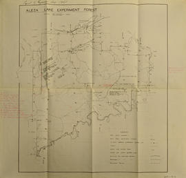
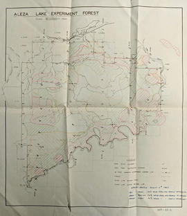
Sketch showing locations of elevations and benchmarks, Aleza Lake Forest, Cariboo

Map showing Jasper Park, Fraser River and Prentiss Gray's 1926 adventure

Proposed railway spur - Aleza Lake Forest Experiment Station

Aleza Lake timber reserve: Cariboo District, B.C.

Map showing Mining Properties in Vicinity of Stewart and Salmon River. Portland Canal Mining Division. British Columbia

Timber Sale X9696

TSX9696, Plot 160 - Sketches Showing Location of Plots, Roads, and Traverse Posts

Timber Sale X9696 Osoyoos District

Timber Sale X9696 Osoyoos District annotated

Preliminary Plan Showing Travelled Route of the Bedaux Sub-arctic Exploration
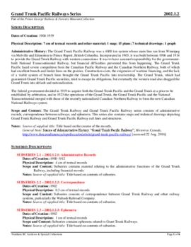
Grand Trunk Pacific Railway

Forest Cover Series, Map 93 J/1, Giscome

Aleza Lake Forest Reserve

Map of Permanent Growth and Yield Sample Plots Showing their Location

Aleza Lake Research Forest 1955 Uncontrolled Mosaic

Dewey Logging Co. Ltd. X72108 annotated

Dewey Logging Co. Ltd. Logging Plan of T.S.X. 72108

Dewey Logging Co. Ltd. X72108

Sinclair Spruce Lumber Co. Ltd., Logging Plan T.S.X. 73378 Hubble Creek

Sinclair Spruce Lumber Co. Ltd., Logging Plan T.S.X. 73378 Hubble Creek annotated

Aleza Lake Experiment Forest Development Map

Aleza Lake Experiment Forest Permanent Plot Map

Aleza Lake Experiment Forest Working Circle T.S.X. Map

Aleza Lake Experiment Forest Working Circle Timber Sale Map

Aleza Lake Experiment Forest Development Map

Aleza Lake Experiment Forest Permanent Plot Map

Aleza Lake Experiment Forest annotated

British Columbia

Aleza Lake Experiment Forest

PP 160 - Conditions after Logging of a Spruce-Balsam Forest in Relation to Spruce Reproduction and to the Rate of Growth of the Second Story
Aleza Lake Experiment Forest

Status of Sustained-Yield Forestry Programme as at 31 December 1962

Aleza Lake Experiment Forest Map No. 1 annotated

Aleza Lake Experiment Forest - Map No. 2

Aleza Lake Experiment Forest - Map No. 3

Aleza Lake Experiment Forest - Map No. 1
Aleza Lake Experiment Forest annotated to show Spruce Beetle

Aleza Lake Experiment Station, Purden P.W.C., and Longworth S.Y.U. annotated

"British Columbia Physiographic Subdivisions"

Aleza Lake Experiment Forest with Working Circle Annotations

Monkman P.S.Y.U., T.F.L. 30, and area

Monkman P.S.Y.U. forest cover map

T.S.X. 96365, Aleza Lake, Sinclair Spruce Lumber Company Ltd.
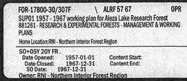
Aleza Lake Research Forest - Management and Working Plan - 1957-1967 - Supplement