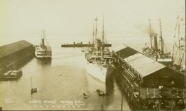
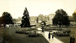
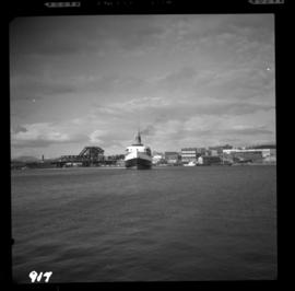
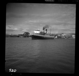
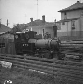
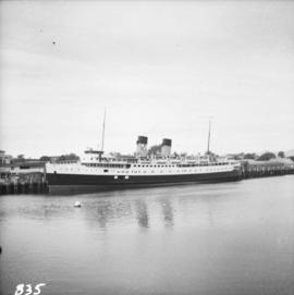
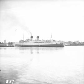
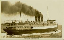
Photograph of the SS "Princess Charlotte" on the open ocean. Metallic annotation on recto reads: "C.P.R.SS Princess Charlotte entered according to act of the parliament of Canada, in the year 1908[?]. by A. Shaw, at the Department of Agriculture." Printed annotation on verso reads "Shaw & Co., Photo. Victoria. B.C. (Empire Series)"
Photograph depicts the bridge at Goodacre Pond in Beacon Hill in Victoria, BC. Duck in foreground.
Photograph depicts the British Columbia Parliament Buildings in Victoria, BC.
Photograph depicts the Empress Hotel in Victoria, BC.
Photograph depicts buildings looking north of the Empress Hotel on Douglas Street in Victoria, BC. The Belmont is on the right and the Customs Building on the left.
Photograph of several vessels within Victoria's outer wharf. Annotation on recto reads: "Empire Series. Outer Wharf, Victoria, BC."
Photograph depicts the British Columbia Parliament Buildings in Victoria, BC.
Photograph depicts a view of Victoria from a ship in the Inner Harbour. Visible on the shore, from right to left, are: the Empress Hotel, the Belmont, the Customs Building, and other buildings along Douglas Street.
Photograph depicts a large construction in Victoria BC, possibly be related to the construction of the Johnson Street Bridge or the construction of a large building near the shoreline.
Photograph depicts the bridge at Goodacre Pond in Beacon Hill in Victoria, BC. Swans are swimming in the pond and there is a path and footbridge behind the pond.
Photograph depicts a military band near the parliament buildings in Victoria, BC.
Photograph depicts a view from the water of the Parliament buildings in Victoria BC. Possible sea plane docked in front centre.
Photograph depicts a boat anchored near shore. Name on the boat is "Algoma". Handwritten annotation below the photograph reads, "Maple Bay 15/8/33".
Photograph depicts a military parade at the Parliament buildings in Victoria, BC.
Photograph depicts the inner harbour at Victoria and the C.P. ship the "Princess Patricia."
Photograph depicts the inner harbour at Victoria and the C.P. ship the "Princess Patricia" putting to sea.
Photograph depicts a 0-4-0 tank locomotive #7 built by Henschel & Sohn in Kassel, Germany in 1936. It is located at 215 Menzies St. in Victoria.
Photograph depicts a church or school on the south side of Craigflower Rd. in Victoria B.C. It is near or on the Songhees Reserve.
Photograph depicts the R.C.N. tribal class destroyer entering the Esquimalt Harbour, looking seawards.
Photograph depicts the Canadian Coast Guard ship "Camsell" in Upper Harbour, Victoria.
Photograph depicts sheds and repair center of the C.P.R. at Victoria, near Lime Bay. The rail-liner just came in from the daily run to Courtenay.
Photograph depicts the Canadian Coast Guard ship "Estevan" in the Upper Harbour at Victoria.
Photograph taken at a coal yard to the east of Tyee Road and north of Bay Street in Victoria.
Photograph depicts "Princess Marguerite" at the CPR wharf in the Inner Harbour of Victoria.
Photograph depicts the CPR "Princess Marguerite" in Victoria Harbour.
Photograph depicts "Princess Marguerite," one of the two CPR cruise ships left on the Pacific Coast.
Photograph depicts a bridge for road vehicles. Also visible is a single track of the CPR that went from Esquimalt to Nanaimo.
Photograph depicts the CPR "Princess Marguerite" in Victoria Harbour.
Photograph depicts a Canadian Coastguard vessel called "Camsell" at the Canadian Coastgaurd wharf in Upper Harbour, Victoria.
Photograph depicts "Princess Patricia" undergoing a minor refitting before winter cruising in warmer climates.
Photograph depicts a bridge for road vehicles. Also visible is a single track of the CPR that went from Esquimalt to Nanaimo. Both were opened to allow a large tug to proceed seawards.
Photograph depicts a trestle over the Selkirk waterfront in the Victoria harbour.
Photograph depicts the CNR main line from Victoria to Duncan. Image captured looking south from Gorge Road towards a Selkirk water trestle. The line behind the camera was in regular use to the Cedar Hill Grass Roads spur. The main line beside the Island highway ran west out of Victoria.
Photograph depicts the entrance to the CNR yards on the west side of the Selkirk waterfront in Victoria. A trestle bridge is immediately behind the camera.
Photograph depicts a laid up CNR raikl car ferry called the "Canora." It had been tied to the CN pier in Vancouver for the winter of 1967/68, but its berth was needed for cruise steamers.
Photograph depicts the end of the trackage near Cedar Hill Cross Road and Borden Road in Saanich. This line was formerly part of the Victoria to Sidney line built by the Canadian Northern Pacific in 1913-1914.
Photograph depicts "W.J Stewart," of Ottawa, that is located on the mid-left with two masts, and "Vector," found on the mid-right with one mast. Both were believed to be hydrographic vessels, painted in white and cream which were not Coastguard colours. Taken on the Upper Harbour of Victoria, at the Coastguard wharf.
Photograph depicts a sunken whaler with a harpoon gun. A destroyer or, possibly, a corvette was being broken up in the middle background.
Photograph depicts St. Ann's Academy, a girls boarding school. In the distance, a graceful spire marks the highest point of the building.
Photograph depicts a totem pole in its final stages of being carved.
Photograph depicts the close up of harpoon guns of a sunken whaler in the Upper Harbour of Victoria.
Photograph depicts St. Ann's Academy, a girls boarding school that was close to the centre of Victoria. In the corner of the property, nuns had established the first school in B.C. in 1853.
Photograph depicts St. Ann's Academy, a girls boarding school that was close to the centre of Victoria. Captured the front of the main building.