Colour-coded geological topographic map. Geological Survey produced for the Bureau of Economic Geology, Department of Mines, Bureau of Economic Geology, Canada. Includes detailed topographic cross section.
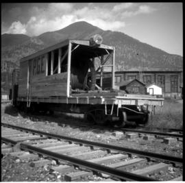
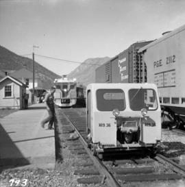
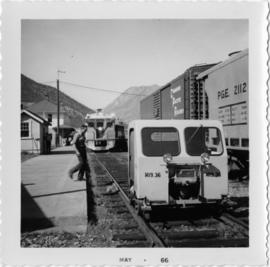
Photograph depicts an auxillary car with a powered winch found at the Pacific Great Eastern yards in Lillooet. Inside the roundhouse in the background was a boiler room that contained a locomotive boiler in working order.
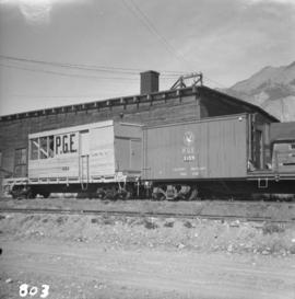
Photograph depicts the Pacific Great Eastern auxiliary tool cars at Lillooet.
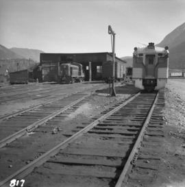
Photograph depicts a Pacific Great Eastern engine shed at Lillooet. At the right is Budd car #10 and at the left is an unidentified diesel.
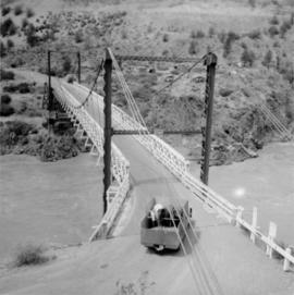
Photograph depicts a car crossing the Lillooet Suspension Bridge (also known as the Lillooet Old Bridge) over the Fraser River.
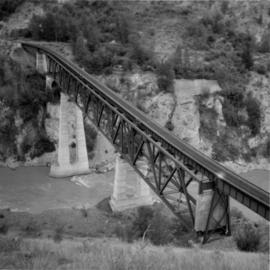
Photograph depicts a PGE crossing over the Fraser River, north of Lillooet. Visible on the far bank was an old grade that led to a former bridge about a mile downstream.
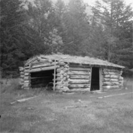
Photograph depicts a cattle shed located 3 miles east of Pavilion Lake, which is 15 miles northeast of Lillooet. It may have been a settler's cabin at one time.
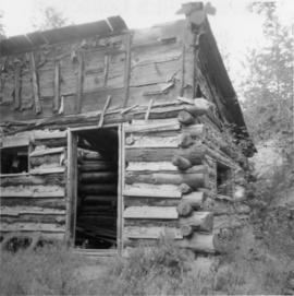
Photograph depicts an abandoned cabin about 100 yards from the Fraser River on Bridge River road, about 2 miles out of Lillooet.
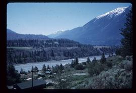
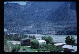
Image depicts a view of the Fraser River in Lillooet, B.C.
Image depicts a view of the Fraser River in Lillooet, B.C.
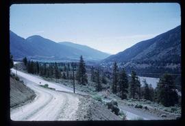
Image depicts a view of the mountains surrounding Lillooet, B.C.
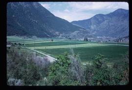
Image depicts some farmland in Lillooet, B.C.
Image depicts the Bridge River near Lillooet, B.C.
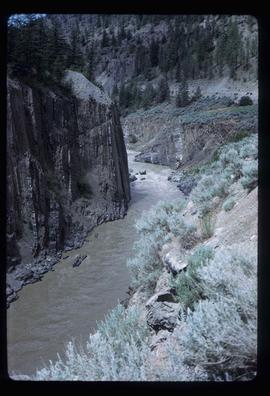
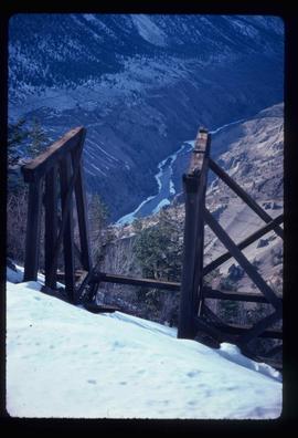
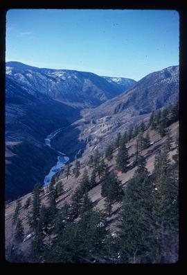
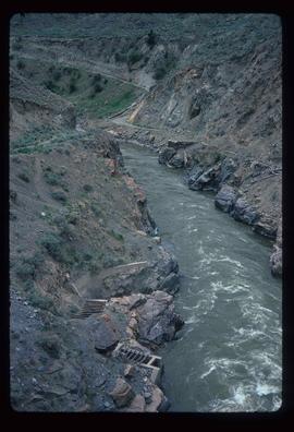
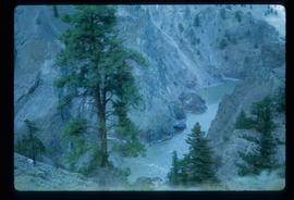
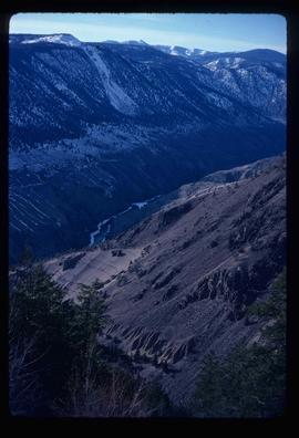
Image depicts the Fraser River running through the Moran Canyon near Lillooet, B.C.
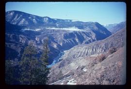
Image depicts the Fraser River running through the Moran Canyon near Lillooet, B.C.
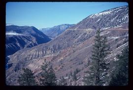
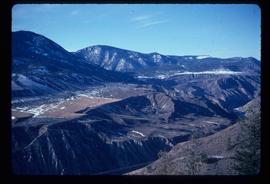
Image depicts the Moran Canyon near Lillooet, B.C.
Image depicts the Moran Canyon near Lillooet, B.C.
Image depicts what is possibly the Fraser River running through the Moran Canyon near Lillooet, B.C.
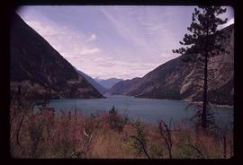
Image depicts a view of Seton Lake, located near Lillooet, B.C.
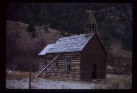
Image depicts an old church located somewhere in Lillooet, B.C.
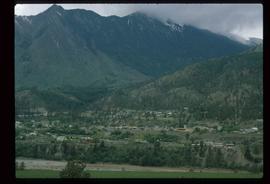
Image depicts a view of Lillooet, B.C.
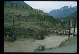
Image depicts two bridges over the Fraser River, located somewhere in Lillooet, B.C.
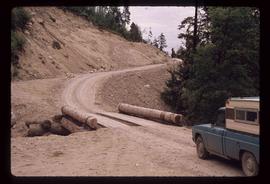
Image depicts the start of Joffre Creek Road, most likely somewhere in the Joffre Lakes Provincial Park.
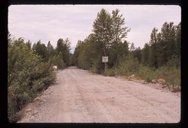
Image depicts a road leading into a First Nations' Reserve at the head of Harrison Lake.
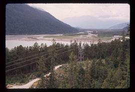
Image depicts the Lillooet River delta at the head of Lillooet Lake.
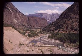
Image depicts the Fraser River near Lillooet, B.C.
This collection consists of photographs and "real photo" postcards that depict the construction and operation of the Pacific Great Eastern Railway line, communities nearby the railway line, and regional geography of areas adjacent to the PGE line.
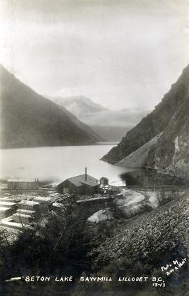
Photograph depicts the steam-operated Durban & Sons sawmill at the east end of Seton Lake. This photograph was taken before the PGE railway grade was built alongside the lake circa 1914-1915.
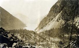
Photograph depicts a view of the east end of Seton Lake. The Seton Lake sawmill and Seton Lake fish hatchery are visible in the foreground. The PGE railway grade alongside the lake has not yet been constructed, dating this photograph at or before 1914.
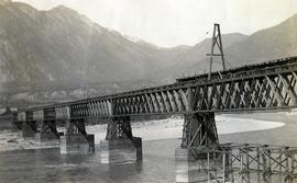
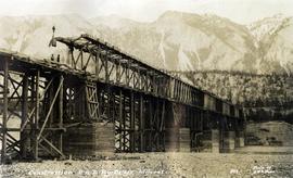
Photograph depicts the Pacific Great Eastern Railway bridge under construction on the original route at Lillooet, which was active 1915 to 1931. Including its approach spans, the bridge was 2,630 ft. long, almost exactly half a mile. The mileage on the PGE's original mileage system was 120.6.
Photograph depicts the Pacific Great Eastern Railway bridge under construction on the original route at Lillooet, which was active 1915 to 1931. Including its approach spans, the bridge was 2,630 ft. long, almost exactly half a mile. The mileage on the PGE's original mileage system was 120.6.
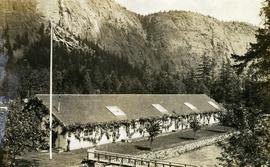
Photograph depicts the Seton Lake hatchery building constructed by the British Columbia provincial government in 1903.
Additional photographs and information about this construction is provided in the Fisheries Commissioner's Report for that year:
"In October, 1902, bids were invited for the construction of a hatchery building and Superintendent's cottage on Lake Creek, the outlet of Seton Lake, near the village of Lillooet. There were six bidders. A contract was let to W. Duguid, of Lillooet, the lowest bidder, in November. The buildings were completed and accepted in March, 1903. The hatchery building is a substantial wooden structure 210 feet long by 40 feet wide. The roof is supported by the walls, thus giving a clear floor space for the 160 hatching troughs, which are each 16 feet long, 16 inches wide and 7 inches deep. Two troughs are placed end to end and extend the width of the building, and receive the water from the head flumes which run lengthwise of the building. The equipment permits of the handling of forty million eggs. The water supply is taken from Lake Creek at a point some 1,400 feet from the hatchery, and about the same distance from Seton Lake, by means of a wooden flume three feet wide and two feet deep. A comfortable cottage for the Superintendent and a boarding-house for the other employees were constructed and furnished. The station in all its equipment is modern, and is not excelled by any other on the coast..."
Hatchery operations were terminated in Seton Creek in 1915 because the salmon runs had been almost destroyed.
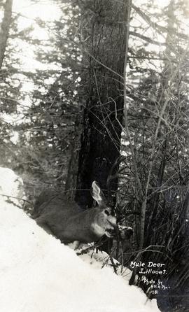
Photograph depicts a a mule deer hunting kill in Lillooet, BC.
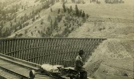
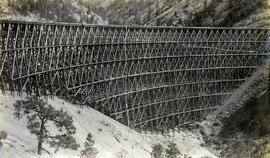
Photograph depicts Mr. Crysdale sitting on a velocipede on the Sallus Creek ("14 Mile") Pacific Great Eastern Railway trestle with an estimated date of very late July 1915 or later. "Canadian Railway and Marine World" reported that track had been laid to 14 miles North of Lillooet by July 30, 1915 (CR&MW , Sept 1915, p341, c2). 14 miles North of Lillooet is approximately 20 rail lengths beyond the North end of this trestle, leading to a "best estimate" of very late July 1915 as the earliest date for this photograph. The velocipede depicted is a 3-wheel, manually propelled vehicle operated by a push-pull (back & forth) action on the actuating handle.
The ca. 1921-1927 “PGE Bridge List” from the notebook of William H. Hewlett (1914-1968) references a Mile 13.7, 14 Mile Creek, frame trestle, 905 ft. long, 182 ft. high, 61 spans of 14.8 feet in the Lillooet Subdivision. A “PGE Track Profile” drawing shows this trestle was on a 1.55% grade and a 12 degree left hand curve. While the drawing had been revised at least twice (with an unknown date for the most recent revision), the pre-“Lillooet Diversion of 1931" mileage figures confirm that the 1915 “Mile 13.7" was in agreement with a more recent hand written note “Sallus Creek”. The trestle appears to have gone by the names "14 Mile" trestle, "13.7 Mile Trestle", and "Sallus Creek" trestle.
Photograph depicts the Pacific Great Eastern Railway trestle located near Sallus Creek in the area around Lillooet, Fountain, and Pavilion. A number of men are working along the trestle, possibly completing final construction work or performing repairs. "Canadian Railway and Marine World" reported that track had been laid to 14 miles North of Lillooet by July 30, 1915 (CR&MW , Sept 1915, p341, c2). 14 miles North of Lillooet is approximately 20 rail lengths beyond the North end of this trestle, leading to a "best estimate" of very late July 1915 or later as the earliest dates for this photograph.
The ca. 1921-1927 “PGE Bridge List” from the notebook of William H. Hewlett (1914-1968) references a Mile 13.7, 14 Mile Creek, frame trestle, 905 ft. long, 182 ft. high, 61 spans of 14.8 feet in the Lillooet Subdivision. A “PGE Track Profile” drawing shows this trestle was on a 1.55% grade and a 12 degree left hand curve. While the drawing had been revised at least twice (with an unknown date for the most recent revision), the pre-“Lillooet Diversion of 1931" mileage figures confirm that the 1915 “Mile 13.7" was in agreement with a more recent hand written note “Sallus Creek”. The trestle appears to have gone by the names "14 Mile" trestle, "13.7 Mile Trestle", and "Sallus Creek" trestle.
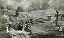
Photograph depicts a Pacific Great Eastern Railway work train on Pavilion Creek trestle at Mile 20.3. laden with workers, railway ties, and a steam donkey. The work train may be returning to a work camp, as a man dressed in the attire of a camp cook is standing beside the track.
The ca. 1921-1927 “PGE Bridge List” from the notebook of William H. Hewlett (1914-1968) references a 389.4 foot long, 34 ft. high, framed trestle with 26 spans of 14.8 feet at Mile 20.3 carrying the line over Pavilion Creek. There was a water tank at Pavilion located between the North end of the siding and the South end of the trestle. A track profile chart confirms that the track at this point is on a 12 degree curve. This photograph was taken at trackside. The structures at the lower left of image 2020.08.82 are consistent with a small construction camp, which accounts for the presence of a camp cook in this image (2020.08.83).
"Canadian Railway and Marine World" reported in their January 1916 issue (p. 11, c.1), that track had been laid to within ½ mile of Clinton (Mile 45.0) on Dec. 14, 1915. If a constant rate of construction had been maintained from Mile 14, reached on July 30, 1915 as previously discussed, to Clinton, the approximate date of completion to Pavilion would be around the end of August, 1915 which is probably the earliest possible date for this photograph.
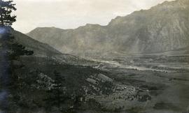
Photograph depicts a view of the Lillooet Indian Reserve in the foreground; the town of Lillooet and the Fraser River are visible beyond.
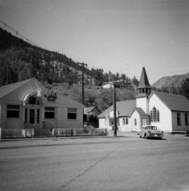
Photograph depicts a liquor store and church on Main St. in Lillooet, B.C.
Photograph depicts the Pacific Great Eastern depot in Lillooet. The 4:05 pm train is about to depart for Vancouver, with a speeder leaving to check rock falls along Seton and Anderson lakes.
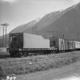
Photograph depicts the Pacific Great Eastern depot in Lillooet. In the photograph is an old locomotive tender on a flat car, used as a mobile water tank for the work crew train.
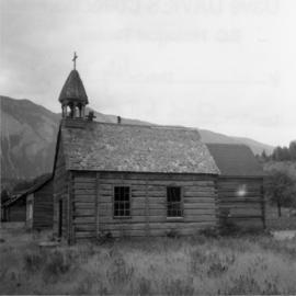
Photograph depicts a church that was built of shaped logs on the territory of the Tsal'alh Nation on the road leading to Seton Lake. Church was derelict, but still held pews, plastic flowers and small shrines.
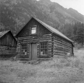
Photograph depicts a log cabin that was inhabited by an older aboriginal man who is visible in the window. The cabin was perhaps 100 years old.
Photograph depicts a southbound Budd car train about to deport.
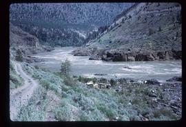
Image depicts the Fraser River somewhere in the Lillooet area.
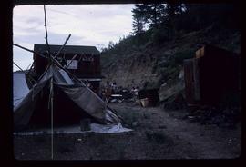
Image depicts a gathering of people for an uncertain event at an uncertain location, possibly in Lillooet, B.C. A few tents are set up in the picture.
Image depicts the Fraser River near Lillooet, B.C.
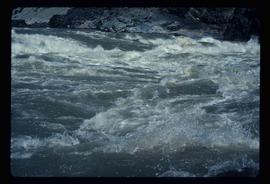
Image depicts the Fraser River running through the Moran Canyon near Lillooet, B.C.
Image depicts the Fraser River running through the Moran Canyon near Lillooet, B.C.
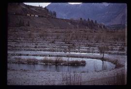
Image depicts rows of water, possibly being irrigation ditches, somewhere in Lillooet, B.C.
Image depicts the Fraser River near Lillooet, B.C.
