Showing 20 results

Archival description
9 results with digital objects Show results with digital objects
2016.5.5.01 · File · [19-?]
Part of Harry Coates fonds

File consists of trail maps and recreation guides from various places in British Columbia, especially Northern British Columbia. Maps include:

  • British Columbia Road Map and Parks Guide
  • Northwood Pulp and Timber Limited Forest Operations Recreation Map
  • Read more
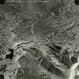
2019.10.4.41407 · Item · 8 Sept. 1969
Part of Lockwood Survey Corporation Ltd. collection

This remote-sensing aerial photograph was taken by Lockwood Survey Corporation Ltd. under contract for the B.C. Forest Service. This historically important aerial photograph depicts the W.A.C. Bennett Dam and Williston Reservoir soon after its floodingRead more

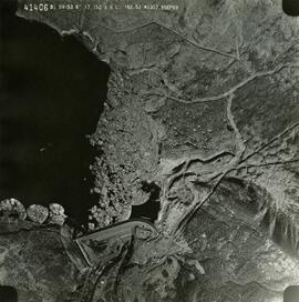
2019.10.4.41406 · Item · 8 Sept. 1969
Part of Lockwood Survey Corporation Ltd. collection

This remote-sensing aerial photograph was taken by Lockwood Survey Corporation Ltd. under contract for the B.C. Forest Service. This historically important aerial photograph depicts the W.A.C. Bennett Dam and Williston Reservoir soon after its floodingRead more

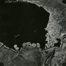
2019.10.4.41405 · Item · 8 Sept. 1969
Part of Lockwood Survey Corporation Ltd. collection

This remote-sensing aerial photograph was taken by Lockwood Survey Corporation Ltd. under contract for the B.C. Forest Service. This historically important aerial photograph depicts the W.A.C. Bennett Dam and Williston Reservoir soon after its floodingRead more

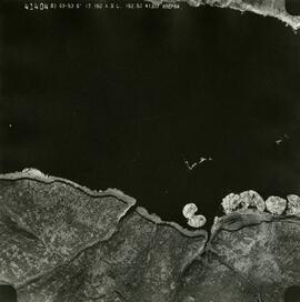
2019.10.4.41404 · Item · 8 Sept. 1969
Part of Lockwood Survey Corporation Ltd. collection

This remote-sensing aerial photograph was taken by Lockwood Survey Corporation Ltd. under contract for the B.C. Forest Service. This historically important aerial photograph depicts the headwaters of Williston Reservoir soon after its creation in 1968Read more

2019.10 · Collection · 1968-1970

These historically important aerial photographs depict Williston Lake soon after its creation in 1968 with the building of the W.A.C. Bennett Dam on the Peace River. Also depicted are the rivers and tributaries that empty into the Williston Reservoir,Read more

Lockwood Survey Corporation Ltd.
2019.10.6 · File · 9 Sept. 1969
Part of Lockwood Survey Corporation Ltd. collection

These remote-sensing aerial photographs were taken by Lockwood Survey Corporation Ltd. under contract for the B.C. Forest Service. Some photographs are annotated to show logging activity; clearcuts, slash piles, log booms, and tree debris on the waterRead more

2019.10.5 · File · 9 Sept. 1969
Part of Lockwood Survey Corporation Ltd. collection

These remote-sensing aerial photographs were taken by Lockwood Survey Corporation Ltd. under contract for the B.C. Forest Service. Some photographs are annotated to show logging activity; clearcuts, slash piles, log booms, and tree debris on the waterRead more

2019.10.4 · File · 8 Sept. 1969
Part of Lockwood Survey Corporation Ltd. collection

These remote-sensing aerial photographs were taken by Lockwood Survey Corporation Ltd. under contract for the B.C. Forest Service. Some photographs are annotated to show logging activity; clearcuts, slash piles, log booms, and tree debris on the waterRead more

2019.10.3 · File · 8 Sept. 1969
Part of Lockwood Survey Corporation Ltd. collection

These remote-sensing aerial photographs were taken by Lockwood Survey Corporation Ltd. under contract for the B.C. Forest Service. Some photographs are annotated to show logging activity; clearcuts, slash piles, log booms, and tree debris on the waterRead more

2019.10.2 · File · 8 Sept. 1969
Part of Lockwood Survey Corporation Ltd. collection

These remote-sensing aerial photographs were taken by Lockwood Survey Corporation Ltd. under contract for the B.C. Forest Service. Some photographs are annotated to show logging activity; clearcuts, slash piles, log booms, and tree debris on the waterRead more

2019.10.1 · File · 3 July 1968
Part of Lockwood Survey Corporation Ltd. collection

These remote-sensing aerial photographs were taken by Lockwood Survey Corporation Ltd. under contract for the B.C. Forest Service. Some photographs are annotated to show logging activity; clearcuts, slash piles, log booms, and tree debris on the waterRead more

2019.10.7 · File · 10 Sept. 1969
Part of Lockwood Survey Corporation Ltd. collection

These remote-sensing aerial photographs were taken by Lockwood Survey Corporation Ltd. under contract for the B.C. Forest Service. Some photographs are annotated to show logging activity; clearcuts, slash piles, log booms, and tree debris on the waterRead more

2019.10.9 · File · 1 Aug. 1970
Part of Lockwood Survey Corporation Ltd. collection

These remote-sensing aerial photographs were taken by Lockwood Survey Corporation Ltd. under contract for the B.C. Forest Service. Some photographs are annotated to show logging activity; clearcuts, slash piles, log booms, and tree debris on the waterRead more

2019.10.8 · File · 1 Aug. 1970
Part of Lockwood Survey Corporation Ltd. collection

These remote-sensing aerial photographs were taken by Lockwood Survey Corporation Ltd. under contract for the B.C. Forest Service. Some photographs are annotated to show logging activity; clearcuts, slash piles, log booms, and tree debris on the waterRead more