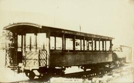
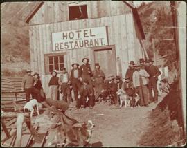
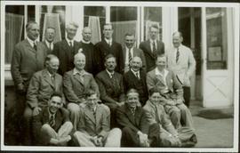
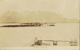
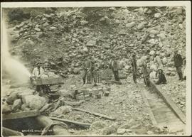
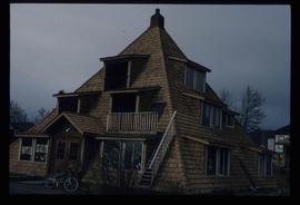
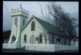
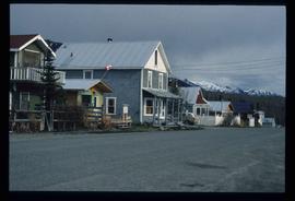
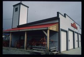
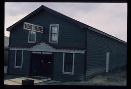
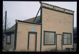
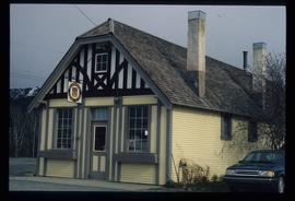
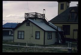
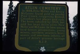
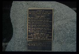
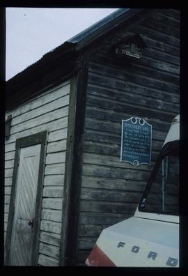
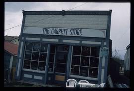
Photographs within this file document natural and artificial features across the landscape of Northern British Columbia. This landscape also includes the physical, built, urban and industrial landscapes; topography; site plans; boundaries, districts, reserves, parks, sanctuaries, towns, villages and cities, etc.
Photograph depicts buildings and signage on either side of dirt road. Unidentified man stands on far left, Atlin Lake and mountains can be seen in background.
Hand inscribed annotation on recto of photograph reads: “Pearl St., Atlin, B.C. Aug. 1899. A.C. Hirschfeld, No.74”.
Photograph depicts tent buildings on either side of dirt road. Unidentified men are visible on left, Atlin Lake and mountains can be seen in background.
Hand inscribed annotation on recto of photograph reads: “Pearl Av. looking towards Atlin Lake, Atlin, B.C., A.C. Hirschfeld, No. 174”
This photograph album consists of photographs, membership cards and correspondence of Herbert F. Glassey. Subjects identified in this album include: automobiles, landscape vistas, hunting scenes, snowshoeing, dog sledding, provincial government offices and waterscapes. Identified geographic locations include: Nesutlane Trading Post, Atlin, Teslin Lake, Atlin Lake, McKee Creek, Taku Glacier and Otter Creek. The following of Mr. Glassey’s membership cards are also included within this album: “White Pass & Yukon Route, No. 308: Government Agent, Atlin account, 1939-1940”; “White Pass & Yukon Route, No. 283: Government Agent account, 1941-1942”; “Registration Certificate, 1940”; “The Wartime Prices and Trade Board, no.1305, 1942”; “Dominion Bureau of Statistics, no.252”; “The Society of Notaries Public Membership Card, 1956”; and “Prince Rupert Liberal Association, 1953”.
Glassey, SarahPhotograph depicts group of working men and 6 dogs standing outside wood building. Hill in background.
Photographs within this file document resource industries within Northern BC such as mining, fishing, forestry etc. They also represent resource industry cooperatives, processing, packing and shipping industries, construction and ship building, as well as salvage companies and operations.
Group portrait featuring 3 rows of unidentified men in suits and one member of the clergy posed on a sidewalk outside a storefront at Atlin, B.C.
Five unidentified miners pose for a photo. Logs and wood scraps in foreground, forest in background.
Printed annotation on recto of photograph: "PLACER MINING, ATLINTOD RIVER, ATLIN, B.C. A.C. HIRSHFELD NO. 753."
Photograph of a vessel in a large body of water with several mountains visible in the background. Printed annotation on recto reads: "Atlin Mt., Atlin, B.C."
Group of five miners stand in mining area on left. Woman, man, and young girl sit and stand on far right in more formal attire. Mining tools and equipment throughout.
Printed annotation on recto of photograph: "Société Minière de B.C., Atlin B.C. July 28th, 1901, A.C. Hirschfeld, No. 707".
Photograph of man on the back of a passenger car attached to a steam engine. Printed annotation on recto is obscured by emulsion damage and reads: "[illegible] Atlin, B.C."
File contains postcard photographs portraying life in various Northern BC Communities. Images depict buildings and streets, church structures, harbours and docks, and views of the shore from the water to name a few.
This antler was a gift to Minister Iona Campagnolo commemorating her visit to Atlin, British Columbia. Inscribed on the antler are the words "Iona Campagnolo - Atlin Fun Days 1977" and a silhouette of dogsled team.
Photograph depicts Iona Campagnolo teaching inuit games to students in Atlin.
This is the inaugural issue of the Atlin Nugget. It contains information regarding: a new campground for Atlin, a new restaurant, a new staff member to the Nugget, dog races, "bigfoot" tracks, and information about the Atlin Arts Society.
Photocopied map depicts mineral and coal mining properties in north western British Columbia.
Collection consists of a travel scrapbook created by Jill Singleton documenting a trip to Alaska, Yukon, Haida Gwaii, and northern BC. Includes photographs, ephemera, handwritten notes, pamphlets, issues of local newspapers, and maps.
This travel scrapbook was created by Jill Singleton to document a trip to Alaska, Yukon, Haida Gwaii, and northern BC. Jill Singleton and Eric Stathers embarked on a 1985 car camping trip using the BC Ferries and Alaska Ferry systems. Includes postcards, ephemera, handwritten notes, pamphlets, issues of local newspapers, and maps. Also includes 37 photographs.
Includes the following:
- "Queen Charlotte Islands Observer" newspaper issue for August 8, 1985
- "A Walking Tour and Business Directory for Queen Charlotte City", June 1985
- "A Walking Tour and Business Directory for Tlell + Port Clements", June 1985
- "A Walking Tour and Business Directory for Skidegate Landing, Skidegate and Sandspit", June 1985
- "A Walking Tour and Business Directory for Masset", June 1985
- "Explorations Q.C.I." pamphlet advertising guiding, outfitting, and touring
- "Sandspit Inn, Queen Charlotte Islands" pamphlet
- "Visit the Queen Charlottes" pamphlet
- Queen Charlotte Islands map, circa 1985
- BC Ferries pamphlet "New in 1985... Inside Passage Day Cruise"
- BC Ferries pamphlet "Tickets and Boarding Information, Inside Passage"
- "Alaska Marine Highway" pamphlet
- "Discover Southeast Alaska, Ketchikan" pamphlet
- "Alaska State Parks" pamphlet/map
- "Tongass National Forest, Alaska" pamphlet/map
- "Alaska Marine Highway Summer Schedule - May 1, 1985 through September 30, 1985" pamphlet
- History leaflet for St. Michael's Cathedral, Sitka, AK
- Alaska Seafood Marketing Institute leaflets, 1984
- Anchorage 1984 Visitors Guide, Anchorage Convention & Visitors Bureau
- "Skagway... some Steps on the Gold Rush Trail... walking Tour of the Historic District - Klondike Gold Rush National Historical Park"
- "Skaguay Alaskan" newspaper issue, Vol. VIII, No. 1880 (1985)
- "Klondike Gold Rush" pamphlet for tourists
- "Broadway, Skagway, Alaska" pamphlet
- "S.S. Tutshi, Carcross" pamphlet
- "Moon Watching" pamphlet by BC Ministry of Lands, Parks and Housing (1980)
- "Some Insects of Provincial Parks" pamphlet by BC Ministry of Lands, Parks and Housing (1980)
- "Stewart, British Columbia - Hyder, Alaska... Your Gateway to Alaska and the Yukon!" pamphlet
- "Stewart-Cassiar Highway 37" map
- "Prince Rupert City Map & Guide" pamphlet
- "Explore Canada's Yellowhead, Western Canada's New Interprovincial Highway" pamphlet (1983)
- "101 Things To Do in Yukon" booklet published by Tourism Yukon (1985)
- "Your Guide to B.C. Ferries' Inside Passage" booklet by British Columbia Ferry Corporation (1985)
- "Port Alberni, British Columbia, Canada" booklet (1981)
Trip itinerary:
- Vancouver, BC
- Nanaimo, BC
- Port Hardy, BC
- Prince Rupert, BC
- Yakoun River, BC
- Haida Gwaii, BC (formerly Queen Charlotte Islands)
- Rennell Sound, BC
- Graham Island, BC
- Queen Charlotte City, BC
- Sandspit, BC
- Prince Rupert, BC
- Ketchikan, AK
- Sitka, AK
- Tenakee Springs, AK
- Juneau, AK
- Skagway, BC
- Carcross, YK
- Atlin, BC
- Telegraph Creek, BC
- Kitwanga, BC
- Prince Rupert, BC
- Prince George, BC
- Lillooet, BC
- Vancouver, BC
Left to right: Deborah Poff, Dennis Macknak, Charles Jago, an unidentified woman, Iona Campagnolo, an unidentified man, Ellen Facey, and an unidentified woman. Unknown man stands on lower deck in foreground. Mountains visible in background. Photograph taken during the Chancellor's 1996 regional tour through Atlin and Whitehorse; see also items 2009.6.1.578 - 2009.6.1.581.
Handwritten annotation on verso reads: "#3 Chancellor's Tour".
Left to right: Deborah Poff, Dennis Macknak, Charles Jago, an unidentified woman, Iona Campagnolo, Ellen Facey, Nick Petraryszak, an unidentified man, and an unidentified woman. Unknown man stands on lower deck in foreground. Mountains visible in background. Photograph taken during the Chancellor's 1996 regional tour through Atlin and Whitehorse; see also items 2009.6.1.578 - 2009.6.1.580.
Left to right: Chancellor Iona Campagnolo, Nick Petraryszak, Ellen Facey, unidentified woman and men. Mountains visible in background. Photograph taken during the Chancellor's 1996 regional tour through Atlin and Whitehorse; see also items 2009.6.1.578 - 2009.6.1.581.
Image depicts numerous old buildings on a main street in Atlin, B.C.
Image depicts a pyramid shaped house, possibly located in Atlin, B.C.
Image depicts what is possibly Atlin Lake, with numerous mountains in the distance and Atlin Mountain visible on the right of the image.
Image depicts the grave of John Wolters in the Atlin Cemetery. It reads: "Born in Kent, England, Jan 16 1857. Died Sept. 21 1905."
File contains slides depicting places around and between Skagway, on the Alaska border, Atlin and Miles Canyon.
Image depicts an Anglican Church at the Atlin Museum.
Image depicts a back street in Atlin, B.C.
Image depicts the fire hall in Atlin, B.C.
Image depicts an old building undergoing a restoration process, possibly in Atlin, B.C.
Image depicts old machinery, at the Atlin Museum in Atlin, B.C.
Image depicts Atlin Lake as well as a small section of Atlin, B.C. The mountain is possibly Atlin Mountain.
Image depicts Atlin Lake.
Image depicts the Globe Theatre in Atlin, B.C.
Image depicts a lake somewhere along what is possibly the Atlin Road to Atlin, B.C.
Image depicts a mountain somewhere along what is possibly the Atlin Road.
Image depicts numerous graves in the Atlin Cemetery.
Image depicts the Pine Tree Restaurant in Atlin, B.C. It is possibly part of the Atlin Museum.
Image depicts the Moose Hall in the Atlin Museum. A sign above the door reads: "In 1905 this building was the new Arctic Brotherhood Hall in Discovery. Some years later it was hauled here in two parts by horses to become the Moose Lodge and Community Hall."
Image depicts the government liquor store in Atlin, B.C.
Image depicts a house with stairs up to a small patio area on its roof in Atlin, B.C.
Image depicts a boat named "the Tarahne," which is located in Atlin, B.C. Atlin Lake and Mountain are visible in the background.
Image depicts a dock on the shore of Atlin Lake, as well as a building that may have once been a hospital. The slide is simply labelled "hospital."
Image depicts a boat named "the Tarahne," which is located in Atlin, B.C. Atlin Lake and Mountain are visible in the background.
Image depicts an old boat on the shore of Atlin Lake.
Image depicts a sign in the Atlin Cemetery, it reads: "In 1898, Fritz Miller and Kenny McLaren found gold on nearby Pine Creek, triggering British Columbia's last placer gold rush. The boom subsided by 1908, but gold has kept Atlin alive. Now Miller and McLaren lie here among hard-bitten prospectors, young miners, northern aviators, brave women and new-born infants, all part of Atlin's pioneer heritage R.I.P."
Image depicts a memorial plaque which reads: "In memory of the Atlin men who gave their lives for their country in World War II," and then proceeds to list several individuals.
Image depicts the post office in Atlin, B.C.
Image depicts an old building which used to be the Discovery Jail. The plaque on it reads: "It cost $800 to build this two cell jail in 1902. The solid walls are 2"x6" laid flat one on top of the other. It was skidded to Atlin in the 1920s and used as a residence for many years."
Image depicts the Garrett Store in Atlin, B.C. A plaque on it reads: "John Garrett, a prominent English cricket player, came to Atlin in 1910 to mine gold. In 1917 he opened this grocery and dry goods store where he also sold his wife's fresh baked bread and sweets."