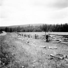
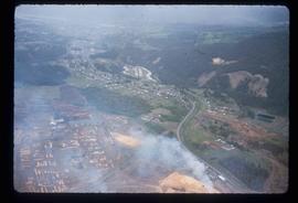
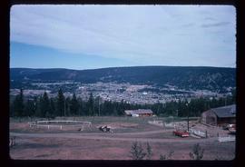
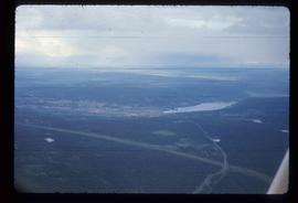
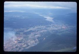
Photograph taken on the Williams Lake to Bella Coola road.
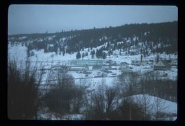
This file consists of 4 copy prints and negatives depicting the Williams Lake townsite, Stampede, and Chimney Creek bridge.
Digitized video clip of silent film footage depicts the Williams Lake Stampede and a parade.
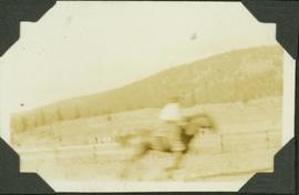
Caption: Williams Lake Stampede, caribou country. Speed? Note the open country; semi dry belt. Item is a blurred photograph of a man on horse back.
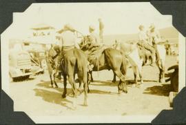
Caption: Williams Lake Stampede, caribou country. Most of the horses aren't much for looks, but they have other qualities. Item is a photograph of four boys (?) on horseback standing in a parking lot.
A b&w plan drafted on a tracing paper, produced by Central Planning and Management Consulting LTD. Prince George. Mackenzie Ave. is identified on the plan. It shows lot, roads and subdivisions.
A b&w plan illustrating subdivision of a region around Second St. and Mackenzie Ave in Williams Lake. Plan is produced by Central Planning and Management Consulting LTD. in Prince George.
Cariboo - Chilcotin region of British Columbia
Image depicts the St. Joseph's Residential School in Williams Lake, B.C.
According to the National Centre for Truth and Reconciliation Archives (https://archives.nctr.ca/Cariboo-Residential-School) :
"Cariboo (Williams Lake) Indian Residential School (IRS) was located southwest of Williams Lake on highway #97 approximately halfway between Quesnel and Kamloops in the BC interior. The IRS operated from 1891 - 1981 (90 years) and closed on June 30, 1981.
Other names identifying the residential school include Williams Lake Industrial School and St. Joseph’s Industrial School from 1891 - 1920; Cariboo Industrial School and Cariboo Indian Industrial School from 1920 - 1927; Cariboo Residential School and Cariboo Indian Residential School from 1923 - 1981; St. Joseph’s Mission School (1929 - 1981), St. Joseph’s Indian Residential School (1932 and 1935), and St. Joseph’s Residential School (1963 and 1969); Cariboo Student Residence and Cariboo Indian Student Residence from 1967 - 1981. The school was also frequently referred to as the Indian School at 150 Mile House because of its location.
The Government of Canada was responsible for funding the school, which was managed and operated by the Roman Catholic Church from July 1891 - March 31, 1969. From April 1, 1969 - June 1981, the federal government managed and operated the IRS. In 1962, an agreement was signed between Her Majesty the Queen in Right of Canada represented by the Minister of Citizenship and Immigration and Indianescom (Oblate Indian and Eskimo Commission) for the management and operation of the Cariboo IRS.
No information regarding which grades were taught at the IRS exists.
Students were from the following bands: Alexandria, Alexis Creek, Alkali Lake, Anaham, Anderson Lake, Ashcroft, Bonaparte, Bridge River, Canim Lake, Canoe Creek, Clinton, Coldwater, Cowichan, Dog Creek, Euchinico, Fountain, High Bar, Kamloops, Kluskus Lake (Kluxkux Lake), Kuklinko, Lake Babine, Lillooet, Little Shuswap, Moricetown, Mount Currie, Natzoo, Nazko, Nemiah Valley, North Thompson, Pavillion, Pemberton, Quesnel, Redstone, Riske Creek, Seton Lake, Skwah, Soda Creek, Squamish, Stone (Stoney), Taodistan, Toosey, Ulkatcho (Ulgatcho), and Williams Lake. "was opened was opened by Roman Catholic missionaries in 1891. In 1902 nine boys ran away from the school, one of them dying of exposure. In 1920, nine boys ate poisonous water hemlock in what parents believed to be a response to discipline at the school. One of these boys died. The school closed in 1981. In the 1980s and 1990s two former staff members pled guilty to charges of sexually abusing students in the 1950s and 1960s. In 1998, a former principal apologized to a former student and school employee who had charged him with a series of sex offences. "
File contains slides depicting places in the area around Williams Lake, Clinton, and the Fraser Canyon.
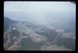
Image depicts an aerial view of Williams Lake, B.C.
Image depicts a view of Williams Lake, B.C.
Lake viewed through coniferous frame, Cariboo-Chilcotin region of British Columbia
Image depicts an aerial view of Williams Lake, B.C.
Image depicts an aerial view of Williams Lake, B.C.
Image depicts an aerial view of Williams Lake, B.C.
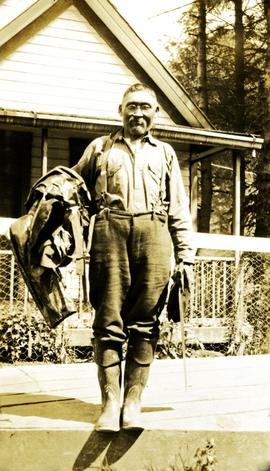
Photograph depicts a man wearing rubber boots, standing on a board walk, a house in the background. Handwritten annotation below photograph reads, "Sweet Wm Smith".
File consists of research materials concerning ornithologist William Rowan. File includes photocopied published and archival research materials, publications, handwritten notes, photographs, and related correspondence.
File consists of archival research materials and related correspondence concerning William Rowan.
File consists of Ainley's Social Sciences and Humanities Research Council (SSHRC) grant application and approval for her research on "William Rowan: A Biography." File includes application forms, correspondence, notes, and a SSHRC publication "Research Grants: Guide for Applicants."
Man in fedora atop a ladder
File contains correspondence from William Kinsella. Includes letters to Brian Fawcett from William Kinsella regarding scheduled readings. Letters dated January 25, 1983; May 9, November 10, December 24, 1985; September 4, 1988.
File consists of material relating to William John "Wiggs" O'Neill, a riverboat pioneer. Wiggs began working on a Skeena River sternwheeler in 1898 and continued working on the river until the end of the steamboat era in 1911. He then moved to Smithers, where he operated the first power plant and owned an auto agency for 43 years. Materials include two books, newspaper clippings, and reproductions of journal articles. Highlights include:
- Wiggs O'Neill, "Steamboat Days on the Skeena River British Columbia", 1963 (book)
- Wiggs O'Neill, "Whitewater Man of the Skeena", 1960 (book)
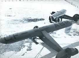
Photograph depicts Jewitt's CF-ABM Fairchild 71 aircraft and a group of men surrounding a Detroit News aircraft NR-32-M, both located at Edmonton Airport.
File consists of material relating to William "Billy" J. Rhimes (Rimes?), editor of the Nechako Chronicle newspaper. Materials include a manuscript titled "1918 in Vanderhoof by Billy Rhimes", as well as newspaper clippings.
File contains correspondence to Brian Fawcett from William (Bill) Hoffer. The items are a booklet entitled, "A Correspondence" that includes typed copies of related correspondence, copyright 1985, 23 pages, and letters dated predominantly 1985.
Portrait photograph depicts Judge William Dow Ferry holding a pipe.
Portrait photograph shows William D. Ferry in his judicial robes.
Photograph is a head-on portrait of Judge William Dow Ferry.
Series consists of records and photographs relating to Judge William Ferry's life and career. Includes school records from Prince George Public School and the University of British Columbia, military photographs, and records, certificates and photographs relating to his his judicial career.
Ferry, William DowPhotograph depicts William Dow Ferry upon his graduation from the University of British Columbia Law School in May 1949.
Files contain a grade six report card, high school entrance certificate, certificates of appointment to various positions, a photocopy about the Dow Family, a map of the Cariboo District, Judge Ferry’s law degree from the University of British Columbia, his Law Society diplomas and his certificate of appointment to the Supreme Court of British Columbia.
File contains correspondence to Brian Fawcett from William Deverell. Includes a letter dated October 27, 1993.
File consists of notes and reproductions relating to William Binney Milner, a Vancouver-based financier who owned Eagle Lake Sawmills at Giscome and the Prince George Citizen newspaper. File also includes photographs depicting the exterior of a house at the address 2890 Marine Drive (2005).
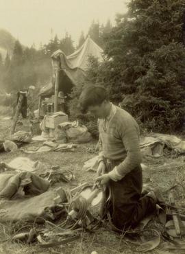
Willard Freer, a packer and guide in remote northern BC, kept a daily diary from 1942 to 1975 that provides a detailed record of life in northern BC and southern Yukon Territory. This collection consists of digital replicas of Willard Freer's diaries from 1942 to 1975, along with accompanying transcripts created by Jay Sherwood, who authored a book about Freer's life.
Excerpts describing the Freer Diaries from "Kechika Chronicler: Willard Freer's Northern BC & Yukon Diaries, 1942-1975" by Jay Sherwood (2023), pages 14-17:
In a letter that [Willard Freer] wrote in 1935, he stated that he had started keeping a diary when he left home. Unfortunately, his early diaries have been lost. In the summer of 1939, while Freer was away working, the BC Provincial Police investigated his neighbour Frank "Shorty" Weber as a suspect in a local murder. The police seized Freer's diaries from his trapping cabin as potential evidence. Freer wrote to the police requesting the return of his diaries, but he never received them. Fortunately, Freer had made copies of his diaries for the summers of 1932 and 1934. His diary for 1934 is particularly important because he was a member of the Bedaux Expedition.
Freer's existing diaries begin in the spring of 1942, when he was still living in the Ingenika River valley, and continue until 1975. The notebook for 1950 and 1951 is missing, and the January to September 1961 section has been removed. ...
Throughout his adult life, Freer wrote a daily journal. The entries are usually brief and direct, with minimal philosophizing. They are often repetitive, describing daily routines. However, the cumulative narrative of Freer's diaries provides a rare look into the history of one of British Columbia's most remote areas.
The pantheon of people recorded in Freer's diaries include many notable individuals who lived and worked in the Kechika River valley and along the Alaska Highway. Willard's journals provide details about specific events in the lives of these people. There are many references to the famous bush pilots Stan Bridcut and George Dalziel. He notes several prospectors who are well-known in northern BC and Yukon.
Willard's work involved extensive travel through northern BC and Yukon. His diaries provide details about the locations he visited. In particular, Freer kept an important record of travel on the Davie Trail between Fort Ware and Lower Post. For every overnight trip he made, Freer recorded the campsite he used, and the amount of time he spent travelling each day.
During the 1940s and 1950s, the Kaska and Kwadacha Tsek'ene still followed their traditional yearly rounds in the Kechika drainage. Freer's diaries detail the lives and routines of numerous Indigenous people over many years. Some of them are mentioned over a hundred times in Freer's diaries. By all accounts, Willard had good relationships with the Indigenous people. In the remote northern BC and Yukon region, where there were few people, working co-operatively was important.
Willard lived and worked at Skook Davidson's Diamond J Ranch during most of the 1940s and at intervals in the 1950s, so his journals provide considerable information about Skook and life at the ranch.
...
Freer's diaries contain considerable information about daily life in the lodges along the Alaska Highway.
...
Freer was involved in many important projects in northern BC and Yukon. He was a member of the famous 1934 Bedaux Expedition. Freer was a packer for BC and federal government survey crews for several summers; worked on the British Columbia-Yukon Boundary Survey for four years; was employed on Geological Survey of Canada (GSC) crews for several years; and spent three field seasons on the BC government's Forest Inventory program. Willard also packed for a couple of large mining exploration companies and was a hunting guide for Robin Dalziel and other guide outfitters.
Freer's diaries can also be used to monitor events like the weather and snowfall. In the winter, when he lived at Skook's ranch or at his cabin, he recorded the temperature in the morning, at midday, and in the evening. He also noted snowfalls. Willard recorded the date that the Kechika froze over in the fall, and when the ice melted off the river in the spring. He also noted his first observations of birds in the spring.
...
The diaries of Willard Freer, which chronicle over thirty years of life in northern BC, are a unique account, providing a gateway to many of the people who lived there and some of the important events that occurred.
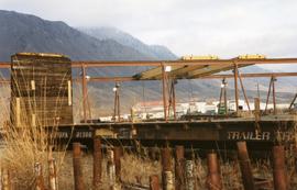
Photograph depicts Wilkinson Steel Ltd. The spur line was inside the property with an empty bulkhead car awaiting removal.
Map depicts the area around Wilkinson Creek near Carmi, BC. Annotated by Davies to show the Kettle Valley Railway.
Series consists of materials related to the oral history related by Wilf Howlett to Audrey Smedley/L'Heureux. Includes 1 bound, 1 unbound, and 1 electronic transcript, as well as three audio recordings, each of which has an accompanying copy.
Consists of 1 floppy disk (Sony 1.44MB high density MFD-2HD) of interview.
Consists of 1 audio recording (Maxell UR) of interview.
Consists of 1 audio recording (Maxell UR) of interview.
Consists of 1 audio recording (Maxell UR) of interview.
Consists of 1 audio recording (Maxell UR) of interview.
Consists of 1 audio recording (Maxell UR) of interview.
Consists of 1 audio recording (Maxell UR) of interview.
The item is an audiocassette interview of Wilf Erickson conducted by Kent Sedgwick. Annotation on cassette case states, "Wilf Erickson Sept 2001 RE: Salmon Portage."
Item is an original report entitled "Wildlife of the Bowron Lakes Region" by R.Y. Edwards.
Item is a reproduction of a "Wildlife Management in Park Act Land Designations" document by the BC Ministry of Lands, Parks and Housing - Parks and Outdoor Recreation Division.
