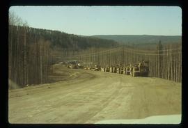
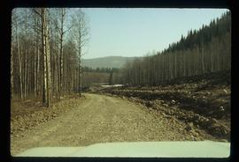
Image depicts an unknown woman on a road in the upper Fraser Canyon.
Image depicts a boat dock on the Nechako Reservoir at Kenny Dam.
Image depicts a boat on the Nechako Reservoir at Kenny Dam.
Image depicts a turbine on the back of an industrial vehicle, located somewhere in Fort St. John, B.C. The slide is labelled "Site one dam; turbine prop. (Russian.)"
Image depicts a turbine on the back of an industrial vehicle, located somewhere in Fort St. John, B.C.
Image depicts two bridges in Telkwa, B.C. One is for trains.
Image depicts the interior of the ferry at Southbank, B.C.
Image depicts a road and field somewhere near Grassy Plains, B.C.
Image depicts a bridge in Hagwilget, B.C.
Image depicts the ferry in Isle Pierre, B.C.
Image depicts the dock for ferries in Isle Pierre, B.C.
Image depicts a stretch of road through the Bulkley Valley.
Image depicts the ferry at Isle Pierre, B.C.
Image depicts an 80 tonne truck at a mine site somewhere in Granisle, B.C.
Image depicts numerous bags of blasting powder at a mine site somewhere in Granisle, B.C.
Image depicts a large, electric shovel at a mine site somewhere in Granisle, B.C.
Image depicts a drill for blasting holes at a mine site somewhere in Granisle, B.C.
Image depicts a boat on Babine Lake, taken from Granisle, B.C.
Image depicts a stretch of road somewhere at Burns Lake, B.C.
Image depicts an unknown individual leaning against a sign at the Stewart Access Road which warns travellers to pack several days of food. Located in Hazelton, B.C.
Image depicts a man, possibly Kent Sedgwick, leaning against a sign forbidding public traffic on the Stewart Access Road from between 5 am to 8 pm. Located in Hazelton, B.C.
Image depicts the train station in Quesnel, B.C.
Image depicts the Cottonwood Bridge.
Image depicts a rail road bridge, possibly the Cottonwood Bridge, at an uncertain location.
Image depicts a beehive burner, as well as rail road tracks, at an unknown location.
Image depicts rail road tracks at an uncertain location.
Image depicts an unknown woman standing in front of a truck that either weighs 80 tonnes, or is capable of carrying that much; the slide is simply labelled "80 tons." It is located at the Gibraltar mine site.
Image depicts what appears to be a Ranch at Soda Creek, B.C.
Image depicts the ferry at Soda Creek, B.C.
Image depicts the Cariboo Road in Soda Creek, B.C.
Image depicts an aerial view of the Williams Lake Airport along Highway 97, just north of Williams Lake, B.C.
Image depicts an aerial view of Highway 97 just north of Williams Lake, B.C.
Image depicts the BCR tracks passing through a mill somewhere near the 100 Mile.
Image depicts the BCR, as well as the Dunkley Lumber Mill, in Strathnaver, B.C.
Image depicts a number of workers putting in blasting powder at the Gibraltar mine site north of Williams Lake, B.C.
Image depicts a loading truck at the Gibraltar mine site north of Williams Lake, B.C.
Image depicts an 80 tonne truck full of rocks at the Gibraltar mine site north of Williams Lake, B.C.
Image depicts the Gibraltar mine site north of Williams Lake, B.C.
Image depicts a rail road construct from Highway 97 at Mile 126; the slide is also labelled "McAlister."
Image depicts the intersection of 15th Ave and Highway 97 in Prince George, B.C.
Image depicts an aerial view of the BC Rail, in Prince George, B.C. It is now known as CN Rail.
Image depicts two trains in Prince George, B.C.
Image depicts a rail road bridge over the Mud River.
Image depicts a helicopter flying over the Woolsey Glacier.
Image depicts a road somewhere in Tumbler Ridge, B.C. There are numerous construction vehicles present.
Image depicts a road somewhere in Tumbler Ridge, B.C. There are three bush planes in the image.
Image depicts numerous campers and other vehicles in Tumbler Ridge, B.C.