Print preview Close

Showing 973 results

Archival description
28 results with digital objects Show results with digital objects
Ministry of Forests Records
2006.18.1.32 · Bestanddeel · 2001-2006
Part of Aleza Lake Research Forest Society fonds

File consists of:

  • Correspondence regarding the transfer of the Ministry of Forests records related to the Aleza Lake Experimental Station
  • Aleza Lake Research Forest research notes on historical records
  • Ministry of Forests Records Classifications
  • Inventory report of BC Forest Service records relating to Aleza Lake
  • Database print-out from the BC Forest Service Prince George Forest Region Research Installation Archive
  • Ministry of Forests website print-outs from 2007, including a page on "Research Branch History"
ALRF Trail Guides
2006.18.4.09 · Bestanddeel · [1993?]
Part of Aleza Lake Research Forest Society fonds

File contains a trail guide co-published by the BC Forest Service and Northwood Pulp and Timber Ltd. entitled "The North Ridge Eco-Trail Guide: Aleza Lake Research Forest".

2016.7.3.49 · Bestanddeel · June 1990
Part of Dr. Joselito Arocena fonds

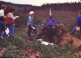
File consists of slides depicting Joselito Arocena's University of Alberta PhD fieldwork. Arocena started his PhD fieldwork in 1988 under the supervision of Dr. Steve Pawluk.

FSTY 205 images
2016.7.3.02 · Bestanddeel · [18 June 1995]
Part of Dr. Joselito Arocena fonds

File consists of slides noted by Arocena as relating to his FSTY 205 course. People and places depicted include: UNBC Forestry faculty, Aleza Lake, Klinka, Tabor Creek, Lake Babine, Bell Mine site, Smithers, Kitwanga, Alaska Highway, Bear Glacier, Muncho Lake, Mt. Robson, and UNBC Campus.

FSTY 205 / FSTY 425 in 1996
2016.7.3.14 · Bestanddeel · Oct. 1996
Part of Dr. Joselito Arocena fonds

File consists of slides depicting FSTY 205 students, Tyner Boulevard, Forests for the World, Chilcotin River, FSTY 425 students, Aleza Lake, soil profiles, and luvisol.

Beaumont and Pine Park
2016.7.3.25 · Bestanddeel · [July 1998]
Part of Dr. Joselito Arocena fonds

File consists of slides depicting Totuk Lake, chernozem, Vanderhoof, a log house, Beaumont Provincial Park, Tamarack Lake, Dahl Lake, an ant hill, and red soil.

FSTY 205 and FSTY 404
2016.7.3.33 · Bestanddeel · Nov. 1999
Part of Dr. Joselito Arocena fonds

File consists of slides depicting Bear Lake, FSTY 205 students, FSTY 404 students, a forestry field camp, Aleza Lake, Paul Sanborn, and UNBC campus.

2016.7.3.35 · Bestanddeel · Aug. 2001
Part of Dr. Joselito Arocena fonds

File consists of slides depicting the UNBC parking lot, the Domano/Gladstone intersection in Prince George, the Bill Reid banners in the UNBC administration building, a car fire, and UNBC faculty and staff.

2023.7.1.09 · Bestanddeel · July 2000
Part of Grant Hazelwood fonds

File consists of the original version a report prepared by Grant Hazelwood for the BC Ministry of Forests entitled "Biological Investigation Report - Gosling Creek" regarding the presence of Tailed Frogs in the area.

2023.7.2.10 · Bestanddeel · [198-?]
Part of Grant Hazelwood fonds

File consists of an original reproduction of a map entitled "Impact of Kemano Expansion on Gitksan-Wet'suwet'en Fishery". The map depicts salmon spawning areas, hydroelectric structures (Kenney Dam, Kemano powerhouse, etc), and Gitksan-Wet'suwet'en communities (Gitwangak, Kitseguecla, Gitanmaax, Hagwilget, Moricetown). Includes notable impacts and Indigenous place names for rivers, creeks, and lakes.

2023.2.2.1.1.2 · Bestanddeel · 1988-1990
Part of Dr. Paul Sanborn fonds

During a year away from studies in 1987-88, Dr. Paul Sanborn developed a successful grant proposal to the Science Council of BC (SCBC) to pursue a postdoctoral project with Dr. Tim Ballard in relation to sulphur-deficient soils in BC and prescribed fire. This project built on an existing broadcast burning study conducted by Macmillan Bloedel Ltd. near Port Alberni on Vancouver Island, led by Bill Beese (later at Vancouver Island University). Dr. Sanborn's work addressed sulphur forms and amounts in the soils at these sites, and the chemical processes influencing sulphur availability in relation to prescribed fire.

Only one part of this work was eventually published:
Sanborn, P.T. and T.M. Ballard. 1991. Combustion losses of sulphur from conifer foliage: Implications of chemical form and soil nitrogen status. Biogeochemistry 12: 129–134. https://doi.org/10.1007/BF00001810

The remainder of the work was documented in this Project Completion Report to SCBC, dated February 28, 1990, and entitled "Effects of Prescribed Fire on Sulphur in Forest Soils".

Thirty-four data files were selected for archival retention. There is some redundancy of content among these, with some formatted for incorporation as tables in the report appendices, and others containing some of the same data, but set up as input files for a statistics program. These account for almost all of the data listed in the Project Completion Report appendices. No glossary of variable names is provided, but these should be identifiable by referring to the Report.

2023.2.2.6.1 · Bestanddeel · 1983
Part of Dr. Paul Sanborn fonds

During the 1980s, Agriculture Canada pedologists Scott Smith (retired from Summerland Research Station, formerly based in Whitehorse) and Charles Tarnocai (retired from Central Experimental Farm, Ottawa) had a large field program which addressed the trends in soil development in the central Yukon. Across this region, particularly between Whitehorse and Dawson City, the land surfaces and surficial deposits vary greatly in age due to the differing extents of glaciations over the past ~2 million years.

Tarnocai and Smith shared the unpublished data and soil samples from this work with Dr. Paul Sanborn, and this resulted in a student project published as:
Daviel, E., P. Sanborn, C. Tarnocai, and C.A.A. Smith. 2011. Clay mineralogy and chemical properties of argillic horizons in central Yukon paleosols. Canadian Journal of Soil Science 91: 83-93. https://doi.org/10.4141/cjss10067

This file consists of photocopies of 76 detailed soil description forms from the 1983 Yukon Paleosol Study by Tarnocai and Smith.

2023.2.2.7.1 · Bestanddeel · 1960, 1971, 1989
Part of Dr. Paul Sanborn fonds

In July 2009, Dr. Paul Sanborn undertook the first soils field research at the Fort Selkirk volcanic field in central Yukon, with helicopter support and funding from the Yukon Geological Survey. This file consists of prints of aerial photographs that depict the area accessed for the study, upstream from the confluence of the Yukon River and the Pelly River.

Air photographs include:
Flight line A17210, Photo Nos. 54-60 (taken 1960)
Flight line A22354, Photo Nos. 43-45, 47-48 (taken 1971)
Flight line A27516, Photo Nos. 48-52 (taken 1989)

2023.2.2.7.3 · Bestanddeel · 2009-2023, predominant 2009-2010
Part of Dr. Paul Sanborn fonds

In July 2009, Dr. Paul Sanborn undertook the first soils field research at the Fort Selkirk volcanic field in central Yukon, with helicopter support and funding from the Yukon Geological Survey. This file includes the following data sets gathered from the research:

  • Ft Selkirk 110114069.xls [particle size analysis data, CANTEST]
  • S1090final.xlsx [chemical analysis data, Ministry of Forests & Range, Analytical Chemistry Laboratory]
  • S1112final.xlsx [chemical analysis data, Ministry of Forests & Range, Analytical Chemistry Laboratory]
  • Ft Selkirk 2009 soils data (updated Sept 15, 2010 and April 10, 2023).xls [consolidated lab data for all 2009 samples]
2023.2.2.8.17 · Bestanddeel · 2004
Part of Dr. Paul Sanborn fonds

This file contains the following photographs in both print photograph and negative format:

Thorsen Bay
Print roll 11, #01-2A
Corresponding slides: slide roll 6, #12-10

Y04-19 (27.5 km on Cultus Bay Rd., near Thorsen Bay)
Date: July 22, 2004
Location Coordinates: 61º 12’ 3.0” N, 138º 28’ 58.3’ W, 819 m asl (± 18.9 m)
Site Description: Roadcut at base of 30º, E-facing slope. Colluviated loess overlies sandy glaciofluvial at 120 cm. Prominent paleosol with “cumulic” B horizon at 80-120 cm, with strong effervescence throughout exposure.
Print roll 11, #3A-5A (profile), #6A-10A (landscape)
Corresponding slides: slide roll 6, #9-7 (profile), #6-1 (landscape)

Sample Depths & Descriptions: Y04-19-01 – charcoal at 95 cm
Roadcut opposite ~ 30 m to NE on grassy S aspect (10° slope) with 15-20 cm of calcareous loess and sand over 2 cm White River ash; strongly effervescent throughout.
Print roll 11, #11A-12A (profile)
Corresponding slides: slide roll 7, #36-35 (profile)

Thorsen Bay landscape
Print roll 11, #13A-16A
Corresponding slides: Slide roll 7, #34-32

Y04-20B
Date: July 22, 2004
Location Coordinates: 61º 10’ 16.5” N, 138º 26’ 18.7’ W, 797.5 m asl (± 5.9 m)
Site Description: wind-eroded Slims soil on glaciolacustrine with contorted bedding (exposed on blown-out roadcut); calcareous to surface; White R ash pockets at 10-20 cm; S aspect, 5° slope.
Print roll 11, #17A-21A
Corresponding slides: Slide roll 7, #31-26

Y04-22
Date: July 22, 2004
Location Coordinates: 61º 9’ 39.24” N, 138º 25’ 7.8’ W, 790.6 m asl (± 6.4 m)
Site Description: toe of 30° slope, W aspect (grassy slope with poplar at toe); 1.0-1.2 of colluviated loess over gravelly glaciofluvial with buried soil at 70-80 cm
Print roll 11, #22A-24A
Corresponding slides: Slide roll 7, #25-24
Archie Creek slides
2023.2.2.10.2.8 · Bestanddeel · Sept. 1995
Part of Dr. Paul Sanborn fonds

File contains 2 rolls (51 slides) taken September 25-26, 1995 that depict paired views of plot vegetation and forest floor surface. Handwritten number notations on slide frames indicate plot numbers from the original research installation.

2023.2.2.12.5 · Bestanddeel · 2007-2009
Part of Dr. Paul Sanborn fonds

File contains the following data sets:

  • BC & Yukon 2008 soils data – compiled.xls [combined chemical & physical data for BC08-06, Y08-39, Y08-41, Y08-43]
  • S925finl.xls [chemical analysis data, Ministry of Forests & Range, Analytical Chemistry Laboratory for pedons BC07-03 & BC07-04; also includes data for Y07-06 & Y07-07 (Klutlan Glacier – see associated file note)]
  • S979finl(revised) – PS edits.xls [chemical analysis data, Ministry of Forests & Range, Analytical Chemistry Laboratory for BC08-06, Y08-39, Y08-41, Y08-43]
  • S994finl_revised.xls [chemical analysis data, Ministry of Forests & Range, Analytical Chemistry Laboratory for BC07-04 (CaCO3-equiv, total & inorganic C, pyrophosphate, oxalate & dithionite extractions) & selected horizons from BC07-07 & BC07-09 (Nazko basaltic soils))
  • CANTEST lab report 91010076.pdf [particle size analyses for BC08-06, Y08-39, Y08-41, Y08-43]
  • CANTEST lab report 90206003.pdf [particle size analyses for Tuya pedons BC07-03 & BC07-04 & Klutan Glacier pedons Y07-06 & Y07-07]
2023.2.2.13.1 · Bestanddeel · 2007-2008
Part of Dr. Paul Sanborn fonds

File contains the following data sets:

  • S925finl.xls [chemical analysis data, Ministry of Forests & Range, Analytical Chemistry Laboratory for pedons Y07-06 & Y07-07; also includes data for BC07-03 & BC07-04 (Boreal Cordillera grassland soils – see associated file note)]
  • S1007finl_revised2.xls [chemical analysis data, Ministry of Forests & Range, Analytical Chemistry Laboratory for pedons Y07-06 & Y07-07: oxalate & dithionite extractions, P retention; also includes P retention data for Nazko pedons BC07-07 & BC07-09]
  • CANTEST lab report 90206003.pdf [particle size analyses for Klutan Glacier pedons Y07-06 & Y07-07; also Tuya pedons BC07-03 & BC07-04 &]
Diamond core drilling
2000.1.1.1.11 · Bestanddeel · 1971- 1977
Part of Cassiar Asbestos Corporation Ltd. fonds

Six metal storage cases containing primarily slides depicting drill core sections in wooden storage trays. Cases contain inventories of slide images as well as annotations which document the year, drill hole number, and the length along the drill hole from which core sections are taken. In addition to the documentation of drill core sections, the cases contain slides depicting the following subjects: “Representative samples” of drill core fragments, drill core fragments in perspective, “physical characteristics” of the drill cores and the storage trays, the pit mine, a worker in a plaid shirt, close up shots of the geology of the working face, and images annotated “SHOTS OF JADE BOULDER CORE J5-J1”. Five slides originally filed separately and stamp dated “Jul. ‘73” depict what is speculated to be employees working on the diamond drilling project include 2 images annotated ‘R. Dickin Aug ‘72’, ‘I. Oliver Aug ‘73’, ‘S. Zimmer Aug ‘73’, and ‘core shack ’73’. The cases contain 234 7x7cm slides and at least 8 5x5 cm slides which are duplicates of the remaining images. The file also contains a slide strip containing several 7x7 cm slide images.

Geology rock samples
2000.1.1.1.12 · Bestanddeel · 1977 - 1991
Part of Cassiar Asbestos Corporation Ltd. fonds

The file contains eight photographs depicting close up images of three rock samples, some photographed with a ruler for scale. One of the rock samples is speculated to be obsidian and the other two are likely serpentine. The images where originally found in an envelope titled "ROCKS" and are likely dated around 1991.

Included in this file are an five photographs of rocks on a shelf, which may be asbestos sample rocks. There are five accompanying negatives to these photographs and are likely dated around 1977. The photographs and negatives were found in an envelope labelled "Negatives - CIMM Photos."

Additionally two negative strips of geology maps of Canada. These negatives were found in an envelope labelled "Negatives - CIMM Papers, Mining, Planning, Geology."

2000.1.1.3.08 · Bestanddeel · July 1987 - Apr.1989
Part of Cassiar Asbestos Corporation Ltd. fonds

File contains images of mine operations and construction, as well as a variety of other subjects.

  • Elements of the underground mine are depicted, including miners working, the marked rock face, yellow ducting and ventilation fan, the portal, mesh rockbolted onto adit walls, shotcrete being applied, and stacked mining construction materials.
  • Mining equipment depicted in this file includes underground ore haulage truck, Wabco ore haulage truck, jackleg drill, stoper drill, scoop tram, jumbo drill, conveyor, pickup trucks, unidentified mixing or grinding machine, a cable wagon and half constructed ore haulage truck in the shop, and a continuous miner (also known as alpine miner or roadheader).
  • A set of images show a dozer and a lowbed truck transporting a temporary building down the pit mine access road.
  • Several images depict drill core fragments, asbestos ore, and geological features of the mine.
  • Mining related process are depicted, including a young man sluicing and panning, a mine building under construction, and an unidentified steel frame structure with a hydraulic device suspended on a rail.
  • A set of images shows a railway or highway construction project, including stockpile of construction materials, rail cars, caboose, locomotive, front end loader, dump truck, concrete mixing trucks, semi-trucks, and a rail car with large steel drums which are speculated to be specialized for tunnel construction.
  • Further images show what is speculated to be tunnel construction.
  • A set of images at a high ceiling underground mine which is not Cassiar depicts a man in a suite by a underground ore haulage truck, and other mining vehicles including a crane.
  • A set of images depict an ungulate herd, possibly bighorn sheep, on a mountain side.
  • The file includes several images which depict personal life, presumably from a family vacation, and access to these images may be restricted. These images depict man with children on a fishing trip, adults and children around a pool, a woman on a motorcycle, and a house and kitchen. Several groups of images are contained in envelopes annotated with dates and “K. Minty”.
2000.1.1.2.09 · Bestanddeel · [ca. 1950 - 1976]
Part of Cassiar Asbestos Corporation Ltd. fonds

Images contain technical engineering drawings from the Asbestos Mining Corp. Drawings are primarily of plant buildings and mining and milling equipment, but also include drafts of town site and utilities, (extensive images of water and sewer pipes and septic systems). Microfiche slides are 4.6cm x 3.5cm mounted on 8.3 x 18.2 cm paper cards with systematic puncture marks, presumed to be an antiquated form of computer memory. Slides are numbered ranging from 1001 to 1549 and a drawing number ranging from 1006 to 8008, generally in the format “2017/02/02”. Microfiche are dated 1950- 1976, several are dated “OLD”, and several are undated. All microfilm reels are annotated “CASSIAR ENGINEERING DRAWINGS”.

Shipping & Transportation
2000.1.1.3.21 · Bestanddeel · 1962 - 1983
Part of Cassiar Asbestos Corporation Ltd. fonds

File contains photographs pertaining to the transportation of asbestos fibre.

  • These include portraits of Clinton trailer trucks, trucks from the Cassiar Transport Division at Mile 860 on the Alaskan Highway, the assembly of large freight trucks, an unidentified bridge, and ships and buildings at the Cassiar Shipping Facilities at Pier 94 on the Asbestos Warf in North Vancouver, B.C.
  • Twenty-three photographs dated 1982 depict asbestos fiber bales on pallets and inside shipping containers, with accompanying annotations commenting on the quality of the packing. Several images show fibre bales broken during shipment. An accompanying note reads: "SMD - please ensure this cannot reoccur.", and a photo caption reads: "pierced bags are resulting as an environmental problem as fibre is beginning to build up in certain containers." One of the photographs depicting the Cassiar Transport Division was used for promotional posters with the following commentary: "The Cassiar Transport Division operates out of Whitehorse, Yukon Territory and is responsible for delivering the asbestos to the White Pass and Yukon Route terminal in Whitehorse. Fuel oil and supplies are backhauled to the mines. By the end of 1967, the fleet will consist of 65 tractor-trailer units, each of which will carry 23 tons of asbestos. The distance from Whitehorse to Cassiar is 357 miles and Clinton is 403 miles. During the past year, the Division's trucks traveled 2,213,534 miles and handled 75,100 tons, and the mileage to 3.5 million miles. This is a year-round operation and convoys arrive at the mine daily in spite of the long difficult haul. The Division currently employs 43 drivers and 35 mechanics and operates its own maintenance and rebuild facilities in Whitehorse. Over the years these men have established and enviable record of safety, cost and performance."
  • Additional photographs that have been integrated depict the Asbestos wharf and its condition, 31 slides of wharf, maps of shipping routes, storage, forklifts, shipping trucks, and packaged asbestos.
  • Also included in this file are two copies of a "Photo Survey - Cassiar Ton Units - "Amstelveld & Trojoland" on arrival to Brisbane & Sidney - August 1967." This collection of photographs is a part of an assessment of the efficiency of shipping and transport to Australia from Cassiar. Pictures include: loading, forklifts, storage, ripped bags, broken straps, wharfs, trucks, slings. There are accompanied annotations with each of the photos explaining the safety hazards or inefficiency of the situation. This report was found inside a box linked to James Hardie Industries Ltd. This company is not mentioned in the photograph annotations, but could be related to the report since James Hardie Industries Ltd. was a key player in asbestos mining and manufacturing in Australia.
  • Collection of photos of roadside spill of Asbestos, depicting a man with shovel cleaning up on 5 June 1985
  • Photos from Eternit Societe Anonyme (a European company that Cassiar shipped to) of packaged Asbestos in storage in 1967
  • Collection of photos of James Hardie Coy. Pty. Ltd. shipment of asbestos that was not stored or transported effectively. Many photos depict broken bags as a result of inadequate storage and forklift punctures.
  • Collection of photos of Cassiar/Stewart Road Proposal. Photos depict tests of the various stages of shipping and transportation process including forklift tests, Marineo Sling tests, stacking tests, durability tests, container loading tests, problems with current units etc. Also included is a marketing drawing if proposed shipping plan - drawn by "Stewart 1977."
  • Photos of shipping process of Turners Asbestos Fibres Lmt. Photos depict lowering asbestos pallets onto barge with swing, and storage on barge.
  • Collection of photos of a shipment of asbestos, but the bags of fibre are not identified as a Cassiar shipment therefore the location is unknown.
Awards
2000.1.1.4.2 · Bestanddeel · 1962 - 1978
Part of Cassiar Asbestos Corporation Ltd. fonds

File contains photographs depicting superintendents accepting safety awards on behalf of Cassiar Asbestos Corporation ltd, and BCIT Scholarship Winners.

Slides and oral histories
2002.14.1.10.30 · Bestanddeel · 1982-1993
Part of Marianne (Marika) Ainley fonds

File consists of computer disk with "over[looked?] oral histories" files. Slides primarily contain pictures of women who were the subjects of Ainey's research.

2002.14.1.11.01 · Bestanddeel · [between 1995 and 2002]
Part of Marianne (Marika) Ainley fonds

File consists of excerpts of course notes from Ainley's courses, Gender 707: Feminist Perspectives on Science and Technology and Women's Studies 403: Science, Technology and Women's Lives; the proceedings from Ainley's presentation at the History of Science Society Annual Conference in 1997, "Women and Field Work in Canada: persistence and strategies, 1815-1990"; and excerpts.