2020.4.7.017
·
Item
·
1982
Part of G. Gary Runka fonds
140 results with digital objects
Show results with digital objects
2023.7.3.01
·
Item
·
1992
Part of Grant Hazelwood fonds
Map depicts the Kitlope range, Kimsquit Watershed, and area around Kitlope Lake. Includes Indigenous place names, grease trails, Indigenous village sites, and wildlife information.

2012.05.01.01.23
·
Item
·
[ca. 1967]
Part of Columbia Cellulose Company, Ltd. fonds
Item is a map showing the watersheds of Diana Lake, Rainbow Lake and Prudhomme Lake.

2007.1.60.03.5
·
Item
·
[1994?]
Part of Aleza Lake Research Forest fonds
Item is a reproduced map of Aleza Lake annotated to show a 1994 RFP study area.

2007.1.60.03.4
·
Item
·
[199-?]
Part of Aleza Lake Research Forest fonds
Item is a photocopied map of the Aleza Lake area annotated to show transects.

2012.05.01.01.30
·
Item
·
[ca. 1967]
Part of Columbia Cellulose Company, Ltd. fonds
Item is a map that distinguishes the regions covered by Tree Farm Licence No. 1 granted to Columbia Cellulose and Three Farm Licence No. 40 granted to Skeena Kraft. Major locations indicated in this map include: Prince Rupert, Terrace, Hazelton, Smithers, Kitimat, Skeena River, and Nass River. Railway routes are also shown.

2007.1.80.1.01
·
Item
·
1954
Part of Aleza Lake Research Forest fonds
Map reflects reserve boundary, roads, trails, 20 feet contour intervals, air photo centre, declination, swamps, and mile post at the Aleza Lake Forest Reserve.
2016.5.5.06
·
Item
·
1984
Part of Harry Coates fonds
Item is McBride, B.C. Sheet 93H and Part of 83E Second Status Edition (1971) from "Classification and Interpretation of some Ecosystems of the Rocky Mountain Trench, Prince George Forest Region, British Columbia: First Approximation" (1984).

2006.18.5.20
·
Item
·
[197-?]
Part of Aleza Lake Research Forest Society fonds
Forest cover map showing a crossing area of the McGregor River is annotated with a road and ferry crossing.
2016.5.5.05
·
Item
·
1984
Part of Harry Coates fonds
Item is McNaughton Lake, B.C. Map 83D and Part of 83C Second Status Edition (1975) from "Classification and Interpretation of some Ecosystems of the Rocky Mountain Trench, Prince George Forest Region, British Columbia: First Approximation" (1984).
2020.4.7.018
·
Item
·
[198-?]
Part of G. Gary Runka fonds
Photocopied map depicts mineral and coal mining properties in north western British Columbia.

2006.18.5.15
·
Item
·
[1966?]
Part of Aleza Lake Research Forest Society fonds
Large-format map depicts the Monkman Public Sustained Yield Unit (PSYU) east of Prince George.

2006.18.5.14
·
Item
·
[1966?]
Part of Aleza Lake Research Forest Society fonds
Large-format map depicts the Monkman Public Sustained Yield Unit (PSYU) and Tree Farm Licence 30 east of Prince George.
2020.4.7.022
·
Item
·
Dec. 2005
Part of G. Gary Runka fonds

2006.18.5.19
·
Item
·
1975
Part of Aleza Lake Research Forest Society fonds
Large-format map depicts Northwood Pulp & Timber operating areas in 1975.
2000.1.2.6.13
·
Item
·
December 31, 1972
Part of Cassiar Asbestos Corporation Ltd. fonds
This map depicts the ore type and geology that can be found among each of the bench layers. Classifications and grades of ore are included within it. Different bench layers are included in the map. Annotations include a title in the back of the map written out as "1972 BENCH PLANS".

2007.1.60.02.1
·
Item
·
Mar. 1993
Part of Aleza Lake Research Forest fonds
2020.4.7.019
·
Item
·
1982
Part of G. Gary Runka fonds
2003.8.4.1.1.2.1
·
Item
·
[1971?]
Part of Adam Zimmerman fonds
Hand annotated map depicts the proposed location of the Northwood Pulp Ltd. Beaver Bridge over the Fraser River near Prince George.

2006.18.5.05
·
Item
·
[1928?]
Part of Aleza Lake Research Forest Society fonds
Reproduced map on mylar depicts a proposed railway spur for the Aleza Lake Forest Experiment Station.
2023.2.2.9.1
·
Item
·
22 June 2000
Part of Dr. Paul Sanborn fonds
Map depicts range reference area exclosure locations for livestock and wildlife in the Fort St. John Forest District.
2003.8.4.9.33.1
·
Item
·
1987
Part of Adam Zimmerman fonds
Map is a "Recreation and Logging Road Guide to the Forest Lands of Vancouver Island Alberni Valley and the Surrounding Area" created for the public.
2003.8.4.9.33.2
·
Item
·
1987
Part of Adam Zimmerman fonds
Map is a "Recreation and Logging Road Guide to the Forest Lands of Vancouver Island Alberni Valley and the Surrounding Area" created for the public. Backside states "Welcome to TFL 44", along with promotional imagery and information for backcountry travelers.
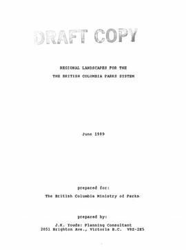
2023.7.3.08
·
Item
·
June 1989
Part of Grant Hazelwood fonds
Item is an original draft copy of "Regional Landscapes for the British Columbia Parks System".

2006.18.5.17
·
Item
·
18 May 1971
Part of Aleza Lake Research Forest Society fonds
Map reproduction of the Sinclair Spruce Lumber Co. Ltd. T.S.H.L. A01848 C.P. 310 cutting area, likely in the Aleza Lake Research Forest.

2007.1.45.49.14
·
Item
·
20 Aug. 1957
Part of Aleza Lake Research Forest fonds
Logging plan of Sinclair Spruce Lumber Company's T.S.X. 73378 at Hubble Creek shows areas to be cut.

2007.1.45.49.15
·
Item
·
20 Aug. 1957
Part of Aleza Lake Research Forest fonds
Logging plan of Sinclair Spruce Lumber Company's T.S.X. 73378 at Hubble Creek shows areas to be cut. Annotations show areas logged.

2006.18.5.04
·
Item
·
[1925?]
Part of Aleza Lake Research Forest Society fonds
Reproduced map on mylar depicts locations of elevations and benchmarks at the Aleza Lake forest.
2020.4.7.015
·
Item
·
1982
Part of G. Gary Runka fonds

2012.05.01.02.02
·
Item
·
1962
Part of Columbia Cellulose Company, Ltd. fonds
Item is a map of British Columbia's Status of Sustained-Yield Forestry Programme as at 31 December 1962. The map has been annotated to show forest area surveyed by Celgar Ltd. as base for new kraft mill.

2008.6.01
·
Item
·
1969
Part of Dr. Philip Burton Forestry Collection
Item consists of a map of British Columbia showing Status of Sustained-Yield Forestry Programme as at December 31, 1969 with colour coded areas indicating Public Sustained Yield Units, Special Scale Areas, Tree Farm Licences, and Major Parks.

2007.1.45.49.07
·
Item
·
5 Oct. 1932
Part of Aleza Lake Research Forest fonds
Map of Timber Sale X9696 shows the area for the TSX with spruce balsam timber. Location is 4 miles from the Myra Station of the Kettle Valley Railway.

2007.1.45.49.09
·
Item
·
[1932?]
Part of Aleza Lake Research Forest fonds
Map of Timber Sale X9696 shows topography for the area. Location is 4 miles from the Myra Station of the Kettle Valley Railway.

2007.1.45.49.10
·
Item
·
[1932?]
Part of Aleza Lake Research Forest fonds
Map of Timber Sale X9696 shows topography for the area. Location is 4 miles from the Myra Station of the Kettle Valley Railway.

2007.1.25.8.1
·
Item
·
28 Nov. 1967
Part of Aleza Lake Research Forest fonds

2007.1.45.49.08
·
Item
·
[1932?]
Part of Aleza Lake Research Forest fonds
Map of Timber Sale X9696 shows the area for the TSX with the location of plots, roads, traverse posts, and the Forest Branch cabin. Location is 4 miles from the Myra Station of the Kettle Valley Railway.