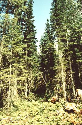
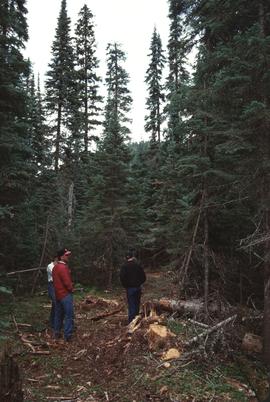
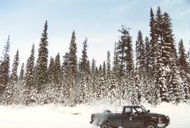
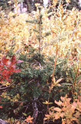
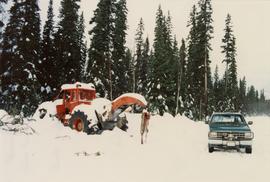
Annotation on slide: "Basal scarring on Douglas fir, Summit Lake".
Annotation on slide: "Summit Lk., Mod. vol. removal".
No annotation on slide.
Annotation on slide: "Heavy Residual Basal Area: Summit Lake".
File contains a photocopy of the BC Forest Service publication entitled "The Aleza Lake Research Forest: 'A Rich Past and a Bright Future' Provincial Colleges Tour" from June 1991.
Series consists of records relating to the management and administration of the Aleza Lake Research Forest.
File consists of correspondence and proposals relating to various Aleza Lake Research Forest projects.
Annotation on slide: "Horse-logging single-tree selection, Pass Lake SBSvk"
File consists of photographic prints and slides depicting partial-cutting and select logging during the EP 1162 Summit Lake research project.
Annotation on photograph verso: "Summit Lake Trial EP 1162, Winter 1991/1992"
File consists of clippings from various serial publications regarding the Aleza Lake Research Forest.
File consists of slides depicting the Aleza Lake Research Forest and area taken by Michael Jull.
Annotation on slide: "BCMoF"
Annotation on photograph verso: "July-Aug. 1991, View of Summit Lake EP 1162. Area from top of Teapot Mountain, looking east. Trial area is east of Crooked River, north of Caine Creek [Forest Service] Road, south of gravel pit (on right)".
Annotation on photograph verso: "D6 grapple skidder used for road development only. 27/12/91. Summit Lake Selection Trial"
Map is an uncontrolled mosaic of aerial photography of the Aleza Lake Research Forest, with a July 1990 date of the air photography.
Series consists of records created or accumulated by the Aleza Lake Research Forest Society regarding the research forest's history. Includes oral histories and material from long-time personnel that worked at the ALRF, such as Harry Coates, John Revel, and Frank Hellenius. Also contains copies of archival records from other archival institutions that concern the history of ALRF, which were compiled as part of a 2006/2007 history internship project.
File consists of:
- "A Summary of Historical Orders-in-Council affecting the Aleza Lake Forest Reserve", Mike Jull, 18 Dec. 1996
- Photocopied memorandum from F.S. McKinnon regarding "Transfer of Aleza Lake to D.F. Prince George", 9 Sept. 1963
- Photocopied 1928 article by P.M. Barr from Forestry Chronicle 4(3) entitled "The Aleza Lake Experiment Station: Its Development and Purpose"
- "A Brief History of the Aleza Lake Experiment Station", [Tim Decie, 1981?]
- Contact information for living relatives of Percy Barr, as of 1990
- Photocopy of 1930 article by Percy Barr entitled "Spruce Reproduction in British Columbia"
- Photocopy of records from BC Archives from a visit by Harry Coates from the file GR 1348 "The Young Mens Forestry Training Program"
- Photocopy of excerpt regarding "Amanita Lake/Diameter Limit Logging"
- Various small-scale maps and charts regarding Aleza Lake
- "Aleza Lake Research Forest Information Session Notes with Mike Jull, Manager of ALRF"
File consists of:
- Poem written by John Revel in 1963 entitled "Cruisers (To George Silburn)"
- Eulogy for John Revel by Mike Jull, May 2015
- Obituary for John Revel in July-August 2015 issue of BC Forest Professional
- Photograph printed on foamcore of John Revel and two others checking cones from 1972 seed crop
File consists of:
- Minutes of the First Meeting of the Aleza Lake Management Committee, 30 Nov. 1990
- "Comments on the Proposed Terms of Reference for the Aleza Lake Management Committee" collated by Michael Jull, April 1991
- Correspondence from Ken Collingwood to Phil Halkett regarding release of funding for the Aleza Lake Research Forest, 22 Nov. 1991
Mylar map depicts the area encompassed by the Aleza Lake Research Forest.
Videocassette is a VHS recording of an interview with John Revel produced by Spectrum Videoworks as part of a BC Forest Service "Esprit de Corps" institutional memory project.
File contains four maps of the Aleza Lake Research Forest showing locations of Permanent Sample Plots in partial cut timber sales.
File contains a possible photocopied excerpt (pages 14-47) from "A Field Guide for the Identification and Interpretation of Ecosystems of the SBSj1 in the Prince George Forest Region", which was a 1987 unpublished BC Ministry of Forests report by C. DeLong, S. Jenvey and A. McLeod.
Item is a BC Forest Service beverage coaster.
Map reproduction depicts major areas of the Aleza Lake Experiment Forest.
Large-format map depicts Northwood Pulp & Timber operating areas in 1975.
File is a Resource Folio of maps and accompanying information created by Northwood Pulp & Timber regarding Timber Sale Harvesting Licence A01847, Willow River Block, Willow River P.S.Y.U. Includes maps that depict ungulates, waterfowl, recreation areas, special influence areas, and timber types. Most of the sheets have a duplicate, some with very slight variations. The following maps are supposed to be included in the but were missing upon arrival at the Archives: fish & topography, cutting permits & roads, and soils.
Map reproduction of the Sinclair Spruce Lumber Co. Ltd. T.S.H.L. A01848 C.P. 310 cutting area, likely in the Aleza Lake Research Forest.
Forest cover map showing a crossing area of the McGregor River is annotated with a road and ferry crossing.
Map reproduction of the Aleza Lake Research Forest depicts timber sale areas, forest cover, and other details.
Large-format map depicts the Monkman Public Sustained Yield Unit (PSYU) and Tree Farm Licence 30 east of Prince George.
File consists of:
- An original final draft of John Revel's problem analysis entitled "Silviculture in Spruce-Alpine Fir Types in the North Central Interior of British Columbia" for E.P. 639 with the Research Division of the BC Forest Service.
Large-format map depicts the Monkman Public Sustained Yield Unit (PSYU) east of Prince George.
File consists of:
- Photocopied version of John Revel's problem analysis entitled "Reforestation in the Vancouver Forest District (Plantation Assessment)" for E.P. 585 with the Research Division of the BC Forest Service.
Slide depicts a black bear eating garbage by wooden outbuildings, possibly at the Aleza Lake Experiment Station.
Slide depicts a detonation in an area of cleared ground in a forested area, likely the Aleza Lake Experiment Station. Work may have been undertaken for roadbuilding activities at the Experiment Station.
Slide depicts a cleared area at the Aleza Lake Experiment Station with plant regeneration.
File consists of slides depicting the Aleza Lake Research Forest and area taken by John Revel.
Slide depicts a heavily forested area with fallen logs, likely at the Aleza Lake Experiment Station.
Slide depicts the original wooden BC Forest Service sign for the Aleza Lake Forest Experiment Station.
Slide depicts a burning building at the Aleza Lake Experiment Station on the date it was shut down by the BC Forest Service.
Slide depicts a view of what is possibly the Upper Fraser River.
Slide depicts the Ranger Station at the Aleza Lake Experiment Station.
File consists of photocopied material regarding the Aleza Lake Experimental Station from BC Archives.
Slide depicts a man operating heavy equipment in a forest, likely at the Aleza Lake Experiment Station.
Slide depicts a sawmill in operation, likely located in the Upper Fraser area, with a pile of burning wood products and a beehive burner.
Slide depicts a bulldozer clearing ground, likely at the Aleza Lake Experiment Station.
Map is an original linen Aleza Lake Experiment Forest map that reflects the reserve boundary, roads, trails, 20 feet contour intervals, air photo centre, declination, swamps, and mile posts.