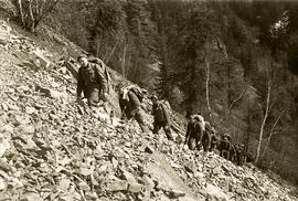
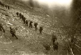
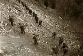
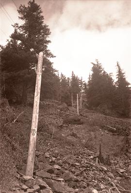
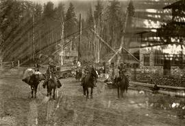
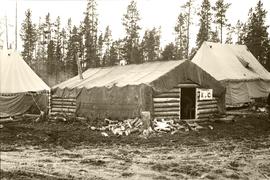
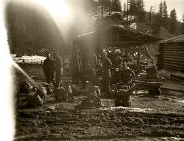
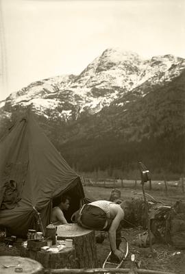
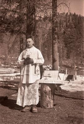
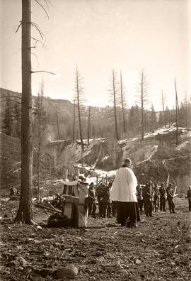
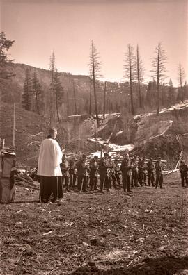
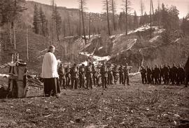
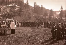
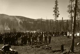
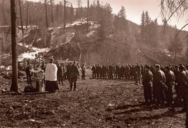
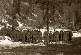
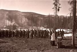
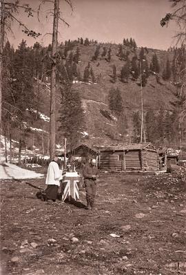
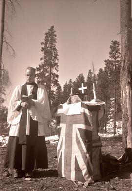
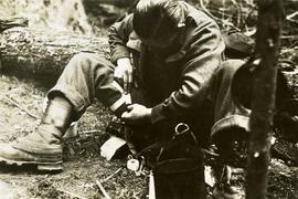
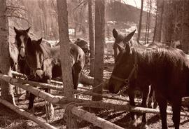
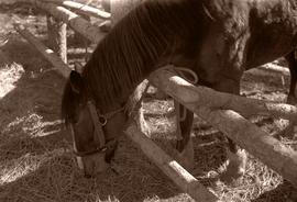
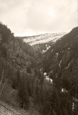
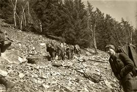
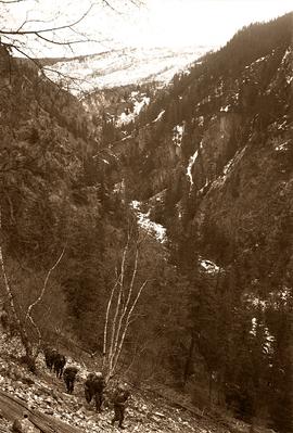
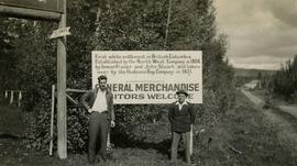
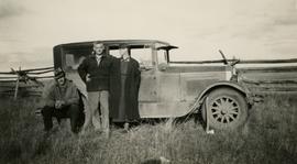
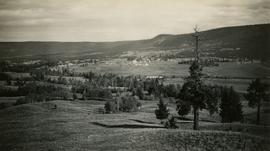
Photograph depicts the Hudson Bay buildings at Fort St. James.
Photograph depicts (from left to right) Gordon Wyness and Jack Lee in front of the Fort St. James sign, which reads "First white settlement in British Columbia. Established by the North West Company in 1806 by Simon Fraser and John Stuart and taken over by the Hudson's Bay Company in 1821. - General Merchandise Visitors Welcome".
Photograph depicts (from left to right) Gordon Wyness, Philip Monckton, and Lavender Monckton by their 1930 Buick Series 40 car in the Williams Lake area. In this image, the car may be broken down; Wyness noted that they "were forced to spend the nite in a school house due to condenser burning out in the car". Wyness also noted that they had "just finished tying in Fraser Mtn", suggesting that they had just completed survey work in the Fraser Mountain area.
Photograph depicts a view of the community of Williams Lake, taken from the Chilcotin Road to the west.
Photograph depicts a view of the Fraser River from what Wyness calls "Fraser Mountain". There are a number of places named "Mount Fraser" in British Columbia, but the exact location of where this photograph was taken is unclear.
Photograph depicts Mount Begbie, noted by Wyness to be the highest point on the Cariboo Highway at mile 85. Mount Begbie is located at approximately 51°28'33''N, 121°22'00''W, on the east side of Cariboo Hwy, between 70 Mile House and 100 Mile House, in the Lillooet Land District. Also visible in this photograph is the Cariboo Highway road.
Photograph depicts Mount Begbie, noted by Wyness to be the highest point on the Cariboo Highway at mile 85. Mount Begbie is located at approximately 51°28'33''N, 121°22'00''W, on the east side of Cariboo Hwy, between 70 Mile House and 100 Mile House, in the Lillooet Land District. Wyness annotated this photograph with the statement that they "tied this one in"; 'tying in' is a land survey term, implying that the crew may have also been surveying in this area.
Photograph depicts (from left to right) Gordon Wyness, Louis LeBourdais, and Earl Malcolm (owner of Quesnel Hotel) standing in front of a 1930 Buick Series 40 car at Twilight Lodge in Lac La Hache, BC. The group was preparing to leave for Prince George.
Photograph depicts Lake Chelan in Washington state.
Photograph depicts a railway track along a river in the Columbia River Basin, north of Wenatchee, Washington.
Photograph depicts a man, likely Gordon Wyness, sitting on the front of a 1930 Buick Series 40 car at the Snoqualmie Pass summit.
In 1936, Gordon Young Wyness was employed by Philip M. Monckton, a B.C. Land Surveyor. Between June 5 and October 8, Wyness joined Monckton and a group of others on a land survey expedition in northwestern BC. The survey crew travelled to various locations in the area including Telkwa, Hazelton, Burns Lake, Francoise Lake, Vanderhoof, Prince George, Quesnel, Lytton, and Hope. Wyness documented their journey in this photograph album. Based on the photographs, it appears that the crew led by Philip Monckton consisted of Jack Lee and Gordon Wyness; Mrs. Lavender Monckton (nee O'Hara) also accompanied the group.
In addition to the 50 photographs included in the album, this collection also includes five additional unique photographs that accompanied the album.
Wyness, Gordon YoungThis fonds encompasses the academic and administrative career of esteemed Canadian historian Dr. Robin Fisher during his tenure at the University of Northern British Columbia. The records span Dr. Fisher's appointments at UNBC as professor, founding chair of the Department of History, Dean of Arts and Science, and Dean of the College of Arts, Social and Health Sciences.
Series include:
- Personal Records relating to Dr. Fisher's various appointments at UNBC
- Treaty Advisory records originating from Dr. Fisher's involvement in the Northern Interior Regional Advisory Committee and other treaty process advisory activities
- Teaching records relating to the development of Dr. Fisher's undergraduate and graduate courses, primarily in the Department of History
- Conferences & Service records relating to conferences attended or organized by Dr. Fisher, as well as activities given in service to the University or the community
This fonds illustrates the writing career of Canadian author Ann Walsh. Types of records included in this fonds include: published and unpublished short stories, manuscripts, correspondence, grant applications, photographs, audio and video recordings, contracts, book reviews, plotting notes, speaking notes, promotional materials and workshop materials.
Walsh, AnnPhotograph depicts soldiers unloading an American military jeep from a military truck, possibly somewhere between Bella Coola and Anahim Lake during the WWII Polar Bear training exercise.
Photograph depicts a soldiers transferring water from military truck water bag to a large water bag on the ground, possibly somewhere between Bella Coola and Anahim Lake during the WWII Polar Bear training exercise.
Photograph depicts a soldiers with packs walking over a wooden log bridge, possibly somewhere between Bella Coola and Anahim Lake during the WWII Polar Bear training exercise.
Photograph depicts a large number of soldiers bearing packs walking in a line through a rancher's field, possibly somewhere between Bella Coola and Anahim Lake during the WWII Polar Bear training exercise.
Photograph depicts soldiers walking along road with children watching nearby, possibly somewhere between Bella Coola and Anahim Lake during the WWII Polar Bear training exercise.
Photograph depicts a three mounted soldiers with a pack horse in front of a stone building, possibly somewhere between Bella Coola and Anahim Lake during the WWII Polar Bear training exercise. Another man and a woman stand in the background near a truck and a flagpole.
Photograph depicts a three military tent buildings, possibly somewhere between Bella Coola and Anahim Lake during the WWII Polar Bear training exercise. One of the buildings has a "K of C" (Knights of Columbus) sign on it.
Photograph depicts a group of seated soldiers, relaxing with their packs nearby, likely somewhere between Bella Coola and Anahim Lake during the WWII Polar Bear training exercise.
Photograph depicts a two soldiers in their undershirts by their tent, likely somewhere between Bella Coola and Anahim Lake during the WWII Polar Bear training exercise. Morning coffee supplies sit on a stump nearby. One of the soldiers is seated, trying on his snowshoes.
Photograph depicts a man (possibly a soldier out of uniform) smoking a cigarette by a vehicle, likely somewhere between Bella Coola and Anahim Lake during the WWII Polar Bear training exercise.
Photograph depicts a soldier cooking over a campfire, likely somewhere between Bella Coola and Anahim Lake during the WWII Polar Bear training exercise.
Photograph depicts a group of soldiers seated on the ground with their shoes off and caring for their feet, likely somewhere between Bella Coola and Anahim Lake during the WWII Polar Bear training exercise.
Photograph depicts a second military chaplain reading by a makeshift tree stump altar, likely somewhere between Bella Coola and Anahim Lake during the WWII Polar Bear training exercise.
Photograph depicts a military chaplain reading by a makeshift altar to a large group of soldiers, likely somewhere between Bella Coola and Anahim Lake during the WWII Polar Bear training exercise.
Photograph depicts a military chaplain standing by a makeshift altar with a cabin and group of soldiers in background, likely somewhere between Bella Coola and Anahim Lake during the WWII Polar Bear training exercise.
Photograph depicts a military chaplain reading by a makeshift altar with the Union Jack flag, likely somewhere between Bella Coola and Anahim Lake during the WWII Polar Bear training exercise.
Photograph depicts a number of soldiers wearing packs near a military truck, likely somewhere between Bella Coola and Anahim Lake during the WWII Polar Bear training exercise.
Photograph depicts a solider mending his uniform likely somewhere between Bella Coola and Anahim Lake during the WWII Polar Bear training exercise.
Photograph depicts a tethered pack horses in makeshift log stalls between Bella Coola and Anahim Lake during the WWII Polar Bear training exercise.
Photograph depicts a tethered pack horse between Bella Coola and Anahim Lake during the WWII Polar Bear training exercise.
Photograph depicts a narrow mountain gorge between Bella Coola and Anahim Lake during the WWII Polar Bear training exercise.
Photograph depicts a line of soldiers hiking up switchbacks on a steep rocky slope between Bella Coola and Anahim Lake during the WWII Polar Bear training exercise.
Photograph depicts a row of utility poles between Bella Coola and Anahim Lake during the WWII Polar Bear training exercise.
Photograph depicts soldiers trekking through mountainous terrain between Bella Coola and Anahim Lake during the WWII Polar Bear training exercise.