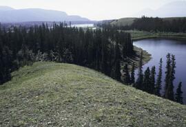
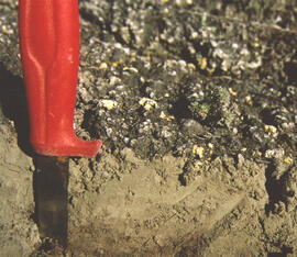
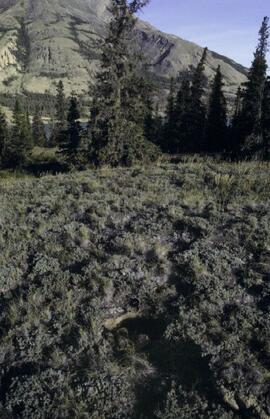
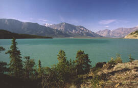
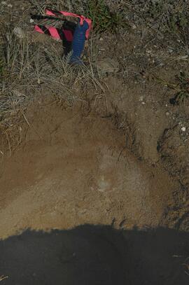
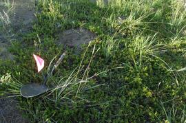
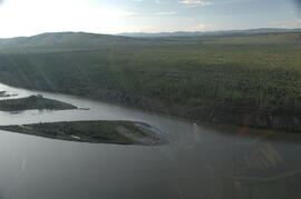
Slide roll contains the following photographs:
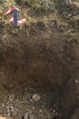
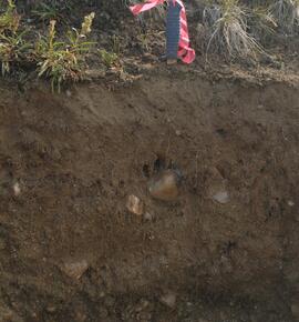
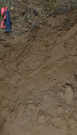
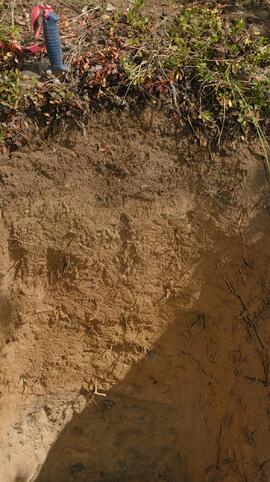
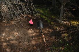
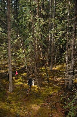
Y03-11 (Silver City road section)
Date: August 12, 2003
Location Coordinates: 61° 2’ 3.6” N, 138° 22’ 48.8” W, 806.7 m asl (± 8.7 m)
Site Description: roadcut through SW-facing hill exposes loess over glaciofluvial gravel, with 4 paleosols in colluviated loess
Sample Depths & Descriptions:
- Y03-11-01 - 0-18 cm - ACk (fresh loess)
- Y03-11-02 - 18-47 cm - Soil 1 – Bmk
- Y03-11-03 - 47-100 cm - Loess
- Y03-11-04 - 100-110 cm - Soil 2 – includes charcoal
- Y03-11-05 - 110-160 cm - Loess with secondary carbonate in root channel
- Y03-11-06 - 160-170 cm - Soil 3 – Ahk with charcoal
- Y03-11-07 - 160-170 cm - Soil 3 – Bmk
- Y03-11-08 - 170-198 cm - Loess with secondary carbonate in root channel
- Y03-11-09 - 198-202 cm - Soil 4 – Ahk – laterally continuous for ~ 1.5 m
- Y03-11-10 - 202-230 cm - Loess with secondary carbonates in roots
- Y03-11-11 - 230-255 cm - Soil 5 – Ahk – includes abundant charcoal bands
- Y03-11-12 - 230-255 cm - Soil 5 – Bmk – infilled squirrel burrows immediately below
- Y03-11-13 - 255-300 cm+ - Loess
Additional notes on modern soil & paleosols:
Soil 1 - consists of Bmk horizon material with 2 distinct colours: 7.5YR 4/3 d & 10YR 4/3 d
- loess between Soils 1 & 3 is sandier
Soil 2 - 90% Ahk material, 2-10 cm thick
- Ahk – 10YR 3/2 d
- Bmk – 7.5YR 4/2 d
- less abundant carbonate than in paleosols & loess below
Soil 3 - most of exposure has Ahk (2-5 cm thick) over Bmk (4-10 cm thick), with carbonates as for Soil 5
Soil 4 - mostly Ahk (10YR 3/2 d) material 2-8 cm thick, some Bmk (10YR 4/2 d) < 2 cm thick, with carbonates as for Soil 5
Soil 5 - complex intermixing of Ahk & Bmk material, charcoal most abundant in Ahk
- individual colour bands 2-10 cm thick
- overall dip of horizons (10° to W) is parallel to surface
- similar size & density of secondary carbonates as in loess above & below; associated with root channels, < 5 mm diameter, covering ~ 5% of surface
Slide roll 4, #36-32 (corresponding prints and negatives: Print roll 5, #26-30)
Y03-12 (island off Slims River delta)
Date: August 13, 2003
Location Coordinates: 61° 1’ 9.1” N, 138° 29’ 27.9” W, 819 m asl (± 6.0 m)
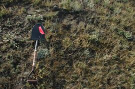
Site Description: good grassland development on undulating aeolian veneer over bedrock, SW aspect; vegetation: A. frigida, C. purpurescens, P. glauca, Erigeron, Plantago, Oxytropis; good crust cover, mossy on more northerly aspects
Sample Depths & Descriptions:
- Y03-12-01 - Crust
- Y03-12-02 - 0-10 cm - ACk
Slide roll 4, #31-10 (miscellaneous site views of Y03-12 & Slims R delta island)
This file contains the following photographs in both print photograph and negative format:
Slims River delta
Date: August 10, 2003
Location Coordinates: 61° 00’ 16.5” N, 138° 30’ 45.6” W, 790 m asl (± 11.0 m)
Print roll 3, #5A-6A: delta surface with salt efflorescences (Deschampsia caespitosa, Puchinella nuttalli, Aster siberica, Triglauca palustre); Juncus & Ranunculus on more active surface near river.
7A-9A: moister Deschampsia site, polygonal cracking patterns (W side of highway)
10A-12A: closeups of efflorescences
Cultus Bay / Rat Lake
Date: August 10, 2003
Location Coordinates: 61° 09’ 57.1” N, 138° 25’ 25.5” W, 806 m asl (± 6.2 m)
Slides #17-15: Rat Lake area (corresponding prints and negatives: Print roll 3, #13A-16A)
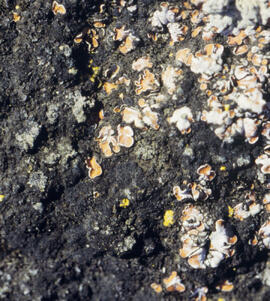
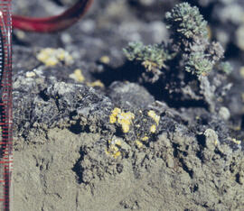
Print roll 3, #17A-19A: Collema & Psora crusts on exposed ridge on coarser substrate where loess has blown off (Corresponding slides: Slide Roll 2 #14-13)
Y03-03 (Rat Lake)
Date: August 10, 2003
Location Coordinates: 61° 10’ 3.5” N, 138° 25’ 37.2” W, 798.3 m asl (± 13.0 m)
Site Description: SW aspect, 45% slope; vegetation: Carex filifolia, A. frigida, Elymus trachycaulis
Sample Depths & Descriptions:
- Y03-03-01 - Crust
- Y03-03-02 - 0-9 cm - Ahk (10YR 4/2 m; weak-moderate, fine granular)
- Y03-03-03 - 9-53 cm+ - Ck (2.5Y 6/3 m; massive)
Print roll 3, #20A-22A (Corresponding slides: Slide Roll 2: #12-10)
Y03-04 (Rat Lake)
Date: August 10, 2003
Location Coordinates: 61° 10’ 10.5” N, 138° 26’ 3.7” W, 800.2 m asl (± 8.7 m)
Site Description: S aspect, 40% slope; vegetation: Elymus, Artemisia, flax, Penstemon, Linum lewisii
Sample Depths & Descriptions:
- Y03-04-01 - Crust
- Y03-04-02 - 0-6 cm - Ck (strongly effervescent)
- Y03-04-03 - 6-16 cm - Ahkb
- Y03-04-04 -16-75 cm+ - Ck (strongly effervescent; includes Bmk pockets)
Print roll 3, #25A-28A (Corresponding Slides: Slide Roll 2: #9-7)
Y03-05 (SE of Rat Lake)
Date: August 10, 2003
Location Coordinates: 61° 9’ 43.2” N, 138° 25’ 34.8” W, 811.5 m asl (± 8.9 m)
Site Description: upper slope / crest; recent local sandy eolian veneer over older loess; vegetation: Carex, Elymus, Poa, Erigeron
Sample Depths & Descriptions:
- Y03-05-01 - Crust
- Y03-05-02 - 0-5 cm - Ahk
- Y03-05-03 - 5-19 cm - Ck1
- Y03-05-04 - 19-31 cm - Ahkb (siltier)
- Y03-05-05 - 31-50 cm+ - Ck2
Print roll 3, #34A-#E (Corresponding Slides: Slide Roll 2: Slides #6-1)
This file contains the following photographs in both print photograph and negative format:
Y03-06
Date: August 10, 2003
Location Coordinates: 61° 4’ 1.5” N, 138° 21’ 57.4” W, 825.3 m asl (± 9.5 m)
Site Description: top of slope, E aspect
Sample Depths & Descriptions:
- Y03-06-01 - Crust
- Y03-06-02 - 0-6 cm - Ahk (10YR 3/2 m; strongly effervescent)
- Y03-06-03 - 6-14 cm - Bmk (2.5Y 3/3 m; strongly effervescent)
- Y03-06-04 - 14 cm+ - IICk (strongly effervescent)
Print roll 4, #1-2 (Corresponding slides: Slide roll 3 #36-35)
Y03-07 (peninsula near Kluane visitor centre, Sheep Mt.)
Date: August 11, 2003
Location Coordinates: 61° 1’ 42.8” N, 138° 29’ 36.2” W, 786.7 m asl (± 5.7 m)
Site Description:
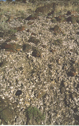
- recent (?) landslide with loess accumulation in pockets, thinner on boulder surfaces, dominated by dark cyanobacteria crusts
- limited loess accumulation due to exposure of site
- crust is calcareous at surface
Sample Depths & Descriptions: - Y03-07-01 - Crust
- Y03-07-02 - 0-6 cm - Ck
- Y03-07-03 - 6-9 cm - Ahkb
- Y03-07-03 - 9 cm+ - Rock
Print roll 4, #3-10 (Corresponding slides: Slide roll 3 #34-30)
Lower Slims River (lookout knoll at parking lot N of visitor centre)
Date: August 11, 2003
Location Coordinates: 60° 59’ 56.4” N, 138° 33’ 36.4” W, 844.8 m asl (± 7.3 m)
Site Description: some fire disturbance, but lower slopes have more intact crusts on loess (calcareous to surface)
Print roll 4, #11-17 (Corresponding slides: Slide roll 3 #29-26)
Lower Slims R (lowest bench below lookout knoll)
Date: August 11, 2003
Location Coordinates: 60° 59’ 51.8” N, 138° 33’ 36.2” W, 814.3 m asl (± 7.9 m)
Site Description: not burned; good intact crust; vegetation: A. frigida, Calamogrostis purpurea, Erigeron caespitosus, Linnaea, Carex filifolia (sparse cover ~ 50%)
Print roll 4, #18-20 (Corresponding slides: Slide roll 3, #25-23)
Slims Soil
(Holocene paleosol with well-developed B horizon under Neoglacial calcareous loess – location not recorded, but likely from roadcut exposure along main Slims R trail)
Print roll 4, #21 (Corresponding slides: Slides roll 3, #22)
S-facing opening above main trail
Date: August 11, 2003
Location Coordinates: 60° 59’ 53.1” N, 138° 34’ 9.0” W, 822.9 m asl (± 15.0 m)
Site Description:
- Nostoc crust, also with Collema
- calcareous to surface
- site has later successional stage, with Arctostaphylos & Juniperus starting to move in
Print roll 4, # 22-25
Lower end of Sheep Creek
Date: August 11, 2003
Misc. views of grassland vegetation and landscape (locations not recorded)
Print roll 4, #26-33 (Corresponding slides: Slides roll 3, #21-18)
Overlook at lower end of Sheep Creek canyon
Date: August 11, 2003
Location Coordinates: 60° 59’ 42.2” N, 138° 34’ 38.1” W, 878.0 m asl (± 9.5 m)
Site Description: heavy use by sheep (abundant droppings) but still has ~ 50% crust coverage
Print roll 4, #34-35 (Corresponding slides: Slides roll 3, #17-16)
Downvalley view toward Slims R delta, near Sheep Creek (?)
Date: August 11, 2003
(location not recorded)
Print roll 4, #36-E
Slide roll contains the following photographs:
Thorsen Bay
Print roll 11, #01-2A; slide roll 6, #12-10
Y04-19 (27.5 km on Cultus Bay Rd., near Thorsen Bay)
Date: July 22, 2004
Location Coordinates: 61º 12’ 3.0” N, 138º 28’ 58.3’ W, 819 m asl (± 18.9 m)
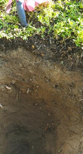
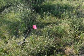
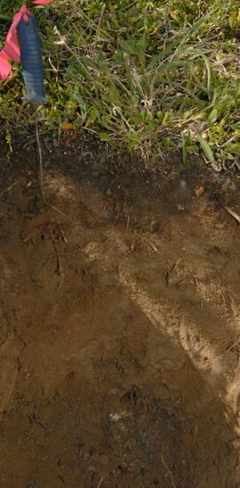
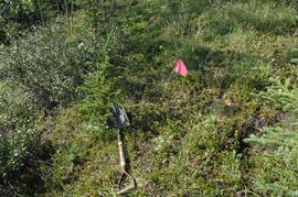
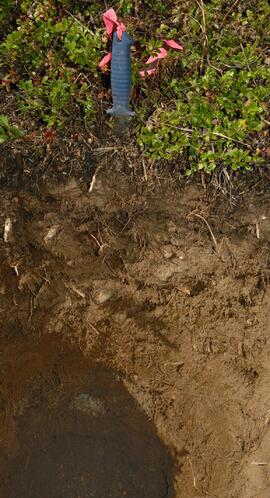
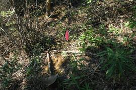
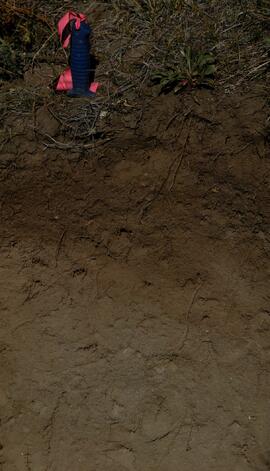
Site Description: Roadcut at base of 30º, E-facing slope. Colluviated loess overlies sandy glaciofluvial at 120 cm. Prominent paleosol with “cumulic” B horizon at 80-120 cm, with strong effervescence throughout exposure.
Slide roll 6, #9-7 (profile), #6-1 (landscape)
Corresponding prints and negatives: Print roll 11, #3A-5A (profile), #6A-10A (landscape)
Slide roll contains the following photographs:
Y04-19 (27.5 km on Cultus Bay Rd., near Thorsen Bay)
Date: July 22, 2004
Location Coordinates: 61º 12’ 3.0” N, 138º 28’ 58.3’ W, 819 m asl (± 18.9 m)
Site Description: Roadcut at base of 30º, E-facing slope. Colluviated loess overlies sandy glaciofluvial at 120 cm. Prominent paleosol with “cumulic” B horizon at 80-120 cm, with strong effervescence throughout exposure.
Sample Depths & Descriptions: Y04-19-01 – charcoal at 95 cm
Roadcut opposite ~ 30 m to NE on grassy S aspect (10° slope) with 15-20 cm of calcareous loess and sand over 2 cm White River ash; strongly effervescent throughout.
Slide roll 7, #36-35 (profile)
Corresponding prints and negatives: Print roll 11, #11A-12A (profile)
Thorsen Bay landscape
Slide roll 7, #34-32
Corresponding prints and negatives: Print roll 11, #13A-16A
Y04-20B
Date: July 22, 2004
Location Coordinates: 61º 10’ 16.5” N, 138º 26’ 18.7’ W, 797.5 m asl (± 5.9 m)
Site Description: wind-eroded Slims soil on glaciolacustrine with contorted bedding (exposed on blown-out roadcut); calcareous to surface; White R ash pockets at 10-20 cm; S aspect, 5° slope.
Slide roll 7, #31-26
Corresponding prints and negatives: Print roll 11, #17A-21A
Y04-22
Date: July 22, 2004
Location Coordinates: 61º 9’ 39.24” N, 138º 25’ 7.8’ W, 790.6 m asl (± 6.4 m)
Site Description: toe of 30° slope, W aspect (grassy slope with poplar at toe); 1.0-1.2 of colluviated loess over gravelly glaciofluvial with buried soil at 70-80 cm
Slide roll 7, #25-24
Corresponding prints and negatives: Print roll 11, #22A-24A
Cultus Bay Rd.
(landscape views looking W from road; lake is likely at ~61°4’ 10.5”N, 138°22’ 31.5”)
Slide roll 7, #23-22
Corresponding prints and negatives: Print roll 12, #0A-2A
Y04-26 (EW)
Date: July 23, 2004
Location Coordinates: 61º 1’ 59.8” N, 138º 21’ 53.6” W, 836.1 m asl (± 7.7 m)
Site Description: grassland at crest of 33° terrace scarp, S aspect.
Sample Depths & Descriptions: Y04-26-01 – 0-10 cm
Slide roll 7, #21-20
Corresponding prints and negatives: Print roll 12, #14A-15A
Y04-27
Date: July 23, 2004
Location Coordinates: 61º 2’ 0.9” N, 138º 21’ 53.6” W, 843.6 m asl (± 5.8 m) (~ 35 m N of Y04-26)
Site Description: spruce forest on terrace surface; level.
- 0-8 cm - Loess-rich forest floor; strongly calcareous.
- 8-13 cm - Bmk
- 13-15 cm - Discontinuous pockets of White R ash
- 15-35 cm - Bmk (Slims soil) – no charcoal visible
- 35-75 cm - Gray calcareous loess.
- 75 cm+ - Gravelly sandy glaciofluvial deposit.
Slide roll 7, #19-18
Corresponding prints and negatives: Print roll 12, #16A-17A
Y04-28 (EW)
Date: July 23, 2004
Location Coordinates: 61º 2’ 34.4” N, 138º 21’ 57.0” W, 820.2 m asl (± 6.1 m)
Site Description: grassland on esker crest W of Jenny L; 30° slope, SW aspect
Sample Depths & Descriptions: Y04-28-01: 0-10 cm
Slide roll 7, #17-16
Corresponding prints and negatives: Print roll 12, #18A-19A
Y04-30 (between eskers, W of Jenny Lake)
Date: July 23, 2004
Location Coordinates: 61º 2’ 31.6” N, 138º 21’ 52.3’ W, 817.6 m asl (± 6.1 m)
Site Description: Level (base of saddle). Colluviated loess to 90 cm+, with White River tephra at 15-17 cm, brownish paleosol at 17-35 cm, underlain by turbated Bmku with multiple charcoal-rich bands.
Sample Depths & Descriptions:
- Y04-30-01 – charcoal at 13 cm (above WR tephra)
- Y04-30-02 – charcoal at 22 cm (below WR tephra)
- Y04-30-03 – charcoal at 75 cm
Slide roll 7, #15-13
Corresponding prints and negatives: Print roll 12, #20A-22A
Y04-31 (EW)
Date: July 23, 2004
Location Coordinates: 61º 3’ 9.2” N, 138º 21’ 30.3’ W, 837.2 m asl (± 6.4 m)
Site Description: crest of N-S esker ridge
Sample Depths & Descriptions: Y04-31-01: 0-10 cm
Slide roll 7, #12-11
Corresponding prints and negatives: Print roll 13, #1-3
Y04-32
Date: July 23, 2004
Location Coordinates: 61º 3’ 7.4” N, 138º 21’ 27.7’ W, 823.7 m asl (± 13.7 m)
Site Description: toeslope on NE side of same ridge as for Y04-31; 20° slope, NE aspect; Cryosol with permafrost at 34 cm; 30 cm of forest floor organic horizons; abundant charred wood fragments at top of mineral soil & in lowest part of organic horizon.
Slide roll 7, #10-9
Corresponding prints and negatives: Print roll 13, #4-5
Y04-34
Date: July 23, 2004
Location Coordinates: 61º 3’ 47.7” N, 138º 21’ 2.5’ W, 838 m asl
Site Description: Toe of 30º, W-facing grassland slope. Colluviated loess with White River tephra at 8-9 cm, brownish paleosol (9-35 cm), overlying sandy glaciofluvial at 35-70 cm+.
Sample Depths & Descriptions: Y04-34-01: charcoal at 34 cm
Slide roll 7, #8-7
Corresponding prints and negatives: Print roll 13, #6-7
Y04-35 (EW)
Date: July 23, 2004
Location Coordinates: 61º 3’ 49.9” N, 138º 21’ 1.1” W, 854.4 m asl (± 6.3 m)
Sample Depths & Descriptions: Y04-35-01: 0 – 10 cm
Slide roll 7, #6-5
Corresponding prints and negatives: Print roll 13, #8-10
(Location not recorded: Print roll 13, #11-12)
Y04-36
Date: July 23, 2004
Location Coordinates: 61º 8’ 11.5” N, 138º 25’ 50.8” W, 825.6 m asl (± 14.5 m)
Site Description:
- 10-0 cm - LF
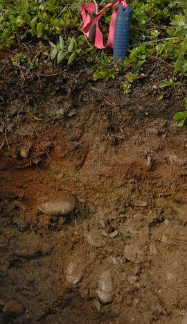
- 0-15 cm - Bmk1 (7.5YR 4/6 m)
- 15-28 cm - Bmk2 (2.5Y 4/3 m)
- 28-48 cm - Ck
- 48-55 cm+ - IICk (sandy gravelly glaciofluvial)
- No charcoal visible in mineral horizons
Slide roll 7, #4-3
Corresponding prints and negatives: Print roll 13, #13-14
Y04-37
Date: July 23, 2004
Location Coordinates: (roadcut adjacent to Y04-36)
Site Description: multiple colour bands in Slims soil; some charcoal blobs (not sampled) which are right size to have been roots.
Slide roll 7, # 2-1
Corresponding prints and negatives: Print roll 13, #15-19
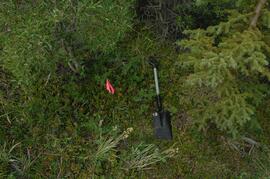
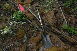
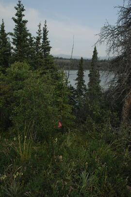
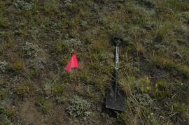
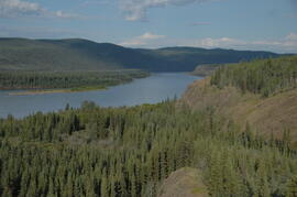
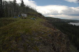
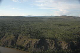
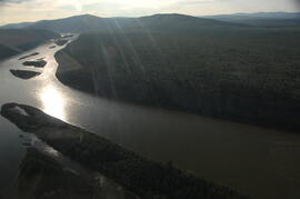
Photograph depicts a Kluane Lake transect 1 location.
Photograph depicts a Kluane Lake transect 1 location.
Photograph depicts a Kluane Lake transect 1 location.
Photograph depicts a Kluane Lake transect 2 location.
Photograph depicts a Kluane Lake transect 2 location.
Photograph depicts a Kluane Lake transect 2 location.
Photograph depicts a Kluane Lake transect 2 location.
Photograph depicts a Kluane Lake transect 2 location.
Photograph depicts a Kluane Lake transect 2 location.
Photograph depicts a Kluane Lake transect 2 location.
Photograph depicts a Kluane Lake transect 2 location.
Photograph depicts a Kluane Lake transect 3 location.
Photograph depicts a Kluane Lake transect 3 location.
Photograph depicts a Kluane Lake transect 3 location.
Photograph depicts a Kluane Lake transect 3 location.
Photograph depicts a Kluane Lake transect 3 location.
Photograph depicts a Kluane Lake transect 3 location.
Photograph depicts a Kluane Lake transect 3 location.
Photograph depicts a Kluane Lake transect 3 location.
Photograph depicts a Kluane Lake transect 3 location.
Photograph depicts a Kluane Lake transect 3 location.
Photograph depicts a Kluane Lake transect 3 location.
Colour-coded map dividing Northwestern British Columbia, the Western Northwest Territories, and the Yukon physiographically.
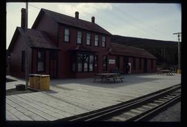
Image depicts the train station in Carcross, Y.T.
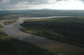
Image depicts the river which runs through Miles Canyon, located near Whitehorse Y.T.
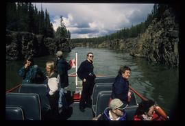
Image depicts several unidentified individuals on a boat in the Miles Canyon near Whitehorse Y.T.
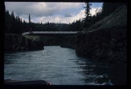
Image depicts the Robert Lowe Bridge, built in 1922, in the Miles Canyon near Whitehorse Y.T.
File contains slides depicting locations along the White Pass railway through Alaska, British Columbia, and the Yukon Territories.
File consists of records created and accumulated by Gary Runka over the course of his consultancy work for Department of Indian Affairs and Northern Development for the "Impact Analysis of Proposed Mining Road Access, Casino Trail" project in Carmacks, Yukon. This file was numbered as G.G. Runka Land Sense Ltd. client file #144; that client number may be seen referenced elsewhere in the G. Gary Runka fonds. The Land Sense Ltd. client files generally include records such as correspondence, contracts, invoices, project reports, publications, ephemera, memoranda, maps or map excerpts, legal documents, meeting materials, clippings, and handwritten notes.
Includes the following reports:
- Government of Yukon Department of Community and Transportation Services, "Proposed Casino Trail Route Location and Terrain Analysis Study", January 1986
- Casino Trail Project Advisory Committee, "Summary Report", Dec. 1985
- Spencer Environmental Management Services Ltd. for Indian and Northern Affairs Canada, "Socio-Economic/Environmental Overview for Proposed Casino Trail", December 1985.
Maps include:
- "Casino Trail Key Plan", Yukon Department of Community and Transportation Services, 17 Oct. 1985;
- Annotated section of NTS map "Snag, Yukon Territory";
- Annotated NTS map "Carmacks, Yukon Territory";
- Untitled Casino Trail area, Spencer Environmental Management Services Ltd. - 2 copies;
- "(2116) MacMillan River World Aeronautical Chart", Canada Department of Mines and Technical Surveys, 1965;
- Annotated combined duplicated copies of NTS maps for Snag and Carmacks, Yukon Territory;
- Untitled soil map for Casino Trail area, possibly by G.G. Runka Land Sense Ltd., n.d.;
- Copy of combined annotated NTS maps for Carmacks, Rowlinson Creek, and Mount Nansen, Yukon Territory showing soil types, possibly by G.G. Runka Land Sense Ltd.
During the 1980s, Agriculture Canada pedologists Scott Smith (retired from Summerland Research Station, formerly based in Whitehorse) and Charles Tarnocai (retired from Central Experimental Farm, Ottawa) had a large field program which addressed the trends in soil development in the central Yukon. Across this region, particularly between Whitehorse and Dawson City, the land surfaces and surficial deposits vary greatly in age due to the differing extents of glaciations over the past ~2 million years.
Tarnocai and Smith shared the unpublished data and soil samples from this work with Dr. Paul Sanborn, and this resulted in a student project published as:
Daviel, E., P. Sanborn, C. Tarnocai, and C.A.A. Smith. 2011. Clay mineralogy and chemical properties of argillic horizons in central Yukon paleosols. Canadian Journal of Soil Science 91: 83-93. https://doi.org/10.4141/cjss10067
This file consists of photocopies of lab data sheets for Tarnocai & Smith Yukon soil samples from the Land Resource Research Institute, Agriculture Canada.
These lab data sheets were transcribed into an Excel spreadsheet (see item 2023.2.2.6.3).
During the 1980s, Agriculture Canada pedologists Scott Smith (retired from Summerland Research Station, formerly based in Whitehorse) and Charles Tarnocai (retired from Central Experimental Farm, Ottawa) had a large field program which addressed the trends in soil development in the central Yukon. Across this region, particularly between Whitehorse and Dawson City, the land surfaces and surficial deposits vary greatly in age due to the differing extents of glaciations over the past ~2 million years.
Tarnocai and Smith shared the unpublished data and soil samples from this work with Dr. Paul Sanborn, and this resulted in a student project published as:
Daviel, E., P. Sanborn, C. Tarnocai, and C.A.A. Smith. 2011. Clay mineralogy and chemical properties of argillic horizons in central Yukon paleosols. Canadian Journal of Soil Science 91: 83-93. https://doi.org/10.4141/cjss10067
This data set consists of transcribed data from lab data sheets, showing McQuesten-Dawson City paleosol data from the Tarnocai and Smith 1983 AAFC Yukon Paleosol Study. The data set includes chemical and particle size data for Tarnocai & Smith samples, as determined by the Ag Canada lab. Note that the “Site” column indicates the NTS topographic map sheet (e.g. 115P/13) for the sampling locations.
