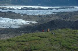
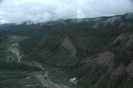
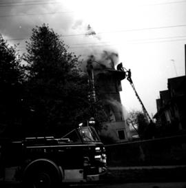
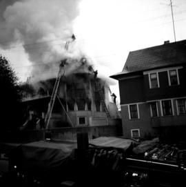
Trekkers crossing a log bridge towards a clearcut section of forest
Habit of <i>Anemone</i> in white flower
File contains correspondence to Brian Fawcett from Sandra Walton. Includes a letter to Brian Fawcett from Sandra Walton, Program Assistant/ Fine Arts and design at the Simon Fraser University, regarding a publication of the Westcoast Review. Letter dated January 7, 1986.
Photograph depicts the "Westbridge II" tug at the Kingcome Navigation dock, Vancouver.
Photograph depicts the Westbridge CPR depot on the Kettle Valley Line. It is located about 11 miles north of Rock Creek and at about mile 123.3 east of Penticton. The depot house is disused and the sidings contained no cars, so there appears to be no local traffic.
Handwritten annotation on recto of photograph: "FOOTING WEST WALL AUG 8/64." Photograph depicts a construction worker near freshly poured cement footings. Building is semi-visible in background on left, tall steel framework behind footings on right. The hard had of a second worker is visible behind footings.
Handwritten annotation on recto of photograph: "WEST WALL FOOTING AUG 8/64." Photograph depicts a construction worker standing on rebar in forms built for cement footings. A front end loader and backhoe tractor can be seen on wood platform above footings. Mountainside in background.
Photograph depicts the West Summerland CPR station in the Okanagan. The station often was used but not permanently manned. It was located at mile 9.5 from Penticton. The view is looking south.
Photograph depicts the West Summerland CPR station in the Okanagan, located 9.5 miles from Penticton. The cloud in the middle distance is stone dust from a crusher on the east side of the track. The spur to the right leads to an old crusher but does not appear to be used.
This image is part of the outbound sequence of aerial images obtained on the helicopter flight to the Klutlan Glacier study site. The sequence starts from the base camp at the White River crossing on the Alaska Highway and heads south, to a point just upvalley of the debris-covered terminus (approx. 10-15 km from Alaska border), and turning back north to the landing spot on the Generc River floodplain close to the study site (see Fig. 1 in paper).
This image is part of the return trip sequence of aerial images obtained on the helicopter flight leaving the Klutlan Glacier study site. On the return leg at the end of the day, the flight initially went upvalley to pick up another party.
This image is part of the outbound sequence of aerial images obtained on the helicopter flight to the Klutlan Glacier study site. The sequence starts from the base camp at the White River crossing on the Alaska Highway and heads south, to a point just upvalley of the debris-covered terminus (approx. 10-15 km from Alaska border), and turning back north to the landing spot on the Generc River floodplain close to the study site (see Fig. 1 in paper).
File consists of correspondence and investor information from Central Equities Ltd. regarding the Westpine Apartment Strata.
Photograph depicts the West peak of the Cassiar mine, pit partially visible below. Drill visible in left foreground at highest elevation of mine, north west mountain range in background.
Photograph depicts the West peak of the Cassiar mine, pit partially visible below. Mining equipment barely visible in foreground at highest elevation of mine, north west mountain range stands in background, and mine valley crosses midground.
Valley landscape, Northern British Columbia
Image depicts woods located west of Leo Creek, with mountains in the distance.
Item is an original "West Nass Wildlife Survey, February 27, 1990" by Grant Hazelwood.
Item is an original piece of an annotated map depicting West Lake pulp harvesting forest.
Item is an original map depicting West Lake pulp harvesting forest.
Item is an original map depicting the West Lake harvesting forest and is a partial topographical map. The map includes pen markings.
Photograph depicts a view of a snow-covered lake, with trees in foreground and treed hills in background. Reads on verso as follows : "West Lake looking North (3)".
Item is an original map depicting the West Lake forest.
File consists of notes and reproductions relating to West Lake Elementary School.
Plan produced by Central Planning and Management Consulting LTD, Prince George BC Canada. Illustrating land use plan of West Lake. The following information appears on the plan: the main plan, "Location Plan" and "Depth Contour Plan-West Lake Scale: 1"=1056'"
3 b&w plans drafted on a tracing paper. 1. Depth Contour Plan - West Lake 2. Location Plan 3. West Lake Development. Produced by Central Planning and Management Consulting LTD. Prince George B.C. Canada. 2F. Land Use Plan Fractional N1/2 of D.L. 4228 Cariboo District Except Easterly 20 Chains.
A b&w plans drafted on a tracing paper illustrating the West Lake Development plan.
A b&w plans drafted on a tracing paper showing subdivisions of a region.
A colour map of an unidentified location.
File contains correspondence to Brian Fawcett from Corry Wyngaarden. Includes a letter to Brian Fawcett from Corry Wyngaarden of the Western Front Society, regarding payment for permission to copy his audio type of his reading.
Collection consists of a 50th anniversary video about the history of the West Fraser Timber Company Ltd.
This West Fraser Timber Company Ltd. 50th anniversary video covers the history of the company through interviews, narration, and historical images.
File consists of correspondence regarding West Fraser Mills' Forest Development Plan for T.F.L. 41 (1996-2001). Also includes attachments regarding the plan and comments regarding the operating area watershed and specific blocks.
Photograph depicts a view of Vancouver's West End.
Grasses, Heracleum lanatum and Populus deltoides along shoreline of Francois Lake
Photograph depicts the extreme west end of C.P.R. trackage at Coal Harbour, looking east towards the yards and downtown after a snowfall.
Photograph depicts the west end of a passing loop in Jura. Looking east.
Photograph depicts the west end of a passing loop in Jura.
File contains issue number 12 of "West Coast Writing", which contains "Work in Progress" by Fawcett, along with the work of many other poets.
File consists of issues of the literary periodical entitled "West Coast Review", including volume 22 issue 3 through volume 23 issue 4.