A b&w plan re Tentative Plan for Subdivision of N1/2 of D.L. 2172 C.D., produced by Central Planning and Management Consulting LTD. Tabor Lake is identified on this plan.
A b&w plan, re Tentative Plan for Subdivision of N1/2 of D.L. 2172 C.D. produced by Central Planning and Management Consulting LTD. Tabor Lake is identified on this plan.
A b&w plan re Tentative Plan for Subdivision of N1/2 of D.L. 2172 C.D. drafted on a tracing paper, produced by Central Planning and Management Consulting LTD. Tabor Lake is identified on this plan.
A b&w plan re Tentative Plan for Subdivision of N1/2 of D.L. 2172 C.D. drafted on a tracing paper, produced by Central Planning and Management Consulting LTD. Tabor Lake is identified on this plan.
Original colour plan re "Proposed plan of subdivision of DL8379 except the most northerly 20 metres in parallel width thereof and DL 8380 except Block A land, the easterly 80 feet Cariboo District."
A b&w plan produced by W.D. Usher and Associates Land Surveyors Prince George B.C. Plan of Subdivision of N.E. 1/4 and S.E. 1/4 of District Lot 4633, S.E. 1/4 District Lot 9095 and Block A. District Lot 9095 and Part of S.W. 1/4 District Lot 4633, Block B, District Lot 9095 and District Lot 9095 Cariboo District-British Columbia.
A b&w plan drafted on tracing paper. Proposed Subdivision of Lots-8,9 PL.24949, and Lot-1, PL.30204, NE1/4Sec.34, TP.19, RG.18, Kamloops, B.C. Copper Head Dr., Trans Canada Highway, Iron Mask Road and etc are identified on the plan. Produced by Central Planning and management Consulting LTD PG BC
The item is a reproduction of a section of survey map drafted on 18 March 1915 and revised on 23 May 1916. The reproduction was likely created in 1990. The Plan Number is 1268 and highlights the area along the Nechako and Fraser Rivers. The map details subdivisions East of Carney Street, North of Twentieth Avenue and South of Ninth Avenue. Annotations in pencil state different map scale variations and "cemetery setback."
The item is a reproduction of a survey map drafted in approximately 1911 and revised in May 1914. The reproduction was likely created in 1990. The annotation states, "Plan 1391" and is circled in red ink. The area covered is along the Nechako and Fraser Rivers and Northeast of First Avenue.
The item is a reproduction of a survey map drafted June 1912. The reproduction was likely created in 1990. The area covered is Central Fort George, South of 5th Street, East of Alden Avenue, North of 12th Street and West of Fraser Street. Annotations state, "Plan 1085 Carney Addition."
File consists of subdivision control by-law no. 55 for the Regional District of Fraser Fort-George.
Map produced by the Composite Mapping Division, Province of British Columbia
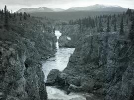
Photograph depicts the rocky cliffs of the Sturdee River Canyon with a low mountain range in the background.
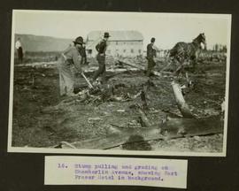
Typed caption glued to album page directly below photograph reads: "16. Stump pulling and grading on Chamberlin Avenue, showing Fort Fraser Hotel in background." Photograph depicts men and a horse working at preparing the land along Chamberlin Avenue. Photographer: Dominion Stock & Bond Corporation.
Jasper National Park
File consists of a published copy of the Nechako River Project's Canadian Technical Report of Fisheries and Aquatic Sciences report entitled "Study of Juvenile Chinook Salmon in the Nechako River, British Columbia, 1985 and 1986".
Item is a photograph of a copy print, resulting in a low quality photographic reproduction. Reproduced as a print, slide, and a negative. Location of original photograph is unknown.
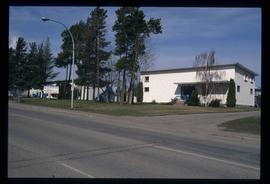
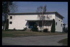
Image depicts Studio 2880 Arts Complex in Prince George, B.C. Map coordinates 53°54'36.9"N 122°46'30.3"W
Image depicts a building which is a part of the Studio 2880 Arts Complex on 15th Avenue in Prince George, B.C.
Item is an original report by David Hatler entitled "Studies of Radio-collared Caribou in the Spatsizi Wilderness Park Area, British Columbia".
File consists of issues of the literary periodical entitled "Studies in Canadian Literature".
File consists of Student's Guide to Prince George c. 1994.
File consists of photographs of UNBC Students. Includes images of Tara Robinson.
File consists of essays and assignments written by Barry McKinnon over the course of his education.
File consists of photographs of UNBC Student Society.
File consists of photographs of UNBC Student Services Street.
File consists of essays and papers written by students.
Videotape contains footage of: 16-Dec-00 - Student for a Day participants - students; Matheson, Ryan
File consists of photographs of the Student Awards Night in 1999.
File consists of photographs of the Student Awards Night in 1998.
File consists of photographs of the Student Awards Night in 1997.
File consists of photographs of the 1997 Student Awards.
File contains handwritten messages, photocopied invitations to a field tour, and related correspondence.
Photograph depicts Stuart Wilson and Nina Norgan.
