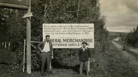
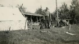
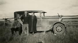
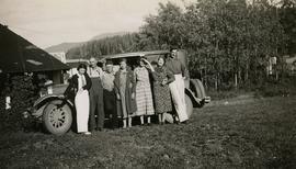
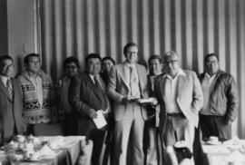
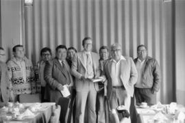
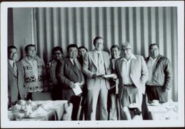
File consists of notes and reproductions relating to the 4th Duke of Sutherland in Windermere, BC. Also includes photographs depicting Windermere [2005?].
Photographs within this file pertain to the early exploration of northern British Columbia.
Photograph is a group portrait of the attendees at the Federal-Provincial Canada Land Inventory Coordinators Meeting in Victoria, March 31-April 1, 1971. Starting from the back row, left to right, attendees included: John Senyk, B.C.; Jim Allin, B.C.; Fred Frederickson, B.C.; Red Ward, Ontario; George Rathwell, Saskatchewan; John Foster, Ottawa, Charlie Rowles, B.C.; David Glover, Ottawa; Bill Yeomans, B.C.; Don Coombs, Ottawa; Harold Hoyt, N.B.; Brian King, Ottawa; Art Benson, B.C.; Scott Johnston, Ottawa; Dan Blower, B.C.; Vic Solman, Ottawa; Don Benn, B.C.; Dick Spilsbury, B.C.; Les Lavkulich, B.C.; Doug Lacate, B.C.; John Wilcox, B.C.; Alf Leahey, B.C.; Mike Romaine, Ottawa; Dick Marshall, B.C.; Gary Runka, B.C.; Norm Sprout, B.C.; Ken Beanlands, Newfoundland; Mick Roberts, Ottawa; Paul Lajoie, Ottawa; Pat Duffy, Ottawa; Bert Brink, B.C.; Merv McKay, Manitoba; Rich Goulden, Manitoba; Reg McCormack, Ottawa; Gerry Howell-Jones, B.C.; Marcel Belzile, Quebec; Paul Deane, Ottawa; Laurie Farstad, B.C.; Stu Scott, Alberta.
Pile driver situated on Prince Rupert shoreline. Tents and wooden buildings visible on rocky background. Printed annotations on recto of photograph read: "First pile driven at Prince Rupert BC. June 8 '06."
Photograph of a large crowd gathered in front of a Grand Trunk Pacific train. Residential buildings atop a hill are visible in the background. Annotation on recto reads: "First Train Leaving Prince Rupert June 14 1911"
File consists of collected research materials regarding the settlement of Fort St. James. Materials include booklets, postcards, pamphlets, maps, an information placemat, newspaper clippings, a newsletter, and reproductions of a map, articles, and images. Highlights include:
- Parks Canada, "Fort St. James National Historic Park", 1981 (booklet)
- "Fort St. James National Historic Park", [197-?] (postcard)
- Chamber of Commerce, "Fort St. James", [198-?] (pamphlet)
- "Fort St. James, B.C., Canada Chundoo Motor Inn", [197-?] (postcard)
- Parks Canada, "Fort St. James National Historic Park", 1985 (pamphlet)
- Parks Canada, "National & Historic Parks Guide", 1985 (pamphlet)
- Parks Canada, "Fort St. James National Historic Park", 1977 (pamphlet)
- Environment Canada Lands Directorate, "Soil Capability for Agriculture, Fort St. James", 1974 (map)
- Fort St. James, "Murray Ridge Ski Hill", [198-?] (pamphlet)
- Illustration from Provincial Archives of British Columbia, "Fort St. James, Mount Murray in the distant background", [192-?] (print photograph reproduction)
- Illustration from Provincial Archives of British Columbia, "Fort St. James Pageant, heft to the right, Norman Mathews in costume of Clark at old post, Sir George Simpson as Chief factor, CH. French; AC Murray as C.F. Arch, McDonald', 1928 (print photograph reproduction)
- Illustration from Provincial Archives of British Columbia, "Fort St. James-Celebrations-Dominion Day: Tug-of-war-Fort St. James", July 29,1911 (print photograph reproduction)
- Illustration from Provincial Archives of British Columbia, "Indian Village at Fort St. James-Stuart Lake", 1913 (print photograph reproduction)
- Caledonia Inns, "The History of New Caledonia Established 1806", [198-??] (placemat)
- National Historics, "Fort St. James", Vol.1 1999 (newsletter)
File consists of notes, clippings, and reproductions relating to Fort St. James, the community and historic site. Includes material regarding the development of the community as a trading post for Hudson's Bay Company and the development of the historic site. Includes: "Fort St. James National Historic Site" pamphlet prepared by Parks Canada (1981); "Fort St. James National Historic Park" pamphlet prepared by Parks Canada (1974 and 1978); and photographs entitled "UNBC Student trip" and depict a snowy landscape and wooden cabin (Mar. 2004).
Photograph depicts the Francois Lake Ferry. Gordon Wyness stands next to the survey crew's Buick car in the middle of the boat. Jack Lee leans on the railing at the back of the boat.
Photograph depicts a view of François Lake taken from the ferry going to Northbank Point on right-hand side. The survey crew camped there in June 1936.
Photograph depicts a view of Fraser River from a location near Marguerite, BC.
This fonds illustrates the life and work of G. Gary Runka and his contributions to the province of British Columbia. Gary Runka was the first General Manager of British Columbia's Agricultural Land Commission and helped establish the provincial Agricultural Land Reserve. After transitioning from a government career to private consulting, Runka provided comprehensive professional services through his land consultancy business, G.G. Runka Land Sense Ltd., offering land capability and environmental assessments, integrated resource management, land and water use conflict resolution, and interdisciplinary land use planning. Described by colleagues as one of BC's most highly respected agrologists and influential land use planners, Runka had a 52-year career working on (or against) an incredible number of landmark projects in British Columbia, such as the Site C Project. Gary Runka’s partner in life and vocation, Joan M. Sawicki, worked with Gary on many of these projects—as well as her own; her contributions are also represented throughout the records of this fonds.
Gary Runka's deep connection to the land is evident from his earliest papers on aerial photo interpretation, his work with the Canada Land Inventory, through his speeches and his work establishing the BC Agricultural Land Reserve and in his subsequent consulting career through G.G. Runka Land Sense Ltd. Gary Runka's influence and legacy was recognized in the tributes paid after his death, including the post-humus award as the Real Estate Foundation's "Land Champion" for 2014.
The G. Gary Runka fonds has been divided into the following nine series:
1) Personal Records
2) Speeches & Publications
3) Professional Records
4) Agricultural Land Commission
5) Land Sense Ltd.
6) Client Files
7) Maps
8) Photographs
9) Digital Records
Subseries consists of publications, manuscripts, and drafts of worked written, co-written, or edited by G. Gary Runka over the course of his career. Also includes conference proceedings that contain contributions by G. Gary Runka.
Photograph depicts Gary Runka receiving a Agricultural Institute of Canada Fellow award at the 1990 AIC Convention at the Penticton Conference Centre.
Photographs within this file document natural and artificial features across the landscape of Northern British Columbia. This landscape also includes the physical, built, urban and industrial landscapes; topography; site plans; boundaries, districts, reserves, parks, sanctuaries, towns, villages and cities, etc.
File consists of information gathered on Gerald (Gerry) Smedley Andrews, Surveyor General of the Province of British Columbia and Director of Mapping and Provincial Boundaries Commissioner. File contains greeting cards, correspondence, articles written by both Audrey L'Heureux and Gerry Andrews, a booklet on land surveying, and reproductions from the G. Smedley Andrews collection at BC Archives. Correspondence includes letters to and from L'Heureux and her publisher Northern B.C. Book Publishing as well as letters between L'Heureux and Gerry Andrews. Highlights include:
- Reproduction of G.S. Andrews' article "Surveys and Mapping in British Columbia Resources Development", 1954 (article)
- G.S. Andrews, "The Land Surveying Profession in British Columbia", 1955 (booklet)
- Reproduction of article by Gerry Andrews in The Victoria Naturalist 46 (3) entitled "My Bear", 1989 (article)
- G. Smedley Andrews, "Metis Outpost", 1985 (promotional pamphlet)
- Reproduction of paper by G. Smedley Andrews entitled "The Makings of a Surveyor General", 1989 (document)
- Dave Robinson and Mike Hocking, "The Monkman Pass and Trail: A Brief History", 1982 (book)
- G.S. Andrews, "Professional Land Surveyors of British Columbia: Cumulative Nominal Roll, 4th Edition", 1978 (booklet).
File also includes a photograph reprint of "Trout Lake Johnny" from the collection of the uncle of G.S. Andrews.
File consists of notes, clippings, and reproductions relating to Kent Sedgwick's research on Giscome. Also includes a photograph depicting St. Fredrick's church in Giscome.
File consists of notes and reproductions relating to Kent Sedgwick's research on Giscome. Includes: "Joe Rositano" typed transcript of an oral interview with Joe Rositano conducted by Dan Watt (14 Apr. 2000). Also includes photographs depicting various buildings in Giscome (2009), and a CD containing photographs depicting the Giscome town plans (2009).
In 1936, Gordon Young Wyness was employed by Philip M. Monckton, a B.C. Land Surveyor. Between June 5 and October 8, Wyness joined Monckton and a group of others on a land survey expedition in northwestern BC. The survey crew travelled to various locations in the area including Telkwa, Hazelton, Burns Lake, Francoise Lake, Vanderhoof, Prince George, Quesnel, Lytton, and Hope. Wyness documented their journey in this photograph album. Based on the photographs, it appears that the crew led by Philip Monckton consisted of Jack Lee and Gordon Wyness; Mrs. Lavender Monckton (nee O'Hara) also accompanied the group.
In addition to the 50 photographs included in the album, this collection also includes five additional unique photographs that accompanied the album.
Wyness, Gordon YoungPhotograph depicts (from left to right) Gordon Wyness and Jack Lee at a camp scene "at Bobtail" (possibly Bobtail Lake) near Vanderhoof. As noted in the album caption, the crew had "just returned from Vanderhoof". The telegraph cabin roof and their 1930 Buick Series 40 car is visible at right.
Photograph depicts (from left to right) Gordon Wyness and Jack Lee in front of the Fort St. James sign, which reads "First white settlement in British Columbia. Established by the North West Company in 1806 by Simon Fraser and John Stuart and taken over by the Hudson's Bay Company in 1821. - General Merchandise Visitors Welcome".
Photograph depicts Gordon Wyness at the Bobtail campsite after having just returned from a night of camping without a tent on Bobtail Mountain. Wyness noted (on photograph verso) that there were pack rats in the telegraph cabin in the background of this photograph.
Photograph depicts Gordon Wyness sitting on a historic boat, which he described as built ca. 1860 and could carry "7 Indians" and 5000 lbs of freight up the river. Located nearby is a telegraph cairn erected to commemorate the Collins Overland Telegraph lines that began in Quesnel in 1865. Until 1907, Quesnel was the terminus for the telegraph line. Behind Wyness is a replica of a Cornish water wheel that was originally located at Williams Creek in Barkerville. This location is now called Ceal Tingley Memorial Park-Heritage Corner and is located along Front Street in Quesnel, near the Fraser River Bridge. The cairn and water wheel still stand in this location, however the boat was removed around 1941.
According to additional information from Quesnel & District Museum & Archives, Wyness may have been provided with inaccurate information about the canoe depicted. The canoe believed to have been located at that spot was actually created in 1905 to pack out the Grand Trunk Preliminary Survey Team, which was led by J.M. Rolston.
Photograph depicts (from left to right) Gordon Wyness, Louis LeBourdais, and Earl Malcolm (owner of Quesnel Hotel) standing in front of a 1930 Buick Series 40 car at Twilight Lodge in Lac La Hache, BC. The group was preparing to leave for Prince George.
Photograph depicts (from left to right) Gordon Wyness, Philip Monckton, and Lavender Monckton by their 1930 Buick Series 40 car in the Williams Lake area. In this image, the car may be broken down; Wyness noted that they "were forced to spend the nite in a school house due to condenser burning out in the car". Wyness also noted that they had "just finished tying in Fraser Mtn", suggesting that they had just completed survey work in the Fraser Mountain area.
Item is a copy print of a photograph of a group of people in a cleared area with a small tent in the background in Prince Rupert on June 1, 1906. The people in the photograph are identified as: Mrs. J.L. Williams, Jack or Jock Williams, Mrs. Porter, Miss Mai Johnston, Mrs. R.L. McIntosh, J.H. Pillsbury, Mr. Pinder ? (Engineer), Captain Jenner ?, Mrs. S.G. Harris, and Cannon Rushbrook.
Photograph depicts a group of people leaning up against the survey crew's Buick car in Francois Lake. Based on the transcription on the photograph verso, from left to right the individuals are: "Mrs. Hunter", "Bobby", Jack Lee, "Edna", "Verna", "Banker's wife", and Gordon Wyness.
The group stands against wall, banquet tables in foreground.
Handwritten annotation on verso reads: "Minister DINA Hugh Faulkner + Kitamaat Band Council for Land Claim presentation".
Group shot of Hugh Faulkner and the Kitimaat Band Council at a land claims presentation during the North Coast District Council meeting. Eight council members are pictured.
The group stands against wall, banquet tables in foreground.
Handwritten annotation on verso reads: “Minister DINA Hugh Faulkner + Kitamaat Band Council for Land Claim presentation”.
Photograph of a partially sunken sailboat near a harbour. Individuals on debris and in a rowboat are surveying the damage. Annotation on recto reads: "GTP. SS Prince Rupert Sept 28th 1920 McRae." Handwritten annotation on verso reads "CTP "Prince Rupert" Sunk at Prince Rupert BC 1920."
File consists of notes and reproductions relating to Hansard, a community along the East Line. File contains material regarding the community and the building of a railway bridge over the Fraser River at Hansard. File also includes photographs depicting the new Hansard bridge (2005).
File consists of collected research materials regarding the re-branding of Hazelton into a historic town. Materials include newspaper clippings, photographs, pamphlets, reproductions of articles, photographs, and a map. Highlights include:
- BC Provincial Archives reproduction, "Mule Train at Hazelton, B.C.", [191-?] (photograph)
- BC Provincial Archives reproduction, "Hazelton, B.C. Believed to be a Hudson Bay Pack Train", [191-?] (photograph)
- BC Provincial Archives reproduction, "Resembles terrain encountered in the Skeena area", 1865 (photograph)
- Kasan, "An Authentic Indian Village Hazelton, British Columbia", [197-??] (pamphlet)
- Hazelton, "Discover the Hazeltons - your Entrance to a New and Exciting Northern Frontier", [197-?] (pamphlet)
- Parks Canada, "Kitwanga Fort National Historic Site", 1984 (pamphlet)
- Hazelton, "Hand of History, Tour of the Hazelton Area Highway 16", [198-?] (pamphlet)
Collection consists of materials related to Fort George surveying and preemption, including both legal and personal correspondence, legal documents and records, plans of lots, photographs, and a map. Includes records from the Cariboo Investment Company, Ltd., J.B. Henderson-Roe and C.H. Henderson Roe.
Photograph depicts the Hudson Bay buildings at Fort St. James.
Photograph depicts the townsite of Hudson's Hope featuring a number of small wooden buildings clustered in a field. The Hudson's Bay post is building visible on far left.
Many people are seated around a meeting table. Hugh Faulkner is at the head of the table, seated beside a flip chart with the word "Agenda" written at the top.
Hugh Faulkner and Kitamaat Band Council members sitting at a table talking during the Kitamaat Band North Coast District Council meeting and land claim presentation.
Hugh Faulkner is sitting at a table and speaking into a recording device that is held by two men. A third man is sitting with his back to the camera.
Hugh Faulkner, Kitamaat Band Council members, and an unknown man sitting at a table talking during the Kitamaat Band North Coast District Council meeting and land claim presentation.
Several large buildings on a rocky shore. Wood piles and a crane are visible in the background. Annotation on recto reads: "Prince Rupert BC"
Minister Iona Campagnolo speaking at the North Coast District Council, three unidentified men and two unidentified women seated around her. Handwritten annotation on verso reads: “North Coast District Council”.
Iona Campagnolo sitting and speaking with Mr. and Mrs. Solomon Doolan in Kincolith during the North Coast Council meeting and land claim presentation with the Kitimaat Band Council.
Photograph depicts MP Iona Campagnolo, a RCMP officer, and a customs officer standing in front of a boundary marker at the Canadian-American border between Hyder and Stewart.
Collection consists of material resulting from Dr. Mike Evan's Island Cache Recovery Project Collection. Includes oral history interviews of former Island Cache (Cottonwood Island) residents on recording media (cassette and VHS) as well as transcripts of the oral histories. Also includes administrative records for the project and photocopies of background research material used for the project, such as Prince George city records, newspaper clippings, photographs, and correspondence.
Evans, Michael JohnPhotograph depicts Jack Lee and the survey crew's 1930 Buick Series 40 car below the Boston Bar tunnel on their return trip.
Photograph depicts Jack Lee (front) and Gordon Wyness drinking lakeside in Marble Canyon. The survey crew had been travelling along Marble Canyon Road, which is now Highway 99. The lakes in Marble Canyon are now named Turquoise Lake, Crown Lake, and Pavilion Lake. Wyness notes the blueness of these lakes and the white mountains of this area.
Photograph depicts (from left) Jack Lee and Gordon Wyness sitting on a car next to their equipment while surveying at an Indian Reserve. A cabin on the reserve is also depicted. According to the transcription on the photograph verso, they were surveying road through an "Indian Reserve South of South bank François Lake".
Photograph depicts (from left) Jack Lee and Philip Monckton leaning up against their 1930 Buick Series 40 car before leaving for Southbank Francois Lake. Behind them is the cabin they stayed in at Burns Lake, which was owned by Ben[?] Smith.