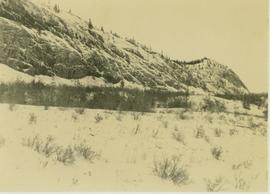
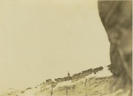
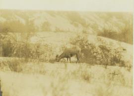
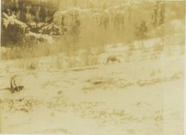
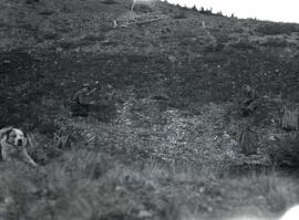
Photograph depicts a big horned sheep grazing in a brush covered area with the base of a hill in the background.
Photograph depicts a big horned sheep(?) grazing in a brush covered area with a forest in the background.
Photograph depicts a big horned sheep standing at the edge of a precipice.
Photograph depicts a big horned sheep standing at the edge of a striated precipice.
Photograph depicts a big horned sheep standing at the precipice of a snow-covered mountain ridge.
Photograph depicts a big horned sheep standing amidst a bush covered valley with a snow-covered mountain in the background.
Photograph depicts a big horned sheep standing on the edge of a steep, striated cliff.
Photograph depicts the "Big Slide" at Lillooet. Also visible are a horse-drawn cart and the Fraser River.
Slide depicts a mixture of bighorn sheep and fallow deer around a trough. The photograph was taken in Kaleden, BC. Original slide index description: "illegible sheep & fallow deer, Kaleden."
Photograph depicts Bill and canoe on sandy shore, river and opposite shore in background. Handwritten annotation on recto of photograph: "Billy Barnett at Giscome Portage."
Photograph depicts three men guiding canoe through water. Bushes and forest slash in foreground, bushes on swampy shore in background. Handwritten annotation on recto of photograph: "Bill Barnett at stern of canoe."
Photograph depicts Bill Blackwater on stage playing a guitar at a Glen Vowell potluck.
Photograph depicts Bill Blackwater singing on stage while playing a guitar at a Glen Vowell potluck.
Photograph depicts two men, Bill Martin and Clarence Waldof, picking blueberries along a hillside surrounded by their bags and a dog.
Photograph depicts Cassiar's Chief Geologist Bill Plumb and unidentified man standing on shore by yellow Cassiar supervisor's truck. A third man stands on Airplane parked on lake behind them, and miscellaneous equipment lies on shore at Bill's feet. Photograph speculated to have been taken at Aeroplane Lake, approximately 35 miles east of Cassiar. Bill Plumb led many expeditions for the purposes of Cassiar's outside exploration endeavours.
Photograph depicts Cassiar's Chief Geologist Bill Plumb and unidentified man standing on shore by yellow Cassiar supervisor's truck. Airplane is parked on lake behind them, and miscellaneous equipment lies on shore at Bill's feet. Photograph speculated to have been taken at Aeroplane Lake, approximately 35 miles east of Cassiar. Bill Plumb led many expeditions for the purposes of Cassiar's outside exploration endeavours.
Photograph depicts Bill Plumb at recently excavated wall of serpentinite with cross fracturing filled with asbestos fibre. Handwritten annotation on note attached to photo: "Chief Geologist Wilfred M Plub at Discovery at Clinton Creek 1963 + or -."
Photograph of man, believed to Bill Pratt, with a fox on top of a mountain.
Photograph depicts William (Bill) Storie at location known as Limestone Mountain, southwest of Cassiar, B.C. Photo features profile of Bill, hands in pocket, Cassiar valley and mountains in background. Storie was a renowned prospector in the Cassiar area, and the new school at Cassiar was named for him in 1992.
Photograph depicts a view from the railroad looking toward the river and mountain beyond at Billings siding.
Photograph depicts Mr. Barnett seated in floating canoe tied to tree on shore. Forest on opposite shore in background. Handwritten annotation on verso of this photograph reads: "Billy Barnett". It is speculated that this photograph may have been taken on the Fraser River near Giscome Portage, B.C.
Photograph depicts a man in snowshoes leading a line of dogs pulling supplies on a toboggan. The second figure, walking behind dogs, is believed to be a man named Fred Burden. Forest trees in background. Handwritten annotation on recto of photograph reads: "Billy Seymour at toboggan". Billy Seymour was a South Fort George man of First Nations descent, employed by the Hudson's Bay Company, and well-known for his ability and endurance in land travel by foot.
Photograph depicts the only biplane and canavas covered, light aircraft amongst a group of 25 machines in excellent condition.
Photograph depicts Birch Island Bridge over the North Thompson River.
Photograph depicts a bird on a snow-coved wooden ledge with snow-covered trees in the background.
Photograph possibly depicts a hummingbird on a nest.
Photograph depicts a snow-covered forest clearing with six structures and a truck. Buildings have been numbered 1-8 with pen. Original handwritten annotations on verso of photograph are signed by Tom Marsh. Photograph is taped to paper. Typed annotation on recto of paper reads: “1. Bridge over creek. 2. Blacksmith shop. 3. Powerhouse. 4. Headframe over 200’ shaft. 5. Office 6. Water tanks from powerhouse. 7. Bunkhouse. 8. Truck. 9. Cookhouse behind #6 cannot be seen. We were always able to find the cookhouse even though hidden in this picture. Taken about 1935 by Russell Ross, supt. Quesnel Quarts Mine. Tom Marsh, Box 156, Squamish B. C.”
Photograph depicts a panoramic view of Stewart B.C. Annotation on front "Bird's Eye View" "Stewart, BC"
Aerial view of Prince George and surrounding forested area. Printed annotation on recto reads: "Prince George, B.C."
Photograph depicts Birken Station on the Pacific Great Eastern. It is 113.6 miles from North Vancouver and at an altitude for 1575 ft. The view is looking north.
Typed message on front reads: “Happy Birthday Your Honour, You have a way of making each person you come in contact with feel so special, so we all want to wish you the happiest birthday year ever. Staff of Government House, October 18, 2002.” Signed by the staff of Government House.
Handwritten annotation on verso reads: “The Rock - I spent 6 years creating 6 gardens surrounding”.
Group of men, women, and children pose in front of large building.
Handwritten annotation on verso reads: "Metlakatla BC / with Bishop Ridley - 4th from left - back row / Mrs Ridley - 4th from left - front row / [?] - [super?] of Ridley Home (beside the Bishop) / Father Hogan - behind the Bishop".
Group of men, women, and children pose in front of large building. Rev. William Edwin Collison stands on far left (son of Archdeacon W.H. Collison).
Handwritten annotation on verso reads: "Early Church Workers at Metlakatla BC / Bishop & Mrs Ridley in centre / (Approx 1898 - 1899)".
The Bishop sits at a table, drinking tea.
Handwritten annotation on verso reads: "[...?] taken at Eastbourne Missionary Exhibition March 1903 [...?]".
Photograph of a large glacier. Printed annotation on recto reads: "Bitter Creek Glacier."
Wide angle perspective of the Bitter Creek glacier, with trees visible in the foreground. Printed annotation on recto reads: "Hughes #22 Bitter Creek Glacier."
Handwritten caption beside this photo reads: "Bear at the Dump". Photograph depicts a black bear facing the camera and sitting alert in clearing.
Slide depicts a black bear eating garbage by wooden outbuildings, possibly at the Aleza Lake Experiment Station.
Caption describing photograph: "Black Spruce germinator. EMK seed."
Caption describing photograph: "Black Spruce Lot 1398. Planted 1969. Row No. 2, Tree No. 14. 1969 leader = 4.5"."
Caption describing photograph: "Black Spruce Lot 1398. Planted on Buckhorn Burn Spring 1968 at 10' by 10' spacing. 1968 leader = 5", 1969 leader = 1"."
Caption describing photograph: "Black Spruce residuals (Ht 35-40', 5-9" DBH Age 80). Potentially commercial pulp wood remaining after pulp logging a fully stock 95 yrs stand of Lodgepole pine and White Spruce on imperfectly drained silty clay. Mile 6.5 Hart Highway. (Illustrate frequent occurrence of P mariana on soils other than organic muck or sphagnum bogs)."
Caption describing photograph: "Black Spruce as GBW Film 4 Frame 7 ( 2007.1.30.2.045) on left. Betula glandulosa and willow on right, resulting from fire history--foreground showing development of organic peat over clay."
Image depicts a view of Blackburn Schools, possibly taken from Tabor Mountain.