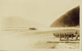
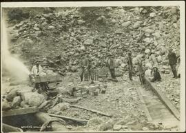
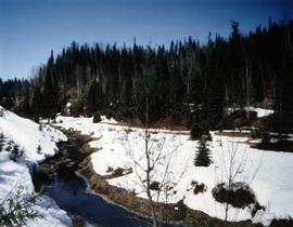
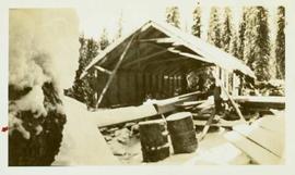
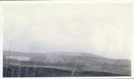
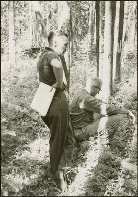
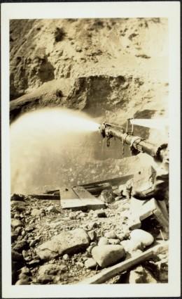
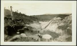
Photograph depicts man standing in front of large streams of water spraying from pipe into mining area, hills in background.
Photograph depicts a miner spraying enclosed area of river bed with water at high velocity. Cliffs in background.
Photograph depicts water being sprayed from a pipe at high velocity over edge in mining area. Man's leg in foreground, cliffs in background.
Photograph depicts water being sprayed from pipes at high velocity in mining area. Unidentified man in midground, cliffs in background.
Item is a photocopy of a 1976 report by Hazelwood and the Spatsizi Research Committee entitled "Spatsizi Plateau Wilderness Park: A Resource Information and Research Discussion Paper" for the BC Ministry of Recreation and Conservation.
Photograph is one of five depicting EP 106.
Item is the 1936 strip notes accompanying the BC Forest Service report from Myra, BC titled "Southern Interior District Experimental Plot No. 160: Conditions After Logging of a Spruce-Balsam Forest in Relation to Spruce Reproduction and to the Rate of Growth of the Second Story".
Item is the office copy of a 1929 BC Forest Service report from Myra, BC titled "Southern Interior District Experimental Plot No. 160: Conditions After Logging of a Spruce-Balsam Forest in Relation to Spruce Reproduction and to the Rate of Growth of the Second Story".
Item is the field copy of a 1929 BC Forest Service report from Myra, BC titled "Southern Interior District Experimental Plot No. 160: Conditions After Logging of a Spruce-Balsam Forest in Relation to Spruce Reproduction and to the Rate of Growth of the Second Story".
Photograph depicts the Cassiar mine, pit partially visible behind West peak in right centre of image. South west mountain range in background.
Photograph depicts scattered buildings, an outhouse, and tents on a rough clearing. A river and its cutbacks are in the background.
Wooden piles driven into a river bed, pile driver visible in background. Handwritten annotation on recto reads: "South fork intake before gate built, pile driven to refusal".
This unpublished 1993 UBC undergraduate thesis by J. Hickling entitled "Some long term effects of scarification on soil properties and site productivity" includes some soils data from the Archie Creek site.
Item is an original technical publication of the British Columbia Forest Service by J. Harry G. Smith entitled "Some Factors Affecting Reproduction of Engelmann Spruce and Alpine Fir".
Photograph of a vessel filled with lumber just off the coast of a shore also littered with lumber. Mountains are barely visible in the background.
Item is a "Soil Survey Report on Part of Aleza Lake Forest Experimental Station" by R.A. Fisher of the Forest Surveys Division, British Columbia Forest Service.
This "Soil Profile Description: Kiskatinaw LTSP Site" document provides a description of Kiskatinaw pedon.
The key results from the regional soil mineralogy study were later published as:
J.M. Arocena and P. Sanborn. 1999. Mineralogy and genesis of selected soils and their implications for forest management in central and northeastern British Columbia. Canadian Journal of Soil Science 79: 571-592. https://doi.org/10.4141/S98-07
Caption describing photograph: "Soil (sod) development over lacustrine deposits. Depth to carbonated layer (1922 fire) 2.5", depth to parent material 6". Note blocky structure of deposit (clay). Root penetration to 1'. Root penetration of willow and aspen to 1.5'. Blocky structure from fluctuating water table, gentle slope to land form."
Photograph depicts a view of a small village near a river, a narrow dirt road boarders the river.
Group of five miners stand in mining area on left. Woman, man, and young girl sit and stand on far right in more formal attire. Mining tools and equipment throughout.
Printed annotation on recto of photograph: "Société Minière de B.C., Atlin B.C. July 28th, 1901, A.C. Hirschfeld, No. 707".
Photograph depicts a snowy mountain landscape in the Canadian Rockies where Prentiss Gray found his prized mountain goat.
Photograph shows snow melt at Aleza Lake Research Forest in spring season.
Photograph depicts an open air work or woodshop covered with snow, surrounded by lumber and steel drums.
Item is a photograph of Ray Williston and John Liersch in a small wood area southwest of Prince George.
Item is a photograph of from left, Ralph Robbins and Jack Paine of the BC Forest Service, Ray Williston, Chief Forester for Canadian Forest Products Tom Wright, Deputy Minister of Forests Finley McKinnon, Canadian Forest Products Vice-President in Charge of Development John Liersch, and BC Chief Forester John Stokes investigating small wood in an area near Prince George.
Item is a photograph of Mr. Williston, Chief Forester John Stokes and Tom Wright of Canadian Forest Products examining an area near Prince George in order to determine the timber area required for a Pulp Harvesting License for a proposed pulp mill that would depend completely on waste wood.
Photograph depicts reeds and marsh grasses in the foreground, a beaver house at center of photograph with open water and treed shoreline in the distance.
Photograph depicts the bow of a boat in the foreground, a wide shallow channel extending beyond the boat perhaps opening to a lake beyond. Treed forest on the far shore, a lone mountain peak in the distance.
Photograph depicts a two men on small fishing boat, called a gillnetter, moored at a fish packer dock with six men at work. One man is transferring materials from crates into large bags while several others watch. Handwritten annotation in pen on verso reads: “Fish Packer”
Caption describing photograph: "Small area of transplants on West side of clearing, established Spring 1966. Note thrifty stand of aspend with Spruce understory, typical of stands on this soil type and history of burning."