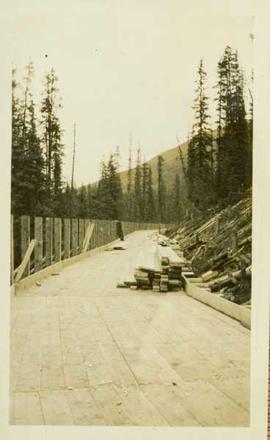
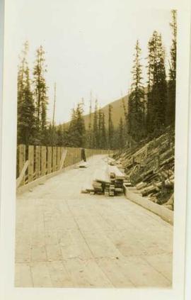
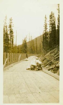
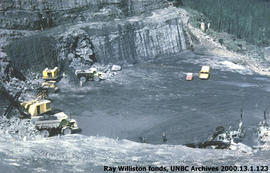
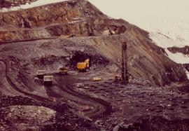
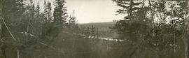
Photograph depicts mine area. Switchback road and higher benches in background. Blasthole drills, track shovels, and ore haulage trucks can be seen on level in foreground and higher bench in background. Mountains visible in distance. Benches in background speculated to be located on the mine's West Peak.
Photograph depicts ore cars on cables running between tramline towers. Flowers in foreground, mine valley and McDame mountain in background. Tramline ran through mine valley, between loading station (2000.1.13.19.197) in mine and dump station at mill on plantsite (2000.1.1.3.19.124)
Photograph depicts three women wearing white aprons while conducting tests on asbestos fibre in lab area, miscellaneous equipment throughout room.
Photograph depicts part of the vacuum dust control and removal system in the Cassiar mill building. Unidentified man can be seen at rotary air-lock, in which heavy blown dust would collect before dropping to plenum conveyor resting just above floor. From here, the dust would eventually be expelled at the tailings pile outside of the mill. Second unidentified man can be seen climbing steps in background. This section of the mill was located above the lab.
Photograph depicts Zora Ivanovska in safety gear, vaccuming asbestos dust from "hall screen" in mill (slanted vibrating tables with varying mesh sizes, used to separate different lengths of fibre). Mill General Foreman Tony Pinto is visible on far right, with unidentified man.
Caption describing photograph: "Condition after clear cut logging. Birch, balsam, thimbleberry, raspberry, E.S. and fern. Main Access Road, F.E.S. Aleza Lake."
Caption describing photograph: "Condition after hand pulling, piling and burning, and rough clearing. Note roots in soil. Northwest Cor of present clearing."
Photo depicts workers at construction site of Cassiar's new mill building.
Photograph depicts construction of a possible steamboat at Soda Creek.
Photograph depicts a large construction in Victoria BC, possibly be related to the construction of the Johnson Street Bridge or the construction of a large building near the shoreline.
Photograph depicts the construction of a wood planked flume 8ft wide around the side of a mountain.
Item is a photograph of the construction of the WAC Bennett Dam.
Slide depicts a detonation in an area of cleared ground in a forested area, likely the Aleza Lake Experiment Station. Work may have been undertaken for roadbuilding activities at the Experiment Station.
Photograph is part of a series of photographs depicting Olin Corporation's Fria location.
Photograph depicts five men sitting on a rough, log table. Table is under a tarp, upturned pails and cooking utensils are on the table.
Photograph depicts a rough table under a canvas tarp. There are various cooking utensils on the table and hanging from the tarp support. A man stands behind the table.
Item is an original report by the Northwest Chapter of the Steelhead Society of British Columbia entitled "Copper (Zymoetz) River Steelhead Radio Telemetry, November 1988 to June 1989". Includes original photographic prints pasted into the report.
Photograph depicts Cornel Neronovitch at a Peden Hill sawmill. Caption on back of photograph states: "Cornel Neronovitch".
Photograph depicts Cornel Neronovitch standing by a 'Maple Leaf' Chevrolet truck near the Peden Hill sawmill. Raw logs are stacked and chained on the truck.
Photograph depicts a narrow canyon on the Fraser River.
Photograph depicts a steamboat on the Fraser River with a full view of the paddles.
Photograph depicts a steamboat on the Fraser River.
Photograph depicts a view of rough river waters from the deck of a steamboat.
Photograph depicts men standing near three covered wagons pulled by team of horses on street. Buildings line the street on left behind trees with protective structures built around their trunks. A windmill stands near small building and woodpiles in background on right. Trees on hill are visible in distance. Handwritten annotation on recto of photograph: "Quesnel".
Map reflects highways, main, branch and property roads, trails, public sustained yield unit boundaries, cutting permit boundary, contours, height of land, edge of lake, merchantable and immature timber, non-commercial cover, and swamps.
Photograph depicts two men and two dogs resting near a wooden rowboat stopped along the shoreline of upper Osilinka River near Swiggums mining claims.
Photograph depicts a full length image of (presumably) one of Holland's survey crewmen.
Photograph depicts a lofty view of a winding river, forest in the foreground, rolling forested hills in the background.
Photograph depicts a looking through trees to a view of a river, forested low hills in the background.
Item is an original report by Grant Hazelwood and Steve Head regarding "Crooked River Fisheries and Wildlife". Includes one original photographic print pasted into the report. This project was aimed at improving the recreational use of the Crooked River and it's adjoining corridor.
Photograph depicts five men standing in a field of cut hay. Some men are holding scythes, buildings, forest and rolling hills in background.
Photograph depicts 5 men in a field using scythes to cut grain.
Photograph depicts two men navigating a small raft across the waters of Babine Lake, BC. Low mountains in the distance. [55th parallel]
Photograph depicts a snowy mountain slope with a rocky ridge in the background. Two men and five horses are traversing across the snowy slope.
Photograph depicts a long line of horses with packs traveling toward the photographer on a snowy mountain pass.
Photograph depicts three men and five horses traversing through the snow. The men are on foot leading the horses.
Photograph depicts four men pulling a long canoe across a clearing on a wheeled trailer.
Photograph depicts crossing summit between John Brown and Kitseucla creeks. Survey of 55th parallel.
Caption describing photograph: "Crown form."