2012.13.1.135.6.04
·
Item
·
2006
Part of J. Kent Sedgwick fonds
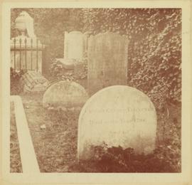
Photograph depicts a monument and grave stone for Captain Frank Odin of the Steamboat Charlotte. Annotation on verso: "Capt. Odin Monument, Soda Creek cemetery, 2010".