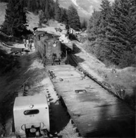
Perspective of pier and wharf as seen from the water. Port Simpson and hill in background. Sternwheeler can be seen on shore.
Photograph depicts a piece of abandoned track leading to the peat plant at #8 road on Lulu Island on the Westminster Highway. The track runs parallel to the Westminster Highway, which is at the left beyond the photo. The rail is undated and marked, "Rlymney Steel" (South Wales). The photo is looking west and the Canadian National Railway (CN) spur lies a quarter mile behind the camera.
Photograph depicts a woman standing on a step outside a building this woman is tending to a toddler. The building is constructed of chinked logs.
Photograph depicts a woman, three adult men and two boys. They are standing on soil with bushes and trees in the background. Handwritten annotation below photograph reads, "A Picnic Party 6/6/27".
Photograph depicts a large group of women, men, and children standing and sitting on grass. Stand of trees crosses midground, forest visible in background. Handwritten annotation on verso of photograph: "Picnic at Fort George (Central) 1920." Photograph believed to have been taken at current location of Spruceland Shopping Center.
Photograph depicts Trudeau's photographer looking into the camera while standing behind the prime minister and an unknown man. All three men are wearing white hardhats.
Image depicts an unknown woman taking pictures. Nearby are the skeletal remains of an unknown animal. The location is somewhere near the upper Fraser Canyon.
Photograph depicts the a painting of three men in the Royal Highland military uniforms. Typed annotation glued to verso of photograph provides an interpretation of this piece of art: "The 42nd (Royal Highland) Regiment of Foot - 1782. The first battalion of this British regiment arrived in New York in 1756. After serving in numerous campaigns and engagements in North America, the 42nd (Royal Highland) Regiment of Foot garrisoned in Nova Scotia. It is from this famous regiment that the Black Watch (Royal Highland) Regiment of Canada derives its name and much of its colorful dress and traditions."; "Le 42nd (Royal Highland) Regiment of Foot - 1782. Le premier bataillon de ce régiment britannique arriva à New-York en 1756. Après plusieurs campagnes en Amérique du Nord, il fit garnison en Nouvelle-Ecosse. C'est de ce fameux régiment que s'inspirent les uniformes et les traditions du Black Watch (Royal Highland) Regiment of Canada. Cornemuses et tambours y ont toujours joué un rôle important et pittoresque."
Photograph depicts a painting of a naval gun race with men in striped shirts pulling canons and an onlooking officer in uniform. Typed annotation glued to verso of photograph provides an interpretation of this piece of art: "Course de canons de la Marine. Deux équipes, en costumes de la Marine de 1812, réalisent une variante sensationnelle de la course de canons traditionnelle de la Marine. Elles doivent démanteler complètement les canons antiques, les porter en une course d'obstacles difficile et les réassembler pour faire feu. Il faut du courage, du muscle, et des mois d'entraînement."; "Naval gun race. Two teams in naval costumes of 1812 stage a thrilling variation on the traditional naval gun race. They must completely dismantle the antique cannons, carry them over a grueling obstacle course and reassemble the guns for firing. It takes courage, muscle and months of training."
Photograph depicts a painting of a battle regiment consisting of six men holding rifles and one man looking on. Typed annotation glued to verso of photograph reads: "Le Régiment de Carignan-Salières - 1665. This famous regiment was dispatched to Canada (then called New France) by King Louis XIV and disembarked from its small sailing vessels on eastern shores in the spring of 1665. Historically it was an important event. Until then, the colonists had been obliged to provide their own defence and the French regiment was the first military protection they enjoyed."; "Le Régiment de Carignan-Salières - 1665. Ce fameux régiment fut envoyé au Canada (appelé alors Nouvelle-France) par Louis XIV. Au printemps de 1665, il débarquait sur les rivages de l'est. Jusque-là, les colons avaient dû se défendre par leurs propres moyens; c'était la première protection militaire qui leur était offerte. L'arrivée des troupes régulières ramenèrent l'espoir aux colons découragés."
Handwritten notation affixed to photographs reads: “Pride of Place on a Young Liberal’s Wall, 1984”; handwritten card from Inniss Photo Service Reg’d, Brockville accompanying the photograph reads: “To Iona Campagnolo, From:- Jan Inniss, My son Scott (+ his mother) attended your recent address in Brockville . . . . I thought you might be interested in seeing what happened to one of your posters . . . A place of honor in his room . . + notice how it takes precedence over the Premier”.
This remote-sensing aerial photograph was taken by Lockwood Survey Corporation Ltd. under contract for the B.C. Forest Service. This historically important aerial photograph depicts the W.A.C. Bennett Dam and Williston Reservoir soon after its flooding in 1968.
The identification coding on these photographs can be interpreted as follows:
- The largest number on the leftmost side is the frame number for the photograph.
- The following code to the right in the format B) 69-53 is currently unknown, but may refer to an internal project number for the Lockwood Survey Corporation.
- The 6" may refer to the camera's focal length in inches.
- Next is "17,150 ASL" which is 17,150 feet Above Sea Level.
- Following is "152.52" which refers to the camera's focal length in millimeters, which equals 6 inches.
- The "W1307" may refer to the reel, but that is unconfirmed.
- "8 SEP 69" is the date the photo was taken.
This remote-sensing aerial photograph was taken by Lockwood Survey Corporation Ltd. under contract for the B.C. Forest Service. This historically important aerial photograph depicts the headwaters of Williston Reservoir soon after its creation in 1968 with the building of the W.A.C. Bennett Dam on the Peace River.
The identification coding on these photographs can be interpreted as follows:
- The largest number on the leftmost side is the frame number for the photograph.
- The following code to the right in the format B) 69-53 is currently unknown, but may refer to an internal project number for the Lockwood Survey Corporation.
- The 6" may refer to the camera's focal length in inches.
- Next is "17,150 ASL" which is 17,150 feet Above Sea Level.
- Following is "152.52" which refers to the camera's focal length in millimeters, which equals 6 inches.
- The "W1307" may refer to the reel, but that is unconfirmed.
- "8 SEP 69" is the date the photo was taken.
Photograph depicts (from left to right) Philip Monckton, Gordon Wyness, and Lavender Monckton at the Beaverly Geodetic Station, 7 miles west of Prince George. Surveying equipment (tripod, theodolite, and wire) are stationed at centre.
Photograph depicts Phil B working underground.
Photo depicts the interchange of passengers of a northbound dayliner around the wreckage of a derailment. Two budd car units from Vancouver can been seen in the background. Passengers were being transferred to a "scratch" train assembled at Lillooet and consisting of a budd car, caboose and a diesal switcher.
Photo depicts the transfer of a Vancouveer to Lillooet dayliner to the unit made up at Lillooet wich consisted of a budd car, caboose and switcher. The scene of the Seton Portage derailment was found 100 yards behind the photo.
Photo depicts the largest crane on the Pacific Great Eastern and is stationed in Prince George.
Photo depicts a crane #6501 in position to lift locomotive #703. It was about to re-rail one end of the locomotive. Image captured looking towards the south with the shoo-fly in the immediate foreground and Setan Lake in the background.
Photo depicts a distant view of the Seton Portage wreck,. Squamish Shops crane was standing on the minor line of the loop. The crane was self-propelled and after its launch it had broken its drive axle. This was replaced by a standard axle and, therefore, was propelled by a switcher.
Photo depicts a close up view of the rear of the locomotive #703. It was stopped at the head of a freight onn the main line portion of the loop awaiting a southbound loaded freight. Its tracks were derailed, fuel tranks ruptures and a sliver of steel from the box car was forced into its forward tracks. The left side of the cab was also sheared.
Photo depicts the general view of a derailment, looking eastward. The derailed locomotive #703 was found beside a squashed box car. By this time, a PGE bulldozer had prepared a road bed for the wreck.
Photo depicts a shoo-fly that had been built around the Seton Portage wreck. locomotive #703 had stood at this spot just before the switch when the cars of the southbound freight piled into it.
Photo depicts a Pacific Great Eastern working train approaching Seton Portage. It had been diverted from the derailment to fill in a burnt out wooden culvert on the edge of Anderson Lake.
Photo depicts the removal of about 70 bales from a box car.
Photo depicts a derailment in Seton Portage at the Pacific Great Eastern broken switch on mile 139.8.
Photo depicts the general view of the clean up of the derailment in Seton Portage. The track in which a speeder stands a gondola car with rolls were the two tracks of the loop. They were both severed and respliced in making the "second edition" of the shoo-fly.
Photograph depicts a caboose and flanger car #1823.
Photograph depicts the Pacific Great Eastern line through Williams Lake.
Photograph depicts a caboose and flanger car #6016
Photograph depicts horses beside track about 300 yards south of the passenger depot in Williams Lake.
Photograph depicts a Pacific Great Eastern bridge over the Capilano River in northwest Vancouver. Also visible is a switching locomotive.
Photograph taken from the depot in Squamish that runs a half a mile spur down to a dumping site beside the Squamish River. Image displays the log dump looking towards the east with the depot in the background, towards the right.
Photograph depicts loading logs on the Pacific Great Eastern, north of Squamish.
Photograph depicts a wrecked steel box car used by a farmer as some kind of shed with some of the side panels removed.
Photograph depicts the Bridge River Hydro Power Station on the edge of Seton Lake. A BC Hydro First Aid trolley with a heater connection was plugged in. The train was the fastest method to get an injured person to Lillooet from Shalalth as it was about 16 miles by rail in comparison to 50 miles by uneven dirt road. Ordinary PGE trollies were used by injured civilians between D'Arcy and Lillooet as it was the quickest method of evacuation.
Photograph depicts an the eastern portal of a Pacific Great Eastern tunnel on the west side of the Bridge River Hydro project in Shalalth. Penstocks of the hydro plants are clearly visible on the hill side.
Photograph depicts the depot in Shalalth that faces Seton Lake.
Photograph taken at the depot in Seton Portage. A northbound Dayliner of 3 Budd cars that have stopped are visible. This train ran daily from North Vancouver to Lillooet.
Photograph taken at the end of the Pacific Great Eastern passing loop near the Portage River. Image captures the general view of a rail lifting train about to commence work. The train moved backwards at a slow walking pace and picked up rails. Track fastening were collected by 2 men and thrown on a flat car.
Photograph depicts 5 attached cars which are nearest to the camera and belong to the "Bridge and Building" work train. They were set at the location for a week before travelling to Hanceville.
Photograph depicts a close up of a rail lifting train. 65 Ibs of rails were being placed in a gondola by the crane. The work crew consisted of: a crane driver, hook onto rail men (on ground), gondola, rail positioner, 2 men collecting track fastenings found on each side of the flat care, spare men, and a supervisor.
Photograph depicts the rear portion of a southbound way freight on the passing loop in Seton Portage. Visible is a caboose with leaf springs.
Photograph depicts a north, upgrade, and mainly empty freight preceded by its "checking" speeder which was about to enter a crossing loop.
Photograph depicts two "slave units" heading north after having been spliced into the middle of loaded southbound freight the previous day. Continous movement was performed daily.
Photograph depicts a passing loop from main traffic as well as a spur for work cars and one frieght unloading loop (a box car on the left is standing on it).
Photo displays a quickly disappearing Pacific Great Eastern logo. Davies found it on a tool car of a track maintenance train.
Photograph depicts a ballast car that was built in 1955. Behind it was a "Bridge and Buildings" work car or a former cattle car built in 1914.