Showing 93 results
Archival description
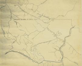
"Groundhog Coalfield Properties and Geology"
"Groundhog Coalfield Properties and Geology"
"Habitat Types and Terrain Assessment of the Columbia River Marshes"
"Habitat Types and Terrain Assessment of the Columbia River Marshes"
Highway 16 West: Gateway to Alaska
Highway 16 West: Gateway to Alaska
Kitimat City Centre
Kitimat City Centre
Kitimat-Stikine Regional District Regional Resource Inventory
Kitimat-Stikine Regional District Regional Resource Inventory
"Mineral and Coal Strategic Economic Development Plan North West British Columbia"
"Mineral and Coal Strategic Economic Development Plan North West British Columbia"
"North Coast LRMP G2G Outcomes - Proposed Final Zoning - December 2005"
"North Coast LRMP G2G Outcomes - Proposed Final Zoning - December 2005"
"Okanagan Connector"
"Okanagan Connector"
Plan showing provincial government property in the subdivision of Lots 933 & 934, Group 1, Cariboo District, South Fort George, British Columbia, to be offer for sale at public auction
Plan showing provincial government property in the subdivision of Lots 933 & 934, Group 1, Cariboo District, South Fort George, British Columbia, to be offer for sale at public auction
Pre-emptor's map of Fort George
Pre-emptor's map of Fort George
Preemptor's map Sheet No. 3 Valleys of Fraser, Salmon & Willow Rivers in Fort George and Peace River Land Recording Districts
Preemptor's map Sheet No. 3 Valleys of Fraser, Salmon & Willow Rivers in Fort George and Peace River Land Recording Districts
"Producing Mines and Significant Mineral and Coal Deposits of British Columbia"
"Producing Mines and Significant Mineral and Coal Deposits of British Columbia"
"Southeastern British Columbia Coal Properties and Geology"
"Southeastern British Columbia Coal Properties and Geology"
Stuart Lake, Fort St. James, and Fraser Lake area map
Stuart Lake, Fort St. James, and Fraser Lake area map
"Super Crop Forage Seeds for B.C."
"Super Crop Forage Seeds for B.C."
Terrace, British Columbia
Terrace, British Columbia
Trans-Canadian Alaska Railway Proposed Route
Trans-Canadian Alaska Railway Proposed Route
Trans-Canadian Alaska Railway Survey: Plan showing progress of survey parties
Trans-Canadian Alaska Railway Survey: Plan showing progress of survey parties
Union Steamship Company of British Columbia Map No. 2 Northern Run
Union Steamship Company of British Columbia Map No. 2 Northern Run
"Vancouver Island's Forests"
"Vancouver Island's Forests"
World Aeronautical Chart: Iskut River
World Aeronautical Chart: Iskut River


![Proposed Land Use 1978-2012, Official Community Plan, City of Prince George [1979 Amendment]](/uploads/r/northern-bc-archives-special-collections-1/c/e/d/ced2c18ae074ee79ace57d0454f038b5e09774ff682567e053093476af37c166/2023.5.1.14_-_1979_-_1978-2012_Official_Community_Plan_City_of_Prince_George_JPG85_tb_142.jpg)
![Proposed Land Use 1978-2012, Official Community Plan, City of Prince George [1982 Amendment]](/uploads/r/northern-bc-archives-special-collections-1/6/6/9/669fc9dc3b840a6896f6a2a968a948283a3c5d972b6b48d718b427a57ebbe67f/2023.5.1.22_-_1982_-_Proposed_Land_Use_1982-2012_JPG85_tb_142.jpg)


![Vancouver Carney Study [Existing Land Use]](/uploads/r/northern-bc-archives-special-collections-1/d/8/4/d841cd29016ddb96663d51e137bd7a3b7c4dfe3ec645baca199615e3e4464da3/2023.5.1.21a_-_Vancouver_and_Carney_Study_Area_Existing_Land_Use_JPG85_tb_142.jpg)


