Showing 189 results

Archival description
27 results with digital objects Show results with digital objects
2012.13.6.53 · File · [before 2004]
Part of J. Kent Sedgwick fonds

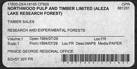
Item is an original map depicting provincial parks across northern British Columbia and was published by the British Columbia Department of Lands, Forests and Water Resources. The map includes pen marks and highlighting.

2012.13.2.19.04 · File · 1968, 1980, 2002-2010
Part of J. Kent Sedgwick fonds

File consists of notes, clippings, and reproductions relating to Quesnel, Barkerville, and Wells. Includes: "An Historic Walk of Carson Avenue, Quesnel, B.C". pamphlet prepared by the Quesnel Branch Cariboo Historical Society (1990); "Wells, B.C". pamphlet by the Wells Historical Society (1980); "Cottonwood House Provincial Historic Park" pamphlet by the Province of British Columbia (1980); and vol. 1 of the Cariboo Gazette newspaper (2002). Also includes a map depicting Bowron Lake Park in British Columbia (1968).

1996.8.3.39 · File · [197-?]
Part of Chander Suri fonds

File consists of assorted real estate listings and appraisals for investment properties in Prince George, Mackenzie, and Vanderhoof. A survey of Tabor Lake, documents from a continuing education seminar for engineers, and recreational area assessments are also included. Also includes 19 street traffic and parking maps of Prince George from the 1970s.

2006.18.5.18 · File · 1974
Part of Aleza Lake Research Forest Society fonds

File is a Resource Folio of maps and accompanying information created by Northwood Pulp & Timber regarding Timber Sale Harvesting Licence A01847, Willow River Block, Willow River P.S.Y.U. Includes maps that depict ungulates, waterfowl, recreation areas, special influence areas, and timber types. Most of the sheets have a duplicate, some with very slight variations. The following maps are supposed to be included in the but were missing upon arrival at the Archives: fish & topography, cutting permits & roads, and soils.

"Salmon Valley" 1986 map
2012.13.6.81 · File · 1986
Part of J. Kent Sedgwick fonds

Item is an original 1986 map depicting Salmon Valley in British Columbia and was published by the Department of Energy, Mines and Resources Ottawa Canada.

2012.05.01.01 · File · Jun. 1967
Part of Columbia Cellulose Company, Ltd. fonds

File consists of a folder containing documents describing Skeena Kraft Limited. Folder consists of:

  • Svenska Cellulosa Aktiebolaget--A Forest Products Giant
  • Columbia Cellulose Company, Limited--A Corporate History
  • Two World-Wide Sales Organizations to Market Skeena Kraft Pulp
  • Skeena Kraft Limited Adopts Distinctive Housemark Symbol Adapted from Sun Totem, Kee-War-Kow, Family Crest of Sky People
  • The Nass and Skeena Valleys--A New Economic Region Terrace and Prince Rupert are Hubs in Finance and Services
  • MISSING: Twinriver Timber Limited: New Company Created to Administer Two Tree Farm Licence Areas
  • The Forests Behind the Coast Range Produce Superior Pulp
  • Efficient New Woodroom Highlights Skeena Mill
  • Integrating Two Power Systems--A Marriage with Convenience One Power Group Serves Two Mills
  • Pulping Group Features Flexible Bleaching Sequence and World's Largest Flakt Drier
  • New Dams Create Huge Storage Area for Skeena Water Supply
  • Advanced Process Control Techniques Employ Computers Extensively
  • Skeena Kraft Mill Quality Control and Process Control Tune Mill to Produce Prime Quality Pulps
  • Co-ordination and Administration of Construction and Design of Skeena Kraft Shared by H.A. Simons and Central Engineering of Columbia Cellulose
  • Purchasing and Traffic Departments Buy and Move More than 25,000 Tons of Materials During Skeena Kraft Construction Co-ordinated Sea and Land Transport System Introduced
  • Skeena Kraft--Hundreds of New Jobs Canada-Wide Recruiting Programme Attracts New Workers to Growing Nass-Skeena Region;
  • Also includes 19 photographs; 12 technical drawings and diagrams; 2 maps;
  • Promotional pamphlet "The Skeena Kraft Story."
2012.13.2.20.01 · File · 1980, 2002-2004
Part of J. Kent Sedgwick fonds

File consists of notes, clippings, and reproductions relating to Strathnaver, BC. Also includes maps depicting Cottonwood River and Hixon areas of the Cariboo Land District (1972 and 1980).

Subdivision planning
1996.8.4.29 · File · [between 1970 and 1990]
Part of Chander Suri fonds

File consists of neighbourhood planning maps for Langley, Abbotsford, Prince George, and Aldergrove. Includes housing plans in Calgary and a newspaper clipping.

2016.5.5.01 · File · [19-?]
Part of Harry Coates fonds

File consists of trail maps and recreation guides from various places in British Columbia, especially Northern British Columbia. Maps include:

  • British Columbia Road Map and Parks Guide
  • Northwood Pulp and Timber Limited Forest Operations Recreation Map
  • Provincial Parks of Northern British Columbia
  • Visitor's Guide: Mackenzie Woodlands
  • Visitors Guide: Mackenzie Woodlands
  • Mackenzie Forest District Recreation Map
  • Dawson Creek Forest District Recreation Map
  • Morice Forest District Recreation Map
  • Fort St. James Forest District Recreation Map
  • Lakes Forest District Recreation Map
  • Cariboo Forest Region Recreation Map
  • Lakes District Visitors Map
  • Prince George Forest District Recreation Map
  • Vanderhoof Forest District Recreation Map
  • Fort St. John Forest District Recreation Map
  • Cariboo Forest Region Recreation Map (East)
  • Robson Valley Forest District Recreation Map
  • Fort Nelson Forest District Recreation Map
  • Forest Service Recreation Sites: Valemount - Blue River
  • Forest Service Recreation Sites: McBride - Goat River
  • Forest Service Recreation Sites: Prince George West
  • Forest Service Recreation Sites: Moberly - Sukunka
  • Forest Service Recreation Sites: Nation - Takla
  • Forest Service Recreation Sites: Murrat - Kiskatinaw
  • Recreation Road Map for the Prince George Forest Area (1987-1988)
  • Recreation Road Map for the Prince George Forest Area (1997)
  • The Bobtail Forest Service Road Tour
  • Forest Recreation Map: Northwood Pulp and Timber Limited
  • Forest Operations Recreation Map: Northwood pulp and timber limited
  • Forest Service: Recreation Sites Williston/Mackenzie
  • Forest Service Recreation Sites Prince George West
  • The Official Prince George Tourist Street Map
  • Ecological Reserves in British Columbia (July 1990)
  • Prince George Forest District map (April 1990) with annotations regarding trials.
2023.7.2.12 · File · 1979-1986
Part of Grant Hazelwood fonds

File consists of an original and photocopied maps collected by Grant Hazelwood primarily in conjunction with work for the Upper Nass Assessment Project. The majority consist of Canadian National Topographic System (NTS) maps annotated with draft biophysical mapping, collected species inventory data, area boundaries, or other information for the project.

2012.13.2.15.29 · File · [before 1980]
Part of J. Kent Sedgwick fonds

File consists of notes and reproductions relating to the Vanderhoof and area townsites. Also includes a map depicting the South Hazelton townsite before 1980.

Wansa Thinning Trials
2016.5.1.35 · File · [19-?]
Part of Harry Coates fonds

File consists of photocopied data tables for Wansa Thinning Trials and map of Wansa Sanitation-Spacing Trials (Sx 80405).

"Welcome to Prince George"
2012.13.6.57 · File · 1994
Part of J. Kent Sedgwick fonds

Item is an original 1994 map titled "Welcome to Prince George" that includes the Prince George Heritage River Trails. The map was published by the City of Prince George.

2002.14.1.09.168 · File · [after 2001]
Part of Marianne (Marika) Ainley fonds

File consists of research materials concerning First Nations science primarily in the Yukon but also in northern BC, North West Territories, and Native Americans in Alaska. File includes tourism promotional materials from the Yukon and Alaska.