File consists of an oral history given by Lois Richet, which was gathered as part of Dr. Mike Evan's Island Cache Recovery Project. Includes consent forms, transcripts, and the recorded oral history on the original media.
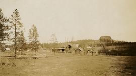
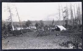
Photograph depicts a view of Lone Butte, BC. The butte formation of the same name (Lone Butte) is visible in the background; a ranch or residence is visible in the foreground. Wyness notes that Lone Butte was the "last one [they] tied in". "Tying in" is a land surveying technique. Since the photograph is dated October 1936 and Wyness described the survey trip as lasting June 5 - October 8, 1936, that implies that Lone Butte was the last location they surveyed on this trip.
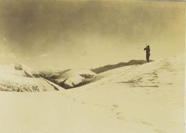
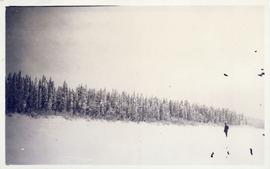
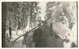
Photograph depicts one unidentified man surveying a landscape from a snowy mountain peak with other mountain ranges in the background.
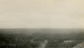
Photograph depicts Mount Begbie, noted by Wyness to be the highest point on the Cariboo Highway at mile 85. Mount Begbie is located at approximately 51°28'33''N, 121°22'00''W, on the east side of Cariboo Hwy, between 70 Mile House and 100 Mile House, in the Lillooet Land District. Also visible in this photograph is the Cariboo Highway road.
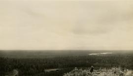
Photograph depicts Mount Begbie, noted by Wyness to be the highest point on the Cariboo Highway at mile 85. Mount Begbie is located at approximately 51°28'33''N, 121°22'00''W, on the east side of Cariboo Hwy, between 70 Mile House and 100 Mile House, in the Lillooet Land District. Also visible in this photograph is the Cariboo Highway road.
Series consists of planning documents relating to the British Columbia Lower Mainland collected by planner Chander Suri, reflecting his early career activity in that region. These records include metropolitan transportation and housing studies as well as industrial, residential, and agricultural land reports.
File consists of notes and reproductions relating to the MacKay family in Strathnaver, British Columbia.
Item is a map annotated in colour by the City of Prince George Planning Department depicting major residential development proposals from June 1975 to August 1977 in the City of Prince George. This map was drawn for the City of Prince George interim Community Plan.
Item is an original copy of "Making a Difference: The Canada Land Inventory" Fact Sheet 88-5 by the Canadian Wildlife Service, Environment Canada.
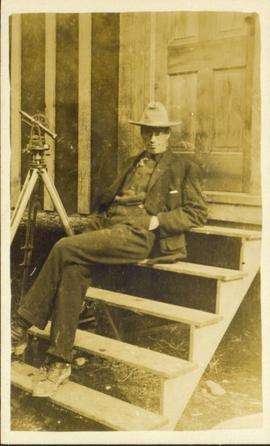
Photograph of a happy man reclining on a short exterior staircase. A surveyor's transit can be seen in the background.
Item is an original BC Department of Agriculture publication entitled "Management and Improvement of Meadows on Organic Soils of Interior British Columbia".
Item is a copy of "Management Strategy for the Driftwood-Reiseter Planning Area".
File consists of a speech given by Gary Runka entitled "Managing Conservation Lands to keep Nature's Pulse Beating" for the BC Trust for Public Lands.
Commentary on this speech by Barry Smith of the Ministry of Agriculture and Lands:
"GGR's was the opening address at the workshop. While this speech is focused on the issue of Best Management Practices (BMP), comments about the ALR are woven into the presentation. This copy of the speech appears to be a draft version and includes several hand-written amendments with some points crossed out.
In the opening, mention is made of the grounding that the 2008 document "Taking Nature's Pulse: the Status of Biodiversity in British Columbia" has provided the workshop.
This speech provides an historical overview of the broader provincial context of BMP's drawn from 40 years of GGR's experience. The following is a selection of his comments:
- BMP's are part of the "tool kit" of policy and management mechanisms that have been experimented with over the decades to try to rationalize human economic activities with the needs of other species and overall ecosystem well-being.
- Historically the 1960s and 70s Canada Land Inventory program that emerged from the Resources for Tomorrow conferences was a significant benchmark mapping land capability for agriculture, forestry, recreation, wildlife and waterfowl use (of which GGR was centrally involved).
- Within BC, using the CLI, the 1973 Land Commission Act authorized the establishment of a provincial zone to protect those sacred lands with the biophysical capability to grow food.
One point was not used in the speech (crossed out). The speaking notes, however, include a reference to the Land Commission legislation originally having a complimentary conservation objective that had since been removed. GGR makes the point that still having the conservation function may have contributed positively to current struggles to preserve natural habitat. Regardless, it is noted that the concept of the ALR has been a unique, effective and, most importantly a lasting management practices tool for conserving lands identified as biophysically significant.
A further selection of points made:
- We need to evolve BMP tools that are adaptable yet resilient in the face of changing knowledge, climate change and ever-evolving social priorities.
- Traditionally, planning has been most associated with local governments in the form of official community, regional and neighbourhood plans and as an outgrowth of the ALR - Agricultural Area Plans.
- Environment Farm Planning - by agreeing to engage in the conservation planning process, participating farmers and ranchers have qualified for funding to carry out farm improvements benefitting conservation and biodiversity.
- The work of the Delta Farmland and Wildlife Trust is outlined (p. 8)
- "My final words of wisdom are - Be focused and be pragmatic"
- "Many of the best intentions to standardize land management practices for conservation lands have been great on paper - but never quite make it on the ground."
- And, if BMP are not implemented effectively on the ground, they cannot play the critical role they need to play in 'keeping nature's pulse beating'."
File consists of a speech given by Gary Runka to the Agricultural Institute of Canada entitled "Managing Our Land Resources for Survival and Pleasure".
Commentary on this speech by Barry Smith of the Ministry of Agriculture and Lands:
"This speech is aimed at land use planning and planners, and GGR provides his definition of "ecology" which includes:
"...the basic characteristics of the land - its geology, soils, climate, vegetation, and animal life, including the devil that does the most damage, man. It also includes the interrelationships within these basic characteristics and of course this is where the word "complexities" comes in. There are no two places where these components combine in exactly the same manner and each ecological unit, if you like, is unique."
GGR mentions the importance of considering options.
This package includes a copy of the speech as well as a second, 2 page document, with the same title in which GGR is noted as 'Manager of the BC Land Commission'. This second document is largely a summary of the more formal speech."
File consists of a non-forester's guide to small scale forestry in BC, prepared under the Canadian-British Columbia Forest Resource Development Agreement.
Item is an original copy of the "Manitoba Land Use Conference Proceedings" on March 11-12, 1981 in Winnipeg. Gary Runka presented on his paper, "Expanding Needs from a Finite Resource: The Necessity for Sound Land Use Planning".
Subseries consists of correspondence and accompanying informational material related to the Department of Manpower and Immigration as well as immigration and unemployment issues in general, particularly as they pertain to northern British Columbia. Records include news releases, newsletters, brochures, speeches from the Minister of Manpower and Immigration, reports, applications. Includes correspondence regarding unemployment insurance, wage scales, immigration policies, the Green Paper on Immigration and Population, and job creation programs. Includes project status summaries and applications for grants from the Local Employment Assistance Program, the Opportunity for Youth Program, the Canada Works Program, and the Young Canada Works Program.
File consists of photocopied maps of Island Cache (Cottonwood Island) and Prince George.
Series consists of maps, plans, and drawings collected by faculty in the UNBC School of Planning and Sustainability. The majority of these maps reflect the planning history of the City of Prince George and include large format, hand-drawn plans created by the City Planning Department from the 1970s and 1980s. Maps from City of Prince George Official Community Plans are also included.
File consists of notes and reproductions relating to Marcus Smith. Marcus Smith was a railway surveyor and in 1872 he was appointed as deputy to the Engineer-in-Chief of the Canadian Pacific Railway and took charge of British Columbia surveys between 1876-78. He worked as a surveyor for the CPR until 1886.
File consists of an oral history given by Margaret Jaffray, which was gathered as part of Dr. Mike Evan's oral history project with the Prince George Metis Elders Society. Includes consent forms, transcripts, and the recorded oral history on the original cassette.
File consists of an oral history given by Marie Jobin, which was gathered as part of Dr. Mike Evan's oral history project with the Prince George Metis Elders Society. Includes consent forms, transcripts, and the recorded oral history on the original cassette.
File consists of an oral history given by Marie McRae, which was gathered as part of Dr. Mike Evan's Island Cache Recovery Project. Includes consent forms, transcripts, and the recorded oral history on the original media.
File consists of an oral history given by Marie Paquette, which was gathered as part of Dr. Mike Evan's oral history project with the Prince George Metis Elders Society. Includes consent forms, transcripts, and the recorded oral history on the original cassettes.
File consists of an oral history given by Mary Gervais, which was gathered as part of Dr. Mike Evan's oral history project with the Prince George Metis Elders Society. Includes consent forms and transcripts.
File consists of an oral history given by Mary Ghostkeeper, which was gathered as part of Dr. Mike Evan's oral history project with the Prince George Metis Elders Society. Includes consent forms, transcripts, and the recorded oral history on the original cassettes.
Item is a draft of J.W. Schwab's paper for the 10th BC Soil Science Workshop (February 20-21, 1986) entitled "Mass Wasting Impacts to Forest Land: Forest Management Implication, Queen Charlotte Islands".
File consists of a master plan for development of Alberta's Provincial Parks. Details the plan, objectives, assessment guides, and features of the plan. Includes one master plan and objective item and one supplementary information package.
File consists two physical development plans for McLeod Lake Band, one by Radloff Engineering and one by Duncan & Associates Engineering Ltd. Includes a map of the development plan.
Item is an original copy of "Methodology - Land Capability for Agriculture - B.C. Land Inventory (CLI)" by G.G. Runka at the Soil Survey Division, BC Department of Agriculture.
File consists of a panel moderation talk given by Gary Runka entitled "Methods of Resolving Land Use Conflicts in BC".
File consists of a study by the Associated Engineering Services Ltd. on the metropolitan traffic of Prince George.
File consists of an oral history given by Mike Lamanes, which was gathered as part of Dr. Mike Evan's Island Cache Recovery Project. Includes consent forms, transcripts, and the recorded oral history on the original media.
Item is a photocopied version of the "Ministry of Transportation and Highways, Province of British Columbia, Cattle Drives on Highways - Draft Policy" by Lorne M. Holowachuk, BC Highway Safety Branch.
File consists of various papers, communications, correspondence, pamphlets, and publications. Includes the following:
- "Speaking Notes - Joan Sawicki, MLA, Parl. Sec. Georgia Basin Initiative to Planning 425 - Dr. Alan Artibise - UBC - September 20, 1995"
- "Principles of Sustainability" (ca. 1995)
- "Preliminary Working Draft of a Background Report on Agriculture and Sustainability in the Fraser Basin" by Wendy R. Holm (1996)
- Agriculture and Sustainability in the Fraser Basin workshop materials from Fraser Basin Management Program
- 1995 Fraser Basin Management Program Board Report Card
- "Speaking Notes for Joan Sawicki, MLIA Burnaby-Willingdon & Parliamentary Secretary, Georgia Basin Initiative, "Peatlands for People": A Conference sponsored by the Burns Bog Conservation Society" (27 January 1996)
- BC Mining Watch! Fact Sheets
- A letter to Gary Runka from Burnaby RCMP regarding a marijuana cultivation report
- Newspaper article "Views sought on land claims" by Joan Sawicki
- Newsletters from the Valhalla Wilderness Society including updates on their local, boreal, and Spirit Bear campaigns
- A letter from David Anderson, Minister of Fisheries and Oceans
- "Drinking Canada Dry: The Threat to Canada's Water under the Proposed Multilateral Agreement on Investment" by Wendy R. Holm
- "Tulsequah Chief Mine Re-opening Project: Report and Recommendations of the Taku River Tlingit First Nation" (1998)
- "1998 British Columbia Electoral Boundaries Commission" pamphlet
- Correspondence and Runka's interview transcript for his participation in the UBC study "Building Consensus in a Complex World: A Study of the Theory and Practice of Participatory Multistakeholder Decision-Making" (1999)
- Winter 1999 newsletter for the Northwest Institute for Bioregional Research in Smithers
- "Knox McCusker: Dominion Land Surveyor" article from BC Historical News (Summer 1999)
- SkyTrain development informational newsletter (Spring 1999)
- Letter from Paul Sanborn to Gary Runka & Joan Sawicki (2002)
- Email from Joan Sawicki to Bella Coola Valley residents regarding the Nascall Power Project
- BC Hydro pamphlet about marijuana grow ops (2006)
- Bella Coola Airport Dike Upgrade Referendum informational documents
- Tweedsmuir-Wright Creek Crossing Rehabilitation and Flood Protection Plan
Floppy consists of G.G. Runka Land Sense Ltd. client file records for jobs.
Floppy directories and file listing:
- 346RESGN.LTR
- ATNARK.AGR
- ATNARK.DOC
- ATNARKO.LTR
- BCMAFF.PRO
- BNGIFT.LTR
- BULKLEY.LTR
- BURNABY.QTE
- CARRNOV.LTR
- COLBASIN.LTR
- CURTIS.LTR
- GAERTNER.LTR
- GARTH.DOC
- GGRTAX.LTR
- GIBSON.EST
- GLOVER.FAX
- GREATA.LTR
- GREEN.DOC
- HANNA.LTR
- INSUR.DOC
- INSURE.TBL
- ISRAEL.DOC
- JOHNS.LTR
- JUL10ROB.LTR
- JUL3ROB.LTR
- KOCHMAR8.LTR
- MAYO.LTR
- MOFPROJ.LST
- MOFSPE9.LTR
- OKNOV8.FAX
- OVTFAOCT.LTR
- PHILLIPS.FAX
- PRIORITY.MGT
- RBFNOV22.FAX
- RFIFEB7.FAX
- ROSSNO20.FAX
- SCHNARE.TBL
- SEVERES.DOC
- SFU.FAX
- STEWART.LTR
- WESAPR30.LTR
- ZBEETNOF.FAX
Floppy consists of G.G. Runka Land Sense Ltd. client file records for jobs.
Floppy directories and file listing:
- 152REF
- 306
- 319TBL.CNT
- 363LYN.FIL
- 376WRK.PLN
- 390
- APP12
- APPCALC
- BCA1
- BEHOLD
- CAVELEG.DOC
- COMM329
- CR306
- DACY.MAP
- ED306
- EVALCR
- GEOL101
- LAND.MAP
- LANDSENS.MAP
- LEG®.DOC
- LUND.MAP
- LYN.MAP
- LYND.MAP
- MSWORD.DOC
- MSWORD.STY
- REF
- REF306
- REFERENC
- RUNKA.MAP
- TC101
- THESIS
- TODAY.MAP
Floppy consists of G.G. Runka Land Sense Ltd. client file records for jobs.
Floppy directories and file listing:
- 152REF
- 152REF.BK!
- 306
- 306.BK!
- 319TBL.CNT
- 363LYN.FIL
- 376WRK.BK!
- 376WRK.PLN
- 390
- 390.BK!
- APP12
- APP12.BK!
- APPCALC
- APPCALC.BK!
- BCA1
- BEHOLD
- CAVELEG.DOC
- COMM329
- CR306
- DACY.MAP
- ED306
- ED306.BK!
- EVALCR
- EVALCR.BK!
- GEOL101
- GEOL101.BK!
- LAND.MAP
- LANDSENS.MAP
- LEG®.DOC
- LUND.MAP
- LYN.MAP
- LYND.MAP
- MSWORD.DOC
- MSWORD.STY
- REF
- REF306
- REFERENC
- RUNKA.MAP
- TC101
- TC101.BK!
- THESIS
- THESIS.BK!
- TODAY.MAP
File consists of a draft report by the Regional District of Fraser Fort-George on the place of mobile homes in municipalities.
File consists of a correspondence sent by the Nechako Improvement District to the Regional District of Fraser Fort-George regarding concerns about zoning mobile home sites.
Item is an original copy of "Moran Dam Environmental Analysis" by the Cariboo Land Capability Analysis Committee and Intersector Special Study Committee of the British Columbia Canada Land Inventory. The committee members were A. Bedwany, D. Benn, D. Blower, R. Marshall, and G. Runka. Includes 24 original colour photographic prints pasted into the report.
