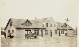
Street view photograph of a large brick with a vehicle parked in front. Printed annotation on recto reads: "C.N.R. Station Prince George, B.C."
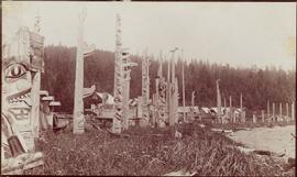
Totem poles (crest poles?) stand in front of a line of houses. Blanketed canoes sit on beach in right foreground; forest in background.
Handwritten annotations on verso read: “Haida Encampment [crossed through with line]"; "Skidegate Queen Charlottes Islands / To illustrate Introduction / Introduction Trophies from a Song [Trail?] Page 1 Heading."
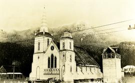
Photograph depicts large church to left of a tower structure. Power lines cross foreground, and other buildings can be seen in background.
Handwritten annotation on verso reads: "New Church Kincolith Nass River BC".
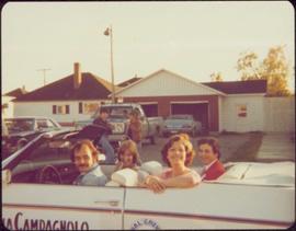
Iona Campagnolo smiles from back seat.
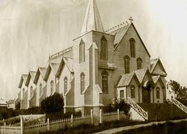
Large church stands behind white fence, unidentified man visible on front steps. Photograph depicts the first church built in Metlakatla, which was burned in a fire in 1901, and replaced in 1903.
Handwritten annotation on verso reads: "With love, from your two old friends JH [& AM Keen?]".
Photograph was taken during a tour of the Skeena riding in the summer of 1978.
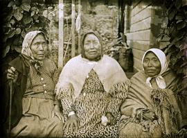
Three women sit in foreground at a porch partially covered with foliage.
Handwritten annotations on verso read: "Elders at Mission House Kincolith Nass River BC".
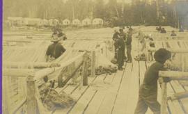
Close view of dock full of rows of nets and a few workers. Rows of bunkhouses on shore in background. Handwritten annotation in pencil on recto reads: “Port Essington B. C.”
Cassiar Asbestos Corporation Ltd opened a second mine in 1967 at what became the one-industry town of Clinton Creek, Y.T. File contains photographs depicting different areas of operations at Clinton Creek. Locations include the mine, plant, town, tailings pile, main office, the 40 Mile River, and surrounding area. Town photos depict the grocery store, cafeteria, medical clinic, school, auditorium residential area, Connell Street and power house. File also includes aerial photographs and images depicting forest fighting, photographers capturing the tailings pile, asbestos samples, mining machinery, staff offices, and operations in the mill, lab, and garage.
Additional photographs integrated into file depict Clinton Creek's surrounding area, and three slides of a tailing pile explosion believed to be Clinton Creek.
Series consists of copies of City of Prince George records photocopied and organized by Island Cache Recovery Project researchers. Includes incoming and outgoing correspondence between the city and Island Cache residents, legal real estate and building inspection documents for Island Cache properties, and reports regarding Island Cache (Cottonwood Island).
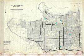
This municipal map of the City of Vancouver from 1987 shows street names and street widening information.
Item is Map 3 of a group of five maps relating to a City of Prince George Study of Construction Aggregates by the firm Willis, Cunliffe, Tair & Company Limited. Map 3 shows geology of the Prince George area and known sources of construction aggregates.
Item is Map 5 of a group of five maps relating to a City of Prince George Study of Construction Aggregates by the firm Willis, Cunliffe, Tair & Company Limited. Map 5 shows drill hole locations.
Item is Map 4 of a group of five maps relating to a City of Prince George Study of Construction Aggregates by the firm Willis, Cunliffe, Tair & Company Limited. Map 4 shows development areas, aggregate sources, and requirements for 1984 and 1994. As the map is undated, it is unclear whether the 1984 and 1994 dates are future estimates.
Item is Map 1 of a group of five maps relating to a City of Prince George Study of Construction Aggregates by the firm Willis, Cunliffe, Tair & Company Limited. Map 1 shows development areas and population for 1984 and 1994. As the map is undated, it is unclear whether the 1984 and 1994 dates are future estimates.
Item is Map 2 of a group of five maps relating to a City of Prince George Study of Construction Aggregates by the firm Willis, Cunliffe, Tair & Company Limited. Map 2 shows development areas and aggregate requirements for 1984 and 1994. As the map is undated, it is unclear whether the 1984 and 1994 dates are future estimates.
File consists of notes, reproductions, clippings, and letters relating to the Junkers aircraft named "The City of Prince George," registration CF-ALX. Includes: "Western Canada Aviation Museum" letter to Dennis McCallum from Karen Schmidt (25 June 1986) and "City of Prince George Junkers F-13 Airplane" typescript document (4 Sept. 1986).
This map is part of Schedule B of the 1993 Official Community Plan, Bylaw No. 5909 for the City of Prince George. This particular map depicts the southwest area of the City of Prince George, including College Heights, UNBC, University Heights, and Vanway.
This map is the Schedule A accompanying map for the City of Prince George's Soil Removal and Deposit Bylaw No. 7022 of 1999. It depicts designated soil removal areas and M.O.T.H. gravel reserves.
This map is the October 2006 amendment (Bylaw 7807) of the Schedule C of the 2001 Official Community Plan, Bylaw No. 7281 for the City of Prince George. This Schedule C map shows the long range land use for the City of Prince George.
This map is the May 2008 amendment (Bylaw 8061) of the Schedule C of the 2001 Official Community Plan, Bylaw No. 7281 for the City of Prince George. This Schedule C map shows the long range land use for the City of Prince George.
This map is the May 2006 amendment (Bylaw 7807) of the Schedule C of the 2001 Official Community Plan, Bylaw No. 7281 for the City of Prince George. This Schedule C map shows the long range land use for the City of Prince George.
This map is Schedule C of the 2001 Official Community Plan, Bylaw No. 7281 for the City of Prince George. This Schedule C map shows the long range land use for the City of Prince George.
This map is part of Schedule B of the 1993 Official Community Plan, Bylaw No. 5909 for the City of Prince George. This particular map reflects the 1998 amendment to the Official Community Plan.
This map is part of Schedule B of the 1993 Official Community Plan, Bylaw No. 5909 for the City of Prince George. This particular map reflects the 1998 amendment to the Official Community Plan.
This map depicts the City of Prince George's plan for soil removal and deposit.
This map is part of Schedule B of the 1993 Official Community Plan, Bylaw No. 5909 for the City of Prince George. This particular map depicts the northwest area of the City of Prince George, including the North Nechako neighbourhood and the Hart.
This map is part of Schedule B of the 1993 Official Community Plan, Bylaw No. 5909 for the City of Prince George. This particular map depicts the northeast area of the City of Prince George, including the industrial areas on Prince George Pulpmill Road and Northwood Pulpmill Road along the Fraser River.
This map is part of Schedule B of the 1993 Official Community Plan, Bylaw No. 5909 for the City of Prince George. This particular map depicts the east area of the City of Prince George, including the Prince George Airport (YXS) and the Blackburn area.
This map is part of Schedule B of the 1993 Official Community Plan, Bylaw No. 5909 for the City of Prince George. This particular map depicts the central area of the City of Prince George, including the Bowl area, the VLA, the Crescents, South Fort George, Heritage, and Peden Hill.
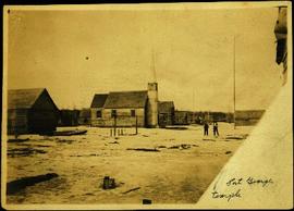
Photograph depicts two men standing in street at the Fort George Reserve. A church with steeple stands in midground, on left side of street. Forest in background. Handwritten annotation on verso and recto of this photograph reads: "Fort George Temple." See item 2009.5.3.28 for photograph depicting this reserve which belonged to the Lheidli T'enneh Band.
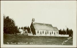
Photograph depicts large church in fenced area, mission house visible behind trees in background.
Printed on image: "The Church. Old Massett. Q.C.I. / J.D. Allen. Photo. C."
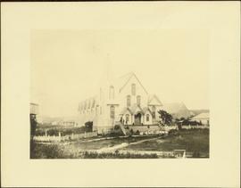
Several unidentified individuals can be seen on front steps of church and a group of small children in white stand in line below steps. Other community buildings are visible in background, white fence crosses foreground. Photograph depicts the first church built in Metlakatla, which was burned in a fire in 1901, and replaced in 1903.
Handwritten annotation on verso reads: "Church (of England) at Metlakahtla - British Columbia. Built by the people of the village - largest church then on the pacific coast."
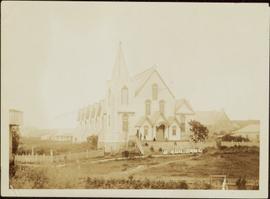
Several unidentified individuals can be seen on front steps of church and a group of small children in white stand in line below steps. Other community buildings are visible in background, white fence crosses foreground. Photograph depicts the first church built in Metlakatla, which was burned in a fire in 1901, and replaced in 1903.
Handwritten annotation on verso reads: "Old church at Metlakatla Before fire. Built by Fr. Duncan & the village people".
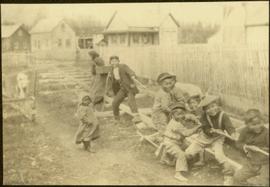
Seven young boys enjoying a game of tug-a-war alongside a wooden track. Track runs along a picket fence through a village. A small girl watches the fun from the sidelines and older woman carries a basket in the background. Handwritten annotation in pen on verso reads: “Native children at play”.
File consists of notes, clippings, and reproductions relating to Chilako River and Indian Reserve No. 4. File contains material regarding the discovery of Indigenous artifacts in an archaeological dig by faculty and students from the University of Northern British Columbia; the establishment of a fur trading fort at Chala-oo-chick for the Hudson's Bay Company; and Indian Reserve No. 4 of the L'heidli T'enneh. Includes photographs depicting Fernie Ollinger's barn on Chilako Station Road and Chilako River (2006).
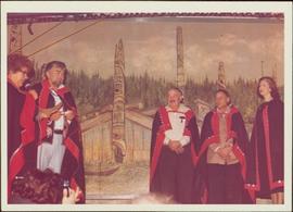
Handwritten annotation on verso reads: “Chief Skidegate (Dempsey Collinson), Feast 1978, Q.C.I.”
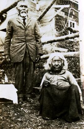
Chief Gideon stands in suit and tie behind his wife who sits on the ground in front. Fence with chicken wire crosses midground, building visible in background.
Handwritten annotation on verso reads: "Chief Gideon & his wife on upper Nass River".
File consists of an oral history given by Chester Jeffery, which was gathered as part of Dr. Mike Evan's Island Cache Recovery Project. Includes consent forms, transcripts, and the recorded oral history on the original media.
File consists of notes, clippings, and reproductions relating to Charles Millar and the Millar Addition in Prince George.
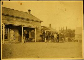
Photograph depicts four men standing near fully packed horse-drawn cart in front of wood buildings, including a long building with a porch and chairs. Trees on hill visible in background. Handwritten annotation on recto of photograph: "Changing teams on the Cariboo Road".
This fonds encompasses the planning career of Chander Suri. The head planner for the Regional District of Fraser-Fort George from 1969 to 1977, Chander Suri embarked on numerous community plan projects in the Prince George area. Suri also worked as an independent planning consultant for local businesses and organizations. Chander Suri's records encompass numerous urban and rural projects facilitating population and industry growth within the RDFFG that spanned beyond Suri's career.
Textual records comprise official and draft planning documents, development reports, planning proposals, contracts, published regulations, socio-economic studies of regions near Prince George, financial and other studies for development sites, illustrated promotional packages/proposals for developments, regional/provincial guides and standards, and correspondence relating to Suri's professional consulting activities. The fonds contains a wide array of maps, architectural plans, and technical drawings ranging from municipal planning layouts, industrial land developments, and private property (commercial and residential) development projects, mainly from in and around Prince George.
These records are relevant to researchers of the subjects of land use, land development and land planning issues in the Prince George and Fraser-Fort George Regional District in the second half of the 20th century.
Series include:
- Maps and Plans relating to development projects in British Columbia, predominantly in the Prince George area
- Lower Mainland Planning material from Suri's early career period
- Regional District of Fraser Fort George Planning records and resource material collected by Suri during his employment at the RDFFG
- Planning Consultancy records relating to Suri’s independent planning consultancy work in his later career period
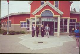
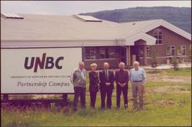
Chancellor Campagnolo stands with five unidentified Quick Start students, Fred Gilbert, and Nick Petraryszak. Photograph was taken during the chancellor's tour of the Peace-Liard Region, 1993.
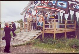
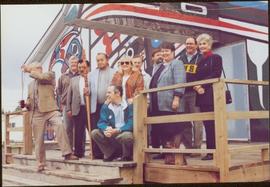
Group features Charles Jago, Mike Hammar, Jacob McKay, Bert McKay, Deborah Poff, Alex Michalos, Dennis Macknak, Margaret Anderson, David Fish, Dean Doug Nord, and Fred Beil. Photograph was taken during the chancellor's tour of Nass Valley, ca. 1992.
Group features Charles Jago, Mike Hammar, Jacob McKay, Bert McKay, Deborah Poff, Alex Michalos, Dennis Macknak, Margaret Anderson, David Fish, Dean Doug Nord, Fred Beil, and Chancellor Iona Campagnolo. Photograph was taken during the chancellor's tour of Nass Valley, ca. 1992.
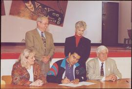
Photograph features UNBC Provost Deborah Poff, UNBC President Dr. Charles Jago, an unidentified man, Chancellor Iona Campagnolo and Reverend Ian MacKenzie signing papers. Photograph was taken during the chancellor's tour of Nass Valley, ca. 1992.
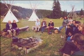
Left to right: Charles Jago and unidentified woman, David Fish, Dennis Macknak, Deborah Poff, unidentified woman and child, Iona Campagnolo, Lee Morrison, Ellen Facey, two unidentified women. Teepees visible in background. Photograph was taken during the chancellor's tour of Xats'ull Heritage Village, Soda Creek First Nation, Williams Lake, B.C.
Chancellor Campagnolo stands with man believed to be the mayor of Tumbler Ridge, President Geoffrey Weller, and Dean Fred Gilbert. Photograph was taken during the chancellor's tour of the Peace-Liard Region, 1993.
Chancellor Campagnolo stands with Chetwynd Mayor Charlie Lasser, President Geoffrey Weller, an unidentified man, and Fred Gilbert. Photograph was taken during the chancellor's tour of the Peace-Liard Region, 1993.
Handwritten annotation on verso reads: "chetwynd".
Two unidentified woman are also visible with the group, on far left and in centre with arm raised. Young girl sits on post in foreground. Photograph was taken during the chancellor's tour of Xats'ull Heritage Village, Soda Creek First Nation, Williams Lake, B.C.



![City of Prince George - Schedule C of the Official Community Plan - Long Range Land Use Map [October 2006 Amendment]](/uploads/r/northern-bc-archives-special-collections-1/6/d/6/6d643c10801eba2ac493689972e57429dba42ec7592f54cb55151b96362d7048/2023.5.1.40_-_2006_Oct_-_City_of_Prince_George_Long_Range_Land_Use_Map_JGP85_tb_142.jpg)
![City of Prince George - Schedule C of the Official Community Plan - Long Range Land Use Map [May 2008 Amendment]](/uploads/r/northern-bc-archives-special-collections-1/4/3/a/43a9e75941f1542735d999de340307d163e79dffdadbf4546bb9346b63f7e734/2023.5.1.41_-_2008_May_-_City_of_Prince_George_Long_Range_Land_Use_Map_JPG85_tb_142.jpg)
![City of Prince George - Schedule C of the Official Community Plan - Long Range Land Use Map [May 2006 Amendment]](/uploads/r/northern-bc-archives-special-collections-1/6/5/5/65536bc04aa97580c140131651dc357dfe5c3a1315822394f388d96940bc39cb/2023.5.1.39_-_2006_May_-_City_of_Prince_George_Long_Range_Land_Use_Map_JPG85_tb_142.jpg)

![City of Prince George - Schedule B of the Official Community Plan, Bylaw No. 5909 [2001 Amendment]](/uploads/r/northern-bc-archives-special-collections-1/c/3/6/c36392b90696286cc6281e8cc2efbf7691c2617726495fa28db2cbdcc20e4e4c/2023.5.1.36_-_Official_Community_Plan_City_of_PG_Schedule_B_2001_JPG85_tb_142.jpg)
![City of Prince George - Schedule B of the Official Community Plan, Bylaw No. 5909 [1998 Amendment]](/uploads/r/northern-bc-archives-special-collections-1/d/6/d/d6d1c4e7e37fc948b97b3caa36447b52f7d2b76b13d45e3710aefee7b13840f0/2023.5.1.33_-_1998_Official_Community_Plan_City_of_PG_JPG85_tb_142.jpg)


