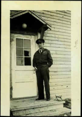
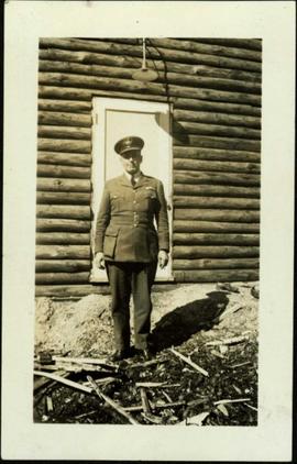
Handwritten photo album caption beside this photo reads: "S/L. A.C. Heaven. C.D. #3 Unit, N.W.S.R. Fort Nelson." Photograph depicts man in uniform standing on steps in front of doorway to unidentified building. Wings medallion on left breast.
Royal Canadian Air ForceFort Nelson, BC
32 Archival description results for Fort Nelson, BC
Photograph album contains 134 snapshots showcasing building activity, equipment, logging, and airplanes in British Columbia and the Yukon, taken during the building of the Alaska Highway in 1942. The photographer is unknown. Many of the photographs depict Fort St. John and Fort Nelson.
Some of the photographs are captioned as follows:
- Looking north at Fort St. John, B.C.
- P.R.A. Bellanea and Army Norseman sea-planes on Charley Lake near Fort St. John, B.C.
- Looking toward outlet of Muncho Lake from Float Plane
- Fort St. John, British Columbia. Canada
- Colonel Ingalls’ bridge across Liard River
- Post Office & Government Telegraph Office
- P.R.A. Camps at Fort St. John, B.C. looking N.E.
- Post Office & Government Telegraph Office - Fort St. John - 1942
- Army Ferry on Peace River near Taylor's Flats
- Looking west on Main Street, Fort St. John, B.C. May - 1942
- Looking southwest across Summit Lake
- Public Roads Administration Headquarters Buildings. Fort St. John, B.C. - April - 1942
- Looking southwest from south bank of Peace River from Old Highway near Taylor Flats, B.C.
- First Army Headquarters - Fort St. John, B.C. - 1942
- Beginnings of Fort Alcan - May 1942 - Fort St. John, B.C.
- Road between 101 and 157
- Other side Muncho Lake
- Big Black Bear
- Liard River, Canada
- Dog Sled. Muskwa River
- Temporary Bridge at Muskwa, B.C.
- Another bridge in British Columbia
- Above Fort Nelson, B.C. White spot in picture is the “moon”
- Mountains N-106
- Coughlin’s equipment at work west of Fort Nelson - Nov. - 1942
- Near Mile Post 175-N descending to shore of Muncho Lake
- First Fairbanks sign erected in Fort St. John. Apr. 1942
- Boat used to cross the Fort Nelson River at Fort Nelson
- Typical P.R.A. Engineers Camp at Mile 84-N
- Fort Alcan - near St. John. British Columbia. “1942.”
- Captain Hinze and Army beachcraft used on Army reconnaissance surveys for Alaska Highway
- Small single motored aircraft used by P.R.A. on Alaska Highway Reconnaissance flights forced down on Gravel Bar on the Laird [sic] River near Mile 313-N
- Near Mile 173-N looking at outlet of Muncho Lake
- Near Mile 145 N. Toad River looking downstream
- Looking southwest at Muncho Lake at Army operations on shore Pioneer Road. First tote road may be seen above.
- Hudson Bay Store at Dease Lake, end of truck portage from Telegraph Creek + Wrangell. Beginning of boat freighting to lower port
- Mile 104 n. Sugarfoot Lake
- Mile 104 N. Sugarfoot Lake
- Looking north from Mile 140 N. at Folding Mountains - approx. 8,000 ft high
- Army forces along Muncho Lake
- Malamute sled dog at Fort Nelson
- P.R.A. location. Engineers’ Camp near Mile 165-N
- Few miles west of Ft. St. John looking downstream at Peace River. Old Fort St. John. Buildings on near shore
- British Columbia Police Plane in Fort Nelson River at Fort Nelson, B.C.
- Few miles west of Fort St. John - Looking across Toad River at Little Folded Mountain near Mile 141
- Looking northwest at P.R.A. an Oakes Camp and Alcan Highway.
- Clouds after a rainstorm over Teslin Lake, Yukon Territory between Watson Lake and Whitehorse.
- Toad River and Big Folded Mountain near Mile 142 N
- Teslin Lake between Watson Lake & Whitehorse Y.K. The lake is 72 miles long
- Whitehorse, Yukon Territory
- Dept. of Transport Ferry on Peace River near Taylor Flats.
- Foothills east of Rocky Mountains between Watson Lake & Whitehorse, Yukon Territory
- Public Roads Administration (P.R.A.) Camp at Whitehorse, Y.K.
- Whitehorse end of the White Pass and Yukon Railway from Skagway, Alaska to Whitehorse, Y.K.
- Husky sled dog. Ft. St. John, B.C.
- Mile 103 N. Looking east at Army Camp at Mile 102 N. - Summit Lake
- Opening of new bridge on Sikanni River
- Peace River Bridge has now replaced this “Ferry” - Fort St. John, B.C
- Muskwa River new Fort Nelson, B.C.
- Bridge across the Muskwa River.
- View of mountains across flat between 101 - and 157
- Plane at Fort Nelson - Ft. Nelson River
- Moose Calves
- Suicide Hill - J 108. Now eliminated from Alaskan Highway
- Road Construction Equipment Center Boom - Bulldozer and Side Boom
- Center Boom. Taken at Water Line
- Early stages of road construction
- Bulldozing for the Highway
- Clearing the tinder for the Highway
- Convoy of trucks on Alaskan Highway
- Repair Camps off Highway
- Mud - Mud - Mud - Mud!
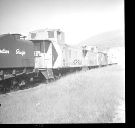
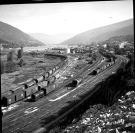
Photograph depicts a line of CPR cabooses and work cars at Nelson. The foremost is #437374 and was built in September, 1948.
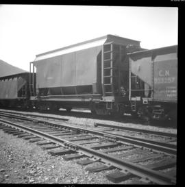
Photograph depicts CPR ore cars at Nelson. These cars are as common to Nelson, as lumber and grain cars are too Kamloops. This is due to the Trail smelter. The high-sided ore car is CN #345098 and it has a capacity of 99 tons and was built in January 1966.
This file consists of photocopy reproductions of three oral history tape transcriptions of interviews with Father Pierre Poullet of the Missionary Oblates of Mary Immaculate (OMI). Poullet was active in missionary work in northern BC between 1937 and [1998?] ; these transcripts mention Lower Post, Telegraph Creek, Dease Lake, McDame, Fort Nelson, Muncho Lake, and the Alaska Highway. The transcripts are titled "Earlier tape", "Tape of Lower Post", and "Tape of Fort Nelson".
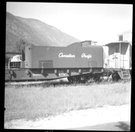
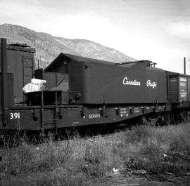
Photograph depicts a CPR firefighting water tank placed on a flatcar, which was the ex tender of a steam locomotive. The service car is #415391 and the pump is at the left, beyond the photo.
Handwritten photo album caption below this photo reads: "S/L. Geo Du Temple. #4 Unit N.W.S.R. Watson Lake." Photograph depicts man in uniform (wings medallion on left breast) standing in front of white doorway of log building. Ground in foreground covered with sticks and sawdust.
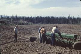
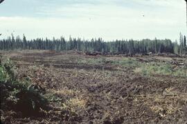
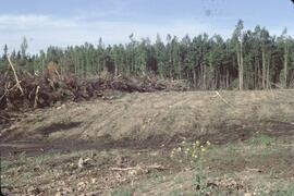
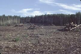
Royal Canadian Air ForceFile consists of records created and accumulated by Gary Runka over the course of his consultancy work for BC Ministry of Lands, Parks and Housing for the "Fort Nelson Deferred Planning Area (DPA)" project. This file was numbered as G.G. Runka Land Sense Ltd. client file #067; that client number may be seen referenced elsewhere in the G. Gary Runka fonds. The Land Sense Ltd. client files generally include records such as correspondence, contracts, invoices, project reports, publications, ephemera, memoranda, maps or map excerpts, legal documents, meeting materials, clippings, and handwritten notes. Includes the "Fort Nelson North Deferred Planning Area for the Ministry of Lands, Parks & Housing, Peace Region - Final Report" by Talisman Land Resource Consultants, February 1983. File also includes 186 accompanying aerial photographs.
Handwritten photo album caption below this photo reads: "Scene on the Apron, 'Any Day' Fort Nelson, Our 'Lodestar' in the foreground." Photograph depicts three planes on apron, surrounded by various unidentified men and trucks. Pavement in foreground, trees in background.
Royal Canadian Air ForcePhotographs within this file document Canadian military service, training activities, military institutions, bases and site; individuals and organizations (eg. veterans, military personnel, militia, cadets), military vehicles and ships, equipment, weapons, uniforms, artifacts and legislation as it pertains to Northern British Columbia.
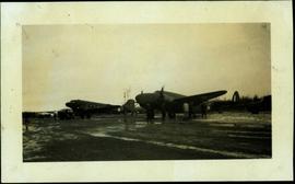
Handwritten photo album caption below this photo reads: " 'Parked For The Night.' C.P.A. [Locheed ?] at Ft. Nelson." Photograph depicts military plane in runway, its engines draped and enclosed in tarp covering. Steel drums and hose on trailer pulled by tractor in foreground, as well as movable staircase. Trees on horizon in background.
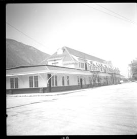
Royal Canadian Air ForcePhotograph depicts the Nelson CPR depot . All the freight traffic work is handled at this office for a wide area. The view is looking west.
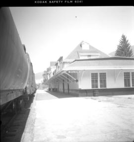
Photograph depicts the Nelson CPR depot, built in 1899. Since there are no passenger trains, freights used the front line, adjacent to the depot. The photograph was taken from the platform and shows a view looking east.
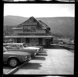
Photograph depicts the Nelson CPR depot, built in 1899 and still well-maintained. Streetcars had a terminal in this yard from 1899-1949, for what was probable the shortest street car system in Canada. The view is looking north and shows the rear view.
Photograph depicts a general view of the Nelson CPR yards. An icehouse shown in another photograph appears on the right edge of the photograph at about 1 3/4" above the right hand bottom corner. The main depot building is just beyond the icehouse at the "10 o'clock" position.
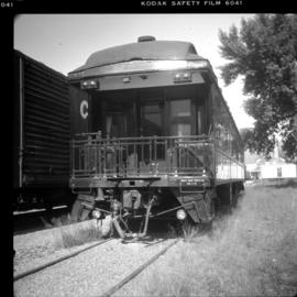
Photograph depicts an old business car located on a spur on the west side of the Nelson CPR depot, where it seems to be a semi-fixture. The business car was #13 and had no dates.
Map depicts the proposed electoral districts of British Columbia, including: Burnaby, Capilano, Cariboo-Chilcotin, Comox-Powell River, Cowichan-Malahat-The Islands, Esquimalt-Saanich, Fort Nelson-Peace River, Fraser Valley East, Fraser Valley West, Kamloops-Shuswap, Kootenay East, Kootenay West, Mission-Port Moody, Nanaimo-Alberni, New Westminster-Coquitlam, North Vancouver-Burnaby, Okanagan North, Okanagan-Similkameen, Prince George-Bulkley Valley, Richmond-South Delta, Skeena, Surrey-White Rock-North Delta, Vancouver Centre, Vancouver East, Vancouver Kingsway, Vancouver Quadra, Vancouver South, and Victoria.
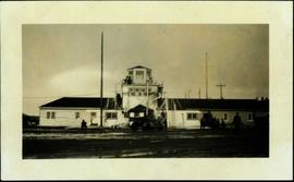
Handwritten photo album caption below this photo reads: "Tower & Adm. Bldg, Ft. Nelson." Photograph depicts long white building with tower raised in middle, ladders and scaffolding in front. Trucks and groups of men in foreground, some on building itself. Power poles in foreground and background.
Royal Canadian Air ForceFile consists of trail maps and recreation guides from various places in British Columbia, especially Northern British Columbia. Maps include:
- British Columbia Road Map and Parks Guide
- Northwood Pulp and Timber Limited Forest Operations Recreation Map
- Provincial Parks of Northern British Columbia
- Visitor's Guide: Mackenzie Woodlands
- Visitors Guide: Mackenzie Woodlands
- Mackenzie Forest District Recreation Map
- Dawson Creek Forest District Recreation Map
- Morice Forest District Recreation Map
- Fort St. James Forest District Recreation Map
- Lakes Forest District Recreation Map
- Cariboo Forest Region Recreation Map
- Lakes District Visitors Map
- Prince George Forest District Recreation Map
- Vanderhoof Forest District Recreation Map
- Fort St. John Forest District Recreation Map
- Cariboo Forest Region Recreation Map (East)
- Robson Valley Forest District Recreation Map
- Fort Nelson Forest District Recreation Map
- Forest Service Recreation Sites: Valemount - Blue River
- Forest Service Recreation Sites: McBride - Goat River
- Forest Service Recreation Sites: Prince George West
- Forest Service Recreation Sites: Moberly - Sukunka
- Forest Service Recreation Sites: Nation - Takla
- Forest Service Recreation Sites: Murrat - Kiskatinaw
- Recreation Road Map for the Prince George Forest Area (1987-1988)
- Recreation Road Map for the Prince George Forest Area (1997)
- The Bobtail Forest Service Road Tour
- Forest Recreation Map: Northwood Pulp and Timber Limited
- Forest Operations Recreation Map: Northwood pulp and timber limited
- Forest Service: Recreation Sites Williston/Mackenzie
- Forest Service Recreation Sites Prince George West
- The Official Prince George Tourist Street Map
- Ecological Reserves in British Columbia (July 1990)
- Prince George Forest District map (April 1990) with annotations regarding trials.
Photograph depicts water car #415319 standing on a little used spur in Nelson. It consists of a locomotive tender mounted on a flat car. It could be used as a firefighting unit, but it is merely lettered "service."
