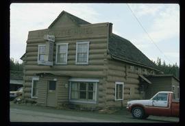
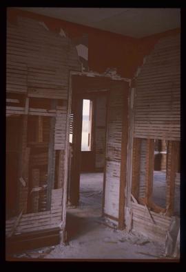
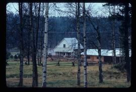
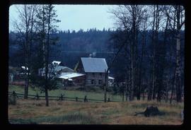
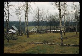
Image depicts an old, collapsing house at the Nautley site in Fort Fraser, B.C.
Image depicts a group of people in the historical village of 'Ksan near Hazelton, B.C.
Image depicts a few old buildings, as well as several unknown individuals somewhere in Moricetown, B.C.
Image depicts a barn with large, Harvestore Systems. It is possibly located on one of the many farms near Vanderhoof, B.C.
Image depicts a totem pole in the historical village of 'Ksan near Hazelton, B.C.
Image depicts the historical village of 'Ksan near Hazelton, B.C.
Image depicts a church located near Mapes, B.C.
Image depicts what appears to be an old mill at an unknown location.
Image depicts the Flying U Ranch at 70 Mile House, B.C.
Image depicts the Lone Butte Hotel in Lone Butte, B.C.
Image depicts the Watson Mansion at the 108 Mile Ranch. It burned down due to a chimney fire in 1983.
Image depicts the Hudson Bay Store in Quesnel, B.C.
Image depicts the old school at 150 Mile House, with what is likely the modern school visible in the background.
Image depicts the old RCMP barn at 150 Mile House, B.C.
Image depicts an old building located somewhere are the Pickard farm north of Soda Creek, B.C.
Image depicts an old barn located at a dairy farm somewhere near Dunlevy Creek in the Dawson Creek area.
Image depicts an old barn located somewhere near Dunlevy Creek in the Dawson Creek area.
Image depicts the old BX Sternwheeler office building in Soda Creek, B.C.
Image depicts a house in Soda Creek, B.C.
Image depicts the old community hall in Soda Creek, B.C.
Image depicts the old jail house in Soda Creek, B.C.
Image depicts the Bohanon House in Quesnel, B.C.
Image depicts numerous unknown individuals at the Bohanon House in Quesnel, B.C.
Image depicts the Bohanon House in Quesnel, B.C.
Image depicts numerous buildings in Hendrix Lake, B.C.
Image depicts the Crosina Store at 153 Mile House.
Image depicts 153 Mile House.
Image depicts the St. Joseph's Mission in Williams Lake, B.C.
Image depicts 100 Mile House, B.C.
Image depicts what appears to be a sawmill at 100 Mile House, B.C.
Image depicts what appears to be a farm at an uncertain location.
Image depicts a farm at an uncertain location.
Image depicts the train station in Quesnel, B.C.
Image depicts the Cottonwood Bridge.
Image depicts a rail road bridge, possibly the Cottonwood Bridge, at an uncertain location.
Image depicts a beehive burner, as well as rail road tracks, at an unknown location.
Image depicts a log house at an uncertain location; the slide is simply labelled "Cariboo."
Image depicts the ruined interior of a mansion at an unknown location.
Image depicts the Watson Mansion in 108 Mile Ranch, B.C. It burned down in 1983 as the result of a chimney fire.
Image depicts 108 Mile Ranch, B.C.
Image depicts the cemetery in Soda Creek, B.C.
Image depicts a section of land, with a few houses, in Soda Creek, B.C.
Image depicts what appears to be a Ranch at Soda Creek, B.C.