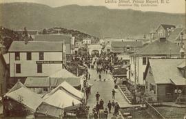
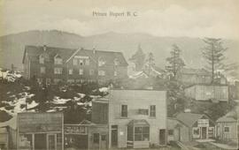
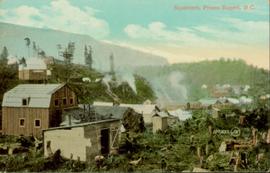
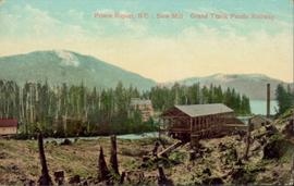
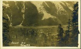
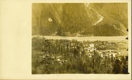
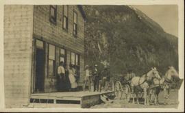
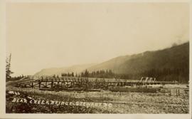
Photograph of a long wooden bridge spanning a river. Forest and hills are visible in the background. Printed annotation on recto reads: "#46 Bear Creek Bridge, Stewart, BC."
Street view photograph of 5th Street. Printed annotation on recto reads: "5th St. Stewart, B.C. Hughes #127."
Street view of various buildings in Stewart, BC, covered with a heavy layer of snow. Visible businesses include "The R. Boyd Young Co." and "Stewart Land Co." Printed annotation on recto reads: "Stewart B.C. Hughes 78."
Photograph is a printed postcard depicting scattered small buildings and a tent. Trees have been removed from the area around the buildings and many stumps remain.
Photograph depicts a large totem pole next to groomed dirt paths. Power poles and river visible in background.
Handwritten annotation on verso reads: "Edenshaw pole in park at Prince Rupert."
Side perspective street view of the Royal Hotel in Prince Rupert BC. The "Ladies [sic] Entrance" sign is visible on the right side of the building. Several vehicles can be seen on the street. Printed annotation on recto reads: " 3rd Ave Prince Rupert Photo W.W.W."
Elevated view of Third Avenue in Prince Rupert. Several cars and delivery trucks are visible driving along the road. Printed annotation on recto reads: "3rd Ave Prince Rupert BC Photo by Wrathalls."
Ground level view of the dry dock in Prince Rupert, BC. Printed annotation on recto reads: "Dry Dock Prince Rupert BC McRae Bros."
Ground level view of the dry dock in Prince Rupert, BC. Printed annotation on recto reads: "$3,000,000 Dry Dock and Shipbuilding Plant, Prince Rupert B.C." Handwritten annotation on verso reads: "With much love. To Many from Raha[??]."
Collection of four photographs of the Prince Rupert dry dock. Printed annotation on recto reads: "Dry Dock and Ship Building Plant, Prince Rupert BC."
Collection of four photographs of the Prince Rupert dry dock. Two images are the finished dry dock buildings. One image is of construction. Printed annotation on recto reads: "Before Launching Canadian Scottish Dry Dock, Prince Rupert BC."
Photograph of the Prince Rupert wharf. A small vessel is docked, and a large tree is in the foreground. Annotation on recto reads: "Prince Rupert Wharf & Harbor[sic]. Allen Photo."
Overhead view of a residential area in Prince Rupert, BC. Printed annotation on recto reads: "Prince Rupert, BC Photo by J.W."
Overhead view of many commercial buildings in Prince Rupert, BC. Printed annotation reads: "Prince Rupert, BC."
Elevated street view of a large crowd gathered on Centre Street in Prince Rupert for Dominion Day celebrations. The Dominion Day arch is visible in the background. Printed annotation on recto reads: "Centre Street, Prince Rupert, B.C. Dominion Day Celebration."
Front view of several commercial buildings in Prince Rupert, BC. Visible are "The Ideal Clothing & Shoe Store," "Bailey and Bell Bakers," and "Hotel Premier." Printed annotation on recto reads: "Prince Rupert, BC." Handwritten annotation on verso reads: "Dear Peggy, Mailui[??] will show you where [illegible] and Dunn Florence [illegible] when you come in Prince Rupert you will see this [illegible]. Aunt Florence." Postcard is addressed to: "Margaret [Illegible] Suby Seabold. Kipap County Washington[??]. Verso is affixed with a Canadian one Cent stamp. Postmarks on verso read: "[Illegible] WASH Sep 6 19[??] Prince Rupert B.C. SP 2 69."
Hand coloured photo of various squatter's shacks and tents, with mountains in the background. Printed annotation on recto reads: "Squatters, Prince Rupert, B.C." Artist's stamp on lower right corner reads: "104,0033 J.V."
Hand coloured photo of a clearing in Prince Rupert with a sawmill in the distance. Printed annotation on recto reads: "Prince Rupert, B.C. : Saw Mill Grand Trunk Pacific Railway." Artist's stamp in the lower right corner reads: "103112 J.V."
Photograph of Stewart BC taken from a distance. Trees in the foreground slightly obscure the village, and a large mountain is visible in the background. Printed annotation on recto reads: "Stewart B.C. Hughes 93."
Street view of downtown Stewart, BC. Photograph shows boards propped up over the swampy area of the future road. Wood debris litters the foreground.
Overhead photograph of a forested area, with Stewart, BC visible in the distance.
Photograph is a printed postcard depicting a team of horses harnessed to a buckboard; a group of people standing on a platform outside a building near Stewart B.C. There are mountains in the background.
Photograph is a printed postcard depicting a wagon track between buildings situated on either side. There are mountains in the back ground. Possibly Stewart, BC.
Groups of men and women can be seen gathered on paths between two large totem poles.
Handwritten annotation on verso reads: "Totem Park Pr Rupert park."
Photograph depicts a totem pole standing on what appears to be a large wooden deck or boardwalk, view of the city in background.
Handwritten annotation on verso reads: "Totem pole in park in Prince Rupert".
Chief Allen sits in chair on raised wooden platform, with bear skin over his knee, and two more bear skins laid on wood blocks in front of him. House stands behind picket fence in background. Pot and pan sit to right of chair in foreground.
Handwritten annotation on verso reads: "Albert Allen Kincolith (Nisga Chief)".
Postcard featuring a car parked outside of Prince Rupert City Hall. Handwritten annotation on verso reads: "Alex Hall, Glyn P.O., Victoria, B.C. Prince Rupert, Billy S."
Slightly elevated photograph of Prince Rupert buildings. A lone vessel is visible in the background. Printed annotation on recto reads: "Courtesy of Can Nat'l Rys. Prince Rupert. B.C." Handwritten annotation on verso reads: "Dear Elma. We reached Prince Rupert (in the picture) today. Friday we arrive at Skagway and the glaciers. Having a fine trip- good weather and a good crowd. Love from Claire." Postcard is addressed to: "Mrs. Claude Millersh, River Forest, Guerneville, Sonoma Co., California." Postcard is affixed with a two cent American stamp. Postmark on verso reads: "Ketohikan Alaska. Jun 28 3 PM 1928."
Photograph depicts a townsite with with several buildings and fences. The image possibly depicts Moberly, though It has been suggested that this is more likely Hudson Hope.
Photograph depicts a log cabin at Peace River with a dirt clearing in the foreground and a tree-covered environment in the background. Fist sign in images reads: "18 MLS to Rolla"; second sign reads: "Rolla Landing".
Photograph depicts the main street of Rolla with a dirt street and wooden sidewalks, tethered horses, and the storefront of H.G. Atkinson General Merchants. Three people are visible walking through the streets.
Photograph depicts a cluster of buildings at Hudson's Hope with a grassy field in the foreground. Hudson's Bay post is the building on the left.
Photograph depicts the townsite of Hudson's Hope featuring a number of small wooden buildings clustered in a field. The Hudson's Bay post is building visible on far left.
Plan of Port Essington consists of an architectural plan for the townsite of Port Essington compiled from plans in Land Registry and described as Composite Plan 537 (originally deposited October 17th 1893). Depicts Skeena River, Hocsal River, individual lots and streets, the B.C. Fishing and Packing Co. Ltd., a graveyard, and the Anglo British Columbia Packing Co.
Photograph depicts a man and horse standing outside a log cabin covered in snow and icicles. In the foreground of the image several loaded packs are laid out surrounding the cabin. The cabin belonged to ranger Alex Nelles' and was located at Willow Creek.
Photograph depicts trekking supplies piled outside Alex Nelles' log cabin. An unidentified man is standing outside the cabin with a horse.
Photograph depicts ranger Alex Nelles' log cabin covered in snow and ice. Beside the cabin is an unidentified man standing next to a horse with travel packs in front of the cabin.
Photograph depicts ranger Alex Nelles' log cabin covered with snow and ice. Surrounding the cabin are cabin are several loaded packs and a horse.
Rev. William Edwin Collison stands to left of wife Bertha who sits on front steps of large shingled home, flower pots in background (oldest son of of Archdeacon W.H. Collison).
Handwritten annotation on verso reads: "Dad & Mother Prince Rupert".
Bertha Collison stands on front steps, to left of second woman standing below.
Handwritten annotation on verso reads: "Mother & Aunt Rose Davies at our house in Prince Rupert".
Side perspective street view of the Canadian Bank of Commerce on a deserted dirt road. Printed annotation on recto reads: "2nd Ave Prince Rupert BC." Illegible faded photographer's mark on lower right corner. Handwritten annotation on verso reads: "The houses and pavements are made of wood. Love Daddy. xx." Postcard is addressed to: "Miss Greta Poole 'Airoudale'[??] Collingwood Road Paigulou Devon England." Postmark on verso reads: "Prince Rupert BC 10:30 AM Aug 5 1925."
File contains postcards portraying life in Prince George, B.C. Images depict street scenes (George Street, Central Avenue, and Hamilton Avenue), government buildings, Hotels, a theatre, a baseball game, and construction of a pier.
Street view photograph of a commercial section in downtown Prince George with several "Campbell's" delivery carts parked along the road. Visible establishments include "Campbell's All Cash Store" and "Club Cafe." Handwritten annotation in blue ballpoint pen on recto reads: "Howdy from Prince George! Going easy with all these kids- good to see Kathee. Snow here. Have fun at the sports show & don't over do it. Thinking of you guys, love Judy and Vic. P.S. Can't wait to go home to somewhere peaceful and quiet. 2-27-83." Postcard is addressed to: "Mr. & Mrs. Hauffer 8429-221 PL. Sn. Edmonds, WA. U.S. 98020." Verso is affixed with four Canadian 8-cent stamps.
Side view of a wooden church, possibly under construction, and other buildings. Printed annotation on recto reads: "Indian Village- Prince George."
Street view of some vehicles parked in front of commercial buildings in Prince/Fort George. Businesses include "J.P. Robertson 'The Men's Store'" and "James & Co. Clothing and Shoes." Printed annotation on recto reads: "Fort George- Corner Hammond and Central."
Street level photo of George Street in Prince George. Visible businesses include "B-A" and "Astoria Hotel." Printed annotation on recto reads: "George St. Prince George."
River in foreground, railroad and city in mid ground and hill in background. Printed annotation on recto reads: “Prince George. B.C. 1924”
Wide angle photograph of a sparsely forested area with Prince/Fort George in the background. Printed annotation on recto reads: "Fort George, B.C."
Street level photo of Third Avenue in Prince George. Visible businesses include "Cut Rate Grocery" and "C.N.R. Cafe." Printed annotation on recto reads: "3rd Ave. Prince George."
Street view photograph of a large brick with a vehicle parked in front. Printed annotation on recto reads: "C.N.R. Station Prince George, B.C."