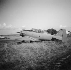
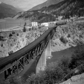
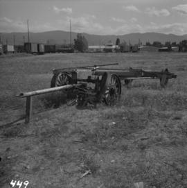
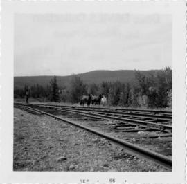
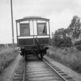
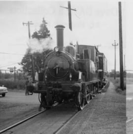
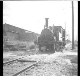
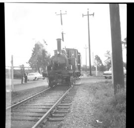
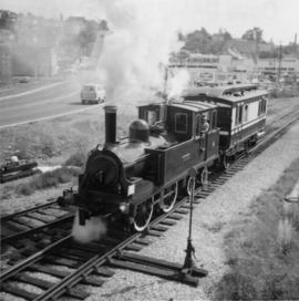
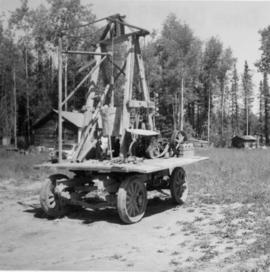
Photograph depicts a possible fence post or well digger found near the Prince George Airport.
Photograph taken at the Mudbay Light Aircraft Airfield in Delta. Visible is an advanced trainer called the "North American (Aviation Co.) Texan" that was of the USA and Harvard in Britain and Canada. Some were built in Canada during WWII.
Film begins with short introduction of girl pointing to a map and drawing a line to where the men will be hunting.
Footage from a small plane overlooking the landscape of what is believed to be either the Bella Coola Valley, Tweedsmuir Provincial Park, Rainbow Mountains, or Chilcotin area.
Footage of hunting party setting up camp in the high country of the mountains. There is a herd of caribou and footage of caribou trophy kill. There is filming of two marmots and additional recordings of camp cooking and socializing.
The film ends with the hunters entering the plane again and returning to their original camp, believed to be Nimpo lake.
Photograph depicts the B.C. Electric Railway swing bridge connecting Lulu Island to the mainland at New Westminster, looking north and taken from Lulu Island. The swinging span is left open except for the passage of freight trains.
Photograph depicts a bridge over Powell Lake, directly behind Powell River town. The bridge is in poor condition and being replaced by steel bridge at right (just off the picture).
Photograph depicts Spences Bridge on the Thompson River and the only surviving pier of the earlier Spences' Bridge. View looking at east bank.
Photograph depicts a rail bridge carrying the C.N.R. track over the Thompson River at Lytton, BCThe bridge is at the confluence of Fraser River and Thompson River. View looking north.
Photograph depicts the Albion Ferry on the Fraser River, as it approaches a ferry slip at Fort Langley.
Photograph depicts two horse drawn freight wagons exhibited at Cache Creek, about 100 yards south of road junction, on the west side of Spences Bridge road.
Photograph depicts a Cariboo Freight Wagon exhibited at Cache Creek, BCThe owner is H.Collins from Cache Creek.
Photograph depicts a steam or motor hauled road lumber wagon. It was found near the beach in Kelowna, BC
Photograph depicts the C.P.R. Penticton yards steam wrecking crane #414337. It forms part of a stand-by wrecking train.
Photograph depicts a C.P.R. way-freight at the disused Wellington Depot on the Esquimalt and Nanaimo Railway, 4 miles north of Nanaimo.
Photograph depicts the C.P.R. depot at Spences Bridge. The view is looking south and shows a northbound freight train moving along the track.
Photograph depicts the Sperry Rail service car #136 for detection of faulty rails at the Penticton C.P.R. depot. It is used mainly to cover rail manufactured prior to 1932.
Photograph depicts the extreme west end of C.P.R. trackage at Coal Harbour, looking east towards the yards and downtown after a snowfall.
Photograph depicts the C.P.R. train station at Kaslo. At one time the line ran between Kaslo and Nakusp, via New Denver. It was lifted in 1915-1920. The trackage now consists of Kootenay Lake slip and about 1 mile of sidings. It is used mainly for oil (incoming) and lumber (outgoing).
Photograph depicts the C.P.R. yards in Vancouver, just west of railway station in the downtown area. The view is looking east from Burrard St.
Photograph depicts the C.P.R. yards just west of downtown passenger station and in front of Pier B, owned by the C.P.R. The view is looking northwest from Burrard St.
Photograph depicts the B.C. Electric Railway trackage at Kerrisdale in Vancouver. The photo was taken from 49th Ave. and West Boulevard, looking north. The second track used to lie to the right of the existing one.
Photograph depicts the former B.C. Electric Railway spur running westwards along Bridgeport Rd., leading from the former main trackage. It was not in use for many years and was lifted in 1965, except for road crossings. The photo is taken from the intersection with Sexsmith Rd., looking east. The former main trackage is sited about 300 yards in the background and at right angles to the track in the foreground.
Photograph depicts the Canadian National Railway (CN) trestle leading to the swing bridge across the north arm of the Fraser River. The view is taken from Lulu Island, looking northeast. Stumps under the trestle indicate this is the second trestle on the site.
Photograph depicts the Canadian National Railway (CN) track on Lulu Island, about 4 miles west of the eastern tip of the island. The track to the right runs along the northern edge of the island and the left-hand track goes to the Lafarge Cement Plant on the south bank of Lulu Island.
Photograph depicts the Canadian National Railway (CN) switcher #7218 and caboose on Lulu Island about to cross the New Westminster Highway, travelling northward on a spur. It came southwards as a loaded freight with 3 boxcars for a small spur behind the photo, and 3 empty cement tank cars for the Lafarge Cement Plant on the south bank of Lulu Island, half a miles distant behind the caboose.
Photograph depicts a piece of abandoned track leading to the peat plant at #8 road on Lulu Island on the Westminster Highway. The track runs parallel to the Westminster Highway, which is at the left beyond the photo. The rail is undated and marked, "Rlymney Steel" (South Wales). The photo is looking west and the Canadian National Railway (CN) spur lies a quarter mile behind the camera.
Photograph depicts an ex-locomotive tender, now a mobile water tank at the Canadian National Railway (CN) depot at Spences Bridge. The mobile water tank holds 11, 600 gallons.
Photograph depicts Tilbury dock on the Delta shore of the Fraser River. The stern of the Canadian National Railway (CN) onboard railcar carrier SS "Canora" is about 10ft away, and showing tidal and moving a piece of dock leading to shore.
Photograph depicts the Canadian National Railway (CN) Tilbury dock at Delta on the lower Fraser River. The view is looking east, upstream.
Photograph depicts a trestle near Australian, BC on mile 364. Visible is a northbound freight of 2 locomotives and about 60 cars.
Photograph depicts a caboose and flanger car #6016
Photograph depicts horses beside track about 300 yards south of the passenger depot in Williams Lake.
Photograph depicts a street car body that formerly belonged to Vancouver, but was found by Davies in Penticton.
Photo depict a disused concentrator of the Granby Mining Company Ltd. Located 5 miles southwest of Princeton and 8 miles east of Copper Mountain ore workings, which are also largely disused. The building of the concentrator commenced in 1917 and the first ore was reduced in October, 1920. Ore cars from workings via the CPR spur entered the snow shed that is visible on the left. Rail track was lifted in 1957.
Photograph depicts a British locomotive, the "Dunrobin," and a saloon coach. The locomotive was about to start a roundtrip to Steveston via Marpole on the BCER track in order to test steaming, bearings, running time, and water consumption. It was its second steaming as it had underwent an overhaul in 1966 not since done until 1940's in the U.K.
Photograph depicts a British locomotive, the "Dunrobin" and a saloon coach on a test run at the BCER track between New Westminster and Marpole. The train was forced to stop because of working going on along the line 200 yards behind the camera.
Photograph depicts a British locomotive, the "Dunrobin, " and a saloon coach beginning a test run on BCER track between New West Minster and Marpole.
Photograph depicts a British locomotive, the "Dunrobin, " and a saloon coach on BCER track in New Westminster. It was on its second steaming trial since the 1940's after it had underwent a complete overhaul at the BCER locomotive shed in New Westmintster in 1966. "Dunbrobin" en route to Steveston via Marpole.
Photograph taken at the Cowichan Valley Forest Museum near Sommos Lake in Duncan. Visible is a 2 truck shay owned by Gerry Wellburn. It was sited beside the Island Highway, at the entrance of the museum.
Photograph taken at the Cowichan Valley Forest Museum near Sommos Lake in Duncan.
Photograph depicts a P & O liner, the "Oriana," passing outward bound from Vancouver between Brockton Point and the Lion's Gate Bridge. Taken from Stanley Park.
Photograph depicts a Canadian Coastguard vessel called "Camsell" at the Canadian Coastgaurd wharf in Upper Harbour, Victoria.
Photograph depicts a 0-4-4 "Dunrobin" locomotive built by Sharp, Stewart, & Co. Ltd. in 1895 at Atlas Works, Glasgow and formerly owned by the Duke of Sutherland. It was taken inside the B.C. Electric Railway locomotive shed at New Westminster where it was receiving a check-over for steam running and a paint job. The cover to steam dome has been removed.
Photograph depicts the end view of the four-wheeled private saloon coach #58A, built in Inverness in 1909 and formerly the property of the Duke of Sutherland. It is owned by the B.C. provincial government and is standing at the New Westminster docks.
Photograph depicts the Pacific Great Eastern northbound daily two-coach Budd car unit approaching Horseshoe Bay depot. Car #31 is leading.
Photograph depicts the Pacific Great Eastern auxiliary tool cars at Lillooet.
Photograph depicts the Pacific Great Eastern track at about Mile 70, in the vicinity of Jordans and Brandy Wine Falls. The photograph was taken from the cab of a Budd car and has a view looking south.
Photograph depicts the Pacific Great Eastern track looking northeast along Seton or Anderson Lake.
Photograph depicts the Pacific Great Eastern line beside Anderson Lake. The photograph was taken from the engineer's compartment of a Budd car unit.