2000.1.1.3.13.45
·
Item
·
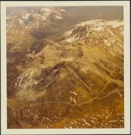
1978
Part of Cassiar Asbestos Corporation Ltd. fonds
Photograph depicts the Cassiar mine, switchback road in foreground, mountain range in background. Pit is visible to right of West peak. The new mine garage can be seen on West peak just above "#7 switchback" in centre of image.