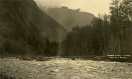
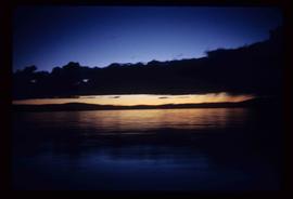
Geographic Features

Elements area

Taxonomy

Code

Scope note(s)

  • Includes both natural and artificial features
  • Physical landscape, built landscape
  • Urban and industrial landscapes
  • Topography
  • Site plans
  • Boundaries, districts, reserves, parks, sanctuaries, towns, etc.
  • NOTE: Mainly but not exclusively pertaining to photographic and cartographic records
  • SEE ALSO: Land, Settlement and Immigration

Source note(s)

  • MemoryBC Subject Groups

Display note(s)

    Hierarchical terms

    Geographic Features

      Equivalent terms

      Geographic Features

        Associated terms

        Geographic Features

          4134 Archival description results for Geographic Features

          4134 results directly related Exclude narrower terms
          Cayoosh Valley
          2012.13.1.54.10 · Item · July 1977
          Part of J. Kent Sedgwick fonds

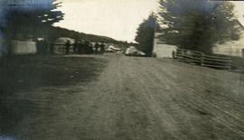
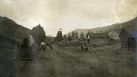
          Image depicts a view of Cayoosh Valley. Cayoosh Creek is visible in the bottom left corner of the image.

          Cassiar - Stewart Highway
          2006.20.9.25 · Item · [ca. 1897 - 1960]
          Part of Northern BC Archives Historical Photograph Collection

          View of snow capped mountains in the distance, vast rolling treed hills in mid ground and a gravel road in the foreground. Road sign indicating severe curve in road situated at the right of the gravel road. Handwritten annotation on verso in pen reads: “Cassiar – Stewart highway”

          Carson Avenue, Quesnel, BC
          2011.3.1.16 · Item · ca. 1930
          Part of North Coast & Central BC Postcard Collection

          Street view photograph looking down Carson Avenue at the Front St. intersection in Quesnel, BC. Several identified businesses line the gravel avenue on the right; however Cowan's Hardware store is visible at the intersection on the left. Printed annotation on recto reads: "Carson Ave., Quesnel, B.C. 1930 Looking East."

          2011.12.03 · Item · ca. 1950
          Part of Giscome, BC Historical Photograph collection

          Photo depicts a street perspective cars lining Third Avenue, in Prince George, BC, ca. 1950. Annotation recto reads: "3rd Ave Prince George BC Photo J. Wrathall." Handwritten annotation in pen on verso of postcard reads: “This is the equivalent of our Granville Street. Both theatres are located here as well as Hudson Bay Co., banks, library & stores.”

          2006.20.9.6 · Item · 19 October 1911
          Part of Northern BC Archives Historical Photograph Collection

          Photograph depicts two, four-horse stagecoaches laden with passengers parked outside the Hotel Northern in South Fort George. A group comprised of primarily men watch the stagecoaches from the veranda of the hotel. Handwritten annotation in bottom right corner of photograph reads: "Cariboo Stage at South Ft. George, BC. Oct 19-1911."

          2009.5.2.31 · Item · [ca. 1900]
          Part of Taylor-Baxter Family Photograph Collection

          Handwritten annotation on verso of photograph: "Early Days on the Cariboo Road. No. 8." Photograph depicts man driving two covered wagons pulled by team of six horses on gravel road. Valley crosses midground, hills in background. Handwritten annotation on recto of photograph: "H. F. Glassey Esq. P.O Box 950 Prince Rupert B.C. Dear Bert: We have been kept very busy have been on committee work all through the convention but it was wonderful will write you a long letter from Vancouver. Mrs Earley wants me to stay until Monday morning train. Met Mr. [Colley?] everything going fine here. I am sure you are busy [...?] Love from Sadie. Mr & Mrs. [Graif?] are living here."

          Cariboo Road
          2012.13.1.6.031 · Item · June 1974
          Part of J. Kent Sedgwick fonds

          Image depicts the Cariboo Road at Hat Creek Ranch, near Highway 99 on the way to Lillooet.