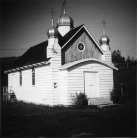
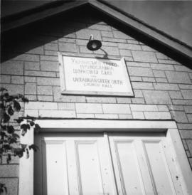
Photograph depicts a Ukranian Greek Orthodox church on the outskirts of Mission. A poster on its door stated that it been 50 years the church had been in Canada (1918-1968).
Mission, BC
17 Archival description results for Mission, BC
Photograph depicts a Ukranian Greek Orthodox church on the outskirts of Mission.
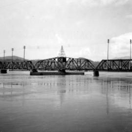
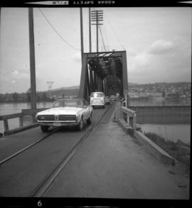
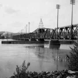
Photograph depicts the swing span of the road and rail bridge at Mission City, looking upstream from the south bank.
Map depicts the proposed electoral districts of British Columbia, including: Burnaby, Capilano, Cariboo-Chilcotin, Comox-Powell River, Cowichan-Malahat-The Islands, Esquimalt-Saanich, Fort Nelson-Peace River, Fraser Valley East, Fraser Valley West, Kamloops-Shuswap, Kootenay East, Kootenay West, Mission-Port Moody, Nanaimo-Alberni, New Westminster-Coquitlam, North Vancouver-Burnaby, Okanagan North, Okanagan-Similkameen, Prince George-Bulkley Valley, Richmond-South Delta, Skeena, Surrey-White Rock-North Delta, Vancouver Centre, Vancouver East, Vancouver Kingsway, Vancouver Quadra, Vancouver South, and Victoria.
Photograph depicts the Mission City rail and road bridge. It is owned by the CPR and was opened in 1891. It was used by road vehicles between 1 July 1927 and the 23 June 1973, using a one way flow system. On the latter day, a new high level road bridge was unofficially opened. By early July 1973, the CPR had removed the wooden deck planking.
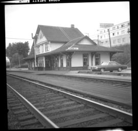
Photograph depicts the Mission City CPR depot located at mile 87.3 from North Bend in Cascade Substation. It was built in 1902 and add onto in 1909. It has living quarters on the 2nd floor that are still in use, which is quite rare for BC in 1973.
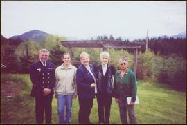
Unidentified officer in uniform stands on far left. The Lieutenant Governor stands between women named Marion (on left) and Rose (on right), see item 2009.6.1.600.
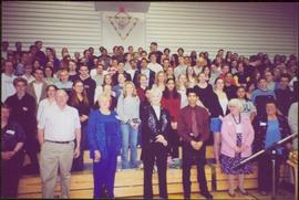
Handwritten annotation on verso reads: “Mission Secondary, May 1 2003”.
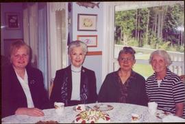
Handwritten annotation on verso reads: “Marian, Iona, Rose, Jill, Mission, May 1, 2003”.
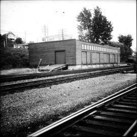
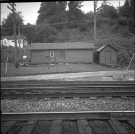
Photograph depicts a freight shed located on the north side of the rail line and some 200 yards west of the Mission City CPR depot.
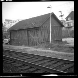
Photograph depicts a CPR storehouse at Mission City. It was marked as "Petroleum Store" but in fact was holding speeders and miscellaneous track equipment. It was sited on the north side of the track at the extreme east end of the depot platform.
Photograph depicts a CPR road and rail bridge at Mission City from the south bank looking towards the city.
Map depicts the city of Vancouver, including the electoral districts of Comox-Powell River, Capilano, North Vancouver-Burnaby, Mission-Port Moody, Burnaby, Fraser Valley West, New Westminster-Coquitlam, Surrey-White Rock-North Delta, Richmond-South Delta, Vancouver South, Vancouver Kingsway, Vancouver Quadra, Vancouver Centre, and Vancouver East.
Photograph depicts small buildings sited on the north side of the tracks and just west of the Mission City CPR depot. They are all in use and well cared for.
