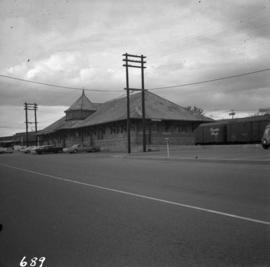
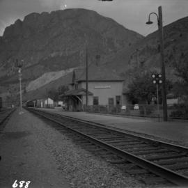
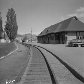
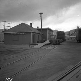
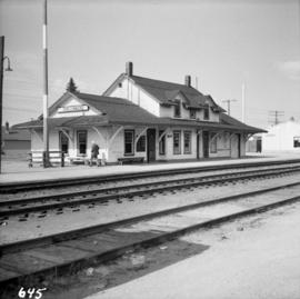
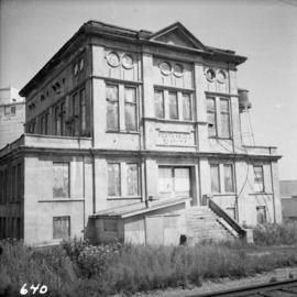
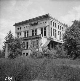
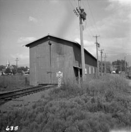
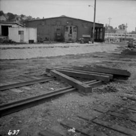
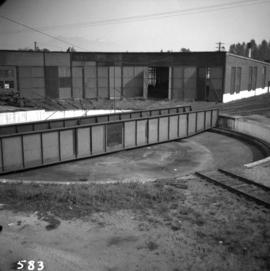
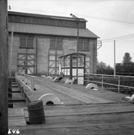
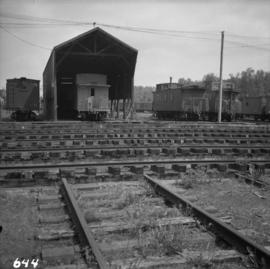
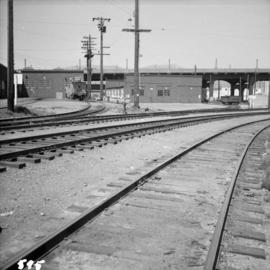
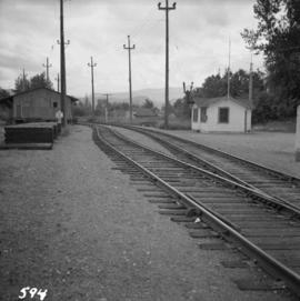
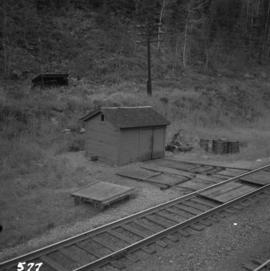
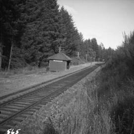
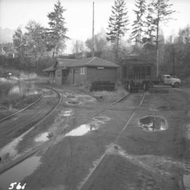
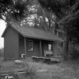
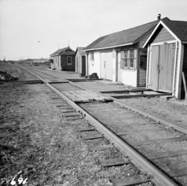
Photograph depicts Canadian National Railway (CN) track crew sheds on Lulu Island at the south end of the Fraser St. road-vehicle bridge, near the intersection of #5 Rd. and Vulcan Way. The track is well used. The view is looking west.
Photograph depicts the Canadian National Railway (CN) depot in Vernon, which is no longer used for passenger traffic.
Photograph depicts the Canadian National Railway (CN) depot at Spences Bridge, from a view looking southwest.
Photograph depicts a disused Canadian National Railway (CN) passenger depot at Kelowna. The offices still used for parcels, ticket sales, etc. There is still good freight traffic.
Photograph depicts the Canadian National Railway (CN) freight depot at Penticton, with a motor/rail tractor in the photo.
Photograph depicts Canadian National Railway (CN) freight crossing Powell St. near Raymur Ave.
Photograph depicts the Canadian National Railway (CN) station at Clearwater, on the mainline between Kamloops and Tete Juane Cache Junction, about 75 miles north of Kamloops. The main trade is lumber. The view is looking south.
Photograph depicts the Canadian National Railway (CN) Kamloops Junction depot, facing east. The single line spur to Kamloops is about two miles long.
Photograph depicts the Canadian National Railway (CN) station at Hope, B.C.
Photograph depicts the Canadian National Railway (CN) Port Mann depot.
Photograph depicts the track transfer transporter at the Canadian National Railway (CN) repair shops at Port Mann.
Photograph depicts the Canadian National Railway (CN) Chilliwack depot, looking north.
Photograph depicts the Canadian National Railway (CN) repair shops at Port Mann. The caboose is receiving a spray paint job.
Photograph depicts the track transfer transporter at the Canadian National Railway (CN) repair shops at Port Mann, showing the east face of the main building.
Photograph depicts a depot and derelict electricity substation at Coghlan, 9 rail miles east of Langley, looking west.
Photograph depicts a derelict substation on the B.C. Electric Railway at Coghlan, 9 rail miles east of Langley. Though marked "Langley", the building is sited as stated.
Photograph depicts the derelict electricity station of the B.C. Electric Railway at Cloverdale.
Photograph depicts the rear and side view of the abandoned Sumas electrical substation on the B.C. Electric Railway at Vedder Mountain.
Photograph depicts a locomotive shed at Chilliwack. Note the electric conductor wire guard at the point where the doors meet at their tops.
Photograph depicts a former car barn of the B.C. Electric Railway at New Westminster. Newly aligned track to doors (from left) #3 and #5.
Photograph depicts the abandoned Sumas substation at Vedder Mountain.
Photograph depicts the C.P.R. depot at New Westminster.
Photograph depicts the electricity station at Coghlan on the B.C. Electric Railway, which is 9 rail miles east of Langley in the Fraser Valley. The view is looking east.
Photograph depicts the B.C. Electric Railway workshops at the south end of the Burrard bridge in Vancouver. The view is looking west and depicts caboose A10 in the background.
Photograph depicts the B.C. Electric Railway depot at Huntingdon and Sumas, about 20 ft from the U.S.-Canadian border. The view is looking southeast.
Photograph depicts the C.P.R. yards just west of downtown passenger station and in front of Pier B, owned by the C.P.R. The view is looking northwest from Burrard St.
Photograph depicts the west side of the C.P.R. engineering shops at Revelstoke. The building appeared to house a machine shop and had no cars or locomotives inside.
Photograph depicts the C.P.R. engineering shops at Revelstoke. The view is looking north, with the line from Arrowhead behind the camera.
Photograph depicts a tower controlling the C.P.R. grade crossing at Alexander St. in Vancouver, B.C.
Photograph depicts the C.P.R. summit of the southern transcontinental C.P. line at Crowsnest Pass on the Alberta-B.C. border. The roundhouse is disused. Four men are working on the turntable; it is unclear whether they are rebuilding its eastern face or demolishing it by breaking down one wall to get at the table. The site is 4,453 ft. above sea level and the view is looking south.
Photograph depicts a turntable outside a disused roundhouse at the C.P.R. yards in Coquitlam. The turntable is still in use.
Photograph depicts a full but unused water tank at Duncan Station on the Esquimalt and Nanaimo Railway on Vancouver Island.
Photograph depicts a water tower beside a rail line.
Photograph depicts a water tower.
Photograph depicts a typical section shed scene anywhere in B.C. It was taken on the C.P.R. track near Flat Creek or Illecillewaet, between Rogers Pass and Revelstoke. The April 25, 1965 CPR Employee timetable lists the mileage at Illecillewaet as 98.2.
Photograph depicts the C.P.R. Pritchard depot, 25 miles east of Kamloops. The passenger turnstile is unusual though found elsewhere in this area. The depot is long unused for passengers and is now used by a permanent way gang.
Photograph depicts the C.P.R. depot at Kimberley. It is in the center of the town, looking up towards the Kimberley mine which is 1 mile away. The last passenger service (1 coach) between Kimberley and Cranbrook ran about 1955.
Photograph depicts the C.P.R. depot at Slocan City. At the left beyond the photo is the ferry slip on Slocan Lake.
Photograph depicts the Malahat Station on the Esquimalt and Nanaimo Railway on Vancouver Island. The view is looking south towards Victoria.
Photograph depicts the C.P.R. Cowichan depot on Vancouver Island. The view is looking south.
Photograph depicts sheds and repair center of the C.P.R. at Victoria, near Lime Bay. The rail-liner just came in from the daily run to Courtenay.
Photograph depicts the C.P.R. depot at Goldstream on Vancouver Island. The view is looking towards Victoria.
Photograph depicts the C.P.R. depot at Duncan on Vancouver Island, with a view looking northeast.
Photograph depicts the C.P.R. train station at Kaslo. At one time the line ran between Kaslo and Nakusp, via New Denver. It was lifted in 1915-1920. The trackage now consists of Kootenay Lake slip and about 1 mile of sidings. It is used mainly for oil (incoming) and lumber (outgoing).
Photograph depicts the Cobble Hill Station on the Esquimalt and Nanaimo Railway on Vancouver Island. The view is looking south.
Photograph depicts a two bay locomotive shed of the round-house style at Alberni on Vancouver Island.
Photograph depicts the unused C.P.R. Shawnigan Lake section house on the Esquimalt and Nanaimo Railway. It is 27.8 miles outside Victoria.
Photograph depicts Koksilah depot of the Esquimalt and Nanaimo Railway on Vancouver Island. It is 2 miles south of Duncan and the view is looking north.
Photograph depicts a former C.N.R. station at Youbou on Lake Cowichan on Vancouver Island. The track is still used to serve the plywood lumber mill at Youbou.
Photograph depicts a view looking east from the end of the C.P.R. track at Coal Harbour in Vancouver, B.C.